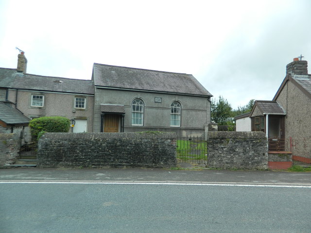
Coed Tyn-y-cwm

Wood, Forest in Cardiganshire

Wales

Coed Tyn-y-cwm

Pwll-clai: Capel Seion
Pwll-clai: Capel Seion Credit: Dylan Moore

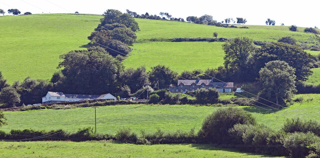
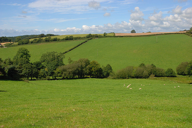
Coed Tyn-y-cwm is a picturesque woodland located in Cardiganshire, Wales. Situated in the heart of the county, the wood is characterized by its lush vegetation and diverse range of flora and fauna. Covering an extensive area, Coed Tyn-y-cwm is a haven for nature enthusiasts and offers a peaceful retreat from the bustling urban life.

The woodland is predominantly composed of native tree species, including oak, birch, and beech, which create a dense canopy that shades the forest floor. This provides a favorable habitat for a multitude of wildlife, such as red squirrels, badgers, foxes, and a variety of bird species. The tranquil atmosphere of the wood is often interrupted by the melodious songs of thrushes, blackbirds, and woodpeckers.

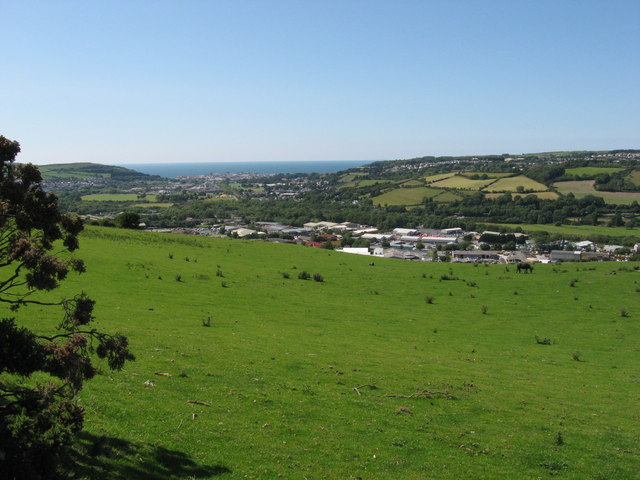
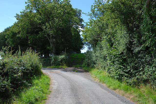
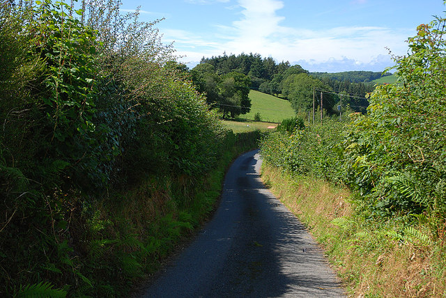
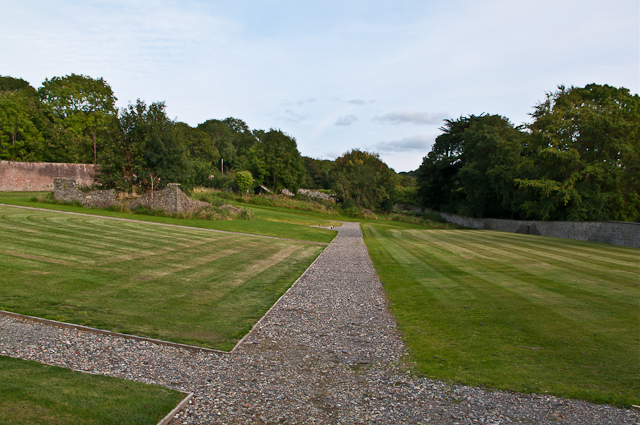
Coed Tyn-y-cwm is crisscrossed with numerous walking trails, allowing visitors to explore its enchanting beauty. These paths wind through the woods, passing by babbling brooks and meandering streams, adding to the charm and serenity of the surroundings. The wood also offers breathtaking vistas, with clearings that provide panoramic views of the rolling hills and valleys that surround it.

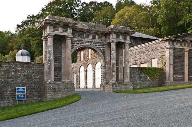
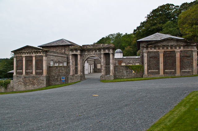
In addition to its natural beauty, Coed Tyn-y-cwm has historical significance. Ruins of an ancient stone circle can be found within its boundaries, hinting at the deep-rooted history of the region.

Coed Tyn-y-cwm is a cherished natural gem of Cardiganshire, offering a tranquil and captivating experience for all who visit. Whether it is for a leisurely stroll, birdwatching, or simply to immerse oneself in the wonders of nature, this woodland is an ideal destination for both locals and tourists alike.

If you have any feedback on the listing, please let us know in the comments section below.

Coed Tyn-y-cwm Images

Images are sourced within 2km of 52.384942/-4.0157633 or Grid Reference SN6278. Thanks to Geograph Open Source API. All images are credited.

Pwll-clai: Capel Seion
View towards Aberystwyth
End of public road at Molecatcher's Wood From here on, the surfaced road continues as a private road to Pencraig. The lane ahead in shadow is "a route with public access".
End of public road at Molecatcher's Wood
From here on, the surfaced road continues as a private road to Pencraig. The lane ahead in shadow is "a route with public access".
Dead-end road past Gors-isaf Giving access to the valley north west of New Cross.
Dead-end road past Gors-isaf
Giving access to the valley north west of New Cross.
Fields north west of New Cross Prime Cardiganshire farmland. The prevalence of names including Gors here suggest that that the valley is boggy, but the only wet part seems to be down at the bottom. Looking down a line which is just a metre or so inside the square.
Fields north west of New Cross
Prime Cardiganshire farmland. The prevalence of names including Gors here suggest that that the valley is boggy, but the only wet part seems to be down at the bottom. Looking down a line which is just a metre or so inside the square.
Pre-Worboys road sign on the B4340 at New Cross / Ygors South east of Aberystwyth. Tucked in against the hedge and camouflaged with algae, a sign points out the B4340 towards Trawscoed.
Pre-Worboys road sign on the B4340 at New Cross / Ygors
South east of Aberystwyth. Tucked in against the hedge and camouflaged with algae, a sign points out the B4340 towards Trawscoed.
Part of Rhos-Lawdden farm, Moriah near Capel Seion One of those hard working old upland farms.
Part of Rhos-Lawdden farm, Moriah near Capel Seion
One of those hard working old upland farms.
The eponymous Capel Seion
Capel Moriah, in Moriah
Moriah
Moriah
Nanteos The main part of the house was built between 1739 and 1757 for Thomas Powell.  The architect is unknown.  The east wing (only just visible through the trees on the right in this photo) was added in 1841 for William Powell, to a design of the architect W R Coultart.  He also planned a similar west wing, but this was not built.  The portico on the front was added in 1848.

It remained in the ownership of the Powell family until the early 20th century, followed by other owners, before falling into disrepair.  Following recent restoration, it is now a hotel.

It is grade I listed - for a full summary and history see <span class="nowrap"><a title="http://www.coflein.gov.uk/pdf/CPG169/" rel="nofollow ugc noopener" href="http://www.coflein.gov.uk/pdf/CPG169/">Link</a><img style="margin-left:2px;" alt="External link" title="External link - shift click to open in new window" src="https://s1.geograph.org.uk/img/external.png" width="10" height="10"/></span>.
Nanteos
The main part of the house was built between 1739 and 1757 for Thomas Powell. The architect is unknown. The east wing (only just visible through the trees on the right in this photo) was added in 1841 for William Powell, to a design of the architect W R Coultart. He also planned a similar west wing, but this was not built. The portico on the front was added in 1848. It remained in the ownership of the Powell family until the early 20th century, followed by other owners, before falling into disrepair. Following recent restoration, it is now a hotel. It is grade I listed - for a full summary and history see LinkExternal link.
Nanteos The main part of the house was built between 1739 and 1757 for Thomas Powell.  The architect is unknown.  The east wing (the two storey block to the right of the main building) was added in 1841 for William Powell, to a design of the architect W R Coultart.  He also planned a similar west wing, but this was not built.  The portico on the front was added in 1848, and the former billiards room, on the far right of the photo, was added in the 1860s.

It remained in the ownership of the Powell family until the early 20th century, followed by other owners, before falling into disrepair.  Following recent restoration, it is now a hotel.

It is grade I listed - for a full summary and history see <span class="nowrap"><a title="http://www.coflein.gov.uk/pdf/CPG169/" rel="nofollow ugc noopener" href="http://www.coflein.gov.uk/pdf/CPG169/">Link</a><img style="margin-left:2px;" alt="External link" title="External link - shift click to open in new window" src="https://s1.geograph.org.uk/img/external.png" width="10" height="10"/></span>.
Nanteos
The main part of the house was built between 1739 and 1757 for Thomas Powell. The architect is unknown. The east wing (the two storey block to the right of the main building) was added in 1841 for William Powell, to a design of the architect W R Coultart. He also planned a similar west wing, but this was not built. The portico on the front was added in 1848, and the former billiards room, on the far right of the photo, was added in the 1860s. It remained in the ownership of the Powell family until the early 20th century, followed by other owners, before falling into disrepair. Following recent restoration, it is now a hotel. It is grade I listed - for a full summary and history see LinkExternal link.
Nanteos - stable court Part of the stable court at Nanteos (see <a href="https://www.geograph.org.uk/photo/3153388">SN6278 : Nanteos</a>).  The court, containing the former stables and a coach house, dates from the 1830s.
Nanteos - stable court
Part of the stable court at Nanteos (see SN6278 : Nanteos). The court, containing the former stables and a coach house, dates from the 1830s.
Nanteos - walled garden The former walled garden at Nanteos (see <a href="https://www.geograph.org.uk/photo/3153388">SN6278 : Nanteos</a>).
Nanteos - walled garden
The former walled garden at Nanteos (see SN6278 : Nanteos).
Nanteos - stable court The grand entrance to the stable court at Nanteos (see <a href="https://www.geograph.org.uk/photo/3153388">SN6278 : Nanteos</a>).  The court, containing the former stables and a coach house, dates from the 1830s.  The arch was once topped by a stone horse and eagles, but these were removed in the 1960s.
Nanteos - stable court
The grand entrance to the stable court at Nanteos (see SN6278 : Nanteos). The court, containing the former stables and a coach house, dates from the 1830s. The arch was once topped by a stone horse and eagles, but these were removed in the 1960s.
Nanteos - stable court Part of the stable court at Nanteos (see <a href="https://www.geograph.org.uk/photo/3153388">SN6278 : Nanteos</a>).  The court, containing the former stables and a coach house, dates from the 1830s.  The arch (much grander when seen from the outside (see <a href="https://www.geograph.org.uk/photo/3153401">SN6278 : Nanteos - stable court</a>) was once topped by a stone horse and eagles, but these were removed in the 1960s.  Through it can be  seen part of the former walled garden (see <a href="https://www.geograph.org.uk/photo/3153397">SN6278 : Nanteos - walled garden</a>).
Nanteos - stable court
Part of the stable court at Nanteos (see SN6278 : Nanteos). The court, containing the former stables and a coach house, dates from the 1830s. The arch (much grander when seen from the outside (see SN6278 : Nanteos - stable court) was once topped by a stone horse and eagles, but these were removed in the 1960s. Through it can be seen part of the former walled garden (see SN6278 : Nanteos - walled garden).
Nanteos The main part of the house was built between 1739 and 1757 for Thomas Powell.  The architect is unknown.  The east wing (on the right) was added in 1841 for William Powell, to a design of the architect W R Coultart.  He also planned a similar west wing, but this was not built.  The portico on the front was added in 1848.

It remained in the ownership of the Powell family until the early 20th century, followed by other owners, before falling into disrepair.  Following recent restoration, it is now a hotel.

It is grade I listed - for a full summary and history see <span class="nowrap"><a title="http://www.coflein.gov.uk/pdf/CPG169/" rel="nofollow ugc noopener" href="http://www.coflein.gov.uk/pdf/CPG169/">Link</a><img style="margin-left:2px;" alt="External link" title="External link - shift click to open in new window" src="https://s1.geograph.org.uk/img/external.png" width="10" height="10"/></span>.
Nanteos
The main part of the house was built between 1739 and 1757 for Thomas Powell. The architect is unknown. The east wing (on the right) was added in 1841 for William Powell, to a design of the architect W R Coultart. He also planned a similar west wing, but this was not built. The portico on the front was added in 1848. It remained in the ownership of the Powell family until the early 20th century, followed by other owners, before falling into disrepair. Following recent restoration, it is now a hotel. It is grade I listed - for a full summary and history see LinkExternal link.
Show me another place!

Coed Tyn-y-cwm is located at Grid Ref: SN6278 (Lat: 52.384942, Lng: -4.0157633)

Unitary Authority: Ceredigion

Police Authority: Dyfed Powys

What 3 Words

///quality.rollover.stir. Near Llanilar, Ceredigion

Related Wikis

Y Gors, Ceredigion

Y Gors is a hamlet in the community of Trawsgoed, Ceredigion, Wales, which is 71.5 miles (115.1 km) from Cardiff and 176.1 miles (283.4 km) from London...
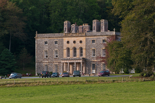
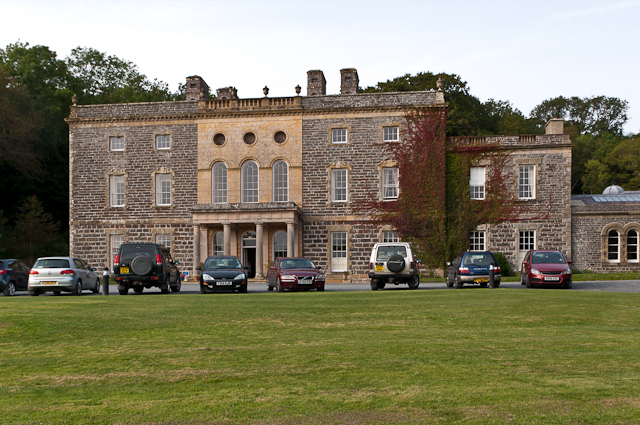
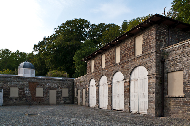
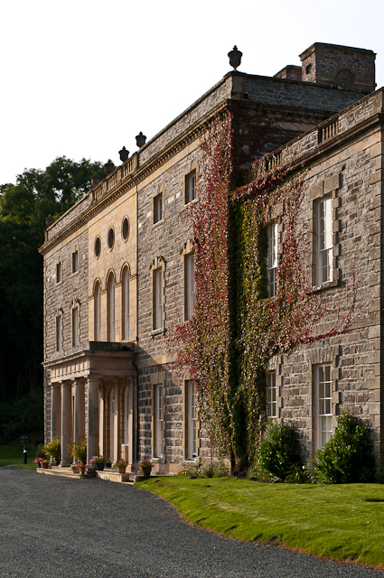
Nanteos Mansion

Nanteos (Welsh: Plas Nanteos, Nanteos Mansion) is an 18th-century former country house in Llanbadarn-y-Creuddyn, near Aberystwyth, Ceredigion, Wales. A...
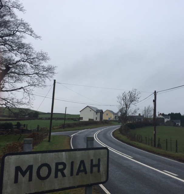
Moriah, Ceredigion

Moriah is a hamlet in the community of Llanfarian, Ceredigion, Wales, which is 73 miles (117.4 km) from Cardiff and 177.1 miles (285 km) from London. Moriah...

Pant-y-crug

Pant-y-crug is a hamlet in the community of Melindwr, Ceredigion, Wales, which is 71.5 miles (115 km) from Cardiff and 175 miles (281.6 km) from London...

Capel Bangor railway station

Capel Bangor railway station is a railway station serving Capel Bangor in Ceredigion in Mid-Wales. It is an intermediate station on the preserved Vale...

Pont Paith

Pont Paith is a hamlet in the community of Llanfarian, Ceredigion, Wales, 73 miles (117.5 km) from Cardiff and 177.9 miles (286.2 km) from London. Pont...

Glanyrafon railway station

Glanyrafon railway station (formerly Glanrafon) is a railway station serving Glanyrafon in Ceredigion in Mid-Wales. It is a request stop on the preserved...

Glanyrafon, Ceredigion

Glanyrafon or Glanrafon is a small village and industrial estate in the community of Llanfarian, Ceredigion, Wales. It lies on the south bank of the Afon...

Have you been to Coed Tyn-y-cwm?

Leave your review of Coed Tyn-y-cwm below (or comments, questions and feedback).