Coed yr Odyn

Wood, Forest in Caernarfonshire

Wales

Coed yr Odyn

Winter birches on Nantgwynant The marshy land between the public footpath and Llyn Dinas on its southeast shore is dotted with Downy Birch - the species of birch (of our two natives) better adapted to such wet soils. On a wet day like this when the higher parts of Snowdonia are unattractive to walkers, lower level paths like this one present opportunties to have the trees stand out against the low-contrast background, and close examination shows that every twig is adorned with droplets of water catching the light from the low clouds.
Winter birches on Nantgwynant Credit: Andy Waddington

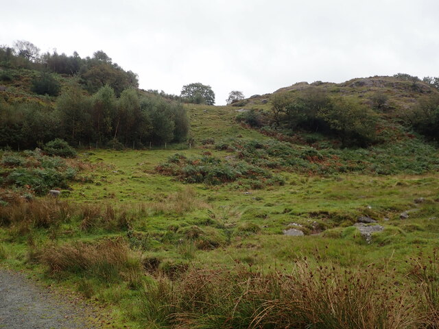
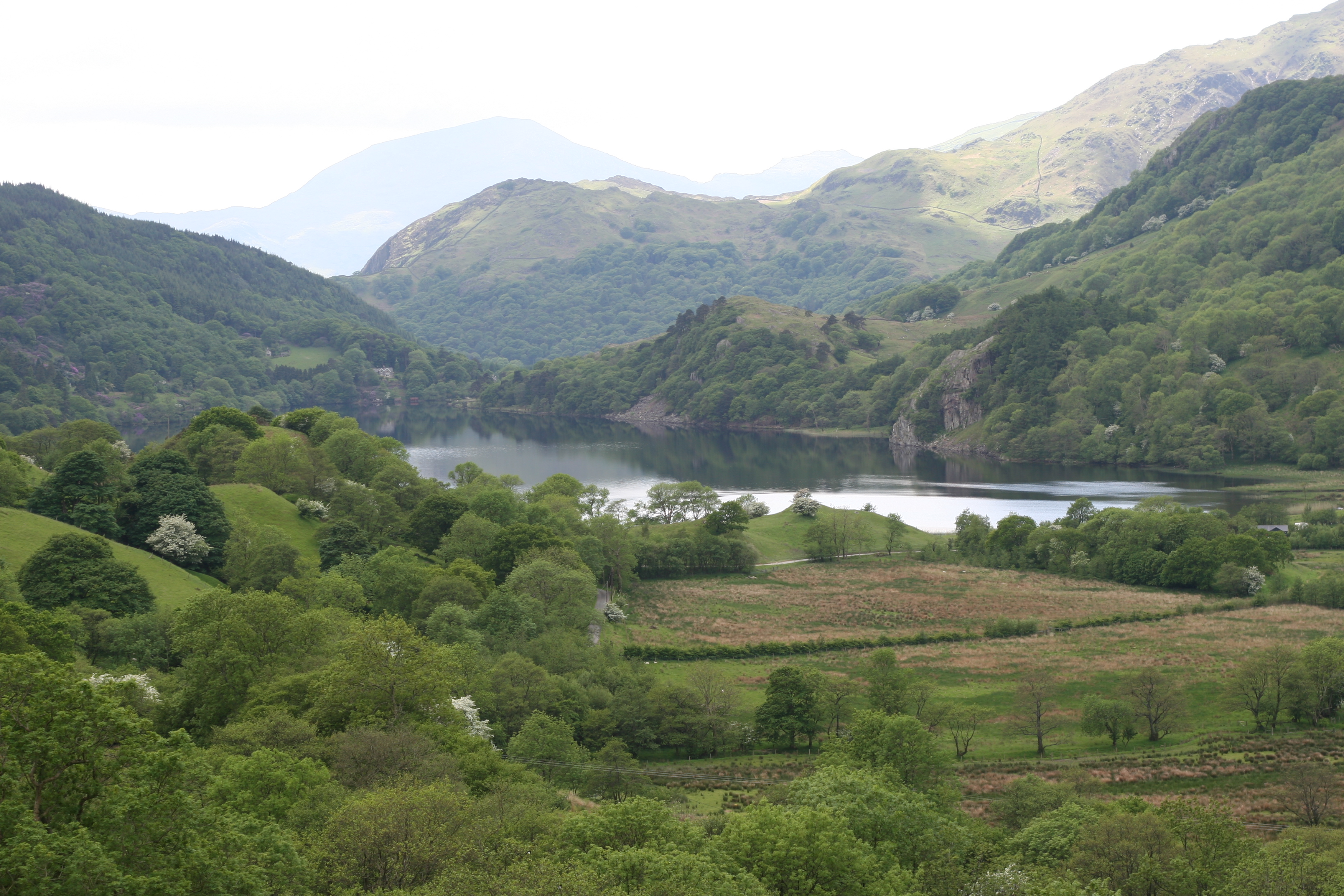
Coed yr Odyn, located in Caernarfonshire, Wales, is a picturesque woodland area that encompasses an area of approximately 100 hectares. The name "Coed yr Odyn" translates to "Wood, Forest" in English, which aptly describes the primary feature of this location.

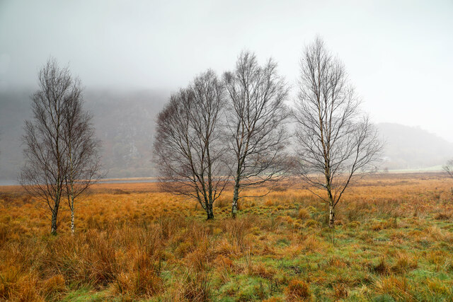
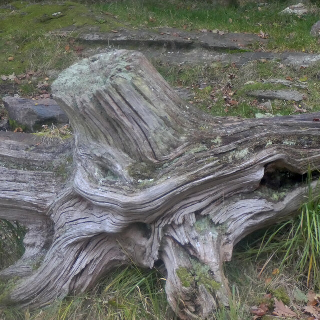
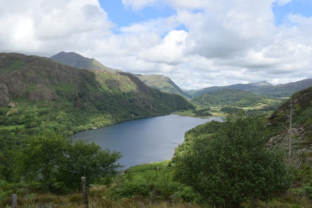
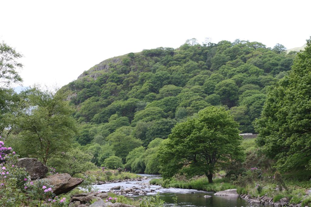
The woodland is nestled within the Snowdonia National Park, which is renowned for its stunning natural beauty and diverse landscapes. Coed yr Odyn boasts a rich and varied assortment of flora and fauna, making it an ideal destination for nature enthusiasts. The forest is characterized by a mix of native tree species, including oak, birch, beech, and ash, providing a lush and vibrant setting.

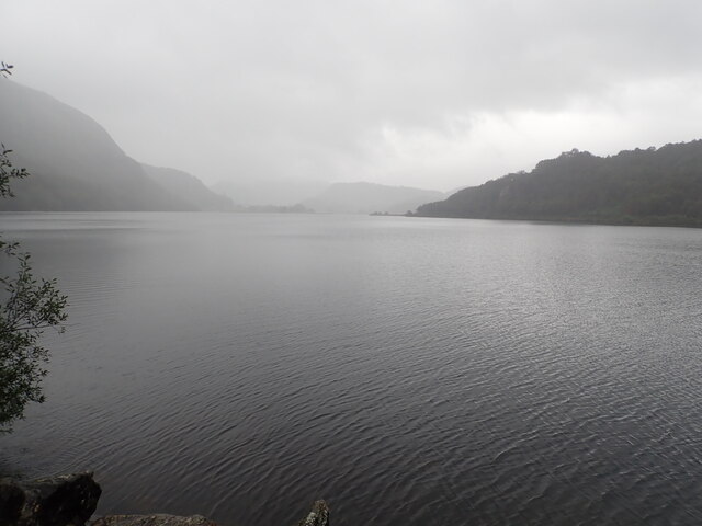
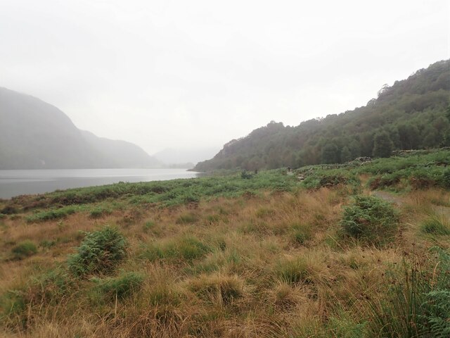
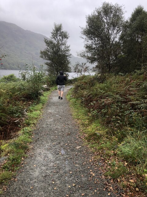
The woodland is crisscrossed by a network of walking trails, allowing visitors to explore and immerse themselves in the tranquil surroundings. These pathways offer breathtaking views of the surrounding mountains and valleys, adding to the overall charm of the area.

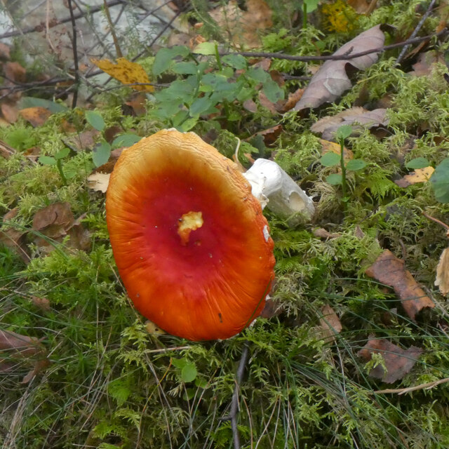
Coed yr Odyn also provides a habitat for a diverse range of wildlife. Visitors may encounter various bird species, such as woodpeckers, owls, and songbirds, as well as small mammals like squirrels and rabbits. The forest floor is also home to a variety of plants, including bluebells, ferns, and mosses, creating a magical atmosphere during spring and summer months.

Overall, Coed yr Odyn is a must-visit destination for those seeking solace in nature and wishing to experience the beauty of a Welsh woodland.

If you have any feedback on the listing, please let us know in the comments section below.

Coed yr Odyn Images

Images are sourced within 2km of 53.031008/-4.0456245 or Grid Reference SH6250. Thanks to Geograph Open Source API. All images are credited.

Winter birches on Nantgwynant The marshy land between the public footpath and Llyn Dinas on its southeast shore is dotted with Downy Birch - the species of birch (of our two natives) better adapted to such wet soils. On a wet day like this when the higher parts of Snowdonia are unattractive to walkers, lower level paths like this one present opportunties to have the trees stand out against the low-contrast background, and close examination shows that every twig is adorned with droplets of water catching the light from the low clouds.
Winter birches on Nantgwynant
The marshy land between the public footpath and Llyn Dinas on its southeast shore is dotted with Downy Birch - the species of birch (of our two natives) better adapted to such wet soils. On a wet day like this when the higher parts of Snowdonia are unattractive to walkers, lower level paths like this one present opportunties to have the trees stand out against the low-contrast background, and close examination shows that every twig is adorned with droplets of water catching the light from the low clouds.
Llyn Dinas North of Beddgelert in the Nant Gwynant Pass, Llyn Dinas is a mountain lake with a footpath around its eastern shore. It is a fairly shallow lake, covering an area of 60 acres.
Llyn Dinas
North of Beddgelert in the Nant Gwynant Pass, Llyn Dinas is a mountain lake with a footpath around its eastern shore. It is a fairly shallow lake, covering an area of 60 acres.
Llyn Dinas North of Beddgelert in the Nant Gwynant Pass, Llyn Dinas is a mountain lake with a footpath around its eastern shore. It is a fairly shallow lake, covering an area of 60 acres. This is looking north from the footbridge which crosses the River Glaslyn
Llyn Dinas
North of Beddgelert in the Nant Gwynant Pass, Llyn Dinas is a mountain lake with a footpath around its eastern shore. It is a fairly shallow lake, covering an area of 60 acres. This is looking north from the footbridge which crosses the River Glaslyn
Llyn Dinas A bit of a damp walk by the lake
Llyn Dinas
A bit of a damp walk by the lake
Footpath round the eastern side of Llyn Dinas
Walking around Llyn Dinas
Moorland and hillocks, near Llyn Dinas
Barn at Llyndy Isaf
Barn at Llyndy Isaf
Glan Llyn Standing proud above the A498
Glan Llyn
Standing proud above the A498
Pont droed dros Afon Goch / Footbridge over Afon Gogh
Bonyn derwen / An oak stump
Caws llyffant / Toadstools (1)
Caws llyffant / Toadstools (2)
Glan Llyn
Glan Llyn
Vista of Llyn Dinas
Vista of Llyn Dinas
Slate slab bridge on Afon Cwm Llan This bridge was built by miners to provide a short cut to the copper mines on slopes of Lliwedd.
Slate slab bridge on Afon Cwm Llan
This bridge was built by miners to provide a short cut to the copper mines on slopes of Lliwedd.
Waterfall on Afon Cwm Llan Afon Cwm Llan is a spate river.
Waterfall on Afon Cwm Llan
Afon Cwm Llan is a spate river.
Rhaeadr Cwm Llan waterfall
Show me another place!

Coed yr Odyn is located at Grid Ref: SH6250 (Lat: 53.031008, Lng: -4.0456245)

Unitary Authority: Gwynedd

Police Authority: North Wales

What 3 Words

///snipped.advice.realm. Near Blaenau-Ffestiniog, Gwynedd

Nearby Locations

Bethania Coed yr Odyn

Related Wikis

Plas Gwynant

Plas Gwynant is an educational resort in Snowdonia, Wales. This country estate also includes a woodland and riverside walks, as well as a parkland and...

Nant Gwynant

Nant Gwynant (also spelt Nantgwynant) is a valley in northern Wales. The A498 road descends 600 feet (180 m) into the valley in about two miles (3 km)...

Llyn Dinas

Llyn Dinas is a lake near Beddgelert, Gwynedd in north Wales. It is formed by the River Glaslyn. Llyn Dinas lies on the valley floor a few miles north...

Llyn Gwynant

Llyn Gwynant is a lake in Snowdonia, Wales. Llyn Gwynant lies on the River Glaslyn, in the Nant Gwynant valley, and is about 1ΒΌ miles (2 km) north east...

Dinas Emrys

Dinas Emrys (Welsh for 'Emrys's city') is a rocky and wooded hillock near Beddgelert in Gwynedd, north-west Wales. Rising some 76 m (250 ft) above the...

Sygun Copper Mine

Sygun Copper Mine is a Victorian copper mine which closed in 1903 but was renovated and reopened by the Amies family as a tourist attraction in 1986, focusing...

Yr Aran

Yr Aran is a mountain peak on a ridge radiating south from Snowdon, Wales' highest mountain, with beautiful views of the summit of Snowdon, Moel Hebog...

Lliwedd Bach

Lliwedd Bach is a top of Y Lliwedd in the Snowdonia National Park, North Wales. It is the last "top" on the main ridge of Y Lliwedd, the other being Y...

Nearby Amenities

Located within 500m of 53.031008,-4.0456245
Source: npe
Lat/Long: 53.0345784/-4.0486256
Source: npe
Lat/Long: 53.033591/-4.0488751
Source: npe
Lat/Long: 53.0327168/-4.049413
Source: npe
Lat/Long: 53.0315183/-4.0501018
Source: npe
Lat/Long: 53.0309442/-4.0517302
Barrier: cattle_grid
Bicycle: yes
Foot: yes
Lat/Long: 53.0332017/-4.0414169
Post Box
Operator: Royal Mail
Post Box Type: lamp
Ref: LL55 147
Royal Cypher: EIIR
Royal Cypher Wikidata: Q33102113
Lat/Long: 53.0335838/-4.0493238
Barrier: cattle_grid
Lat/Long: 53.0349578/-4.0447849
Barrier: entrance
Source: survey;gps
Lat/Long: 53.0349623/-4.0490131
Telephone
Booth: KX100
Covered: booth
Operator: BT
Lat/Long: 53.0346856/-4.0488945
Barrier: cattle_grid
Lat/Long: 53.0315181/-4.048346
Information: guidepost
Tourism: information
Lat/Long: 53.0315494/-4.0483286
Defibrillator
Defibrillator Location: outside Caffi Gwynant on wall of terrace
Emergency: defibrillator
Ref GB The Circuit: F7D8AC5C-B944-4FC9-9EB3-AE730118E494
Lat/Long: 53.0342769/-4.0491662
Power: pole
Lat/Long: 53.0284945/-4.042114
Power: pole
Lat/Long: 53.0289704/-4.0408266
Power: pole
Lat/Long: 53.0293817/-4.0406817
Power: pole
Lat/Long: 53.027617/-4.0423052
Power: pole
Lat/Long: 53.0270346/-4.0430079
Power: pole
Lat/Long: 53.0335934/-4.0472154
Power: pole
Lat/Long: 53.0333681/-4.0459212
Power: pole
Lat/Long: 53.0331153/-4.0446436
Power: pole
Lat/Long: 53.0328389/-4.0435254
Power: pole
Lat/Long: 53.0325686/-4.0424197
Power: pole
Lat/Long: 53.0320332/-4.0423141
Power: pole
Lat/Long: 53.0312587/-4.0421091
Power: pole
Lat/Long: 53.0305314/-4.0418855
Power: pole
Lat/Long: 53.0297693/-4.0416701
Power: pole
Lat/Long: 53.0293559/-4.0411856
Power: pole
Lat/Long: 53.0338527/-4.0485028
The data included in this document is from www.openstreetmap.org. The data is made available under ODbL.

Have you been to Coed yr Odyn?

Leave your review of Coed yr Odyn below (or comments, questions and feedback).