Geo of the Light
Coastal Feature, Headland, Point in Orkney
Scotland
Geo of the Light
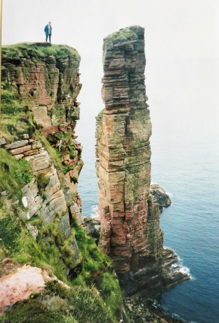
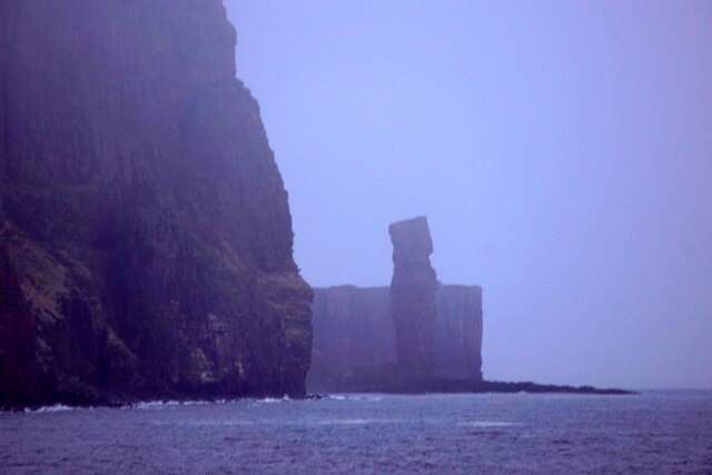
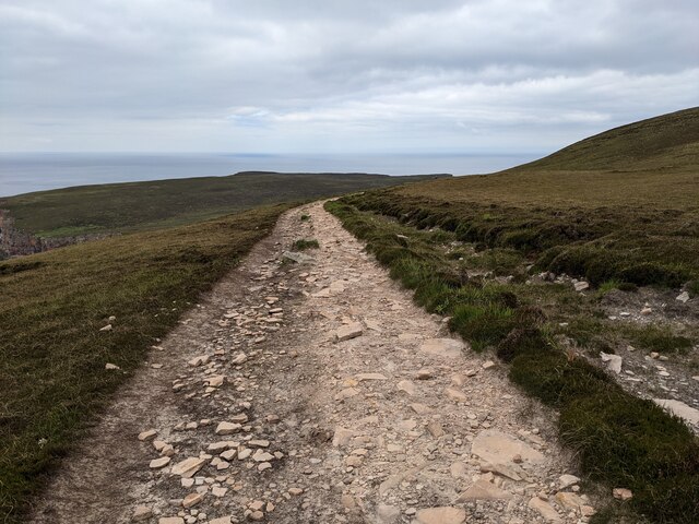
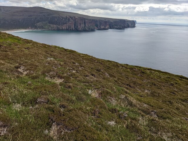
Geo of the Light is a prominent coastal feature located in Orkney, an archipelago in northern Scotland. It is a headland that extends out into the North Sea, forming a distinct point along the coastline. The name "Geo of the Light" is derived from the Old Norse word "geo," meaning a narrow inlet, and the presence of a lighthouse situated on the headland.
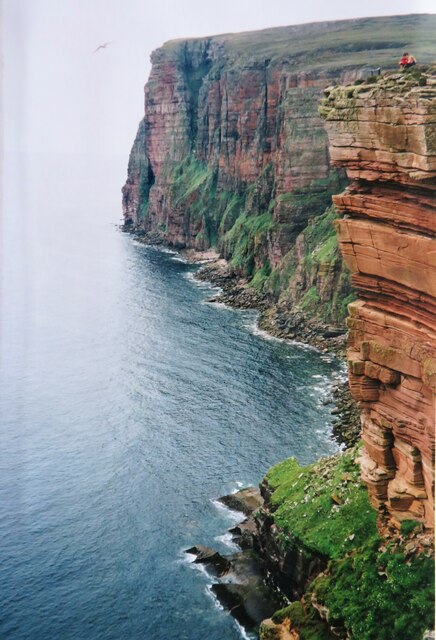
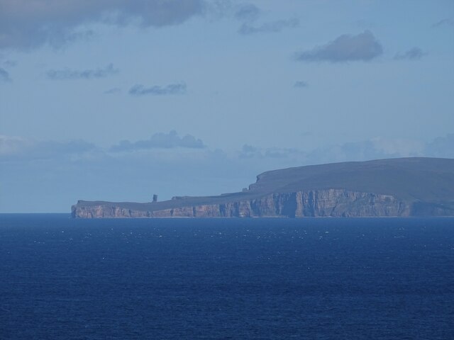
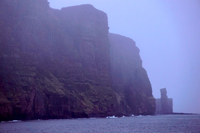
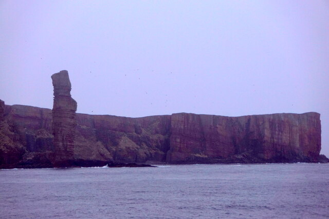
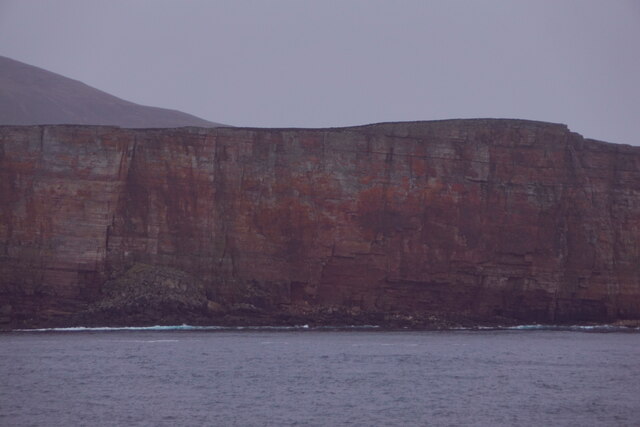
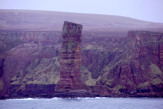
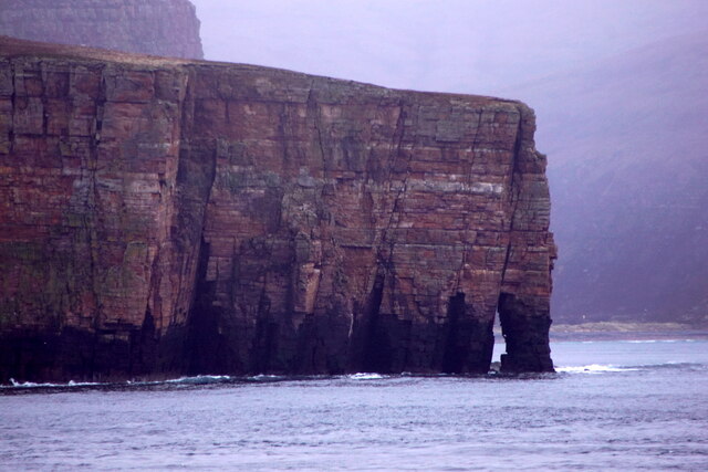
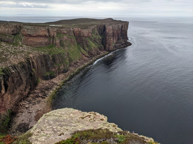
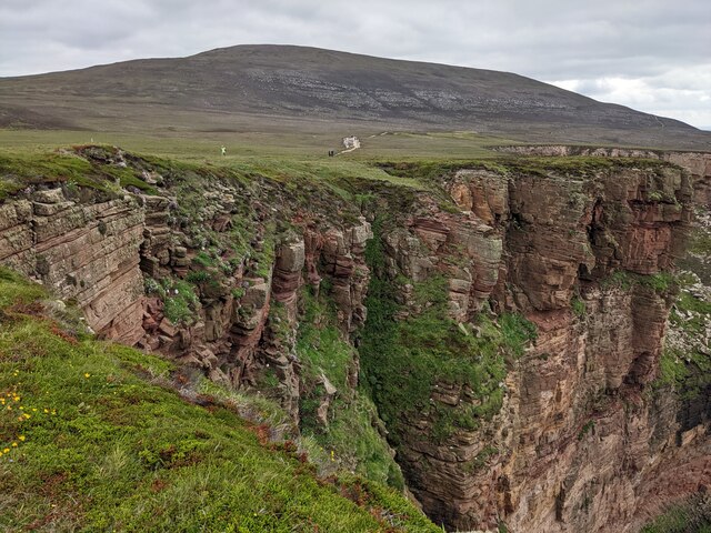
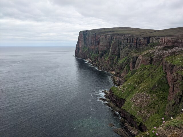
The headland is characterized by rugged cliffs that rise vertically from the sea, reaching impressive heights. These cliffs provide a stunning backdrop to the surrounding landscape, offering breathtaking views of the North Sea and the dramatic coastline. The area is rich in birdlife, with colonies of nesting seabirds such as puffins, guillemots, and razorbills found along the cliffs.
The lighthouse located on Geo of the Light plays a crucial role in guiding ships safely through the treacherous waters around Orkney. Its beacon emits a powerful light that can be seen from kilometers away, serving as a vital navigational aid for vessels passing through the area.
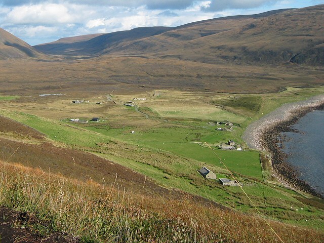
In addition to its natural and navigational significance, Geo of the Light also holds historical importance. The headland is believed to have been inhabited since ancient times, with archaeological remains suggesting human activity dating back thousands of years. These remnants provide insights into the early settlement and cultural practices of the region's past inhabitants.
Overall, Geo of the Light is a captivating coastal feature that showcases the rugged beauty of Orkney's coastline, offers a haven for diverse birdlife, and serves as an important landmark for maritime navigation.
If you have any feedback on the listing, please let us know in the comments section below.
Geo of the Light Images
Images are sourced within 2km of 58.881102/-3.4317242 or Grid Reference HY1700. Thanks to Geograph Open Source API. All images are credited.
Geo of the Light is located at Grid Ref: HY1700 (Lat: 58.881102, Lng: -3.4317242)
Unitary Authority: Orkney Islands
Police Authority: Highlands and Islands
What 3 Words
///opts.meanest.skills. Near Stromness, Orkney Islands
Nearby Locations
Related Wikis

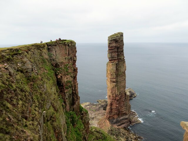
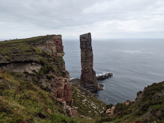
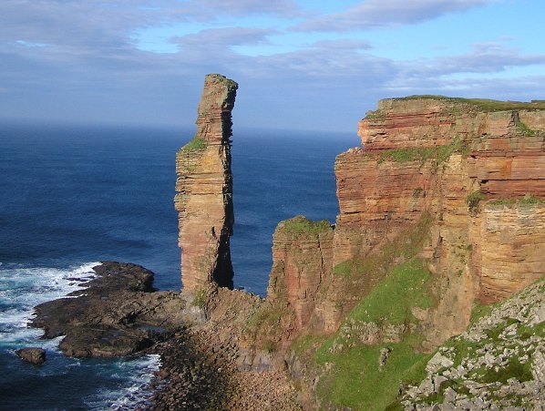
Old Man of Hoy
The Old Man of Hoy is a 449-foot (137-metre) sea stack on Hoy, part of the Orkney archipelago off the north coast of Scotland. Formed from Old Red Sandstone...

HMS Pheasant (1916)
HMS Pheasant was one of 85 Admiralty M-class destroyers built during the First World War for the Royal Navy. She hit and was sunk by a mine in 1917....
Rackwick
Rackwick is a small coastal crofting township in the north west of the island of Hoy in Orkney, Scotland. As well as a handful of tourist amenities the...

Ward Hill, Hoy
Ward Hill is a hill on the island of Hoy in Orkney, Scotland. It lies at the north of the island between Moaness and Rackwick, and is the highest point...

Dwarfie Stane
The Dwarfie Stane is a megalithic chambered tomb carved out of a titanic block of Devonian Old Red Sandstone located in a steep-sided glaciated valley...
Hoy, Orkney
Hoy (Scots: Hoy; from Old Norse Háey, meaning "high island") is an island in Orkney, Scotland, measuring 143 square kilometres (55 sq mi) – the second...

Hoy Sound
Hoy Sound is a body of salt water subject to tidal currents situated south of the town of Stromness in the Orkney archipelago of Scotland. The sound lies...
Nearby Amenities
Located within 500m of 58.881102,-3.4317242Have you been to Geo of the Light?
Leave your review of Geo of the Light below (or comments, questions and feedback).