Trowes' Geo

Coastal Feature, Headland, Point in Caithness

Scotland

Trowes' Geo

North eastern part of The Spur at Dunnet Bay Looking towards Dunnet Head
North eastern part of The Spur at Dunnet Bay Credit: John Ferguson

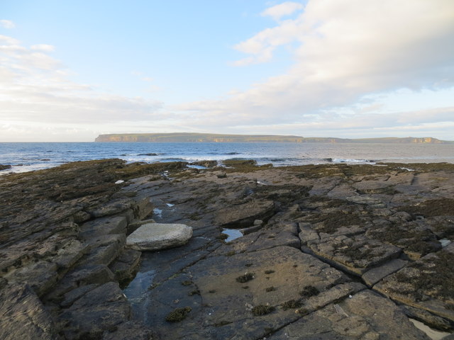
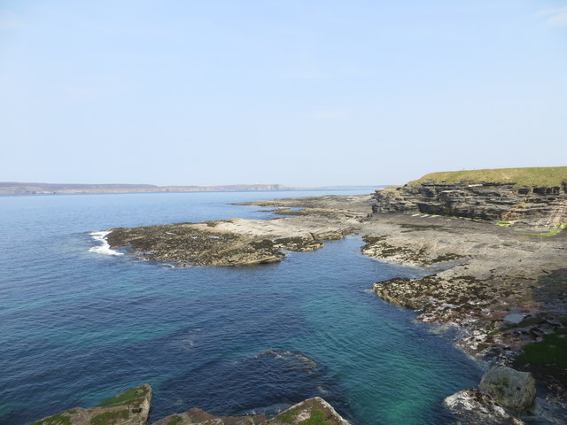
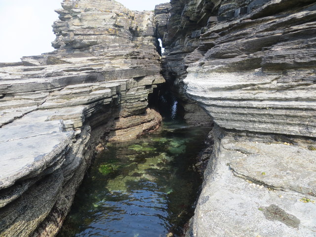
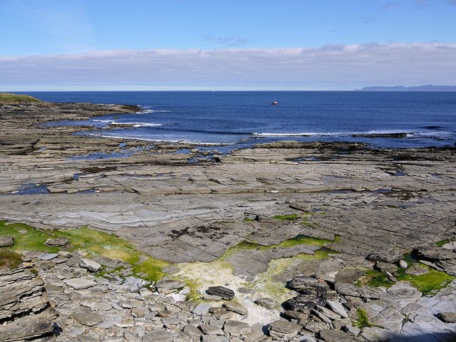
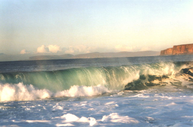
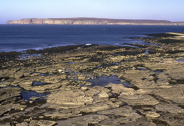
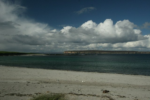
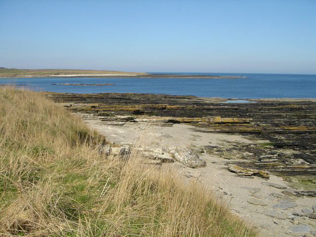
Trowes' Geo is a prominent coastal feature located in Caithness, Scotland. It is a headland that extends out into the North Sea, forming a distinct point on the coastline. The geo is characterized by its rugged and dramatic landscape, with steep cliffs that rise up from the shoreline.

The headland of Trowes' Geo is composed of layers of sedimentary rocks, mainly sandstone and limestone, which have been shaped by millions of years of erosion by wind and water. This geological formation creates a striking visual contrast against the deep blue waters of the North Sea.

Trowes' Geo is also known for its rich biodiversity. The cliffs provide nesting sites for various seabird species, including guillemots, puffins, and razorbills. The surrounding waters are home to a diverse range of marine life, such as seals, dolphins, and a variety of fish species.

Visitors to Trowes' Geo can enjoy breathtaking views of the coastline and the open sea. The headland offers excellent opportunities for hiking and exploring, with several walking trails that lead to viewpoints overlooking the cliffs and the surrounding landscape. The area is also popular among birdwatchers, who come to observe the numerous seabird colonies that inhabit the cliffs.

Overall, Trowes' Geo is a remarkable coastal feature that showcases the beauty of Caithness' natural landscape. Its striking cliffs, diverse wildlife, and picturesque views make it a must-visit destination for nature enthusiasts and outdoor adventurers.

If you have any feedback on the listing, please let us know in the comments section below.

Trowes' Geo Images

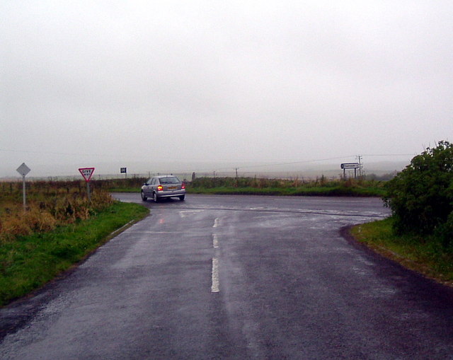
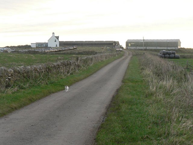
Images are sourced within 2km of 58.603545/-3.4215126 or Grid Reference ND1769. Thanks to Geograph Open Source API. All images are credited.

North eastern part of The Spur at Dunnet Bay Looking towards Dunnet Head
North eastern part of The Spur at Dunnet Bay
Looking towards Dunnet Head
Craig Ware looking over to Dunnet Head
Shoreline features near Craig Ware
View to Murkle and The Pentland Firth View from Castletown/Wedale Road
View to Murkle and The Pentland Firth
View from Castletown/Wedale Road
Castletown, Dunnet Head and Orkney View from Castletown/Weydale Road
Castletown, Dunnet Head and Orkney
View from Castletown/Weydale Road
Olrig Parish Church, Main Street, Castletown Church of Scotland.
Olrig Parish Church, Main Street, Castletown
Church of Scotland.
Disused quarry, Castletown This was Upper Castletown Quarry which produced flagstones <a title="https://www.geograph.org.uk/photo/486868" href="https://www.geograph.org.uk/photo/486868">Link</a> .
In the peak year of 1902 around 500 people were employed in Castletown's flagstone industry.
Disused quarry, Castletown
This was Upper Castletown Quarry which produced flagstones Link . In the peak year of 1902 around 500 people were employed in Castletown's flagstone industry.
Old terraced houses, Castletown Situated at the western end of Main Street (A836) near to the location of the old quarry <a title="https://www.geograph.org.uk/photo/2715950" href="https://www.geograph.org.uk/photo/2715950">Link</a> .
Old terraced houses, Castletown
Situated at the western end of Main Street (A836) near to the location of the old quarry Link .
Clardon Haven
Clardon Haven
Murkle Bay Hoy in the background Dunnet Head to the right
Murkle Bay
Hoy in the background Dunnet Head to the right
Clardon Haven The rocky beach at Clardon Haven, with Dunnet Head in the background.
Clardon Haven
The rocky beach at Clardon Haven, with Dunnet Head in the background.
The Battery, Castletown This is a Victorian battery constructed sometime after 1866 as a training facility for the local artillery volunteers. It is possible that it was armed with the two cannon which now stand at Thurso Castle.
The Battery, Castletown
This is a Victorian battery constructed sometime after 1866 as a training facility for the local artillery volunteers. It is possible that it was armed with the two cannon which now stand at Thurso Castle.
Car park and windmill At Castletown
Car park and windmill
At Castletown
Turn for Sibmister At Murkle
Turn for Sibmister
At Murkle
Junction with A836 On road from Quarryside
Junction with A836
On road from Quarryside
Quarryside Farm, Castletown A farm steading consisting of traditional and modern buildings. Suffolk tups can be seen in the foreground.
Quarryside Farm, Castletown
A farm steading consisting of traditional and modern buildings. Suffolk tups can be seen in the foreground.
Murkle: approaching Mains of Murkle A cat investigates rare traffic on this lane leading only to Mains of Murkle.
Murkle: approaching Mains of Murkle
A cat investigates rare traffic on this lane leading only to Mains of Murkle.
Murkle and Dunnet Head View of Murkle Bay with Dunnet Head across the water and Orkney in the distance.
Murkle and Dunnet Head
View of Murkle Bay with Dunnet Head across the water and Orkney in the distance.
Show me another place!

Trowes' Geo is located at Grid Ref: ND1769 (Lat: 58.603545, Lng: -3.4215126)

Unitary Authority: Highland

Police Authority: Highlands and Islands

What 3 Words

///albatross.inkjet.saying. Near Thurso, Highland

Related Wikis

Murkle

Murkle (Murchill) is a small scattered hamlet, made up of East Murkle and West Murkle located one mile (1.6 km) east of Thurso, in Caithness, Scottish...

Castletown, Highland

Castletown (Scottish Gaelic: Baile a' Chaisteil) is a village on the north coast of the Highland council area of Scotland, situated near Dunnet Bay. It...

Haimer

Haimer is a small hamlet in Caithness, Scotland. It is located on a road just off the A836 and consists of several small settlements and farming facilities...

Olrig

Olrig is a parish in Caithness, Scotland. The main settlement in the parish is Castletown. Prior to the 19th century, the parish was sub-divided into...

Nearby Amenities

Located within 500m of 58.603545,-3.4215126
Created By: almien_coastlines
Source: PGS
Lat/Long: 58.602469/-3.414584
Created By: almien_coastlines
Source: PGS
Lat/Long: 58.602716/-3.41753
Created By: almien_coastlines
Source: PGS
Lat/Long: 58.60297/-3.418023
Created By: almien_coastlines
Source: PGS
Lat/Long: 58.603224/-3.418517
Created By: almien_coastlines
Source: PGS
Lat/Long: 58.603476/-3.419991
Created By: almien_coastlines
Source: PGS
Lat/Long: 58.603727/-3.421465
Created By: almien_coastlines
Source: PGS
Lat/Long: 58.603853/-3.421957
Created By: almien_coastlines
Source: PGS
Lat/Long: 58.604365/-3.42221
Created By: almien_coastlines
Source: PGS
Lat/Long: 58.60462/-3.422457
Created By: almien_coastlines
Source: PGS
Lat/Long: 58.604488/-3.423437
Created By: almien_coastlines
Source: PGS
Lat/Long: 58.60423/-3.423924
Source: PGS
Lat/Long: 58.6040644/-3.4260094
Source: PGS
Lat/Long: 58.6034561/-3.4282695
Source: PGS
Lat/Long: 58.603246/-3.4289355
Source: PGS
Lat/Long: 58.6028766/-3.4298029
The data included in this document is from www.openstreetmap.org. The data is made available under ODbL.

Have you been to Trowes' Geo?

Leave your review of Trowes' Geo below (or comments, questions and feedback).