Scarsa
Cliff, Slope in Orkney
Scotland
Scarsa
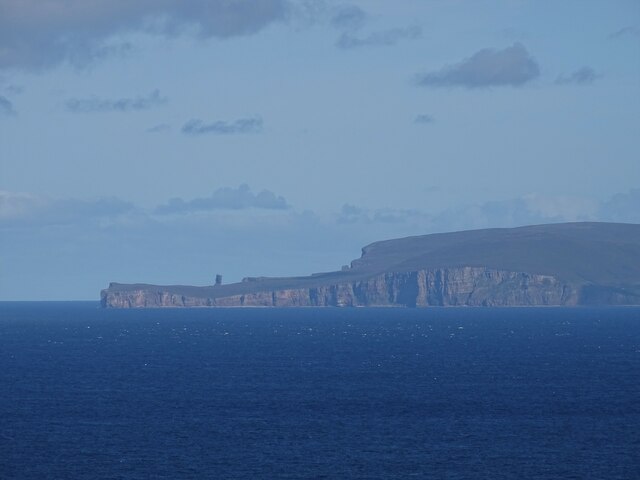
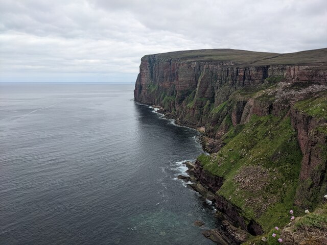
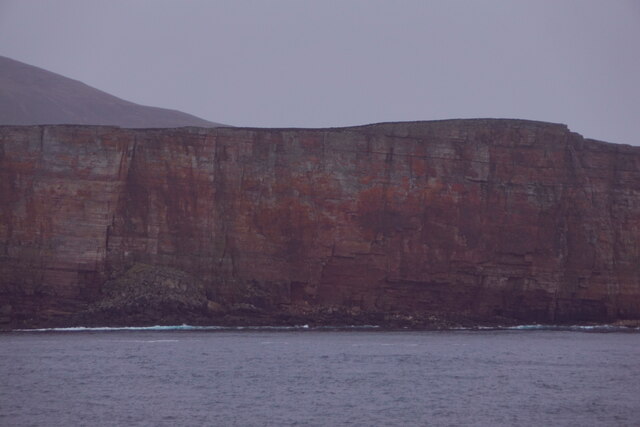
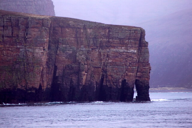
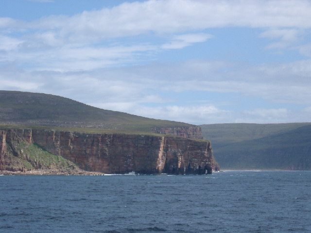
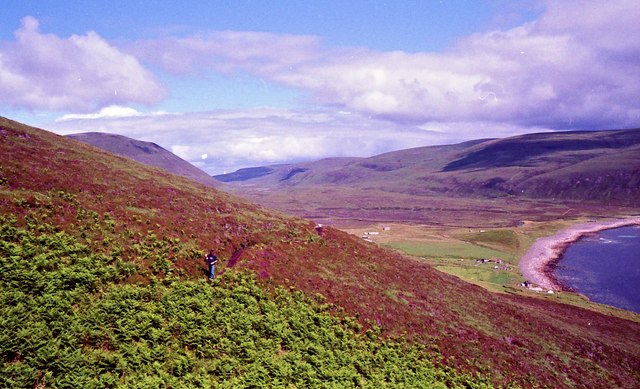
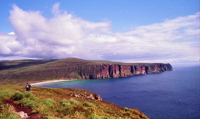
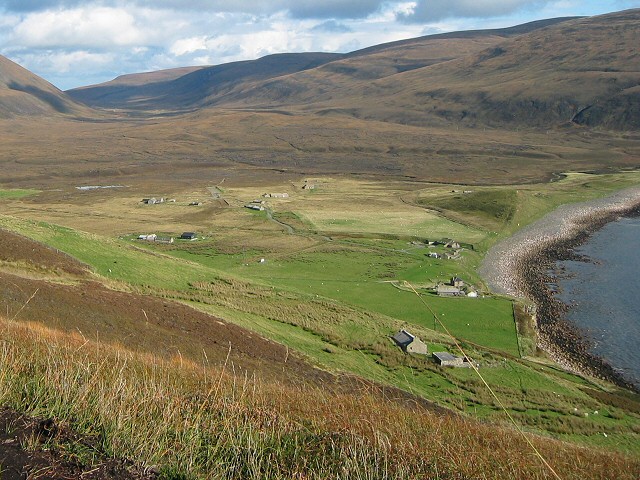
Scarsa is a small settlement located on the west coast of the Orkney Islands, an archipelago in northern Scotland. It is situated on a cliff overlooking the Atlantic Ocean and is characterized by its stunning natural beauty and rugged terrain.
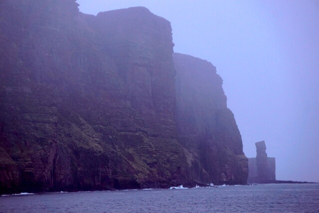
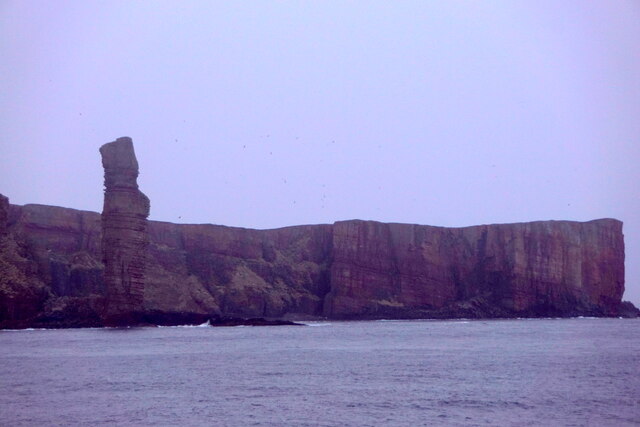
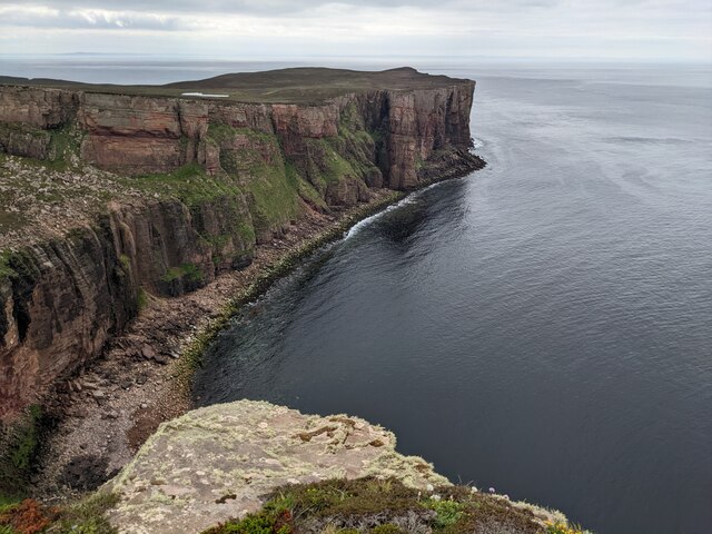
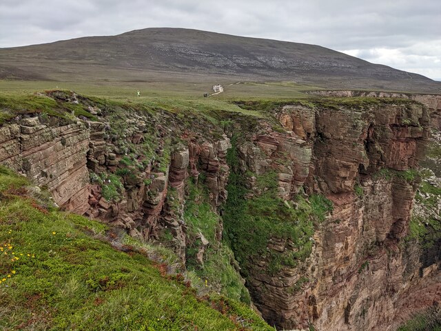
The settlement of Scarsa is known for its dramatic cliff formations and steep slopes, which provide breathtaking views of the surrounding landscape. The cliffs, composed of weathered sandstone and shale, reach heights of up to 50 meters in some areas, creating an impressive backdrop for the village.
The slopes of Scarsa are covered in lush vegetation, including grasses, heather, and wildflowers, which add vibrant colors to the landscape. The area is also home to a diverse range of wildlife, including seabirds such as puffins and gannets, which nest on the cliffs, and seals that can often be spotted basking on the nearby rocks.
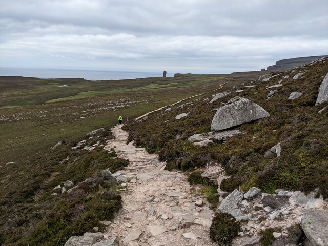
Despite its remote location, Scarsa attracts a small number of visitors who come to admire its natural beauty and enjoy outdoor activities such as hiking and birdwatching. The settlement itself consists of a handful of traditional stone houses, many of which have been renovated and converted into holiday cottages, providing accommodation options for those wishing to explore the area.
Scarsa, Orkney (Cliff, Slope) is a place of outstanding natural beauty, offering visitors a unique opportunity to immerse themselves in the rugged and picturesque landscape of the Orkney Islands.
If you have any feedback on the listing, please let us know in the comments section below.
Scarsa Images
Images are sourced within 2km of 58.887973/-3.4244257 or Grid Reference HY1700. Thanks to Geograph Open Source API. All images are credited.
Scarsa is located at Grid Ref: HY1700 (Lat: 58.887973, Lng: -3.4244257)
Unitary Authority: Orkney Islands
Police Authority: Highlands and Islands
What 3 Words
///imprints.keeps.saving. Near Stromness, Orkney Islands
Nearby Locations
Related Wikis

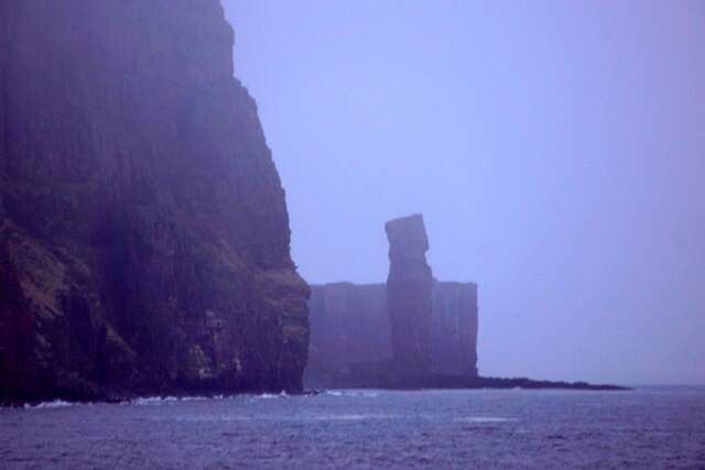
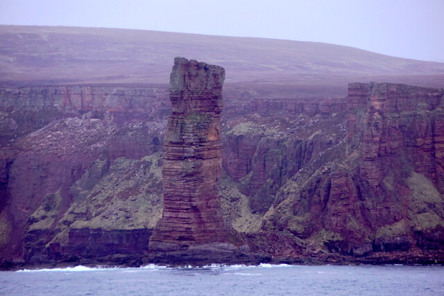
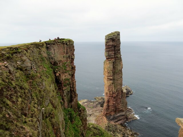
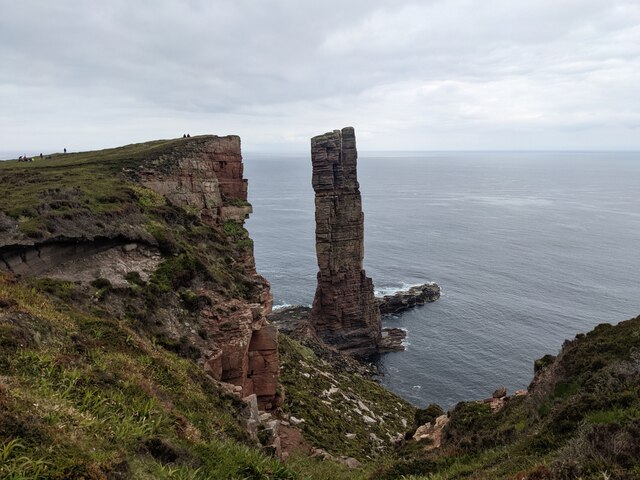
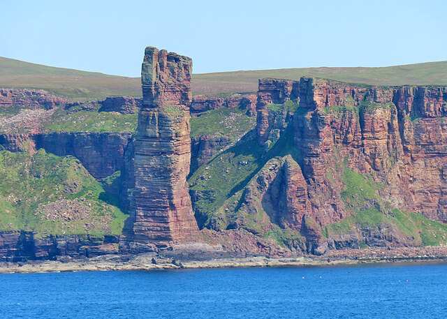
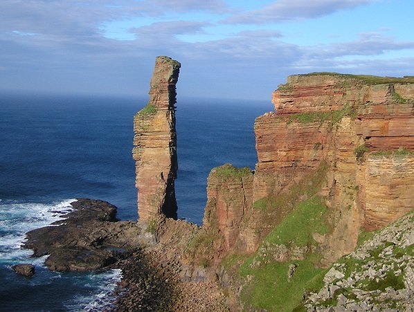
Old Man of Hoy
The Old Man of Hoy is a 449-foot (137-metre) sea stack on Hoy, part of the Orkney archipelago off the north coast of Scotland. Formed from Old Red Sandstone...
Rackwick
Rackwick is a small coastal crofting township in the north west of the island of Hoy in Orkney, Scotland. As well as a handful of tourist amenities the...

HMS Pheasant (1916)
HMS Pheasant was one of 85 Admiralty M-class destroyers built during the First World War for the Royal Navy. She hit and was sunk by a mine in 1917....

Ward Hill, Hoy
Ward Hill is a hill on the island of Hoy in Orkney, Scotland. It lies at the north of the island between Moaness and Rackwick, and is the highest point...

Dwarfie Stane
The Dwarfie Stane is a megalithic chambered tomb carved out of a titanic block of Devonian Old Red Sandstone located in a steep-sided glaciated valley...
Hoy, Orkney
Hoy (Scots: Hoy; from Old Norse Háey, meaning "high island") is an island in Orkney, Scotland, measuring 143 square kilometres (55 sq mi) – the second...

Hoy Sound
Hoy Sound is a body of salt water subject to tidal currents situated south of the town of Stromness in the Orkney archipelago of Scotland. The sound lies...

Breckness House
Breckness House, sometimes known as Breckness Castle, is the site of the 17th century mansion, chapel and burial ground, built by George Graham (1565–1643...
Nearby Amenities
Located within 500m of 58.887973,-3.4244257Have you been to Scarsa?
Leave your review of Scarsa below (or comments, questions and feedback).