Tuaks of the Boy
Coastal Feature, Headland, Point in Orkney
Scotland
Tuaks of the Boy
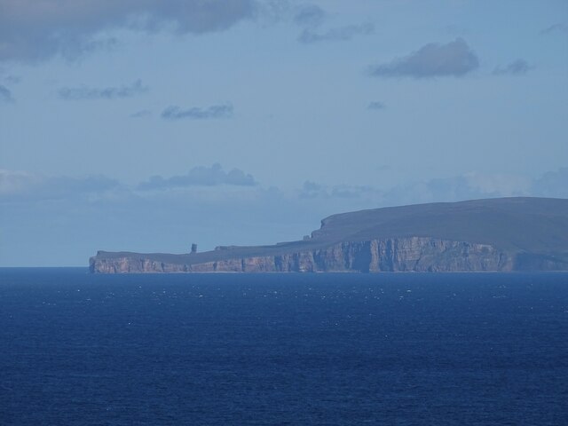
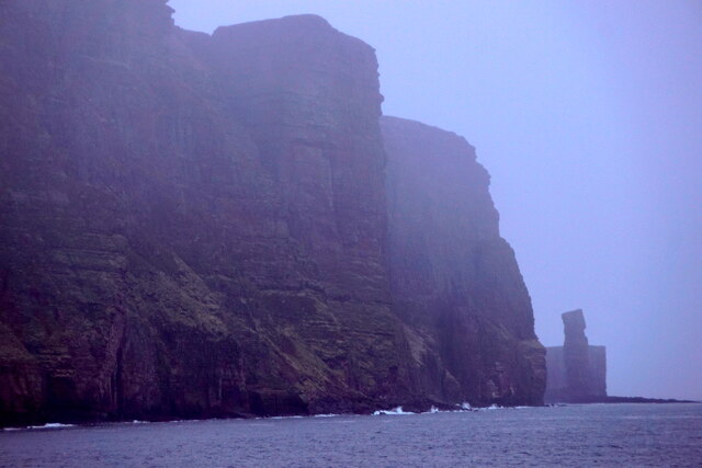
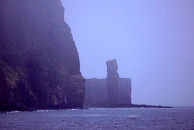
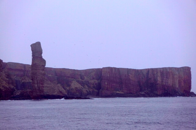
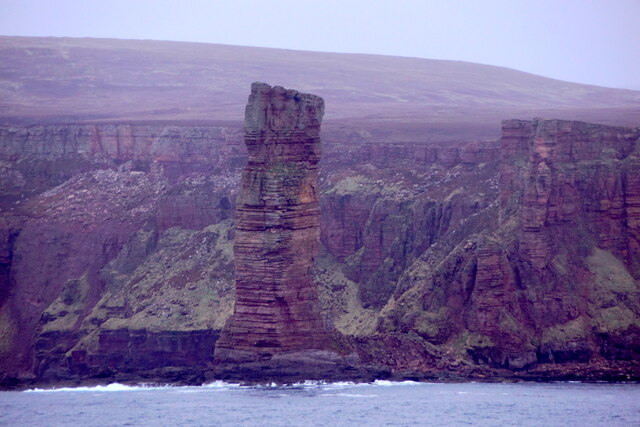
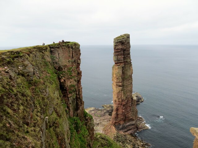
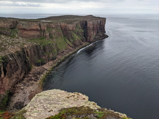
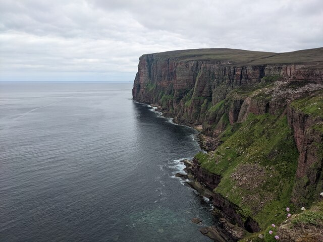
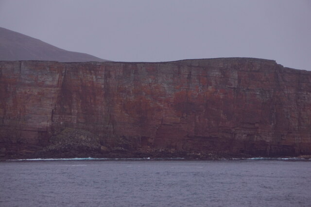
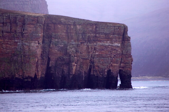
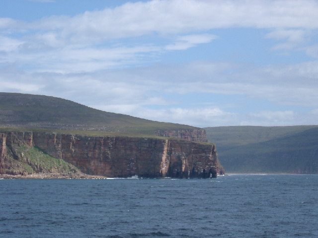
Tuaks of the Boy is a prominent coastal feature located in Orkney, an archipelago situated off the northeastern coast of Scotland. This geological formation takes the shape of a headland or point and is known for its distinctive rugged cliffs and stunning views of the surrounding coastline.
Rising to an elevation of approximately 120 meters, Tuaks of the Boy offers an impressive vista of the North Sea and the nearby islands of Orkney. The headland is composed of layers of sedimentary rocks, primarily sandstone and shale, which exhibit fascinating geological patterns and colors.
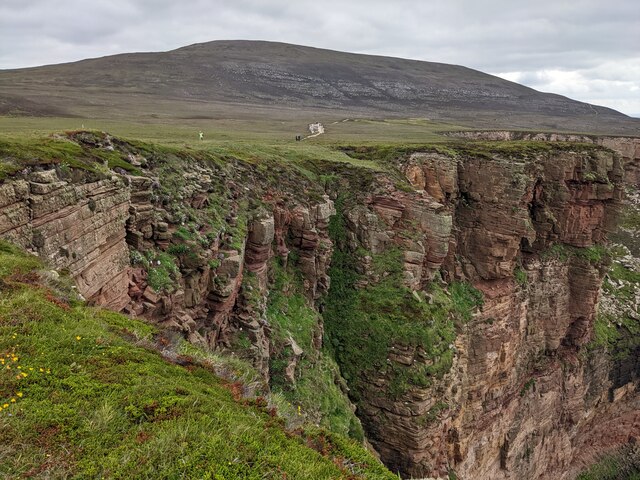
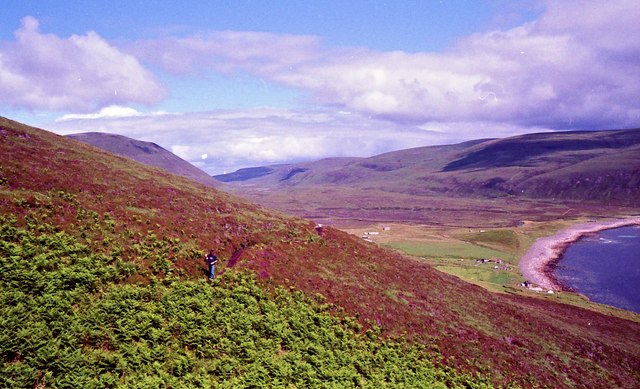
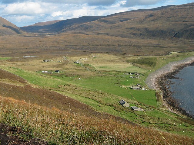
The area surrounding Tuaks of the Boy is rich in wildlife, making it a popular destination for nature enthusiasts. Visitors may be lucky enough to spot a variety of seabirds, including puffins, guillemots, and kittiwakes, nesting on the cliffs. Grey seals can often be seen basking on the rocks below, while occasional sightings of dolphins and whales add to the allure of the site.
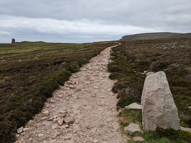
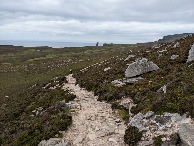
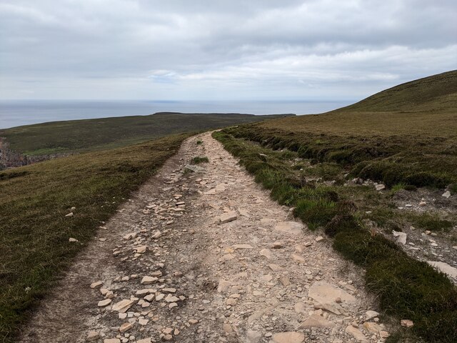
Access to Tuaks of the Boy is relatively straightforward, with a well-maintained footpath leading from a nearby parking area. The path meanders along the cliff edge, providing breathtaking views and ample opportunities for photography. However, caution is advised as the cliffs can be steep and slippery, especially during wet weather.
Overall, Tuaks of the Boy is a captivating coastal feature in Orkney, offering visitors a chance to immerse themselves in the region's natural beauty. With its dramatic cliffs, abundant wildlife, and panoramic views, it is undoubtedly a must-see destination for anyone exploring this picturesque part of Scotland.
If you have any feedback on the listing, please let us know in the comments section below.
Tuaks of the Boy Images
Images are sourced within 2km of 58.885077/-3.4264233 or Grid Reference HY1700. Thanks to Geograph Open Source API. All images are credited.
Tuaks of the Boy is located at Grid Ref: HY1700 (Lat: 58.885077, Lng: -3.4264233)
Unitary Authority: Orkney Islands
Police Authority: Highlands and Islands
What 3 Words
///universal.ripen.table. Near Stromness, Orkney Islands
Nearby Locations
Related Wikis

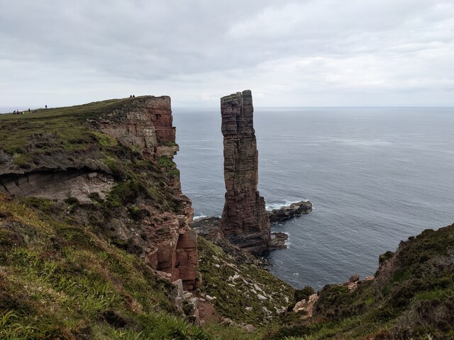
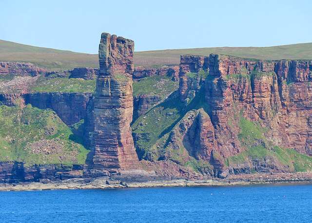
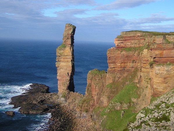
Old Man of Hoy
The Old Man of Hoy is a 449-foot (137-metre) sea stack on Hoy, part of the Orkney archipelago off the north coast of Scotland. Formed from Old Red Sandstone...

HMS Pheasant (1916)
HMS Pheasant was one of 85 Admiralty M-class destroyers built during the First World War for the Royal Navy. She hit and was sunk by a mine in 1917....
Rackwick
Rackwick is a small coastal crofting township in the north west of the island of Hoy in Orkney, Scotland. As well as a handful of tourist amenities the...

Ward Hill, Hoy
Ward Hill is a hill on the island of Hoy in Orkney, Scotland. It lies at the north of the island between Moaness and Rackwick, and is the highest point...

Dwarfie Stane
The Dwarfie Stane is a megalithic chambered tomb carved out of a titanic block of Devonian Old Red Sandstone located in a steep-sided glaciated valley...
Hoy, Orkney
Hoy (Scots: Hoy; from Old Norse Háey, meaning "high island") is an island in Orkney, Scotland, measuring 143 square kilometres (55 sq mi) – the second...

Hoy Sound
Hoy Sound is a body of salt water subject to tidal currents situated south of the town of Stromness in the Orkney archipelago of Scotland. The sound lies...

Graemsay
Graemsay () is an island in the western approaches to Scapa Flow, in the Orkney Islands of Scotland. The island has two lighthouses. Graemsay lies within...
Nearby Amenities
Located within 500m of 58.885077,-3.4264233Have you been to Tuaks of the Boy?
Leave your review of Tuaks of the Boy below (or comments, questions and feedback).