Hodbarrow Point

Coastal Feature, Headland, Point in Cumberland Copeland

England

Hodbarrow Point

Borwick Rails looking towards Millom
Borwick Rails looking towards Millom Credit: Colin Pyle

Hodbarrow Point is a prominent headland located on the coast of Cumberland, a historic county in northwest England. Situated near the town of Millom, it is a significant coastal feature that attracts both locals and tourists due to its unique geological and ecological characteristics.

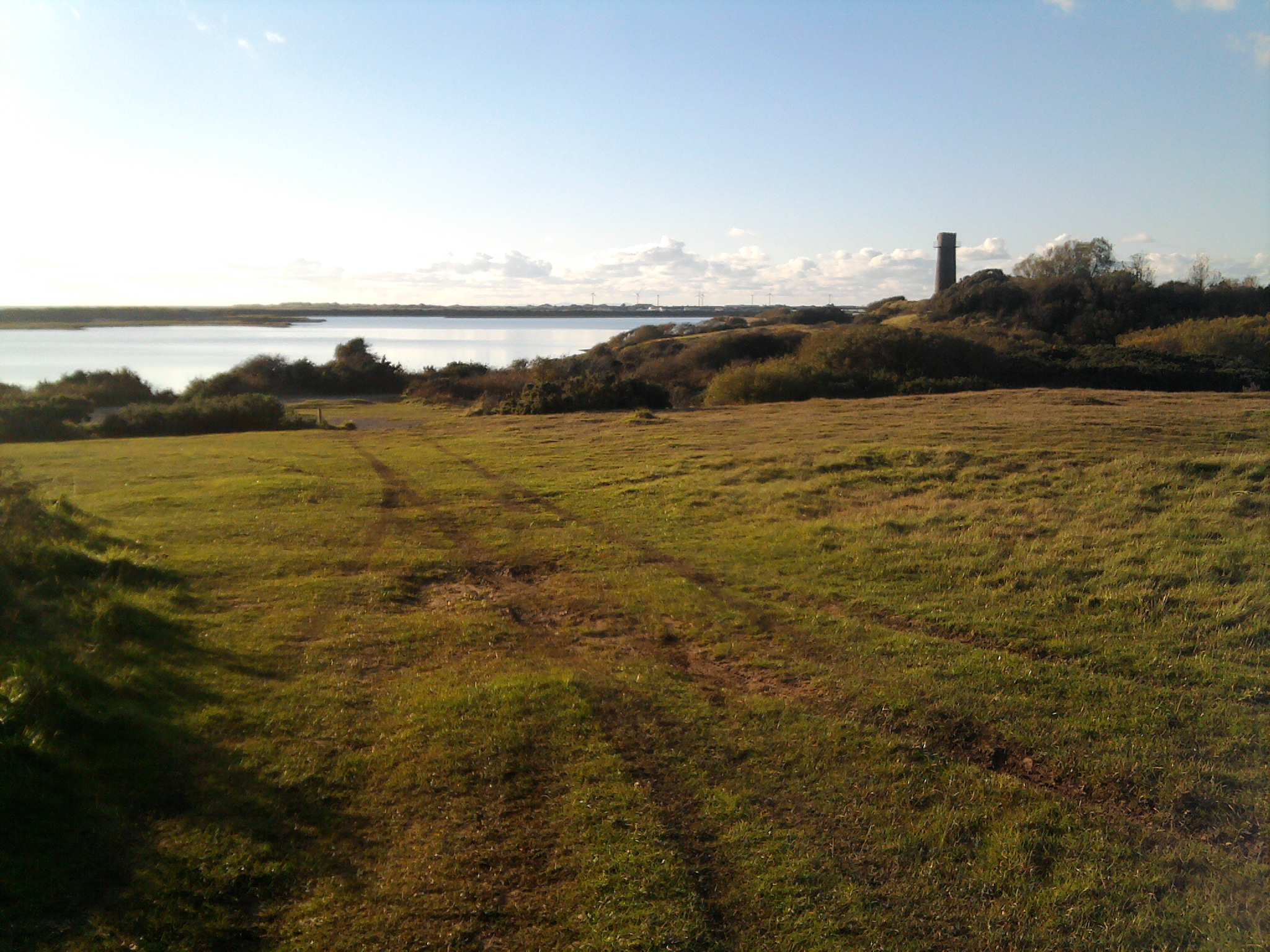
Formed during the last Ice Age, Hodbarrow Point juts out into the Irish Sea, creating a distinct headland that provides panoramic views of the surrounding coastline. It is primarily composed of rocky cliffs and pebble beaches, which are interspersed with stretches of sand dunes and salt marshes. These diverse habitats support a rich variety of flora and fauna, making it an important area for wildlife conservation.

One of the notable features of Hodbarrow Point is its former iron ore mine, which operated from the mid-19th century until its closure in 1968. The mine was a significant contributor to the local economy during its operation and played a crucial role in the industrial development of the region. Today, the remnants of the mining infrastructure can still be seen, including the remains of the mine buildings and railway tracks.

In addition to its geological and historical significance, Hodbarrow Point offers recreational opportunities for visitors. The headland is popular among hikers and nature enthusiasts who enjoy exploring its diverse landscape and observing the various bird species that inhabit the area. It is also a favored spot for fishing, with anglers frequently casting their lines from the rocky shores.

Overall, Hodbarrow Point is a captivating coastal feature that combines natural beauty, historical significance, and recreational opportunities, making it a cherished destination for both locals and visitors alike.

If you have any feedback on the listing, please let us know in the comments section below.

Hodbarrow Point Images

Images are sourced within 2km of 54.191977/-3.2545195 or Grid Reference SD1878. Thanks to Geograph Open Source API. All images are credited.

Borwick Rails looking towards Millom
St Georges Road, Millom
Hodbarrow Lighthouse on the Outer Barrier Established in 1905, Hodbarrow (Haverigg) Lighthouse sits on the Outer Barrier created for the former Hodbarrow Mines.

This photograph was taken during the Coronavirus (COVID-19) pandemic of 2020/21.
Hodbarrow Lighthouse on the Outer Barrier
Established in 1905, Hodbarrow (Haverigg) Lighthouse sits on the Outer Barrier created for the former Hodbarrow Mines. This photograph was taken during the Coronavirus (COVID-19) pandemic of 2020/21.
Ordnance Survey Cut Mark This OS cut mark can be found on the office building east side of Mainsgate Road. It marks a point 6.514m above mean sea level.
Ordnance Survey Cut Mark
This OS cut mark can be found on the office building east side of Mainsgate Road. It marks a point 6.514m above mean sea level.
Mud flats looking across to Black Combe The sand was making very strange hissing gurgling noises where I took this photo
Mud flats looking across to Black Combe
The sand was making very strange hissing gurgling noises where I took this photo
Hodbarrow lagoon and barrier This shows the remains of the inner barrier of hodbarrow ironworks lagoon and a substantial portion of the lagoon itself, which occupies the grid square identified here. The turbines at Kirksanton can be identified in the far distance to the left and the edge of Black Combe is also identifiable.
Hodbarrow lagoon and barrier
This shows the remains of the inner barrier of hodbarrow ironworks lagoon and a substantial portion of the lagoon itself, which occupies the grid square identified here. The turbines at Kirksanton can be identified in the far distance to the left and the edge of Black Combe is also identifiable.
Lighthouse at edge of Hodbarrow lagoon This photo is taken looking back across the Duddon estuary to the Furness peninsula beyond. The lighthouse is on the Cumbria Coastal Way
Lighthouse at edge of Hodbarrow lagoon
This photo is taken looking back across the Duddon estuary to the Furness peninsula beyond. The lighthouse is on the Cumbria Coastal Way
Disused windmill at Hodbarrow This disused windmill is located on the Cumbria Coastal Way at Hodbarrow and is clearly marked in the grid square.
Disused windmill at Hodbarrow
This disused windmill is located on the Cumbria Coastal Way at Hodbarrow and is clearly marked in the grid square.
Rusty Buoy outside Youth Hostel Millom youth hostel is in this grid square and the buoy stands sentinel at the end of its garden. The photo looks across the estuary to the furness peninsula.
Rusty Buoy outside Youth Hostel
Millom youth hostel is in this grid square and the buoy stands sentinel at the end of its garden. The photo looks across the estuary to the furness peninsula.
Remains of  Pier  at Salterhouse Pool On the Duddon estuary, once an integral feature of Hodbarrow Iron Works.
Remains of Pier at Salterhouse Pool
On the Duddon estuary, once an integral feature of Hodbarrow Iron Works.
Hodbarrow sunset Sunset over the lagoon.
Hodbarrow sunset
Sunset over the lagoon.
Old lighthouse, Hodbarrow The old lighthouse from the days before the building of the outer sea wall.
Old lighthouse, Hodbarrow
The old lighthouse from the days before the building of the outer sea wall.
Hodbarrow sunset
Hodbarrow sunset
View of Millom from the park Duddon estuary runs behind the town.
View of Millom from the park
Duddon estuary runs behind the town.
Hodbarrow reserve, looking to old lighthouse Broom bushes in full bloom - following the equally vivid display from the gorse.
Hodbarrow reserve, looking to old lighthouse
Broom bushes in full bloom - following the equally vivid display from the gorse.
Hodbarrow reserve, site of former iron mining and works The lagoon is the result of flooding of former mining area.
Hodbarrow reserve, site of former iron mining and works
The lagoon is the result of flooding of former mining area.
Near Hodbarrow Point, sea wall curving away in the distance
Near Hodbarrow Point
Show me another place!

Hodbarrow Point is located at Grid Ref: SD1878 (Lat: 54.191977, Lng: -3.2545195)

Administrative County: Cumbria

District: Copeland

Police Authority: Cumbria

What 3 Words

///bowhead.butterfly.removals. Near Millom, Cumbria

Related Wikis

Hodbarrow RSPB reserve

Hodbarrow RSPB Reserve is a nature reserve run by the Royal Society for the Protection of Birds (RSPB) on the edge of the Lake District National Park in...

Millom Rural District

Millom was a rural district in Cumberland in England from 1934 to 1974. It was formed by a County Review Order in 1934 by the merger of the Millom urban...

St George's Church, Millom

St George's Church is in the town of Millom, Cumbria, England. It is an active Anglican parish church in the deanery of Furness, the archdeaconry of Westmoreland...

Millom

Millom is a town and civil parish on the north shore of the estuary of the River Duddon in southernmost Cumberland, Cumbria, England. It is situated just...

Haverigg

Haverigg is a village on the south-west coast of Cumbria, England, historically part of the county of Cumberland. In 2001 it had a population of 1,791...

Millom railway station

Millom is a railway station on the Cumbrian Coast Line, which runs between Carlisle and Barrow-in-Furness. The station, situated 16 miles (26 km) north...

Millom Discovery Centre

Millom Heritage and Arts Centre, formerly known as the Millom Folk Museum and Millom Discovery Centre, is located in Millom, Cumbria, England. The museum...

St George's Road, Millom

St George's Road is a cricket ground located off St George's Road in Millom, Cumberland. The ground is bordered to the south–east by the Cumbrian Coast...

Nearby Amenities

Located within 500m of 54.191977,-3.2545195
Source: PGS
Lat/Long: 54.1935848/-3.2519146
Source: PGS
Lat/Long: 54.1937772/-3.2516436
Source: PGS
Lat/Long: 54.1939417/-3.2513911
Source: PGS
Lat/Long: 54.1941347/-3.2511808
Source: PGS
Lat/Long: 54.1942717/-3.2508931
Source: PGS
Lat/Long: 54.1944109/-3.250832
Source: PGS
Lat/Long: 54.1945937/-3.2506585
Source: PGS
Lat/Long: 54.1947855/-3.2503506
Source: PGS
Lat/Long: 54.195074/-3.249822
Source: PGS
Lat/Long: 54.1952516/-3.249444
Source: PGS
Lat/Long: 54.1907624/-3.2613117
Source: PGS
Lat/Long: 54.191279/-3.2595801
Source: PGS
Lat/Long: 54.1915172/-3.2589749
Source: PGS
Lat/Long: 54.1917815/-3.258389
Source: PGS
Lat/Long: 54.1920618/-3.2577047
Source: PGS
Lat/Long: 54.1922949/-3.2571589
Source: PGS
Lat/Long: 54.1925025/-3.2566668
Source: PGS
Lat/Long: 54.1925887/-3.2562235
Source: PGS
Lat/Long: 54.1925184/-3.2559126
Source: PGS
Lat/Long: 54.1924032/-3.2556327
Source: PGS
Lat/Long: 54.1922941/-3.2555062
Source: PGS
Lat/Long: 54.1921965/-3.2553908
Source: PGS
Lat/Long: 54.1919602/-3.2549582
Source: PGS
Lat/Long: 54.1919586/-3.254652
Source: PGS
Lat/Long: 54.1918007/-3.2538658
Source: PGS
Lat/Long: 54.1919181/-3.253825
Source: PGS
Lat/Long: 54.1929502/-3.2528072
Source: PGS
Lat/Long: 54.1930431/-3.252798
Source: PGS
Lat/Long: 54.1930941/-3.2527323
Source: PGS
Lat/Long: 54.1932477/-3.2525024
Source: PGS
Lat/Long: 54.1934195/-3.2521951
Hodbarrow Point
Natural: point
Source: OS7
Lat/Long: 54.1918895/-3.2542261
Ele: 20.4
Man Made: survey_point
Note: N54° 11' 34.5" W3° 15' 15.8"
Lat/Long: 54.1929055/-3.2543475
Man Made: windmill
Ruins: yes
Lat/Long: 54.193023/-3.2542623
Towsey Hole
Historic: mine_shaft
Lat/Long: 54.1921786/-3.2539072
Barrier: bollard
Lat/Long: 54.1923697/-3.2546202
Barrier: bollard
Lat/Long: 54.1923573/-3.2546606
Barrier: bollard
Lat/Long: 54.1923553/-3.2547098
Hodbarrow Lighthouse
Man Made: lighthouse
Ruins: yes
Wikidata: Q17642355
Lat/Long: 54.1940944/-3.2582701
Information: board
Tourism: information
Lat/Long: 54.1941866/-3.2591627
Bench
Material: brick
Lat/Long: 54.1941684/-3.2591769
Information: board
Tourism: information
Lat/Long: 54.192846/-3.2562557
The data included in this document is from www.openstreetmap.org. The data is made available under ODbL.

Have you been to Hodbarrow Point?

Leave your review of Hodbarrow Point below (or comments, questions and feedback).