Hodbarrow Scar

Coastal Feature, Headland, Point in Cumberland Copeland

England

Hodbarrow Scar

Hodbarrow Lighthouse on the Outer Barrier Established in 1905, Hodbarrow (Haverigg) Lighthouse sits on the Outer Barrier created for the former Hodbarrow Mines.

This photograph was taken during the Coronavirus (COVID-19) pandemic of 2020/21.
Hodbarrow Lighthouse on the Outer Barrier Credit: James T M Towill

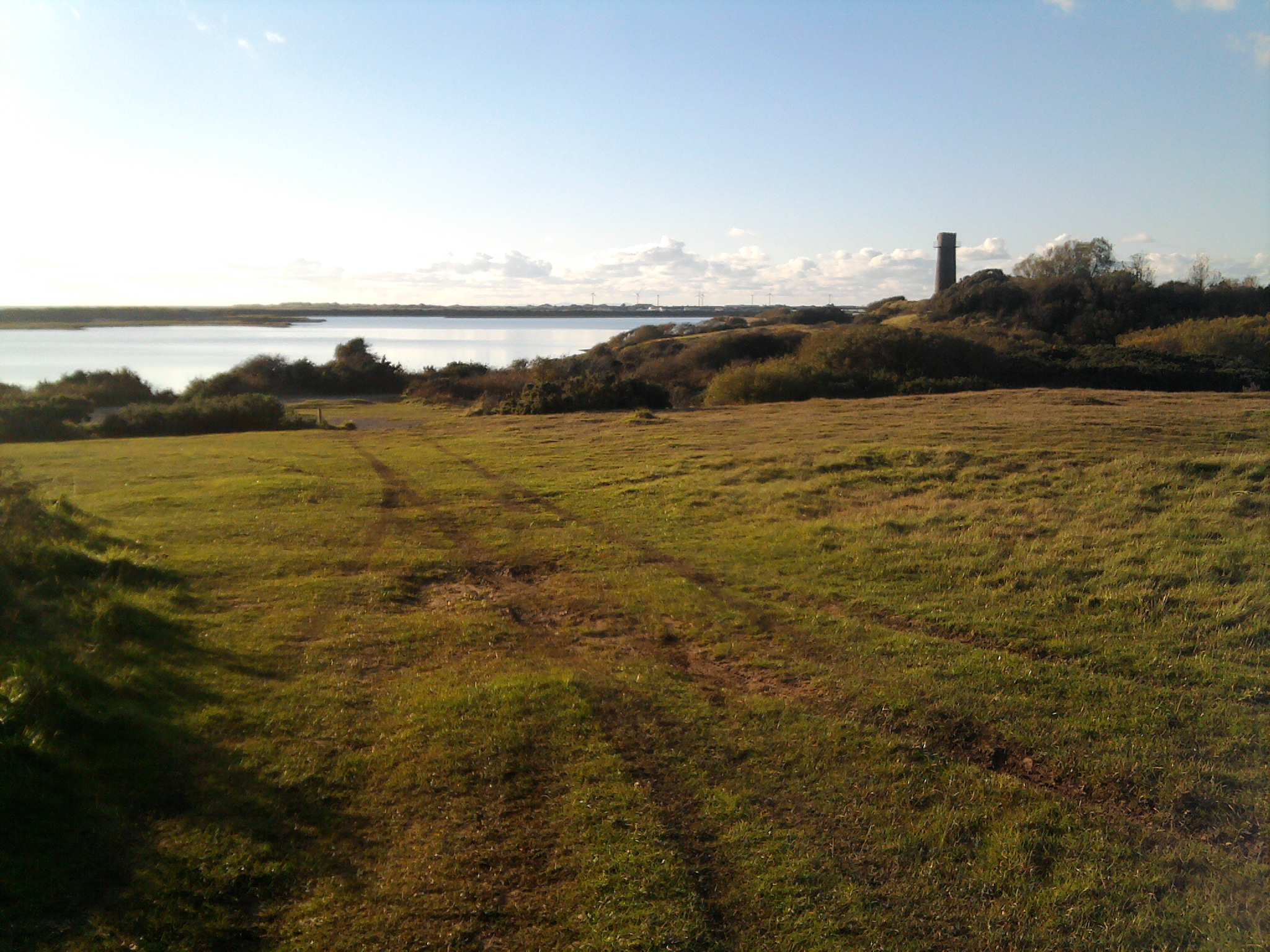
Hodbarrow Scar is a prominent coastal feature located in Cumberland, England. It is a headland or point that juts out into the Irish Sea, creating a distinctive landscape along the coastline. The scar is known for its rugged beauty and is a popular destination for nature enthusiasts and photographers.

The formation of Hodbarrow Scar can be attributed to the natural erosion caused by the sea over thousands of years. The constant battering of the waves against the cliffs has carved out a steep and jagged edge, giving it a dramatic appearance. The scar is made up of layers of sedimentary rocks, which are visible along the exposed cliffs.

The area surrounding Hodbarrow Scar is rich in biodiversity. The cliffs provide nesting sites for various seabirds, including guillemots and kittiwakes. The rocky shoreline is home to a diverse range of marine life, such as crabs, mollusks, and small fish. During low tide, visitors can explore the rock pools teeming with colorful marine organisms.

Hodbarrow Scar also has historical significance. In the 19th century, it was a thriving iron ore mining site, with several mines operating in the vicinity. The scar served as a natural harbor for shipping the mined ore to other parts of the country. Today, remnants of the industrial past can still be seen, including old mine shafts and ruins of buildings.

Overall, Hodbarrow Scar is a captivating coastal feature that offers both natural beauty and historical interest. Its impressive cliffs, diverse wildlife, and remnants of the iron ore industry make it a must-visit destination for those exploring the Cumberland coastline.

If you have any feedback on the listing, please let us know in the comments section below.

Hodbarrow Scar Images

Images are sourced within 2km of 54.193522/-3.2580303 or Grid Reference SD1878. Thanks to Geograph Open Source API. All images are credited.

Hodbarrow Lighthouse on the Outer Barrier Established in 1905, Hodbarrow (Haverigg) Lighthouse sits on the Outer Barrier created for the former Hodbarrow Mines.

This photograph was taken during the Coronavirus (COVID-19) pandemic of 2020/21.
Hodbarrow Lighthouse on the Outer Barrier
Established in 1905, Hodbarrow (Haverigg) Lighthouse sits on the Outer Barrier created for the former Hodbarrow Mines. This photograph was taken during the Coronavirus (COVID-19) pandemic of 2020/21.
Ordnance Survey Cut Mark This OS cut mark can be found on the office building east side of Mainsgate Road. It marks a point 6.514m above mean sea level.
Ordnance Survey Cut Mark
This OS cut mark can be found on the office building east side of Mainsgate Road. It marks a point 6.514m above mean sea level.
The Front housing Pastel rendered housing with sea defences
The Front housing
Pastel rendered housing with sea defences
Rusting and Waiting Iron pulley wheels on the Hodbarrow New Sea Wall that have remained idle since the completion of the defence in 1905. 
Wind turbines can be seen on the southside of the Duddon Estuary.
Rusting and Waiting
Iron pulley wheels on the Hodbarrow New Sea Wall that have remained idle since the completion of the defence in 1905. Wind turbines can be seen on the southside of the Duddon Estuary.
Old Powder Store The old wind mill on Hodbarrow Point was reused by the iron miners to store their black powder between 1855 and 1880 when a new facility was built. Despite its ruined state, there is no record of it being damaged by explosion, so it must be time that is causing it crumble.
Old Powder Store
The old wind mill on Hodbarrow Point was reused by the iron miners to store their black powder between 1855 and 1880 when a new facility was built. Despite its ruined state, there is no record of it being damaged by explosion, so it must be time that is causing it crumble.
Duddon Sands The Duddon Estuary seen from over Furness. The Hodbarrow Lagoon is contained by a wall between Haverigg and Hodbarrow Point on the right [northern] side of the estuary. On the left is the tip of Walney Island and Sandscale Haws.
Duddon Sands
The Duddon Estuary seen from over Furness. The Hodbarrow Lagoon is contained by a wall between Haverigg and Hodbarrow Point on the right [northern] side of the estuary. On the left is the tip of Walney Island and Sandscale Haws.
Cumbria : Duddon Sands Looking down towards Duddon Sands on the Cumbria coastline as a plane from Heathrow heads to Iceland.
Cumbria : Duddon Sands
Looking down towards Duddon Sands on the Cumbria coastline as a plane from Heathrow heads to Iceland.
Duddon Sands With Askham in Furness on the left and Haverigg on the right.
Duddon Sands
With Askham in Furness on the left and Haverigg on the right.
Steel Green, Haverigg Looking west from over Furness, with Millom at lower right.
Steel Green, Haverigg
Looking west from over Furness, with Millom at lower right.
St. George's Church and Graveyard, Millom St. George's Church on a very wet day; the gravestones in view are at the south and west sides of the building.
St. George's Church and Graveyard, Millom
St. George's Church on a very wet day; the gravestones in view are at the south and west sides of the building.
Mosaics on the sea wall path at Haverigg
Mouth of Haverigg Pool Aka the Lazy River. Beyond are the vast tidal sand banks of the Duddon estuary.
Mouth of Haverigg Pool
Aka the Lazy River. Beyond are the vast tidal sand banks of the Duddon estuary.
Haverigg Pool Boats left high and dry at low tide.
Haverigg Pool
Boats left high and dry at low tide.
Boats on the sand banks at Haverigg The tide goes out a long way in the Duddon estuary. In the distance are the sand dunes of Sandscale Haws.
Boats on the sand banks at Haverigg
The tide goes out a long way in the Duddon estuary. In the distance are the sand dunes of Sandscale Haws.
Channel at Hodbarrow In the foreground are  concrete blocks reinforcing the Outer Barrier which cuts off the Hodbarrow Lagoon from the sea.
Channel at Hodbarrow
In the foreground are concrete blocks reinforcing the Outer Barrier which cuts off the Hodbarrow Lagoon from the sea.
Bird hide at Hodbarrow Point With some rather colourful decorations.
Bird hide at Hodbarrow Point
With some rather colourful decorations.
The Hodbarrow Lighthouse Standing on the outer barrier of the Hodbarrow Lagoon, Hodbarrow (alternatively known as Haverigg) Lighthouse was in operation from 1905 to 1949. Recently restored but no longer part of the national system of lights. Next to the lighthouse is an old World War II structure.
The Hodbarrow Lighthouse
Standing on the outer barrier of the Hodbarrow Lagoon, Hodbarrow (alternatively known as Haverigg) Lighthouse was in operation from 1905 to 1949. Recently restored but no longer part of the national system of lights. Next to the lighthouse is an old World War II structure.
Ternery on Hodbarrow Lagoon The island is home to a large number of nesting Sandwich Terns and a rather smaller number of Black Headed Gulls.
Ternery on Hodbarrow Lagoon
The island is home to a large number of nesting Sandwich Terns and a rather smaller number of Black Headed Gulls.
Show me another place!

Hodbarrow Scar is located at Grid Ref: SD1878 (Lat: 54.193522, Lng: -3.2580303)

Administrative County: Cumbria

District: Copeland

Police Authority: Cumbria

What 3 Words

///bogus.ideal.trackers. Near Millom, Cumbria

Related Wikis

Hodbarrow RSPB reserve

Hodbarrow RSPB Reserve is a nature reserve run by the Royal Society for the Protection of Birds (RSPB) on the edge of the Lake District National Park in...

Millom Rural District

Millom was a rural district in Cumberland in England from 1934 to 1974. It was formed by a County Review Order in 1934 by the merger of the Millom urban...

St George's Church, Millom

St George's Church is in the town of Millom, Cumbria, England. It is an active Anglican parish church in the deanery of Furness, the archdeaconry of Westmoreland...

Millom

Millom is a town and civil parish on the north shore of the estuary of the River Duddon in southernmost Cumberland, Cumbria, England. It is situated just...

Nearby Amenities

Located within 500m of 54.193522,-3.2580303
Source: PGS
Lat/Long: 54.1935848/-3.2519146
Source: PGS
Lat/Long: 54.1937772/-3.2516436
Source: PGS
Lat/Long: 54.1939417/-3.2513911
Source: PGS
Lat/Long: 54.1941347/-3.2511808
Source: PGS
Lat/Long: 54.1942717/-3.2508931
Source: PGS
Lat/Long: 54.1944109/-3.250832
Source: PGS
Lat/Long: 54.1945937/-3.2506585
Source: PGS
Lat/Long: 54.1904218/-3.2628137
Source: PGS
Lat/Long: 54.1907624/-3.2613117
Source: PGS
Lat/Long: 54.191279/-3.2595801
Source: PGS
Lat/Long: 54.1915172/-3.2589749
Source: PGS
Lat/Long: 54.1917815/-3.258389
Source: PGS
Lat/Long: 54.1920618/-3.2577047
Source: PGS
Lat/Long: 54.1922949/-3.2571589
Source: PGS
Lat/Long: 54.1925025/-3.2566668
Source: PGS
Lat/Long: 54.1925887/-3.2562235
Source: PGS
Lat/Long: 54.1925184/-3.2559126
Source: PGS
Lat/Long: 54.1924032/-3.2556327
Source: PGS
Lat/Long: 54.1922941/-3.2555062
Source: PGS
Lat/Long: 54.1921965/-3.2553908
Source: PGS
Lat/Long: 54.1919602/-3.2549582
Source: PGS
Lat/Long: 54.1919586/-3.254652
Source: PGS
Lat/Long: 54.1918007/-3.2538658
Source: PGS
Lat/Long: 54.1919181/-3.253825
Source: PGS
Lat/Long: 54.1929502/-3.2528072
Source: PGS
Lat/Long: 54.1930431/-3.252798
Source: PGS
Lat/Long: 54.1930941/-3.2527323
Source: PGS
Lat/Long: 54.1932477/-3.2525024
Source: PGS
Lat/Long: 54.1934195/-3.2521951
Hodbarrow Point
Natural: point
Source: OS7
Lat/Long: 54.1918895/-3.2542261
Ele: 20.4
Man Made: survey_point
Note: N54° 11' 34.5" W3° 15' 15.8"
Lat/Long: 54.1929055/-3.2543475
Man Made: windmill
Ruins: yes
Lat/Long: 54.193023/-3.2542623
Towsey Hole
Historic: mine_shaft
Lat/Long: 54.1921786/-3.2539072
Barrier: bollard
Lat/Long: 54.1923697/-3.2546202
Barrier: bollard
Lat/Long: 54.1923573/-3.2546606
Barrier: bollard
Lat/Long: 54.1923553/-3.2547098
Hodbarrow Lighthouse
Man Made: lighthouse
Ruins: yes
Wikidata: Q17642355
Lat/Long: 54.1940944/-3.2582701
Information: board
Tourism: information
Lat/Long: 54.1941866/-3.2591627
Bench
Material: brick
Lat/Long: 54.1941684/-3.2591769
Information: board
Tourism: information
Lat/Long: 54.192846/-3.2562557
The data included in this document is from www.openstreetmap.org. The data is made available under ODbL.

Have you been to Hodbarrow Scar?

Leave your review of Hodbarrow Scar below (or comments, questions and feedback).