The Neuk
Bay in Orkney
Scotland
The Neuk
The Neuk, located in Orkney, is a picturesque bay situated on the northeastern coast of Scotland. With its stunning natural beauty and tranquil atmosphere, The Neuk is a popular destination for both locals and tourists alike.
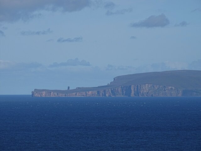
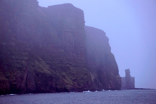
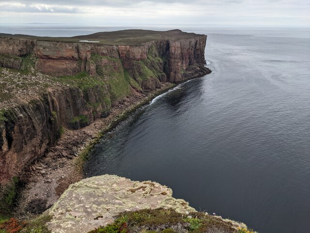
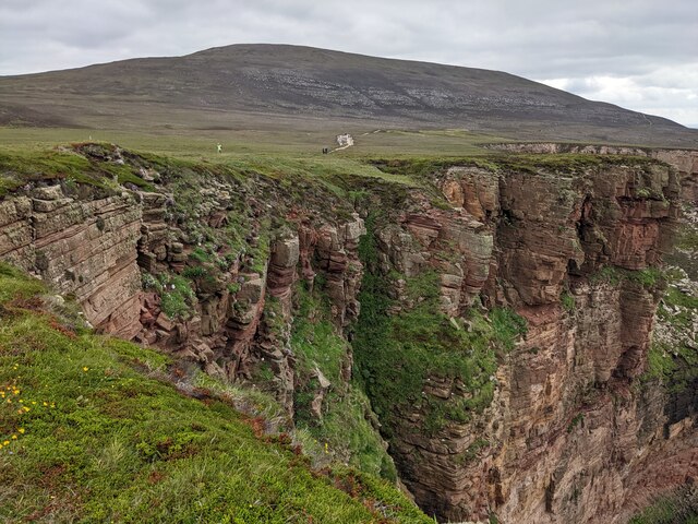
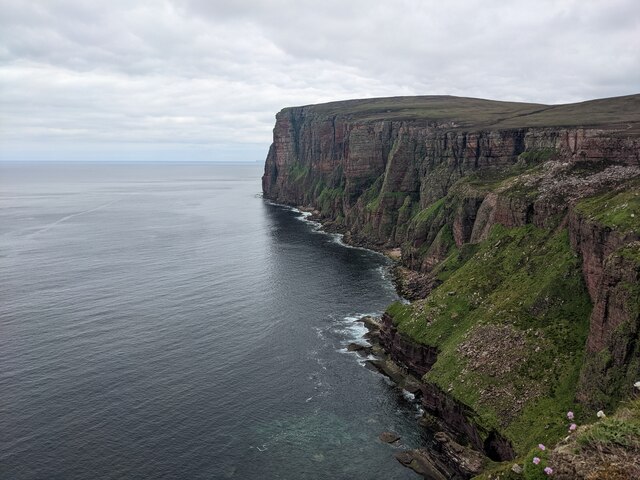
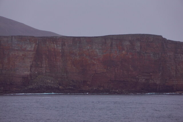
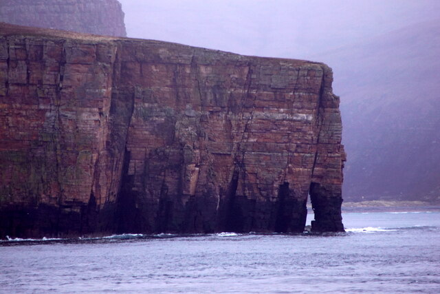
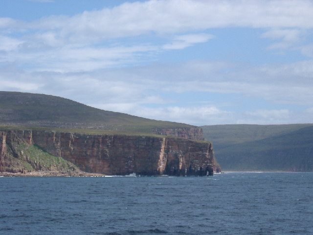
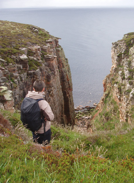
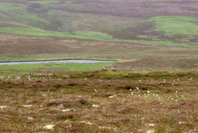
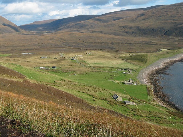
The bay is surrounded by rolling green hills and dramatic cliffs, offering breathtaking views of the North Sea. The crystal-clear waters are home to a diverse array of marine life, making it a haven for nature enthusiasts and scuba divers. The Neuk is also famous for its pristine sandy beach, which stretches for miles and provides the perfect spot for relaxation and sunbathing.
The bay is not only visually appealing but also steeped in history. Nearby, there are numerous archaeological sites, including ancient burial mounds and standing stones, which offer a glimpse into Orkney's rich past. Additionally, The Neuk is in close proximity to Skara Brae, a Neolithic village that is a UNESCO World Heritage Site and one of the best-preserved prehistoric settlements in Europe.
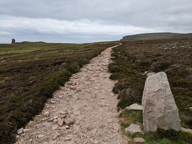
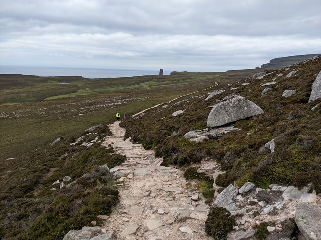
Visitors to The Neuk can enjoy a range of activities, from hiking along coastal paths to birdwatching, as the bay is a habitat for various bird species. The area is also known for its vibrant wildlife, with seals often spotted playing in the waters and otters occasionally seen along the shoreline.
In conclusion, The Neuk in Orkney is a stunning bay that combines natural beauty, historical significance, and diverse wildlife. Whether you are seeking relaxation, adventure, or a glimpse into the past, The Neuk offers something for everyone.
If you have any feedback on the listing, please let us know in the comments section below.
The Neuk Images
Images are sourced within 2km of 58.88775/-3.4300036 or Grid Reference HY1700. Thanks to Geograph Open Source API. All images are credited.
The Neuk is located at Grid Ref: HY1700 (Lat: 58.88775, Lng: -3.4300036)
Unitary Authority: Orkney Islands
Police Authority: Highlands and Islands
What 3 Words
///mirroring.reacting.riverbed. Near Stromness, Orkney Islands
Nearby Locations
Related Wikis

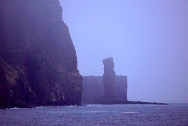
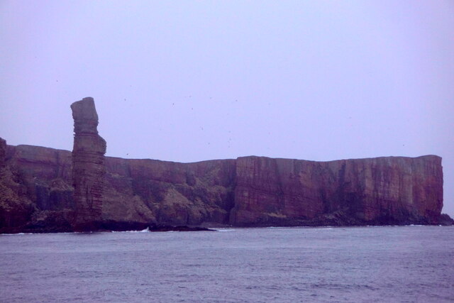
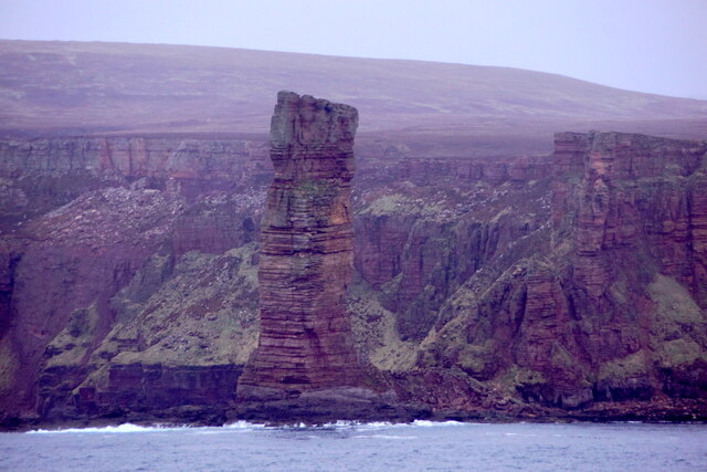
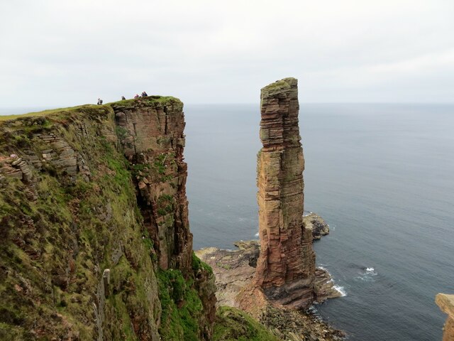
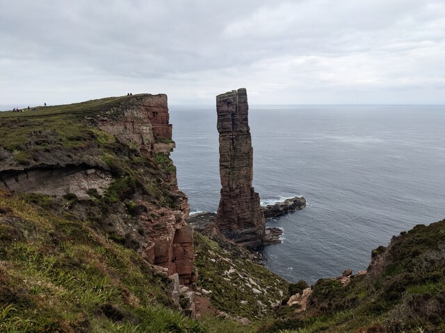
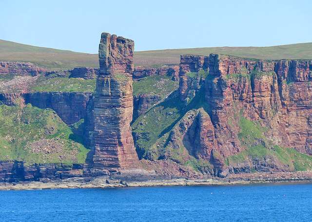
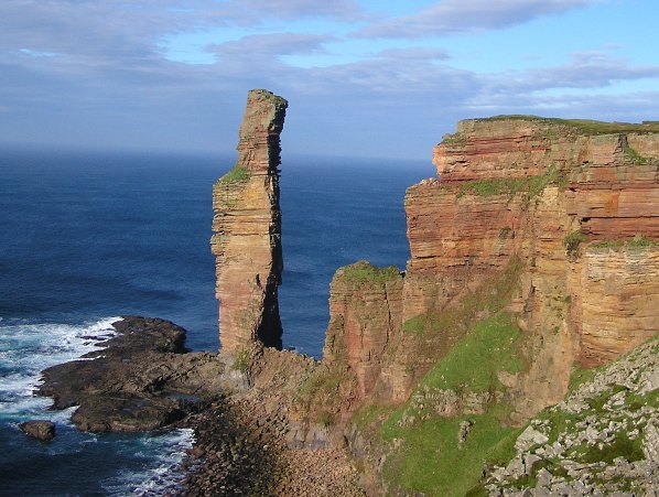
Old Man of Hoy
The Old Man of Hoy is a 449-foot (137-metre) sea stack on Hoy, part of the Orkney archipelago off the north coast of Scotland. Formed from Old Red Sandstone...

HMS Pheasant (1916)
HMS Pheasant was one of 85 Admiralty M-class destroyers built during the First World War for the Royal Navy. She hit and was sunk by a mine in 1917....
Rackwick
Rackwick is a small coastal crofting township in the north west of the island of Hoy in Orkney, Scotland. As well as a handful of tourist amenities the...

Ward Hill, Hoy
Ward Hill is a hill on the island of Hoy in Orkney, Scotland. It lies at the north of the island between Moaness and Rackwick, and is the highest point...

Dwarfie Stane
The Dwarfie Stane is a megalithic chambered tomb carved out of a titanic block of Devonian Old Red Sandstone located in a steep-sided glaciated valley...
Hoy, Orkney
Hoy (Scots: Hoy; from Old Norse Háey, meaning "high island") is an island in Orkney, Scotland, measuring 143 square kilometres (55 sq mi) – the second...

Hoy Sound
Hoy Sound is a body of salt water subject to tidal currents situated south of the town of Stromness in the Orkney archipelago of Scotland. The sound lies...

Breckness House
Breckness House, sometimes known as Breckness Castle, is the site of the 17th century mansion, chapel and burial ground, built by George Graham (1565–1643...
Nearby Amenities
Located within 500m of 58.88775,-3.4300036Have you been to The Neuk?
Leave your review of The Neuk below (or comments, questions and feedback).