Firgrove

Settlement in Lancashire

England

Firgrove

Rochdale Metro station and Mosque in Maclure Road
Rochdale Metro station and Mosque in Maclure Road Credit: Raymond Knapman

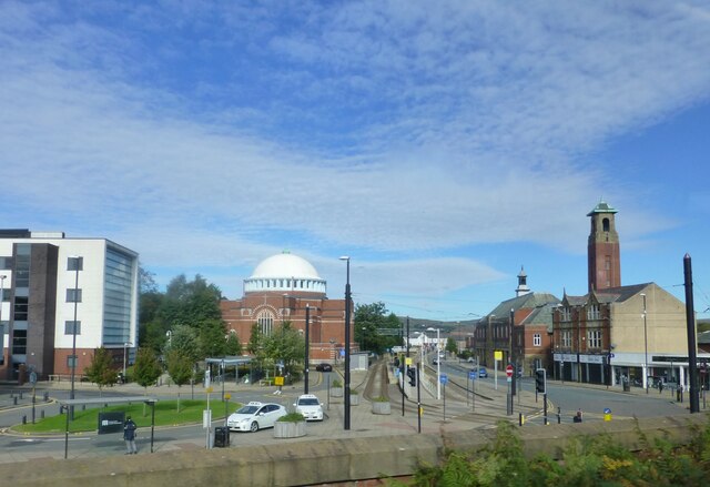
Firgrove is a small village located in the borough of Rochdale, Lancashire, in the northwest of England. Situated on the southern edge of the Pennines, Firgrove is surrounded by picturesque countryside, offering its residents and visitors a serene and tranquil environment.

With a population of around 1,500 people, Firgrove retains a strong sense of community and provides a close-knit atmosphere. The village primarily consists of residential properties, ranging from quaint cottages to more modern housing developments. The local architecture is reflective of Lancashire's traditional style, with stone and brick buildings prevalent throughout the area.

Firgrove benefits from its proximity to Rochdale town center, which is approximately 2 miles away. This allows residents access to a wide range of amenities, including shops, supermarkets, schools, and healthcare facilities. Additionally, the village is well-connected to neighboring towns and cities via a network of roads and public transportation.

Nature lovers will appreciate Firgrove's beautiful surroundings, with numerous walking trails and open spaces nearby. The village is also within reach of Hollingworth Lake, a popular tourist destination known for its sailing and water activities.

Overall, Firgrove offers a peaceful and idyllic setting for those seeking a quieter lifestyle while still being within easy reach of urban conveniences.

If you have any feedback on the listing, please let us know in the comments section below.

Firgrove Images

Images are sourced within 2km of 53.614376/-2.126187 or Grid Reference SD9113. Thanks to Geograph Open Source API. All images are credited.

Rochdale Metro station and Mosque in Maclure Road
The Old Fire Station (Fireground Museum) The old Fire Brigade Station on Maclure Road dates from 1933 (<a href="https://www.geograph.org.uk/photo/3693544">SD8912 : Fire Brigade Station Detail</a>). It became redundant when new premises were built near Halifax Road. (<span class="nowrap"><a title="http://web.archive.org/web/20130716033038/http://www.manchesterfire.gov.uk/my_area/rochdale/rochdale_new_build.aspx" rel="nofollow ugc noopener" href="http://web.archive.org/web/20130716033038/http://www.manchesterfire.gov.uk/my_area/rochdale/rochdale_new_build.aspx">Archive Link</a><img style="margin-left:2px;" alt="External link" title="External link - shift click to open in new window" src="https://s1.geograph.org.uk/img/external.png" width="10" height="10"/></span>  Greater Manchester Fire and Rescue Services)

It is now the home of the Fireground museum <span class="nowrap"><a title="https://www.fireground.org.uk/" rel="nofollow ugc noopener" href="https://www.fireground.org.uk/">Link</a><img style="margin-left:2px;" alt="External link" title="External link - shift click to open in new window" src="https://s1.geograph.org.uk/img/external.png" width="10" height="10"/></span>
The Old Fire Station (Fireground Museum)
The old Fire Brigade Station on Maclure Road dates from 1933 (SD8912 : Fire Brigade Station Detail). It became redundant when new premises were built near Halifax Road. (Archive LinkExternal link Greater Manchester Fire and Rescue Services) It is now the home of the Fireground museum LinkExternal link
Rochdale Fire Station Hose Drying Tower The original tower at the fire station was built, not for practising but, for drying the hoses which would have rotted if put away wet.
Rochdale Fire Station Hose Drying Tower
The original tower at the fire station was built, not for practising but, for drying the hoses which would have rotted if put away wet.
Rochdale Fireground Museum The Fireground Museum is housed in the former fire station on Maclure Road in Rochdale. Twenty-five larger exhibits make up the museum’s appliance fleet, and this is supported by other items of firefighting equipment, uniforms, models, medals and insignia, paintings, curios and other objects. 

See the museum’s website (<span class="nowrap"><a title="https://www.fireground.org.uk/" rel="nofollow ugc noopener" href="https://www.fireground.org.uk/">Link</a><img style="margin-left:2px;" alt="External link" title="External link - shift click to open in new window" src="https://s1.geograph.org.uk/img/external.png" width="10" height="10"/></span> ) for more information.
Rochdale Fireground Museum
The Fireground Museum is housed in the former fire station on Maclure Road in Rochdale. Twenty-five larger exhibits make up the museum’s appliance fleet, and this is supported by other items of firefighting equipment, uniforms, models, medals and insignia, paintings, curios and other objects. See the museum’s website (LinkExternal link ) for more information.
Rochdale Fireground, Pump Street As well as the ‘appliance room’ with six full-size fire engines lined up, many of the museum’s objects are displayed in Pump Street, a recreated Victorian street complete with houses, shops, a police station and a fire station.
Rochdale Fireground, Pump Street
As well as the ‘appliance room’ with six full-size fire engines lined up, many of the museum’s objects are displayed in Pump Street, a recreated Victorian street complete with houses, shops, a police station and a fire station.
Fire Marks at Rochdale Fireground A small selection of insurance companies' fire marks <span class="nowrap"><a title="https://en.wikipedia.org/wiki/Fire_insurance_mark" rel="nofollow ugc noopener" href="https://en.wikipedia.org/wiki/Fire_insurance_mark">Link</a><img style="margin-left:2px;" alt="External link" title="External link - shift click to open in new window" src="https://s1.geograph.org.uk/img/external.png" width="10" height="10"/></span> displayed at the fireground museum inside the old Rochdale Fire Station.
Fire Marks at Rochdale Fireground
A small selection of insurance companies' fire marks LinkExternal link displayed at the fireground museum inside the old Rochdale Fire Station.
Cranberry Street, Rochdale Fireground As well as the Victorian Street (<a href="https://www.geograph.org.uk/photo/7143189">SD8912 : Rochdale Fireground, Pump Street</a>), the Fireground museum also contains this recreation of a war-time scene, "Cranberry Street" displaying objects relating to the Manchester Blitz <span class="nowrap"><a title="https://en.wikipedia.org/wiki/Manchester_Blitz" rel="nofollow ugc noopener" href="https://en.wikipedia.org/wiki/Manchester_Blitz">Link</a><img style="margin-left:2px;" alt="External link" title="External link - shift click to open in new window" src="https://s1.geograph.org.uk/img/external.png" width="10" height="10"/></span> of December 1940.
Cranberry Street, Rochdale Fireground
As well as the Victorian Street (SD8912 : Rochdale Fireground, Pump Street), the Fireground museum also contains this recreation of a war-time scene, "Cranberry Street" displaying objects relating to the Manchester Blitz LinkExternal link of December 1940.
Rochdale Fireground, The Appliance Room The Fireground Museum is housed in the former fire station on Maclure Road in Rochdale. Twenty-five larger exhibits make up the museum’s appliance fleet, and this is supported by other items of firefighting equipment, uniforms, models, medals and insignia, paintings, curios and other objects. 

See the museum’s website (<span class="nowrap"><a title="https://www.fireground.org.uk/" rel="nofollow ugc noopener" href="https://www.fireground.org.uk/">Link</a><img style="margin-left:2px;" alt="External link" title="External link - shift click to open in new window" src="https://s1.geograph.org.uk/img/external.png" width="10" height="10"/></span> ) for more information.
Rochdale Fireground, The Appliance Room
The Fireground Museum is housed in the former fire station on Maclure Road in Rochdale. Twenty-five larger exhibits make up the museum’s appliance fleet, and this is supported by other items of firefighting equipment, uniforms, models, medals and insignia, paintings, curios and other objects. See the museum’s website (LinkExternal link ) for more information.
The Appliance Room, Rochdale Fireground The Fireground Museum is housed in the former fire station on Maclure Road in Rochdale. Twenty-five larger exhibits make up the museum’s appliance fleet, and this is supported by other items of firefighting equipment, uniforms, models, medals and insignia, paintings, curios and other objects. 

See the museum’s website (<span class="nowrap"><a title="https://www.fireground.org.uk/" rel="nofollow ugc noopener" href="https://www.fireground.org.uk/">Link</a><img style="margin-left:2px;" alt="External link" title="External link - shift click to open in new window" src="https://s1.geograph.org.uk/img/external.png" width="10" height="10"/></span> ) for more information.
The Appliance Room, Rochdale Fireground
The Fireground Museum is housed in the former fire station on Maclure Road in Rochdale. Twenty-five larger exhibits make up the museum’s appliance fleet, and this is supported by other items of firefighting equipment, uniforms, models, medals and insignia, paintings, curios and other objects. See the museum’s website (LinkExternal link ) for more information.
Double postbox and more on Yorkshire Street 
The top end of Yorkshire is not pedestrianised. The double postbox (OL16 31) is outside the former Townhead Post Office. Why it is surrounded by pieces of blue foam I cannot say. On the opposite side are a cafe, Cash Converters, a property management company and a hair salon.
Double postbox and more on Yorkshire Street
The top end of Yorkshire is not pedestrianised. The double postbox (OL16 31) is outside the former Townhead Post Office. Why it is surrounded by pieces of blue foam I cannot say. On the opposite side are a cafe, Cash Converters, a property management company and a hair salon.
Ukrainian Catholic Church of Saint Mary 
The Grade II listed <span class="nowrap"><a title="https://historicengland.org.uk/listing/the-list/list-entry/1346258?section=official-list-entry" rel="nofollow ugc noopener" href="https://historicengland.org.uk/listing/the-list/list-entry/1346258?section=official-list-entry">Link</a><img style="margin-left:2px;" alt="External link" title="External link - shift click to open in new window" src="https://s1.geograph.org.uk/img/external.png" width="10" height="10"/></span> church dates from 1821 and was formerly the Anglican Church of St James.  It became a Ukrainian Catholic Church in 1975.
Ukrainian Catholic Church of Saint Mary
The Grade II listed LinkExternal link church dates from 1821 and was formerly the Anglican Church of St James. It became a Ukrainian Catholic Church in 1975.
A671, John Street, Rochdale
Rochdale Town Centre tram terminus The Rochdale Town Centre tram stop in Smith Street is the terminus of the Manchester Metrolink line from Manchester city centre.  Trams normally use the ‘preferred’ left hand platform, the other platform is normally only used at times of service disruption.
Rochdale Town Centre tram terminus
The Rochdale Town Centre tram stop in Smith Street is the terminus of the Manchester Metrolink line from Manchester city centre. Trams normally use the ‘preferred’ left hand platform, the other platform is normally only used at times of service disruption.
Rochdale Railway Station Metrolink Tram Stop 
The tram stop for Rochdale Railway Station is on a reserved tramway the west side of Maclure Road, a short walk from the actual railway station. The tram stop is in the form of an island platform with ramps at both ends. It  opened in 2013 before the line was extended to Rochdale Town Centre in 2014.

On the left is St John the Baptist Roman Catholic Church. It was founded in 1839 but rebuilt    in a Byzantine style with a large dome in the manner of Hagia Sophia to a design by Oswald Hill (pre 1917) and executed in 1925-7 by Ernest Bower Norris. It is Grade II* listed <span class="nowrap"><a title="https://historicengland.org.uk/listing/the-list/list-entry/1376506?section=official-list-entry" rel="nofollow ugc noopener" href="https://historicengland.org.uk/listing/the-list/list-entry/1376506?section=official-list-entry">Link</a><img style="margin-left:2px;" alt="External link" title="External link - shift click to open in new window" src="https://s1.geograph.org.uk/img/external.png" width="10" height="10"/></span>

On the right is the tower of the former Fire Station. The old Fire Brigade Station on Maclure Road dates from 1933 but closed in 2013. At the rear is the Greater Manchester Fire Service Museum <span class="nowrap"><a title="http://gmfsmuseum.org.uk/visiting-museum" rel="nofollow ugc noopener" href="http://gmfsmuseum.org.uk/visiting-museum">Link</a><img style="margin-left:2px;" alt="External link" title="External link - shift click to open in new window" src="https://s1.geograph.org.uk/img/external.png" width="10" height="10"/></span>
Rochdale Railway Station Metrolink Tram Stop
The tram stop for Rochdale Railway Station is on a reserved tramway the west side of Maclure Road, a short walk from the actual railway station. The tram stop is in the form of an island platform with ramps at both ends. It opened in 2013 before the line was extended to Rochdale Town Centre in 2014. On the left is St John the Baptist Roman Catholic Church. It was founded in 1839 but rebuilt in a Byzantine style with a large dome in the manner of Hagia Sophia to a design by Oswald Hill (pre 1917) and executed in 1925-7 by Ernest Bower Norris. It is Grade II* listed LinkExternal link On the right is the tower of the former Fire Station. The old Fire Brigade Station on Maclure Road dates from 1933 but closed in 2013. At the rear is the Greater Manchester Fire Service Museum LinkExternal link
Rochdale Railway Station 

The original Rochdale Station was opened in 1839 adjacent to Moss Lane. It was replaced by the present station in 1889. As well as being on the Lancashire & Yorkshire main line between Manchester Victoria and Leeds there were branches to Bury (1848 - 1970), Bacup (1881 - 1947) and Oldham (1863 - 2009). The latter line was converted into the Metrolink tram line. Trams pass over the main Calderdale line on a flyover before descending to street level, en route to the new stop <a href="https://www.geograph.org.uk/photo/7356286">SD8912 : Rochdale Railway Station Metrolink Tram Stop</a> on Maclure Road.
Rochdale Railway Station
The original Rochdale Station was opened in 1839 adjacent to Moss Lane. It was replaced by the present station in 1889. As well as being on the Lancashire & Yorkshire main line between Manchester Victoria and Leeds there were branches to Bury (1848 - 1970), Bacup (1881 - 1947) and Oldham (1863 - 2009). The latter line was converted into the Metrolink tram line. Trams pass over the main Calderdale line on a flyover before descending to street level, en route to the new stop SD8912 : Rochdale Railway Station Metrolink Tram Stop on Maclure Road.
Rochdale Railway Station Northern Class 150, No. 150135.
Rochdale Railway Station
Northern Class 150, No. 150135.
Rochdale Railway Station Northern Class 150, No. 150103.
Rochdale Railway Station
Northern Class 150, No. 150103.
Rochdale Railway Station Northern Class 150, No. 150131.
Rochdale Railway Station
Northern Class 150, No. 150131.
Show me another place!

Firgrove is located at Grid Ref: SD9113 (Lat: 53.614376, Lng: -2.126187)

Unitary Authority: Rochdale

Police Authority: Greater Manchester

What 3 Words

///tube.vest.await. Near Milnrow, Manchester

Related Wikis

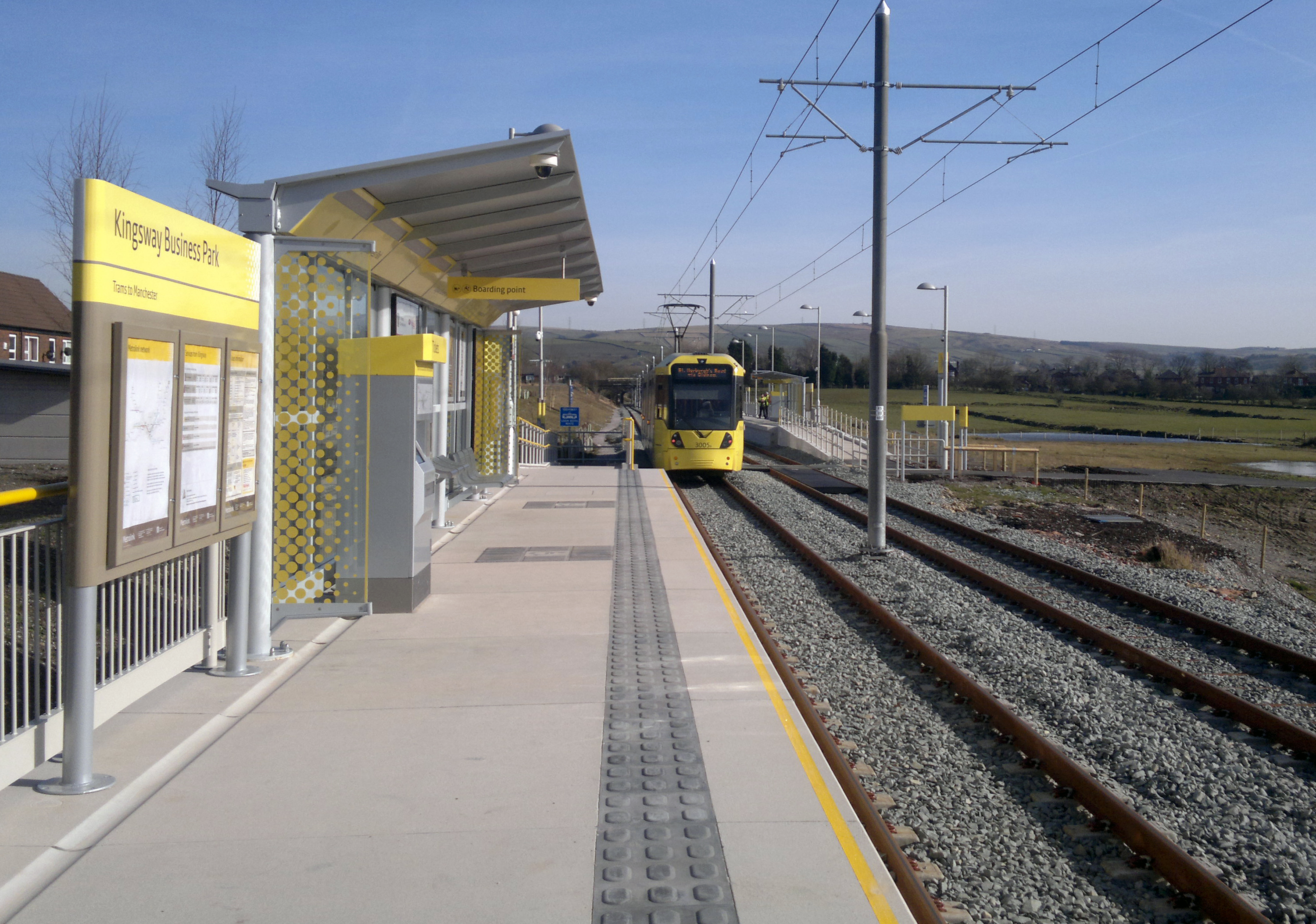
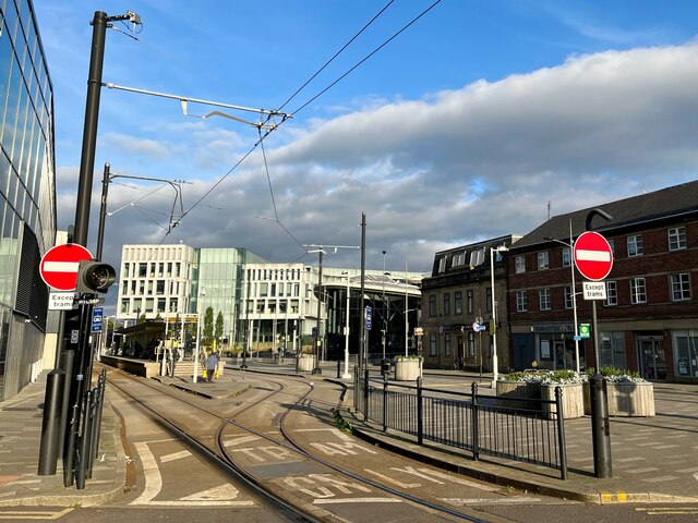
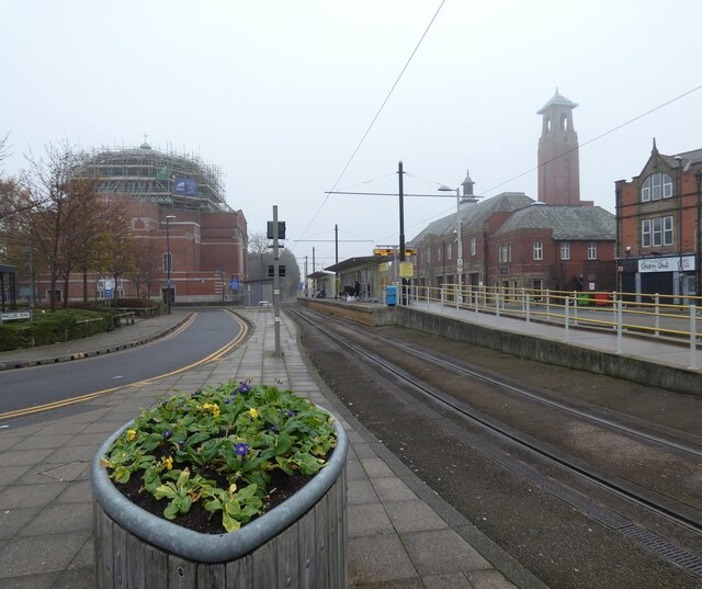
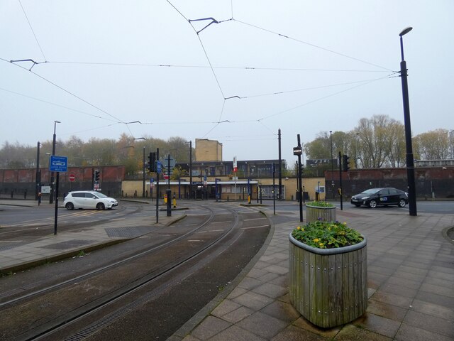
Kingsway Business Park tram stop

Kingsway Business Park is a tram stop on the Oldham and Rochdale Line (ORL) of Greater Manchester's Metrolink network. It is located in Firgrove, on the...

Belfield, Greater Manchester

Belfield is an area within Rochdale, in Greater Manchester, England. It lies at the confluence of the River Beal and River Roch, 1.3 miles (2.1 km) east...
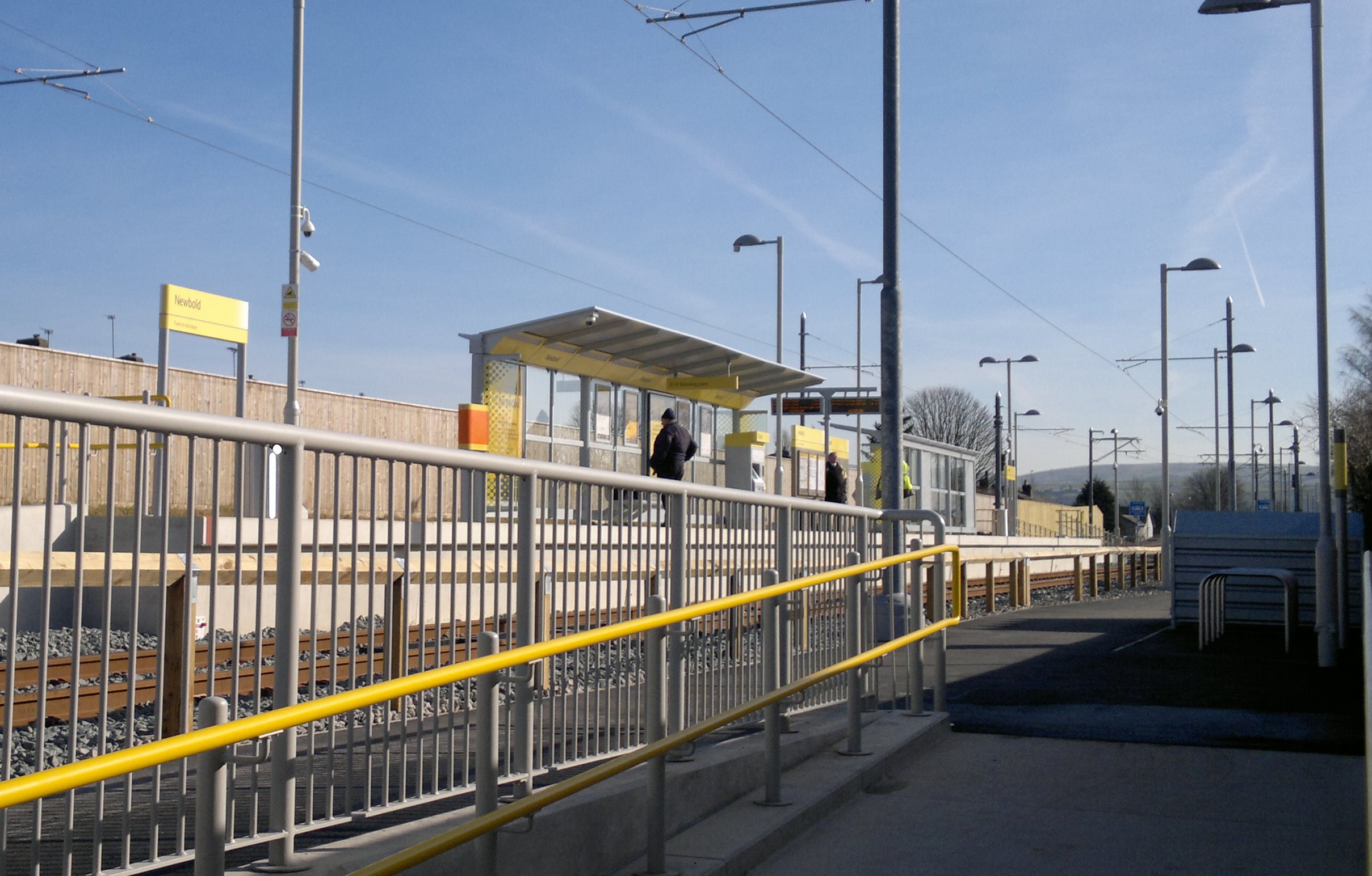
Newbold tram stop

Newbold is a tram stop on the Oldham and Rochdale Line (ORL) of Greater Manchester's Metrolink network. It is located in the Newbold area of Rochdale,...

Athletic Grounds, Rochdale

The Athletic Grounds was a stadium in Rochdale, Greater Manchester, England. It was the home of Rochdale Hornets Rugby League Football Club for over 90...

Milnrow Road

Milnrow Road was a cricket ground in Rochdale, Lancashire. The first recorded match on the ground was in 1868, when the Gentlemen of Rochdale played Australian...

Milnrow

Milnrow is a town within the Metropolitan Borough of Rochdale, in Greater Manchester, England. It lies on the River Beal at the foothills of the South...

Roch Valley Viaduct

Roch Valley Viaduct was a viaduct built in the 1860s in Rochdale, historically in Lancashire, now within Greater Manchester, that carried the Rochdale...

Kingsway Business Park

Kingsway Business Park is a 0.66-square-mile (1.7 km2) business park in the Metropolitan Borough of Rochdale, in Greater Manchester, England.JD Sports...

Nearby Amenities

Located within 500m of 53.614376,-2.126187
Traffic Signals
Traffic Signals: signal
Traffic Signals Direction: backward
Lat/Long: 53.61619/-2.129752
Bus Stop
Milnrow Road/Kingsway
Bench: no
Bus: yes
Naptan AtcoCode: 1800NE20881
Naptan Bearing: E
Naptan CommonName: Milnrow Road/Kingsway
Naptan Indicator: Nr Open Land
Naptan Landmark: NR OPEN LAND
Naptan NaptanCode: mangagdt
Naptan PlusbusZoneRef: MNCRPIC
Naptan ShortCommonName: Kingsway
Naptan Street: MILNROW ROAD
Naptan Verified: no
Network: TfGM
Public Transport: platform
Shelter: no
Source: naptan_import
Lat/Long: 53.6162277/-2.1301265
Bus Stop
Milnrow Road/Kingsway
Bench: no
Bus: yes
Naptan AtcoCode: 1800NE20891
Naptan Bearing: W
Naptan CommonName: Milnrow Road/Kingsway
Naptan Indicator: Op House 331
Naptan Landmark: CHURCH
Naptan NaptanCode: mangagdw
Naptan PlusbusZoneRef: MNCRPIC
Naptan ShortCommonName: Kingsway
Naptan Street: MILNROW ROAD
Naptan Verified: no
Network: TfGM
Public Transport: platform
Shelter: yes
Source: naptan_import
Lat/Long: 53.6160562/-2.130776
Bus Stop
Rochdale Road/Willows Lane
Bus: yes
Local Ref: E
Naptan AtcoCode: 1800NE25381
Naptan Bearing: SE
Naptan CommonName: Rochdale Road/Willows Lane
Naptan Indicator: Thistleyfield
Naptan Landmark: THISTLEYFIELD
Naptan NaptanCode: mangapgm
Naptan PlusbusZoneRef: MNCRPIC
Naptan ShortCommonName: Willows Lane
Naptan Street: ROCHDALE ROAD
Naptan Verified: no
Network: TfGM
Public Transport: platform
Shelter: no
Source: naptan_import
Lat/Long: 53.6144589/-2.1196303
Bus Stop
Rochdale Road/Willows Lane
Bus: yes
Local Ref: C
Naptan AtcoCode: 1800NE25391
Naptan Bearing: NW
Naptan CommonName: Rochdale Road/Willows Lane
Naptan Indicator: O/s House 11
Naptan Landmark: HOUSE 11
Naptan NaptanCode: mangapgp
Naptan PlusbusZoneRef: MNCRPIC
Naptan ShortCommonName: Willows Lane
Naptan Street: ROCHDALE ROAD
Naptan Verified: no
Network: TfGM
Public Transport: platform
Shelter: yes
Source: naptan_import
Lat/Long: 53.6148084/-2.1206743
Bus Stop
Rochdale Road/Crown and Shuttle
Bus: yes
Local Ref: D
Naptan AtcoCode: 1800NE25401
Naptan Bearing: E
Naptan CommonName: Rochdale Road/Crown and Shuttle
Naptan Indicator: Crown & Shuttle
Naptan Landmark: CROWN & SHUTTLE
Naptan NaptanCode: mangapgt
Naptan PlusbusZoneRef: MNCRPIC
Naptan ShortCommonName: Crown and Shuttle
Naptan Street: ROCHDALE ROAD
Naptan Verified: no
Network: TfGM
Public Transport: platform
Shelter: yes
Source: naptan_import
Lat/Long: 53.6153193/-2.122127
Bus Stop
Rochdale Road/Larchway
Bus: yes
Naptan AtcoCode: 1800NE25411
Naptan Bearing: W
Naptan CommonName: Rochdale Road/Larchway
Naptan Indicator: Blind Company
Naptan Landmark: PROPERTY 181
Naptan NaptanCode: mangapgw
Naptan PlusbusZoneRef: MNCRPIC
Naptan ShortCommonName: Larchway
Naptan Street: ROCHDALE ROAD
Naptan Verified: no
Network: TfGM
Public Transport: platform
Source: naptan_import
Lat/Long: 53.6157661/-2.124683
Bus Stop
Rochdale Road/Hartley Street
Bench: yes
Bus: yes
Naptan AtcoCode: 1800NE25421
Naptan Bearing: E
Naptan CommonName: Rochdale Road/Hartley Street
Naptan Indicator: 2nd Hand Shop
Naptan Landmark: PROPERTY 260
Naptan NaptanCode: mangapja
Naptan PlusbusZoneRef: MNCRPIC
Naptan ShortCommonName: Hartley Street
Naptan Street: ROCHDALE ROAD
Naptan Verified: no
Network: TfGM
Public Transport: platform
Shelter: yes
Source: naptan_import
Lat/Long: 53.6162586/-2.1265136
Bus Stop
Rochdale Road/Hartley Street
Bench: no
Bus: yes
Covered: no
Naptan AtcoCode: 1800NE25431
Naptan Bearing: W
Naptan CommonName: Rochdale Road/Hartley Street
Naptan Indicator: O/s House 7
Naptan Landmark: HOUSE 213
Naptan NaptanCode: mangapjd
Naptan PlusbusZoneRef: MNCRPIC
Naptan ShortCommonName: Hartley Street
Naptan Street: ROCHDALE ROAD
Naptan Verified: no
Network: TfGM
Public Transport: platform
Shelter: no
Source: naptan_import
Lat/Long: 53.6161149/-2.126362
Bus Stop
Kingsway/Milnrow Road
Bench: no
Bin: yes
Bus: yes
Naptan AtcoCode: 1800NE25441
Naptan Bearing: S
Naptan CommonName: Kingsway/Milnrow Road
Naptan Indicator: Op Church
Naptan Landmark: RETAIL Park
Naptan NaptanCode: mangapjg
Naptan PlusbusZoneRef: MNCRPIC
Naptan ShortCommonName: Milnrow Road
Naptan Street: KINGSWAY
Naptan Verified: no
Network: TfGM
Public Transport: platform
Shelter: yes
Source: naptan_import
Lat/Long: 53.6158238/-2.1296264
Bus Stop
Kingsway/Milnrow Road
Bench: no
Bin: no
Bus: yes
Naptan AtcoCode: 1800NE25451
Naptan Bearing: N
Naptan CommonName: Kingsway/Milnrow Road
Naptan Indicator: O/s Church
Naptan Landmark: CHURCH
Naptan NaptanCode: mangapjm
Naptan PlusbusZoneRef: MNCRPIC
Naptan ShortCommonName: Milnrow Road
Naptan Street: KINGSWAY
Naptan Verified: no
Network: TfGM
Public Transport: platform
Shelter: no
Source: naptan_import
Lat/Long: 53.6156256/-2.1300339
Bus Stop
Kingsway/Moss Avenue
Bus: yes
Local Ref: E
Naptan AtcoCode: 1800NE25461
Naptan Bearing: N
Naptan CommonName: Kingsway/Moss Avenue
Naptan Indicator: O/s House 295
Naptan Landmark: O/S HOUSE 295
Naptan NaptanCode: mangapjp
Naptan PlusbusZoneRef: MNCRPIC
Naptan ShortCommonName: Moss Avenue
Naptan Street: KINGSWAY
Naptan Verified: no
Network: TfGM
Public Transport: platform
Source: naptan_import
Lat/Long: 53.6134306/-2.1317202
Bus Stop
Kingsway/Moss Avenue
Bus: yes
Local Ref: D
Naptan AtcoCode: 1800NE25471
Naptan Bearing: S
Naptan CommonName: Kingsway/Moss Avenue
Naptan Indicator: Railway Bridge
Naptan Landmark: RAILWAY BRIDGE
Naptan NaptanCode: mangapjt
Naptan PlusbusZoneRef: MNCRPIC
Naptan ShortCommonName: Moss Avenue
Naptan Street: KINGSWAY
Naptan Verified: no
Network: TfGM
Public Transport: platform
Source: naptan_import
Lat/Long: 53.6128461/-2.1318846
Bus Stop
Albert Royds Street/St Ann's Road
Bus: yes
Naptan AtcoCode: 1800NE25971
Naptan Bearing: S
Naptan CommonName: Albert Royds Street/St Ann's Road
Naptan Indicator: O/s House 379
Naptan Landmark: HOUSE 375
Naptan NaptanCode: mangatjt
Naptan PlusbusZoneRef: MNCRPIC
Naptan ShortCommonName: St Ann's Road
Naptan Street: Albert Royds Street
Naptan Verified: no
Network: TfGM
Public Transport: platform
Source: naptan_import
Lat/Long: 53.6175326/-2.1286943
Bus Stop
Albert Royds Street/St Ann's Road
Bus: yes
Naptan AtcoCode: 1800NE25981
Naptan Bearing: N
Naptan CommonName: Albert Royds Street/St Ann's Road
Naptan Indicator: O/s House 376
Naptan Landmark: HOUSE 376
Naptan NaptanCode: mangatjw
Naptan PlusbusZoneRef: MNCRPIC
Naptan ShortCommonName: St Ann's Road
Naptan Street: Albert Royds Street
Naptan Verified: no
Network: TfGM
Public Transport: platform
Source: naptan_import
Lat/Long: 53.6177122/-2.1288612
Fast Food
McDonald's
Addr Country: GB
Addr Housename: Kiingsway Retail Park
Addr Postcode: OL16 5AF
Addr Street: Kingsway
Brand: McDonald's
Brand Wikidata: Q38076
Brand Wikipedia: en:McDonald's
Contact Website: https://www.mcdonalds.com/gb/en-gb/location/rochdale/rochdale---kingsway-retail-park/1-kingsway-retail-park/8260986.html
Cuisine: burger
Drive Through: yes
Fhrs Id: 733558
Source Addr: FHRS Open Data
Takeaway: yes
Lat/Long: 53.6148621/-2.1300123
Traffic Signals
Traffic Signals: signal
Lat/Long: 53.6163517/-2.1291898
Turning Circle
Lat/Long: 53.6142841/-2.1335794
Turning Circle
Lat/Long: 53.6150842/-2.1319821
Car Wash
Lat/Long: 53.6124754/-2.1328351
Kingsway Business Park
Network: Manchester Metrolink
Network Wikidata: Q18548
Operator: Transport for Greater Manchester
Operator Wikidata: Q7834921
Public Transport: stop_position
Railway: tram_stop
Tram: yes
Zone: 4
Lat/Long: 53.6109436/-2.1230115
Barrier: cycle_barrier
Cycle Barrier: double
Cycle Barrier Installation: fixed
Lat/Long: 53.6174845/-2.1272961
Give Way
Lat/Long: 53.6162989/-2.1291065
Crossing
Crossing: uncontrolled
Crossing Ref: zebra
Source: Bing
Lat/Long: 53.6155782/-2.1287984
Crossing
Crossing: uncontrolled
Crossing Ref: zebra
Source: Bing
Lat/Long: 53.6156142/-2.1295469
Crossing
Crossing: uncontrolled
Crossing Ref: zebra
Source: Bing
Lat/Long: 53.6151438/-2.1287919
Pub
Crown and Shuttle
Addr Housenumber: 170
Addr Postcode: OL16 3BU
Addr Street: Rochdale Road
Fhrs Id: 94437
Source: survey
Source Addr: FHRS Open Data
Lat/Long: 53.6153825/-2.1222261
Crossing
Crossing: uncontrolled
Crossing Ref: zebra
Source: Bing
Lat/Long: 53.6148769/-2.1297402
Crossing
Crossing: uncontrolled
Crossing Ref: zebra
Source: Bing
Lat/Long: 53.6150663/-2.1298927
Crossing
Crossing: uncontrolled
Crossing Ref: zebra
Source: Bing
Lat/Long: 53.6151764/-2.1296791
Barrier: bollard
Bicycle: yes
Foot: yes
Horse: yes
Motor Vehicle: no
Lat/Long: 53.6159461/-2.1268439
Asda
Addr Country: GB
Addr Housename: Kiingsway Retail Park
Addr Postcode: OL16 5AF
Addr Street: Kingsway
Addr Unit: 2
Brand: Asda
Brand Wikidata: Q297410
Brand Wikipedia: en:Asda
Contact Website: https://storelocator.asda.com/north-west/rochdale/unit-2-kingsway-retail-park
Fhrs Id: 42822
Opening Hours: Mo-Sa 07:00-22:00, Su 10:00-16:00
Operator: Asda Stores Ltd
Phone: +44 1706 704700
Shop: supermarket
Source Addr: FHRS Open Data
Lat/Long: 53.6155178/-2.1284517
Sports Direct
Addr Place: Kiingsway Retail Park
Addr Postcode: OL16 5AF
Addr Street: Kingsway
Brand: Sports Direct
Brand Wikidata: Q7579661
Opening Hours: Mo-Fr 09:00-20:00, Sa 09:00-19:00, Su 10:00-16:00
Shop: sports
Lat/Long: 53.6147955/-2.1284624
The Food Warehouse
Addr Housename: Kiingsway Retail Park
Addr Postcode: OL16 5AF
Addr Street: Kingsway
Brand: The Food Warehouse
Brand Wikidata: Q87263899
Fhrs Id: 860388
Opening Hours: Mo-Sa 08:00-21:00, Su 10:00-16:00
Phone: +44 1706 559152
Shop: supermarket
Source Addr: FHRS Open Data
Website: https://www.thefoodwarehouse.com/store-locator/kingsway-park-rochdale
Lat/Long: 53.6149862/-2.1284624
Pet Superstore
Addr Place: Kiingsway Retail Park
Addr Postcode: OL16 5AF
Addr Street: Kingsway
Opening Hours: Mo-Fr 09:00-20:00, Sa 09:00-19:00, Su 10:30-16:30
Phone: +44 345 600 5968
Shop: pet
Lat/Long: 53.6151678/-2.1284678
B&M Home Store
Addr Place: Kiingsway Retail Park
Addr Postcode: OL16 5AF
Addr Street: Kingsway
Brand: B&M Home Store
Brand Wikidata: Q4836931
Opening Hours: Mo-Sa 08:00-20:00, Su 10:30-16:30
Phone: +44 330 838 9625
Shop: variety_store
Source: survey
Lat/Long: 53.6153365/-2.1284624
Addr Housenumber: 379
Addr Street: Albert Royds Street
Source: Naptan
Lat/Long: 53.6175033/-2.1284946
Addr Housenumber: 376
Addr Street: Albert Royds Street
Source: Naptan
Lat/Long: 53.6176845/-2.1290471
Addr Housenumber: 7
Source: Naptan
Lat/Long: 53.6160109/-2.1265097
Addr Housenumber: 226
Addr Postcode: OL16 3BN
Addr Street: Rochdale Road
Shop: vacant
Source: survey
Lat/Long: 53.6158223/-2.1242469
Addr Housenumber: 11
Fixme: number looks odd
Source: Naptan
Lat/Long: 53.6146809/-2.1208181
Crossing: informal
Lat/Long: 53.6102426/-2.1283701
Barrier: cycle_barrier
Cycle Barrier: tilted
Foot: yes
Lat/Long: 53.6103015/-2.1285351
Kingsway Business Park
Network: Manchester Metrolink
Network Wikidata: Q18548
Operator: Transport for Greater Manchester
Operator Wikidata: Q7834921
Public Transport: stop_position
Railway: tram_stop
Tram: yes
Zone: 4
Lat/Long: 53.6112478/-2.1243796
Crossing
Crossing: traffic_signals
Crossing Island: no
Crossing Ref: toucan
Kerb: lowered
Tactile Paving: yes
Lat/Long: 53.6161958/-2.129688
Crossing
Crossing: traffic_signals
Crossing Island: yes
Crossing Ref: toucan
Kerb: lowered
Tactile Paving: yes
Lat/Long: 53.6161043/-2.1297209
Crossing
Crossing: uncontrolled
Crossing Island: yes
Tactile Paving: yes
Lat/Long: 53.6160688/-2.1295114
Traffic Signals
Traffic Signals: signal
Lat/Long: 53.6147885/-2.130487
Crossing
Crossing: traffic_signals
Crossing Island: yes
Crossing Ref: toucan
Kerb: lowered
Tactile Paving: yes
Lat/Long: 53.6147539/-2.1305093
Crossing
Crossing: traffic_signals
Crossing Island: yes
Crossing Ref: toucan
Kerb: lowered
Tactile Paving: yes
Lat/Long: 53.6147375/-2.1306976
Generator Method: photovoltaic
Generator Output Electricity: yes
Generator Source: solar
Generator Type: solar_photovoltaic_panel
Location: roof
Power: generator
Lat/Long: 53.6152267/-2.1333649
Generator Method: photovoltaic
Generator Output Electricity: yes
Generator Source: solar
Generator Type: solar_photovoltaic_panel
Location: roof
Power: generator
Lat/Long: 53.6152435/-2.1332388
Generator Method: photovoltaic
Generator Output Electricity: yes
Generator Source: solar
Generator Type: solar_photovoltaic_panel
Location: roof
Power: generator
Lat/Long: 53.6142132/-2.1319005
Generator Method: photovoltaic
Generator Output Electricity: yes
Generator Source: solar
Generator Type: solar_photovoltaic_panel
Location: roof
Power: generator
Lat/Long: 53.614799/-2.1263366
Railway: crossing
Lat/Long: 53.6111123/-2.1236708
Railway: crossing
Lat/Long: 53.6110762/-2.1236896
Barrier: cycle_barrier
Cycle Barrier: double
Cycle Barrier Installation: fixed
Lat/Long: 53.6174797/-2.127075
Crossing
Crossing: uncontrolled
Crossing Island: yes
Tactile Paving: yes
Lat/Long: 53.6163427/-2.1293369
Crossing
Crossing: uncontrolled
Crossing Island: yes
Tactile Paving: yes
Lat/Long: 53.6163336/-2.1291698
Crossing
Crossing: uncontrolled
Crossing Island: yes
Tactile Paving: yes
Lat/Long: 53.6162352/-2.1291911
Traffic Signals
Traffic Signals: signal
Traffic Signals Direction: forward
Lat/Long: 53.6145363/-2.1304296
Traffic Signals
Traffic Signals: signal
Lat/Long: 53.6144617/-2.1308863
Traffic Signals
Traffic Signals: signal
Traffic Signals Direction: forward
Lat/Long: 53.6146665/-2.1309619
Traffic Signals
Traffic Signals: signal
Lat/Long: 53.6160716/-2.1296902
Give Way
Lat/Long: 53.6161447/-2.1297902
Traffic Signals
Traffic Signals: signal
Traffic Signals Direction: forward
Lat/Long: 53.6163622/-2.1293226
Traffic Signals
Traffic Signals: signal
Traffic Signals Direction: forward
Lat/Long: 53.6162388/-2.1291404
Traffic Signals
Traffic Signals: signal
Traffic Signals Direction: forward
Lat/Long: 53.6160463/-2.1295283
Car Rental
Rentruck
Addr City: Rochdale
Addr Housename: Keverick House
Addr Postcode: OL16 5DB
Addr Street: Wallhead Road
Opening Hours: Mo-Fr 08:00-18:00; Sa 08:00-12:00
Phone: +44 1706 640055
Website: https://www.rentruck.co.uk
Lat/Long: 53.6141064/-2.1296815
Atm
Lat/Long: 53.615585/-2.1286146
Crossing
Crossing: uncontrolled
Crossing Markings: yes
Lat/Long: 53.6157947/-2.1245928
Addr Housenumber: 172
Addr Postcode: OL16 3BN
Addr Street: Rochdale Road
Lat/Long: 53.6154355/-2.1224634
Addr Housenumber: 174
Addr Postcode: OL16 3BN
Addr Street: Rochdale Road
Lat/Long: 53.6154554/-2.1225492
Addr Housenumber: 176
Addr Postcode: OL16 3BN
Addr Street: Rochdale Road
Lat/Long: 53.6154706/-2.1226243
Addr Housenumber: 218
Addr Postcode: OL16 3BN
Addr Street: Rochdale Road
Lat/Long: 53.6157673/-2.1239895
Addr Housenumber: 220
Addr Postcode: OL16 3BN
Addr Street: Rochdale Road
Lat/Long: 53.6157824/-2.1240539
Addr Housenumber: 222
Addr Postcode: OL16 3BN
Addr Street: Rochdale Road
Lat/Long: 53.6157975/-2.1241183
Addr Housenumber: 224
Addr Postcode: OL16 3BN
Addr Street: Rochdale Road
Lat/Long: 53.6158118/-2.1241773
Addr Housenumber: 216
Addr Postcode: OL16 3BN
Addr Street: Rochdale Road
Lat/Long: 53.6157562/-2.1239305
Addr Housenumber: 178
Addr Postcode: OL16 3BN
Addr Street: Rochdale Road
Lat/Long: 53.6154857/-2.12269
Addr Housenumber: 192
Addr Postcode: OL16 3BN
Addr Street: Rochdale Road
Lat/Long: 53.6155853/-2.1231542
Addr Housenumber: 198
Addr Postcode: OL16 3BN
Addr Street: Rochdale Road
Lat/Long: 53.6156317/-2.1233575
Addr Housenumber: 208
Addr Postcode: OL16 3BN
Addr Street: Rochdale Road
Lat/Long: 53.6156988/-2.1236876
Addr Housenumber: 204
Addr Postcode: OL16 3BN
Addr Street: Rochdale Road
Lat/Long: 53.6156754/-2.1235668
Addr Housenumber: 202
Addr Postcode: OL16 3BN
Addr Street: Rochdale Road
Lat/Long: 53.6156603/-2.1234856
Barrier: cycle_barrier
Cycle Barrier: tilted
Foot: yes
Lat/Long: 53.6101203/-2.1279276
Waste Basket
Waste: dog_excrement
Lat/Long: 53.6102126/-2.1246878
Fast Food
Subway
Addr Housename: Kingsway Retail Park
Addr Postcode: OL16 5AF
Addr Street: Kingsway
Addr Unit: 8
Branch: Kingsway Retail Park
Brand: Subway
Brand Wikidata: Q244457
Contact Website: https://restaurants.subway.com/united-kingdom/en/rochdale/subway-kingsway-retail-park
Cuisine: sandwich
Drive Through: no
Opening Hours: Mo-Sa 09:30-20:30; Su 10:00-19:00
Phone: +44 1706 654449
Takeaway: yes
Website: https://www.subway.com
Lat/Long: 53.6151968/-2.1298479
Fast Food
Greggs
Addr Housename: Kingsway Retail Park
Addr Postcode: OL16 5AF
Addr Street: Kingsway
Addr Unit: 2
Branch: Kingsway Retail Park
Brand: Greggs
Brand Wikidata: Q3403981
Contact Website: https://www.greggs.co.uk/shop-finder?shop-code=3625
Cuisine: sandwich;bakery
Drive Through: no
Opening Hours: Mo-Sa 07:00-20:30; Su 08:00-17:00
Takeaway: yes
Website: https://www.greggs.co.uk
Lat/Long: 53.6152917/-2.1297791
Cafe
Costa
Addr Housename: Kingsway Retail Park
Addr Postcode: OL16 5AF
Addr Street: Kingsway
Addr Unit: 10
Branch: Kingsway Retail Park
Brand: Costa
Brand Wikidata: Q608845
Cuisine: coffee_shop
Internet Access: wlan
Opening Hours: Mo-Fr 07:30-18:30; Sa 08:00-18:00; Su 08:30-16:30
Outdoor Seating: no
Takeaway: yes
Toilets: yes
Website: https://www.costa.co.uk
Lat/Long: 53.6153844/-2.1297158
The data included in this document is from www.openstreetmap.org. The data is made available under ODbL.

Have you been to Firgrove?

Leave your review of Firgrove below (or comments, questions and feedback).