Belfield Estate

Settlement in Lancashire

England

Belfield Estate

The former Globe Inn, Whitworth Road, Rochdale One of the few local examples of early 20th century (?1920s) terracotta facading and decoration. Since 2014 in use as a veterinary surgery.
The former Globe Inn, Whitworth Road, Rochdale Credit: Alan Murray-Rust

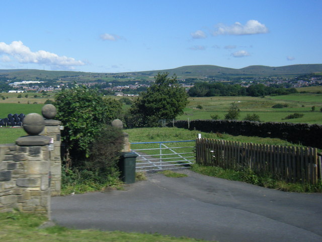
Belfield Estate is a picturesque residential area located in Lancashire, England. Nestled amidst the rolling hills and lush greenery of the Lancashire countryside, this estate offers a serene and tranquil living environment for its residents.

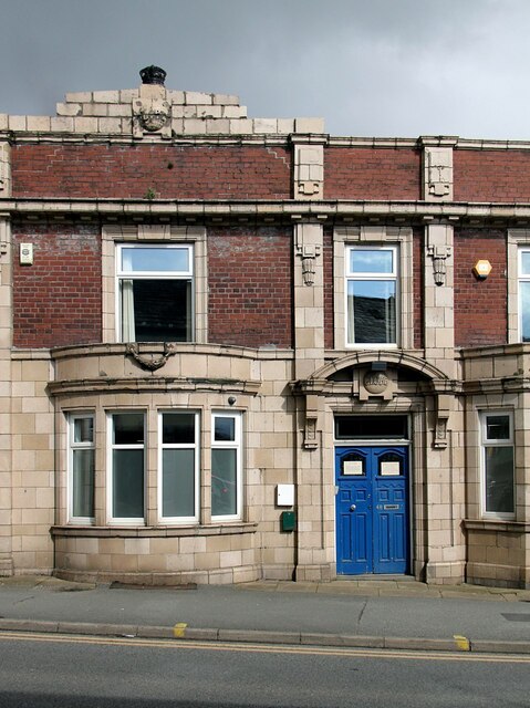
The estate features a range of beautiful and well-maintained properties, including detached houses and spacious cottages. The architecture of the buildings is a blend of traditional and modern designs, adding to the charm and character of the area. Many of the houses boast stunning views of the surrounding countryside, providing residents with a peaceful and idyllic setting to call home.

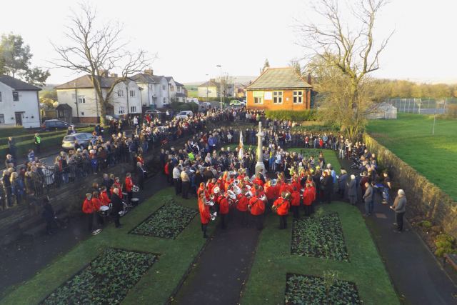
Belfield Estate is known for its close-knit community, with residents often organizing social events and activities to foster a sense of belonging and camaraderie. The estate also offers various amenities for its residents, including parks and green spaces, ideal for recreational activities and leisurely walks.

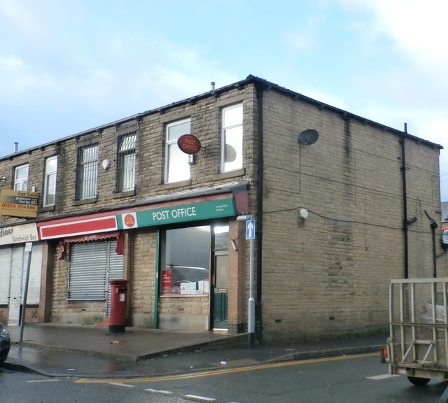
In addition to its natural beauty, Belfield Estate benefits from its convenient location. Situated just a short drive away from the town center, residents have easy access to a range of amenities, including shops, restaurants, and schools. The estate is also well-connected to major transportation routes, making it an ideal choice for those who commute to nearby cities.

Overall, Belfield Estate in Lancashire offers a harmonious blend of natural beauty, a strong sense of community, and convenient location, making it a highly desirable place to live for individuals and families alike.

If you have any feedback on the listing, please let us know in the comments section below.

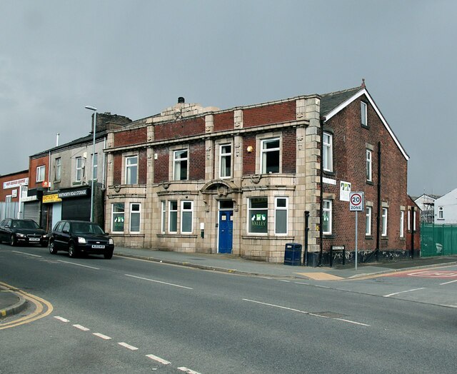
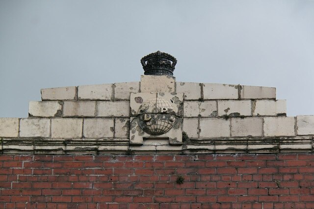
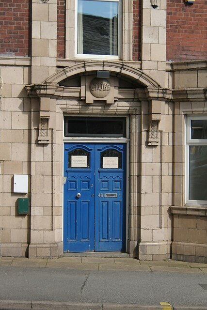
Belfield Estate Images

Images are sourced within 2km of 53.621568/-2.125452 or Grid Reference SD9113. Thanks to Geograph Open Source API. All images are credited.

The former Globe Inn, Whitworth Road, Rochdale One of the few local examples of early 20th century (?1920s) terracotta facading and decoration. Since 2014 in use as a veterinary surgery.
The former Globe Inn, Whitworth Road, Rochdale
One of the few local examples of early 20th century (?1920s) terracotta facading and decoration. Since 2014 in use as a veterinary surgery.
The former Globe Inn, Whitworth Road, Rochdale Terracotta pediment and inn name over the main entrance. See <a title="https://www.geograph.org.uk/photo/7147716" href="https://www.geograph.org.uk/photo/7147716">Link</a> for location.
The former Globe Inn, Whitworth Road, Rochdale
Terracotta pediment and inn name over the main entrance. See Link for location.
The former Globe Inn, Whitworth Road, Rochdale Terracotta 'Globe' sign and cast iron crown above the main front. The globe gives the impression of having been used for target practice! See <a title="https://www.geograph.org.uk/photo/7147716" href="https://www.geograph.org.uk/photo/7147716">Link</a> for location.
The former Globe Inn, Whitworth Road, Rochdale
Terracotta 'Globe' sign and cast iron crown above the main front. The globe gives the impression of having been used for target practice! See Link for location.
The former Globe Inn, Whitworth Road, Rochdale Former main entrance in terracotta. See <a title="https://www.geograph.org.uk/photo/7147716" href="https://www.geograph.org.uk/photo/7147716">Link</a> for location.
The former Globe Inn, Whitworth Road, Rochdale
Former main entrance in terracotta. See Link for location.
The former Globe Inn, Whitworth Road, Rochdale Part view of main front with terracotta detailing. See <a title="https://www.geograph.org.uk/photo/7147716" href="https://www.geograph.org.uk/photo/7147716">Link</a> for location.
The former Globe Inn, Whitworth Road, Rochdale
Part view of main front with terracotta detailing. See Link for location.
Double postbox and more on Yorkshire Street 
The top end of Yorkshire is not pedestrianised. The double postbox (OL16 31) is outside the former Townhead Post Office. Why it is surrounded by pieces of blue foam I cannot say. On the opposite side are a cafe, Cash Converters, a property management company and a hair salon.
Double postbox and more on Yorkshire Street
The top end of Yorkshire is not pedestrianised. The double postbox (OL16 31) is outside the former Townhead Post Office. Why it is surrounded by pieces of blue foam I cannot say. On the opposite side are a cafe, Cash Converters, a property management company and a hair salon.
Ukrainian Catholic Church of Saint Mary 
The Grade II listed <span class="nowrap"><a title="https://historicengland.org.uk/listing/the-list/list-entry/1346258?section=official-list-entry" rel="nofollow ugc noopener" href="https://historicengland.org.uk/listing/the-list/list-entry/1346258?section=official-list-entry">Link</a><img style="margin-left:2px;" alt="External link" title="External link - shift click to open in new window" src="https://s1.geograph.org.uk/img/external.png" width="10" height="10"/></span> church dates from 1821 and was formerly the Anglican Church of St James.  It became a Ukrainian Catholic Church in 1975.
Ukrainian Catholic Church of Saint Mary
The Grade II listed LinkExternal link church dates from 1821 and was formerly the Anglican Church of St James. It became a Ukrainian Catholic Church in 1975.
A671, John Street, Rochdale
Wildhouse Lane farm entrance
Newbold Metrolink stop Opened in 2013. View west.
Newbold Metrolink stop
Opened in 2013. View west.
Newbold Metrolink stop Opened in 2013. View east.
Newbold Metrolink stop
Opened in 2013. View east.
Remembrance Sunday 2014 Remembrance Ceremony at the Wardle Memorial Garden, 9 November 2014, with the Wardle Academy Brass Band.

Taken from an upper floor window of the Wardle & Smallbridge Community Centre (former Wardle UDC offices).
Remembrance Sunday 2014
Remembrance Ceremony at the Wardle Memorial Garden, 9 November 2014, with the Wardle Academy Brass Band. Taken from an upper floor window of the Wardle & Smallbridge Community Centre (former Wardle UDC offices).
Former Drill Hall - Baron Street Built for 2nd Volunteer Battalion Lancashire Fusiliers. In use by TA until 1983.
Former Drill Hall - Baron Street
Built for 2nd Volunteer Battalion Lancashire Fusiliers. In use by TA until 1983.
Inscription on former drill hall - Baron Street The 2nd Volunteer Battalion formed in 1883 from 24 Corps Lancashire Rifle Volunteers and became 6th Battalion Lancashire Fusiliers in 1908.
Inscription on former drill hall - Baron Street
The 2nd Volunteer Battalion formed in 1883 from 24 Corps Lancashire Rifle Volunteers and became 6th Battalion Lancashire Fusiliers in 1908.
Former Drill Hall - Hill Street elevation Gable of the Tee shaped drill hall in the large complex fronting onto Baron Street.
Former Drill Hall - Hill Street elevation
Gable of the Tee shaped drill hall in the large complex fronting onto Baron Street.
Former Drill Hall - from Livesey Street The gable of the Tee shaped drill hall can be seen through the new construction.
Former Drill Hall - from Livesey Street
The gable of the Tee shaped drill hall can be seen through the new construction.
Newbold Post Office
Newbold Post Office
The Crown and Shuttle Public House
Show me another place!

Belfield Estate is located at Grid Ref: SD9113 (Lat: 53.621568, Lng: -2.125452)

Unitary Authority: Rochdale

Police Authority: Greater Manchester

What 3 Words

///shovels.only.glee. Near Milnrow, Manchester

Related Wikis

Belfield, Greater Manchester

Belfield is an area within Rochdale, in Greater Manchester, England. It lies at the confluence of the River Beal and River Roch, 1.3 miles (2.1 km) east...
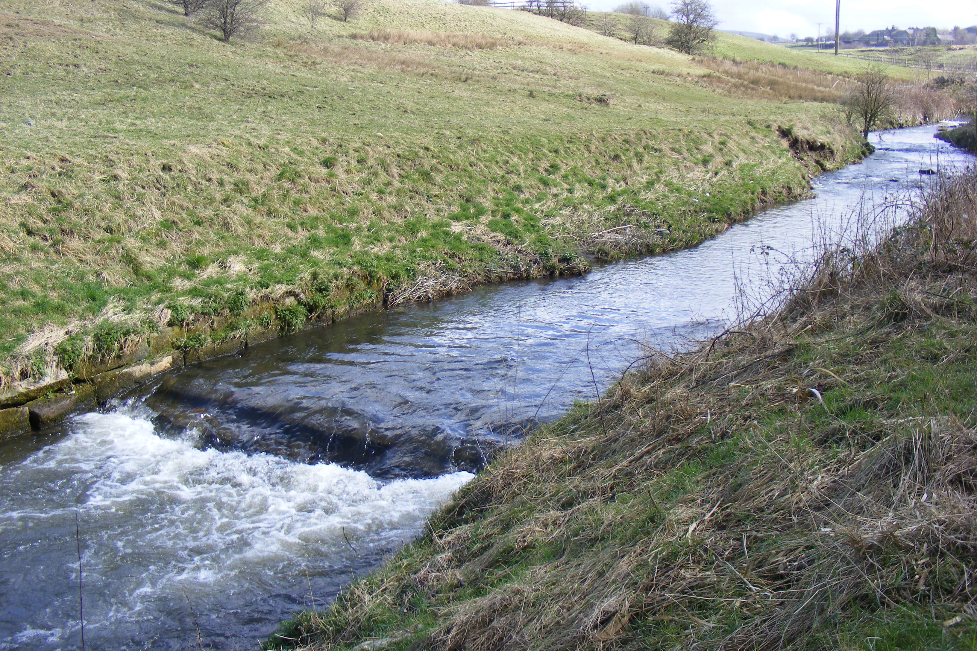
River Beal

The Beal is a small river in Greater Manchester, England, and is a tributary of the River Roch. It rises in the Beal Valley in green space between Sholver...

Ash Brook

Ash Brook is a watercourse in Greater Manchester and a tributary of the River Roch. == Tributaries == Wardle Brook

Arkwright Mill, Rochdale

Arkwright Mill, Rochdale is a cotton spinning mill in Rochdale, Greater Manchester. It was built in 1885 by the Arkwright Cotton Spinning Co. It was taken...

Stanney Brook

Stanney Brook is a watercourse in Greater Manchester, England. It originates in the Burnedge area of Shaw and Crompton, and flows through Milnrow into...

Roch Valley Viaduct

Roch Valley Viaduct was a viaduct built in the 1860s in Rochdale, historically in Lancashire, now within Greater Manchester, that carried the Rochdale...
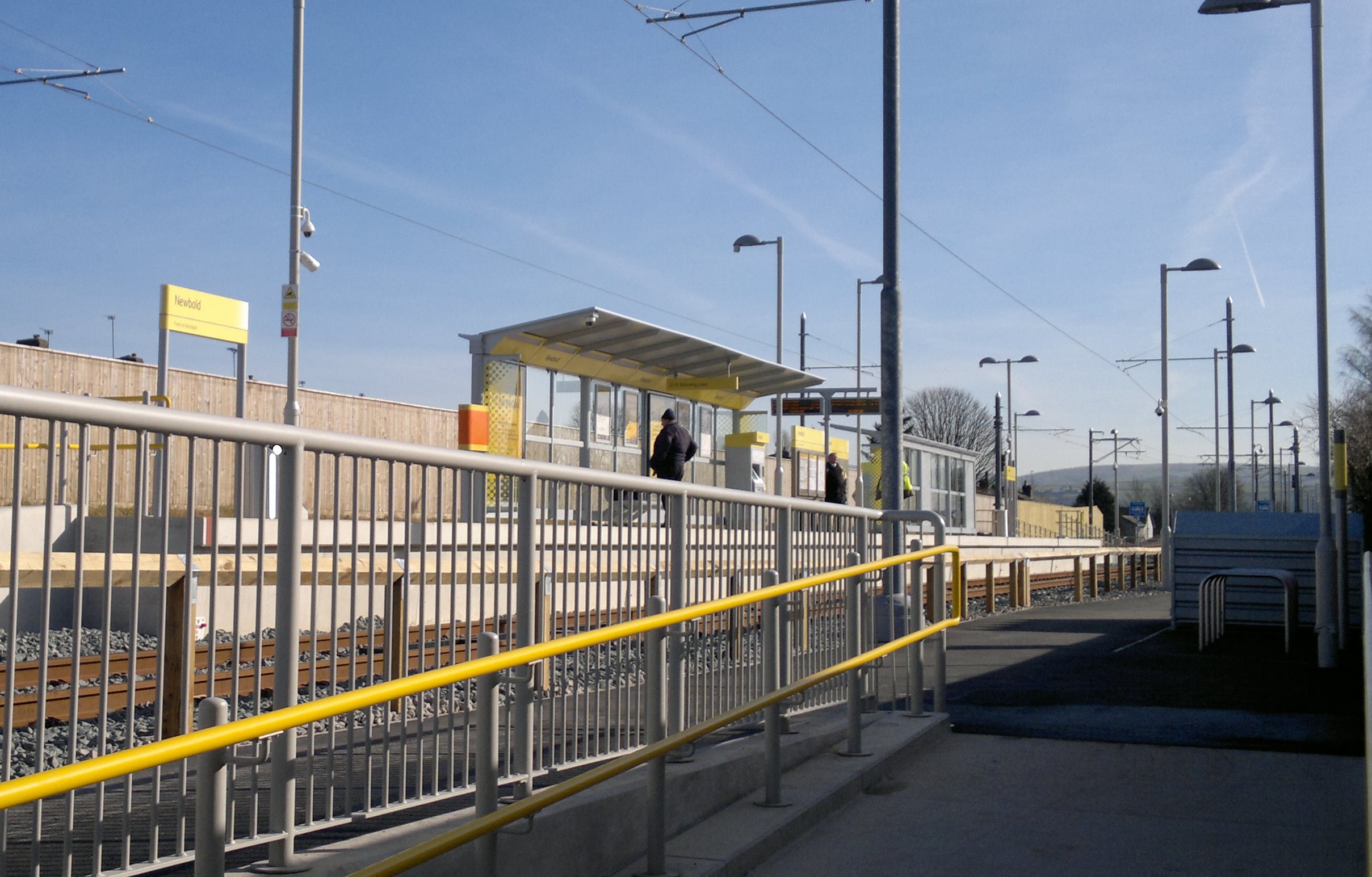
Newbold tram stop

Newbold is a tram stop on the Oldham and Rochdale Line (ORL) of Greater Manchester's Metrolink network. It is located in the Newbold area of Rochdale,...

Hey Brook

Hey Brook is a watercourse in Rochdale, Greater Manchester and a tributary of the River Roch. It originates at the confluence of Buckley Brook and Syke...

Nearby Amenities

Located within 500m of 53.621568,-2.125452
Belfield
Is In: Rochdale, Greater Manchester, England, UK
Place: suburb
Source: npe
Wikidata: Q4882368
Lat/Long: 53.6201588/-2.1289111
Waterway: turning_point
Lat/Long: 53.6222756/-2.127128
Bus Stop
Albert Royds Street/The Mayfield
Bus: yes
Naptan AtcoCode: 1800NE00561
Naptan Bearing: N
Naptan CommonName: Albert Royds Street/The Mayfield
Naptan Indicator: Mayfield Hotel
Naptan Landmark: CO-OP STORE
Naptan NaptanCode: mandwagj
Naptan PlusbusZoneRef: MNCRPIC
Naptan ShortCommonName: The Mayfield
Naptan Street: Albert Royds Street
Naptan Verified: no
Network: TfGM
Public Transport: platform
Source: naptan_import
Lat/Long: 53.6219777/-2.132533
Bus Stop
Albert Royds Street/Bellshill Crescent
Bus: yes
Naptan AtcoCode: 1800NE25941
Naptan Bearing: S
Naptan CommonName: Albert Royds Street/Bellshill Crescent
Naptan Indicator: O/s House 285
Naptan Landmark: HOUSE 285
Naptan NaptanCode: mangatjg
Naptan PlusbusZoneRef: MNCRPIC
Naptan ShortCommonName: Bellshill Cres
Naptan Street: Albert Royds Street
Naptan Verified: no
Network: TfGM
Public Transport: platform
Source: naptan_import
Lat/Long: 53.6214305/-2.1315788
Bus Stop
Albert Royds Street/Firgrove Avenue
Bench: no
Bin: no
Bus: yes
Naptan AtcoCode: 1800NE25951
Naptan Bearing: S
Naptan CommonName: Albert Royds Street/Firgrove Avenue
Naptan Indicator: O/s House 337
Naptan Landmark: HOUSE 337
Naptan NaptanCode: mangatjm
Naptan PlusbusZoneRef: MNCRPIC
Naptan ShortCommonName: Firgrove Avenue
Naptan Street: Albert Royds Street
Naptan Verified: no
Network: TfGM
Public Transport: platform
Shelter: no
Source: naptan_import
Lat/Long: 53.6188628/-2.1287891
Bus Stop
Albert Royds Street/Firgrove Avenue
Bench: no
Bin: no
Bus: yes
Naptan AtcoCode: 1800NE25961
Naptan Bearing: N
Naptan CommonName: Albert Royds Street/Firgrove Avenue
Naptan Indicator: O/s House 340
Naptan Landmark: HOUSE 340
Naptan NaptanCode: mangatjp
Naptan PlusbusZoneRef: MNCRPIC
Naptan ShortCommonName: Firgrove Avenue
Naptan Street: Albert Royds Street
Naptan Verified: no
Network: TfGM
Public Transport: platform
Shelter: no
Source: naptan_import
Lat/Long: 53.6193385/-2.1293801
Bus Stop
Albert Royds Street/St Ann's Road
Bus: yes
Naptan AtcoCode: 1800NE25971
Naptan Bearing: S
Naptan CommonName: Albert Royds Street/St Ann's Road
Naptan Indicator: O/s House 379
Naptan Landmark: HOUSE 375
Naptan NaptanCode: mangatjt
Naptan PlusbusZoneRef: MNCRPIC
Naptan ShortCommonName: St Ann's Road
Naptan Street: Albert Royds Street
Naptan Verified: no
Network: TfGM
Public Transport: platform
Source: naptan_import
Lat/Long: 53.6175326/-2.1286943
Bus Stop
Albert Royds Street/St Ann's Road
Bus: yes
Naptan AtcoCode: 1800NE25981
Naptan Bearing: N
Naptan CommonName: Albert Royds Street/St Ann's Road
Naptan Indicator: O/s House 376
Naptan Landmark: HOUSE 376
Naptan NaptanCode: mangatjw
Naptan PlusbusZoneRef: MNCRPIC
Naptan ShortCommonName: St Ann's Road
Naptan Street: Albert Royds Street
Naptan Verified: no
Network: TfGM
Public Transport: platform
Source: naptan_import
Lat/Long: 53.6177122/-2.1288612
Turning Circle
Lat/Long: 53.6184848/-2.1305692
Turning Circle
Source: Bing
Lat/Long: 53.619955/-2.1285797
Turning Circle
Source: Bing
Lat/Long: 53.6199313/-2.1275645
Post Office
Source: OS_OpenData_StreetView
Lat/Long: 53.6206528/-2.1325723
Barrier: cycle_barrier
Cycle Barrier: double
Cycle Barrier Installation: fixed
Lat/Long: 53.6174845/-2.1272961
Addr City: ROCHDALE
Addr Street: Belton Avenue
Description: Trisha & Jon's Mad House
Lat/Long: 53.622335/-2.1312421
Addr Housenumber: 340
Addr Street: Albert Royds Street
Source: Naptan
Lat/Long: 53.6192613/-2.129452
Go Local
Addr Housename: Belfield Hall
Addr Postcode: OL16 5AA
Addr Street: Albert Royds Street
Addr Unit: F
Brand: Go Local
Brand Wikidata: Q120634011
Shop: convenience
Source: survey
Source Addr: FHRS Open Data
Lat/Long: 53.6196145/-2.1299909
Addr Housenumber: 379
Addr Street: Albert Royds Street
Source: Naptan
Lat/Long: 53.6175033/-2.1284946
Addr Housenumber: 337
Addr Street: Albert Royds Street
Source: Naptan
Lat/Long: 53.6188938/-2.1286019
Addr Housenumber: 376
Addr Street: Albert Royds Street
Source: Naptan
Lat/Long: 53.6176845/-2.1290471
Addr Housenumber: 285
Addr Street: Albert Royds Street
Source: Naptan
Lat/Long: 53.6215028/-2.1314713
Generator Method: photovoltaic
Generator Output Electricity: yes
Generator Source: solar
Generator Type: solar_photovoltaic_panel
Location: roof
Power: generator
Lat/Long: 53.6197372/-2.1315247
Generator Method: photovoltaic
Generator Output Electricity: yes
Generator Source: solar
Generator Type: solar_photovoltaic_panel
Location: roof
Power: generator
Lat/Long: 53.6208611/-2.1324053
Barrier: cycle_barrier
Cycle Barrier: double
Cycle Barrier Installation: fixed
Lat/Long: 53.6174797/-2.127075
Power: pole
Lat/Long: 53.6209891/-2.1182119
Power: pole
Lat/Long: 53.6214647/-2.1187394
Power: pole
Lat/Long: 53.6220263/-2.1194315
The data included in this document is from www.openstreetmap.org. The data is made available under ODbL.

Have you been to Belfield Estate?

Leave your review of Belfield Estate below (or comments, questions and feedback).