Shiftland Copse

Wood, Forest in Surrey Waverley

England

Shiftland Copse

Bungalows on Loxwood Road, Alfold Crossways
Bungalows on Loxwood Road, Alfold Crossways Credit: David Howard

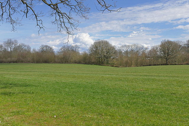
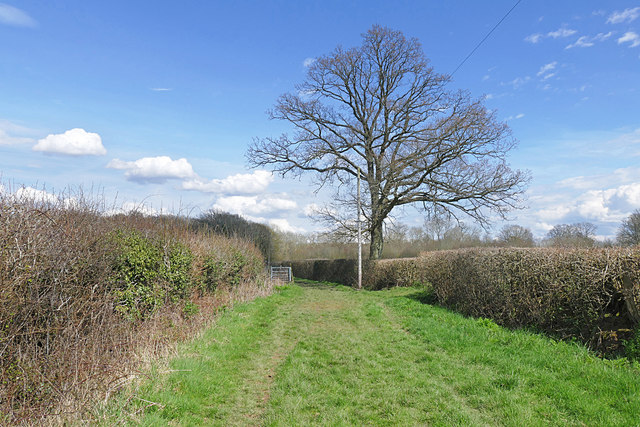
Shiftland Copse is a picturesque woodland located in the county of Surrey, England. Covering an area of approximately 50 acres, this enchanting forest is nestled within the heart of the Surrey Hills Area of Outstanding Natural Beauty.

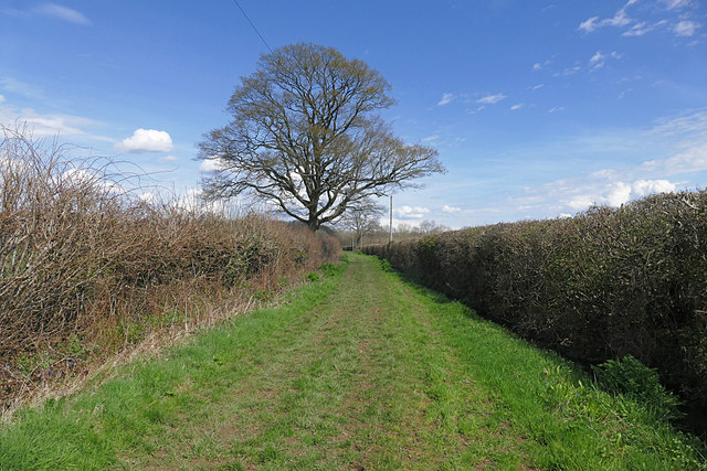
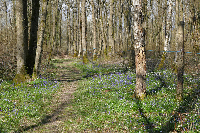
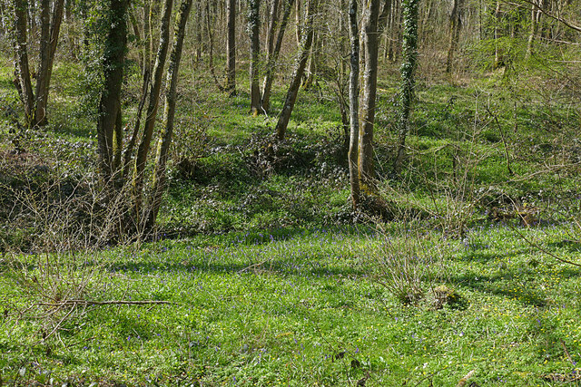
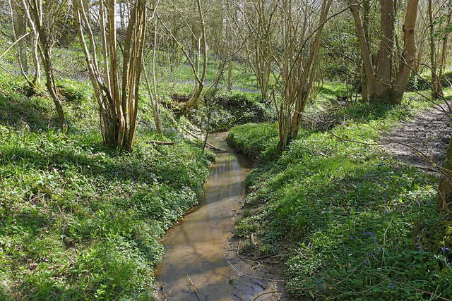
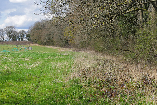
The copse is predominantly composed of broadleaf trees, with a rich variety including oak, beech, and ash. These majestic trees create a dense canopy that filters the sunlight, casting dappled shadows on the forest floor. The vibrant green foliage provides a haven for numerous species of flora and fauna, making it a popular spot for nature enthusiasts and wildlife lovers.

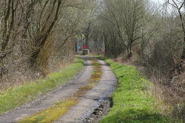
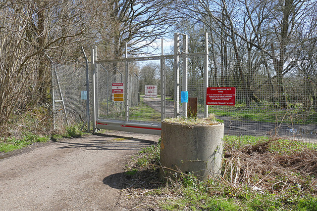
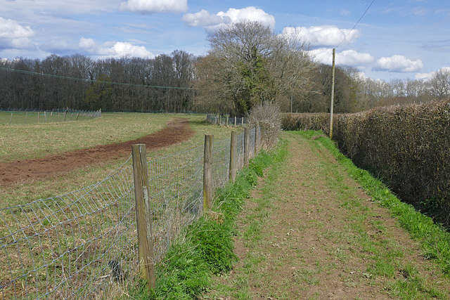
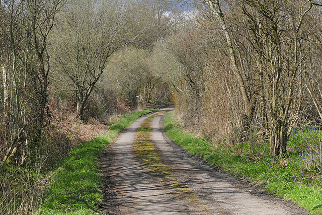
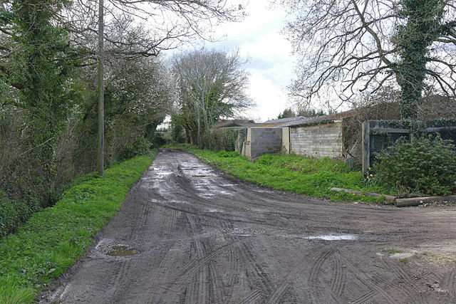
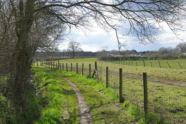
Traversing through the copse, visitors can find a network of well-maintained footpaths that wind their way through the woodland, offering tranquil walks and opportunities for exploration. The paths are flanked by a diverse array of wildflowers, adding pops of color to the serene atmosphere. Birdsong fills the air, and lucky visitors may catch a glimpse of deer, foxes, and other woodland creatures that call Shiftland Copse home.

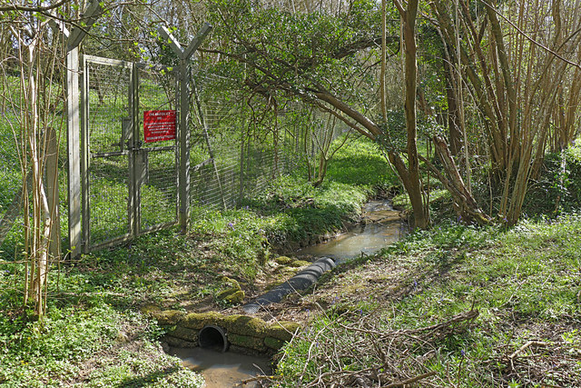
In addition to its natural beauty, Shiftland Copse also holds historical significance. It is believed to have been a part of the ancient woodland that once covered much of Surrey. The copse has witnessed centuries of human activity, with remnants of old charcoal burners and saw pits still visible today, serving as a reminder of the area's rich past.

Overall, Shiftland Copse in Surrey offers a serene escape from the hustle and bustle of everyday life, providing a haven of tranquility and natural beauty for visitors to enjoy.

If you have any feedback on the listing, please let us know in the comments section below.

Shiftland Copse Images

Images are sourced within 2km of 51.111893/-0.53178755 or Grid Reference TQ0235. Thanks to Geograph Open Source API. All images are credited.

Bungalows on Loxwood Road, Alfold Crossways
Loxwood Road, Alfold Crossways
Footpath to High Loxley Road The footpath from Dunsfold Village to High Loxley Road.
Footpath to High Loxley Road
The footpath from Dunsfold Village to High Loxley Road.
Paddocks near Dunsfold An electricity pole in the paddocks near Dunsfold with Jewing's Hurst wood in the background.
Paddocks near Dunsfold
An electricity pole in the paddocks near Dunsfold with Jewing's Hurst wood in the background.
High Loxley Road Looking south towards the Dunsfold Airfield gate.
High Loxley Road
Looking south towards the Dunsfold Airfield gate.
Solar Farm near Dunsfold Airfield The solar farm north of Dunsfold Airfield.
Solar Farm near Dunsfold Airfield
The solar farm north of Dunsfold Airfield.
Sayer's Land near Dunsfold Sayer's Land woods carpeted with bluebells, wood anemones and celandine in the spring sunshine.
Sayer's Land near Dunsfold
Sayer's Land woods carpeted with bluebells, wood anemones and celandine in the spring sunshine.
Dunsfold Airfield gate The gate at the southern end of High Loxley Road.
Dunsfold Airfield gate
The gate at the southern end of High Loxley Road.
Path to High Loxley Road The footpath from Dunsfold to High Loxley Road with Jewing's Hurst woods ahead.
Path to High Loxley Road
The footpath from Dunsfold to High Loxley Road with Jewing's Hurst woods ahead.
Sayer's Land near Dunsfold Looking west across the stream in the dip which forms the boundary between Sayer's Land and Jewing's Hurst.
Sayer's Land near Dunsfold
Looking west across the stream in the dip which forms the boundary between Sayer's Land and Jewing's Hurst.
Fields near Dunsfold One of the fields to the south of the footpath from Dunsfold to High Loxley Road.
Fields near Dunsfold
One of the fields to the south of the footpath from Dunsfold to High Loxley Road.
Stream, Sayer's Land The stream marking the boundary between Sayer's Land on the right and Jewing's Hurst.
Stream, Sayer's Land
The stream marking the boundary between Sayer's Land on the right and Jewing's Hurst.
High Loxley Road, Dunsfold Looking north along the road from Dunsfold Airfield past High Loxley to Pratt's Corner.
High Loxley Road, Dunsfold
Looking north along the road from Dunsfold Airfield past High Loxley to Pratt's Corner.
Dunsfold Airfield gate The disused gate in Sayer's Land marking the boundary of Dunsfold Airfield.
Dunsfold Airfield gate
The disused gate in Sayer's Land marking the boundary of Dunsfold Airfield.
Footpath near Dunsfold The footpath from Dunsfold to the High Loxley Road.
Footpath near Dunsfold
The footpath from Dunsfold to the High Loxley Road.
Access road, New Pound Farm The access road to New Pound Farm near Dunsfold.
Access road, New Pound Farm
The access road to New Pound Farm near Dunsfold.
Paddocks near Dunsfold The paddocks of New Pound Farm near Dunsfold.
Paddocks near Dunsfold
The paddocks of New Pound Farm near Dunsfold.
Wood edge near Dunsfold The western edge of Jewing's Hurst giving way to the paddocks of New Pound Farm between Dunsfold and High Loxley.
Wood edge near Dunsfold
The western edge of Jewing's Hurst giving way to the paddocks of New Pound Farm between Dunsfold and High Loxley.
Show me another place!

Shiftland Copse is located at Grid Ref: TQ0235 (Lat: 51.111893, Lng: -0.53178755)

Administrative County: Surrey

District: Waverley

Police Authority: Surrey

What 3 Words

///hobbies.standards.backed. Near Cranleigh, Surrey

Related Wikis

Dunsfold Aerodrome

Dunsfold Aerodrome (former ICAO code EGTD) is an unlicensed airfield in Surrey, England, near the village of Cranleigh. It extends across land in the villages...

Top Gear test track

The Top Gear test track is used by the BBC automotive television programme Top Gear. It is located at Dunsfold Aerodrome in Surrey, United Kingdom. The...

Wey and Arun Canal

The Wey and Arun Canal is a partially open, 23-mile-long (37 km) canal in the southeast of England. It runs southwards from the River Wey at Gunsmouth...

Fir Tree Copse

Fir Tree Copse is a 6-hectare (15-acre) nature reserve south-east of Dunsfold in Surrey. It is managed by the Surrey Wildlife Trust and is part of the...

London to Portsmouth canal

The London to Portsmouth canal was a concept for the construction of a secure inland canal route from the British capital of London to the headquarters...

Alfold F.C.

Alfold Football Club is a football club based in Alfold, Surrey, England. They are currently members of the Southern Combination Division One and play...

Alfold

Alfold is a village and civil parish in Surrey, England on the West Sussex border. Alfold is a dispersed or polyfocal village in the Green Belt, which...

Dunsfold

Dunsfold is a village in the borough of Waverley, Surrey, England, 8.7 miles (14.0 kilometres) south of Guildford. It lies in the Weald and reaches in...

Nearby Amenities

Located within 500m of 51.111893,-0.53178755
Dunsfold Aerodrome
Aeroway: aerodrome
Alt Name: Top Gear Test Track
Icao: EGTD
Wikidata: Q946638
Wikipedia: en:Dunsfold Aerodrome
Lat/Long: 51.1153355/-0.5309766
Gun Emplacement (Disused)
Military: range
Lat/Long: 51.110944/-0.5362661
Mini Roundabout
Lat/Long: 51.109881/-0.5305604
Mini Roundabout
Lat/Long: 51.1099727/-0.5309123
Traffic Signals
Lat/Long: 51.114425/-0.5284139
Traffic Signals
Lat/Long: 51.114261/-0.5279014
Traffic Signals
Lat/Long: 51.1142328/-0.5282944
Traffic Signals
Lat/Long: 51.1145201/-0.5279692
Turning Circle
Lat/Long: 51.1147113/-0.5295054
Entrance: yes
Lat/Long: 51.1134763/-0.5256679
Lower Seven Acre Copse
Natural: wood
Lat/Long: 51.1084715/-0.5275227
The data included in this document is from www.openstreetmap.org. The data is made available under ODbL.

Have you been to Shiftland Copse?

Leave your review of Shiftland Copse below (or comments, questions and feedback).