Badger Copse

Wood, Forest in Somerset Somerset West and Taunton

England

Badger Copse

Sheep and Buncombe Wood The southern end of the Quantock Hills.
Sheep and Buncombe Wood Credit: Barbara Cook

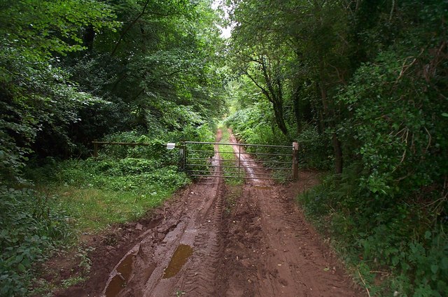
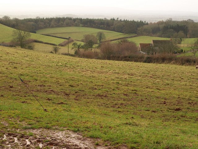
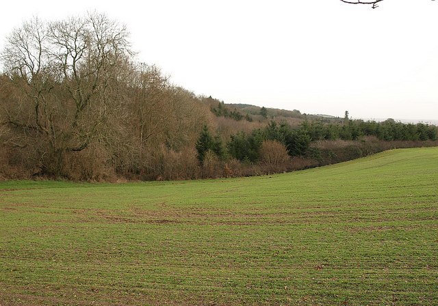
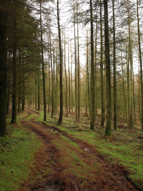
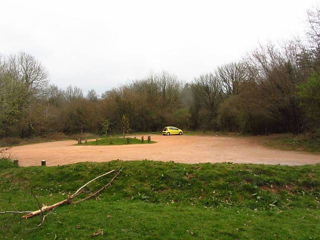
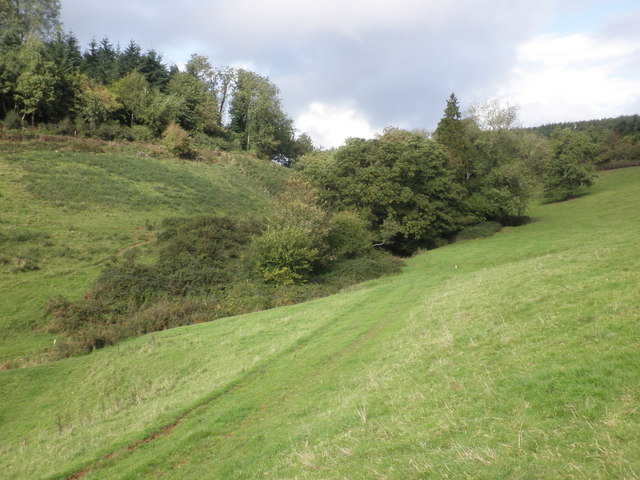
Badger Copse is a picturesque woodland located in Somerset, England. Covering an area of approximately 20 acres, it is nestled in the rolling countryside of the region. The copse is known for its dense collection of trees, predominantly oak and beech, which create a stunning canopy of foliage throughout the year.

The woodland is home to a diverse range of flora and fauna, making it a popular destination for nature enthusiasts and wildlife photographers. Bluebells carpet the forest floor in spring, creating a vibrant display of color, while ferns, mosses, and wildflowers thrive in the shaded areas. The trees provide a habitat for various bird species, including woodpeckers and owls, as well as small mammals such as badgers and squirrels.

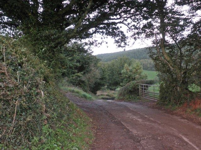
Visitors to Badger Copse can explore the numerous walking trails that wind through the woodland, allowing them to immerse themselves in the tranquil surroundings. The paths are well-maintained and signposted, making it easy to navigate the copse and discover its hidden treasures.

The copse is also a popular spot for picnics and family outings, with several designated areas providing seating and picnic tables. These spots offer visitors the opportunity to relax and enjoy the peaceful ambiance of the woodland.

Overall, Badger Copse is a cherished natural gem in Somerset, offering a sanctuary for both wildlife and humans alike. Its scenic beauty and diverse ecosystem make it a must-visit destination for those seeking a peaceful retreat in the heart of nature.

If you have any feedback on the listing, please let us know in the comments section below.

Badger Copse Images

Images are sourced within 2km of 51.080632/-3.1581537 or Grid Reference ST1831. Thanks to Geograph Open Source API. All images are credited.

Sheep and Buncombe Wood The southern end of the Quantock Hills.
Sheep and Buncombe Wood
The southern end of the Quantock Hills.
Muddy track at Buncombe Wood Also a public right of way.
Muddy track at Buncombe Wood
Also a public right of way.
The southern end of the Quantock Hills, near Kingston St. Mary Taken from the road to Ivyton Farm.
The southern end of the Quantock Hills, near Kingston St. Mary
Taken from the road to Ivyton Farm.
Road above Raswell The road from Kingston St. Mary crosses the northeast corner of the square as it pursues the side of the Kingston Steam valley and approaches Buncombe Hill, where it will climb through Buncombe Wood (background, largely in <a href="https://www.geograph.org.uk/gridref/ST2132">ST2132</a> here). Taken from Bridleway 4/31 - see <a href="https://www.geograph.org.uk/photo/1129484">ST2131 : Approaching Raswell House</a>.
Road above Raswell
The road from Kingston St. Mary crosses the northeast corner of the square as it pursues the side of the Kingston Steam valley and approaches Buncombe Hill, where it will climb through Buncombe Wood (background, largely in ST2132 here). Taken from Bridleway 4/31 - see ST2131 : Approaching Raswell House.
Quantock Greenway The Way follows bridleway 4/31 (also followed by the Macmillan Way West) up a sunken section to meet Cushuish Lane. This is close to the spot from where <a href="https://www.geograph.org.uk/photo/1129487">ST2031 : Road above Raswell</a> was taken.
Quantock Greenway
The Way follows bridleway 4/31 (also followed by the Macmillan Way West) up a sunken section to meet Cushuish Lane. This is close to the spot from where ST2031 : Road above Raswell was taken.
Countryside near Ivyton Farm A view from a gateway on Cushuish Lane. A valley drops from the farm (just off to the right) down the southern slopes of the Quantock Hills.
Countryside near Ivyton Farm
A view from a gateway on Cushuish Lane. A valley drops from the farm (just off to the right) down the southern slopes of the Quantock Hills.
Woodland near Cushuish Looking across a sprouting winter cereal field from Cushuish Lane, here a restricted byway (T9/12, followed by the Quantock Greenway). The unnamed woods are around a steep little valley carrying a stream down towards Yarford.
Woodland near Cushuish
Looking across a sprouting winter cereal field from Cushuish Lane, here a restricted byway (T9/12, followed by the Quantock Greenway). The unnamed woods are around a steep little valley carrying a stream down towards Yarford.
Footpath in Buncombe Wood Broomfield footpath 3, which has climbed very steeply out of the head of the Kingston Stream valley, runs almost level through conifer woodland towards the Merridge Hill / Buncombe -  Cothelstone county road.
Footpath in Buncombe Wood
Broomfield footpath 3, which has climbed very steeply out of the head of the Kingston Stream valley, runs almost level through conifer woodland towards the Merridge Hill / Buncombe - Cothelstone county road.
Field north of Buncombe Wood A field on the upper slopes of the Quantocks, with woods on either side of it. Buncombe Wood is ahead on the crest of the hills. View from the Samaritans Way South West as it follows Bridleway BW 30/30.
Field north of Buncombe Wood
A field on the upper slopes of the Quantocks, with woods on either side of it. Buncombe Wood is ahead on the crest of the hills. View from the Samaritans Way South West as it follows Bridleway BW 30/30.
Car park, Cothelstone Hill A good path leads up to the summit from here.
Car park, Cothelstone Hill
A good path leads up to the summit from here.
Approaching Buncombe Wood
Ivyton Farm
Ivyton Farm
Secluded valley, near Ivyton Farm
Track to the main road from Ivyton Farm
At The Pines junction Buncombe Hill A symbol of an 'empty' horse.
At The Pines junction Buncombe Hill
A symbol of an 'empty' horse.
Ivyton Farm
Ivyton Farm
MacMillan Way West
MacMillan Way West
Old Milestone in Buncombe Wood, Broomfield Parish Carved stone post by the UC road, in parish of BROOMFIELD (SEDGEMOOR District), Buncombe Wood, on grass verge by road, on North side of road. Bridgewater modern, erected by the Bridgwater turnpike trust in the 19th century. 

Inscription reads:-
BRIDG-
WATER
7
MILES
Carved benchmark and rivet on top.

Grade II listed. List Entry Number: 1058932
<span class="nowrap"><a title="https://historicengland.org.uk/listing/the-list/list-entry/1058932" rel="nofollow ugc noopener" href="https://historicengland.org.uk/listing/the-list/list-entry/1058932">Link</a><img style="margin-left:2px;" alt="External link" title="External link - shift click to open in new window" src="https://s1.geograph.org.uk/img/external.png" width="10" height="10"/></span>

Milestone Society National ID: SO_BG07w.
Old Milestone in Buncombe Wood, Broomfield Parish
Carved stone post by the UC road, in parish of BROOMFIELD (SEDGEMOOR District), Buncombe Wood, on grass verge by road, on North side of road. Bridgewater modern, erected by the Bridgwater turnpike trust in the 19th century. Inscription reads:- BRIDG- WATER 7 MILES Carved benchmark and rivet on top. Grade II listed. List Entry Number: 1058932 LinkExternal link Milestone Society National ID: SO_BG07w.
Show me another place!

Badger Copse is located at Grid Ref: ST1831 (Lat: 51.080632, Lng: -3.1581537)

Administrative County: Somerset

District: Somerset West and Taunton

Police Authority: Avon and Somerset

What 3 Words

///vines.caves.rings. Near Bishops Lydeard, Somerset
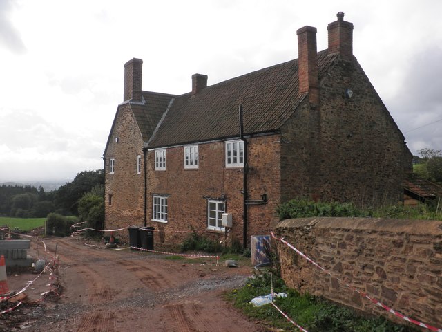
Related Wikis

Cothelstone

Cothelstone is a village and civil parish in Somerset, England, situated in the Quantock Hills six miles north of Taunton. The parish, which includes the...

Seven Sisters (Quantock Hills)

The Seven Sisters is a clump of beech trees on Cothelstone Hill in the Quantock Hills, England. Originally planted in the 18th century, they form a well...
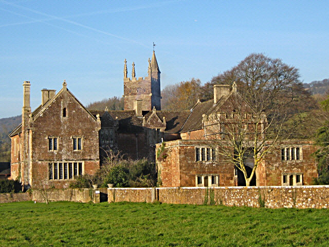
Cothelstone Manor

Cothelstone Manor in Cothelstone, Somerset, England was built in the mid-16th century, largely demolished by the parliamentary troops in 1646 and rebuilt...

West Bagborough Hoard

The West Bagborough Hoard is a hoard of 670 Roman coins and 72 pieces of hacksilver found in October 2001 by metal detectorist James Hawkesworth near...

Tetton, Kingston St Mary

Tetton is an historic estate in the parish of Kingston St Mary in the English county of Somerset. The present grade II* listed Tetton House dates from...

West Bagborough

West Bagborough is a village and civil parish in Somerset, England, about 5 miles (8.0 km) north of Taunton. In 2011, the village had a population of 358...

Bishops Lydeard A.F.C.

Bishops Lydeard Association Football Club is a football club based in Bishops Lydeard, near Taunton, in Somerset, England. They are currently members of...

Broomfield Camp

Broomfield Camp (which is also known as Higher Castles enclosure) is a univallate Iron Age hill fort in the Taunton Deane district of Somerset, England...

Nearby Amenities

Located within 500m of 51.080632,-3.1581537
Brand: National Grid
Brand Wikidata: Q1465461
Material: wood
Operator: National Grid Electricity Distribution
Operator Old: Western Power Distribution
Operator Wikidata: Q7988183
Owner: National Grid Electricity Distribution (South West) Plc
Owner Wikidata: Q114397866
Power: pole
Lat/Long: 51.0803289/-3.1647433
Brand: National Grid
Brand Wikidata: Q1465461
Material: wood
Operator: National Grid Electricity Distribution
Operator Old: Western Power Distribution
Operator Wikidata: Q7988183
Owner: National Grid Electricity Distribution (South West) Plc
Owner Wikidata: Q114397866
Power: pole
Lat/Long: 51.0797058/-3.1646775
Brand: National Grid
Brand Wikidata: Q1465461
Guyed: yes
Material: wood
Operator: National Grid Electricity Distribution
Operator Old: Western Power Distribution
Operator Wikidata: Q7988183
Owner: National Grid Electricity Distribution (South West) Plc
Owner Wikidata: Q114397866
Power: pole
Lat/Long: 51.0789897/-3.1646396
Badger Copse
Place: locality
Lat/Long: 51.0815961/-3.1593972
Dene Hill Plantation
Place: locality
Lat/Long: 51.0831213/-3.1564641
The data included in this document is from www.openstreetmap.org. The data is made available under ODbL.

Have you been to Badger Copse?

Leave your review of Badger Copse below (or comments, questions and feedback).