Boghouse Close Wood

Wood, Forest in Cumberland Copeland

England

Boghouse Close Wood

A595 at Buckman Brow
A595 at Buckman Brow Credit: Colin Pyle

Boghouse Close Wood is a picturesque forest located in Cumberland, England. Situated amidst the rolling hills and lush green landscapes, this woodland is a haven for nature enthusiasts and hikers alike. Covering an area of approximately 500 acres, the wood is home to an abundance of diverse flora and fauna.

The forest boasts a rich variety of tree species, including oak, beech, and ash, which form a dense canopy overhead. The woodland floor is adorned with a vibrant carpet of bluebells, wild garlic, and ferns, creating a stunning visual spectacle during the spring and summer months. Numerous walking trails wind their way through the wood, offering visitors the opportunity to explore its hidden treasures.

Boghouse Close Wood is also home to a plethora of wildlife. Birdwatchers can spot a range of species, including the elusive tawny owl, woodpeckers, and buzzards. The forest is also inhabited by small mammals like squirrels, rabbits, and badgers, as well as a variety of insects and butterflies.

For those seeking tranquility and solace amidst nature, Boghouse Close Wood provides the perfect retreat. The peaceful atmosphere, coupled with the soothing sounds of birdsong and rustling leaves, creates a serene environment that is ideal for relaxation and contemplation. Visitors can bring a picnic and enjoy a leisurely lunch surrounded by the beauty of this enchanting woodland.

Overall, Boghouse Close Wood is a captivating forest in Cumberland, offering a diverse range of flora and fauna, as well as a tranquil setting for outdoor enthusiasts to immerse themselves in the beauty of nature.

If you have any feedback on the listing, please let us know in the comments section below.

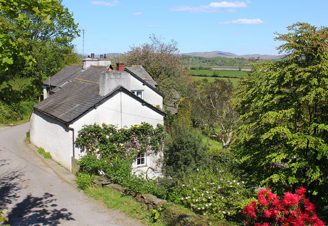
Boghouse Close Wood Images

Images are sourced within 2km of 54.265528/-3.2456053 or Grid Reference SD1886. Thanks to Geograph Open Source API. All images are credited.

A595 at Buckman Brow
A5093 at The Green village boundary
The Punch Bowl Inn, The Green, Millom
Ordnance Survey Cut Mark This OS cut mark can be found adjacent to the letter box at Broadgate. It marks a point 107.274m above mean sea level.
Ordnance Survey Cut Mark
This OS cut mark can be found adjacent to the letter box at Broadgate. It marks a point 107.274m above mean sea level.
Ordnance Survey Cut Mark This OS cut mark can be found on Old Hall Cottage. It marks a point 39.156m above mean sea level.
Ordnance Survey Cut Mark
This OS cut mark can be found on Old Hall Cottage. It marks a point 39.156m above mean sea level.
Ordnance Survey Cut Mark This OS cut mark can be found on a large rock to the west of the track.
Ordnance Survey Cut Mark
This OS cut mark can be found on a large rock to the west of the track.
Start of the track to the Swinside Stone Circle The track branching off to the left leads to the Stone Circle and Swinside Farm.
Start of the track to the Swinside Stone Circle
The track branching off to the left leads to the Stone Circle and Swinside Farm.
SRPS Cumbrian Coast Railtour 2018 : Signal Post Before Duddon Viaduct
SRPS Cumbrian Coast Railtour 2018 : Approaching Duddon Viaduct
Ordnance Survey Cut Mark This OS cut mark can be found on the large boulder in the wall SE side of the road. It marks a point 99.048m above mean sea level.
Ordnance Survey Cut Mark
This OS cut mark can be found on the large boulder in the wall SE side of the road. It marks a point 99.048m above mean sea level.
Ordnance Survey OSBM Bolt This OS Bolt can be found on the large boulder at the side of the barn at Low Broadgate. It marks a point 81.764m above mean sea level.
Ordnance Survey OSBM Bolt
This OS Bolt can be found on the large boulder at the side of the barn at Low Broadgate. It marks a point 81.764m above mean sea level.
Ordnance Survey Cut Mark This OS cut mark can be found on the wall NW side of the road. It marks a point 98.207m above mean sea level.
Ordnance Survey Cut Mark
This OS cut mark can be found on the wall NW side of the road. It marks a point 98.207m above mean sea level.
Ordnance Survey Cut Mark This OS cut mark can be found on the west parapet of Waughfoot Bridge. It marks a point 132.683m above mean sea level.
Ordnance Survey Cut Mark
This OS cut mark can be found on the west parapet of Waughfoot Bridge. It marks a point 132.683m above mean sea level.
Ordnance Survey Rivet This OS rivet can be found on the wall east side of the road. It marks a point 137.962m above mean sea level.
Ordnance Survey Rivet
This OS rivet can be found on the wall east side of the road. It marks a point 137.962m above mean sea level.
Ordnance Survey Flush Bracket (G3077) This OS Flush Bracket can be found on The Oaks. It marks a point 35.752m above mean sea level.
Ordnance Survey Flush Bracket (G3077)
This OS Flush Bracket can be found on The Oaks. It marks a point 35.752m above mean sea level.
Ordnance Survey Cut Mark This OS cut mark can be found on the gatepost NE side of the road. It marks a point 59.489m above mean sea level.
Ordnance Survey Cut Mark
This OS cut mark can be found on the gatepost NE side of the road. It marks a point 59.489m above mean sea level.
Railway near Lady Hall Lancaster to Barrow line near Green Road.
Railway near Lady Hall
Lancaster to Barrow line near Green Road.
Lady Hall Cottages in Lady Hall, Cumbria.
Lady Hall
Cottages in Lady Hall, Cumbria.
Show me another place!

Boghouse Close Wood is located at Grid Ref: SD1886 (Lat: 54.265528, Lng: -3.2456053)

Administrative County: Cumbria

District: Copeland

Police Authority: Cumbria

What 3 Words

///owner.drives.quicksand. Near Millom, Cumbria

Related Wikis

Thwaites, Cumbria

Thwaites is a small village near Duddon Valley and on the edge of the Duddon Estuary in the Lake District National Park in the Borough of Copeland, Cumbria...

St Anne's Church, Thwaites

St Anne's Church is in the village of Thwaites, Cumbria, England. It is an active Anglican parish church in the deanery of Millom, the archdeaconry of...

Millom Without

Millom Without is a civil parish in the county of Cumbria, England. It had a population of 1,638 in 2001, decreasing to 859 at the 2011 Census. Millom...

Foxfield railway station

Foxfield is a railway station on the Cumbrian Coast Line, which runs between Carlisle and Barrow-in-Furness. The station, situated 11+1⁄2 miles (19 km...

Duddon Bridge

Duddon Bridge is a hamlet in Cumbria, England. == References ==

Duddon furnace

The Duddon furnace (Grid Reference SD 197883) is a surviving charcoal-fuelled blast furnace near Broughton-in-Furness in Cumbria. It is on the west side...

Foxfield, Cumbria

Foxfield is a village on the west coast of Cumbria, England, in the Furness district that was part of Lancashire from 1182 to 1974. It lies on the Duddon...

St Mary Magdalene's Church, Broughton-in-Furness

St Mary Magdalene's Church is in Broughton-in-Furness, Cumbria, England. It is an active Anglican parish church in the deanery of Furness, the archdeaconry...

Nearby Amenities

Located within 500m of 54.265528,-3.2456053
Barrier: stile
Lat/Long: 54.2625265/-3.2401397
Barrier: stile
Lat/Long: 54.2655718/-3.2527392
Barrier: stile
Lat/Long: 54.2664269/-3.2486032
Power: pole
Lat/Long: 54.2615398/-3.2467205
Power: pole
Lat/Long: 54.2625848/-3.2443944
Power: pole
Lat/Long: 54.2629617/-3.242644
Power: pole
Lat/Long: 54.2633024/-3.2434709
Power: pole
Lat/Long: 54.2634943/-3.2429801
Power: pole
Lat/Long: 54.2633986/-3.2423626
Location: underground
Pipeline: valve
Service: water
Lat/Long: 54.2630801/-3.2426006
Fire Hydrant
Emergency: fire_hydrant
Fire Hydrant Position: lane
Fire Hydrant Type: underground
Lat/Long: 54.2629986/-3.2420878
Power: pole
Lat/Long: 54.2632109/-3.2414128
Power: pole
Lat/Long: 54.2632025/-3.2411951
Power: pole
Lat/Long: 54.2629502/-3.241356
Post Box
Ref: LA18 125
Source: https://www.flickr.com/search/?q=la18&w=737259%40N20&m=pool
Lat/Long: 54.2629582/-3.2410415
Power: pole
Lat/Long: 54.26321/-3.241459
Power: pole
Lat/Long: 54.2631644/-3.2402753
Power: pole
Lat/Long: 54.2632686/-3.2408466
Lady Hall
Place: hamlet
Lat/Long: 54.2630796/-3.2411839
Power: pole
Lat/Long: 54.268168/-3.2448684
Power: pole
Lat/Long: 54.2688059/-3.2445664
Power: pole
Lat/Long: 54.2694099/-3.2442363
Power: pole
Lat/Long: 54.2694089/-3.2442468
Power: pole
Lat/Long: 54.269815/-3.245671
The data included in this document is from www.openstreetmap.org. The data is made available under ODbL.

Have you been to Boghouse Close Wood?

Leave your review of Boghouse Close Wood below (or comments, questions and feedback).