Castlandhill Woods

Wood, Forest in Fife

Scotland

Castlandhill Woods

Terraced houses on Admiralty Road, Rosyth
Terraced houses on Admiralty Road, Rosyth Credit: Alpin Stewart

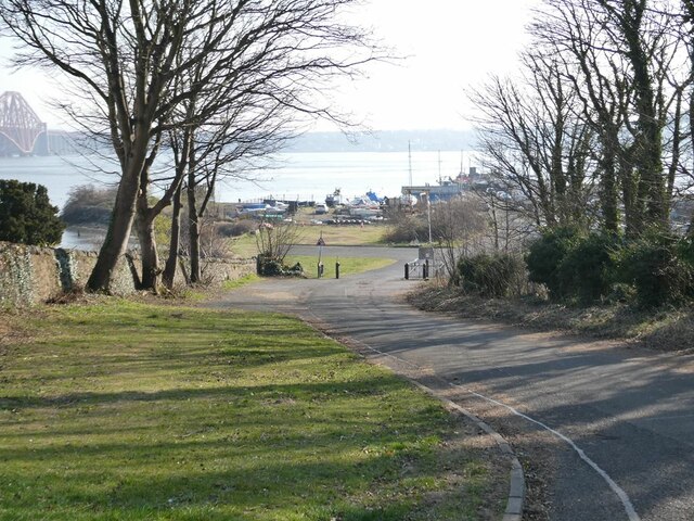
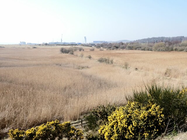
Castlandhill Woods is a picturesque area located in Fife, Scotland. Spread across approximately 20 acres, this woodland offers a serene and tranquil environment for nature enthusiasts and hikers alike. The woods are situated on a hillside, providing stunning views of the surrounding countryside.

The woodland is predominantly composed of native tree species, including oak, birch, and beech. The dense foliage creates a shaded and cool atmosphere, perfect for escaping the summer heat. Bluebells carpet the forest floor in spring, creating a stunning display of vibrant colors.

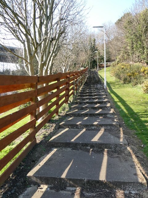
The woods are crisscrossed by a network of well-maintained trails, making it accessible to visitors of all ages and abilities. These paths wind through the trees, leading visitors to various points of interest, such as a small pond and an old stone bridge.

Birdwatchers will be delighted by the diverse avian population in Castlandhill Woods. Species such as woodpeckers, owls, and thrushes can be spotted throughout the year. The forest also provides a habitat for small mammals, including squirrels and hedgehogs.

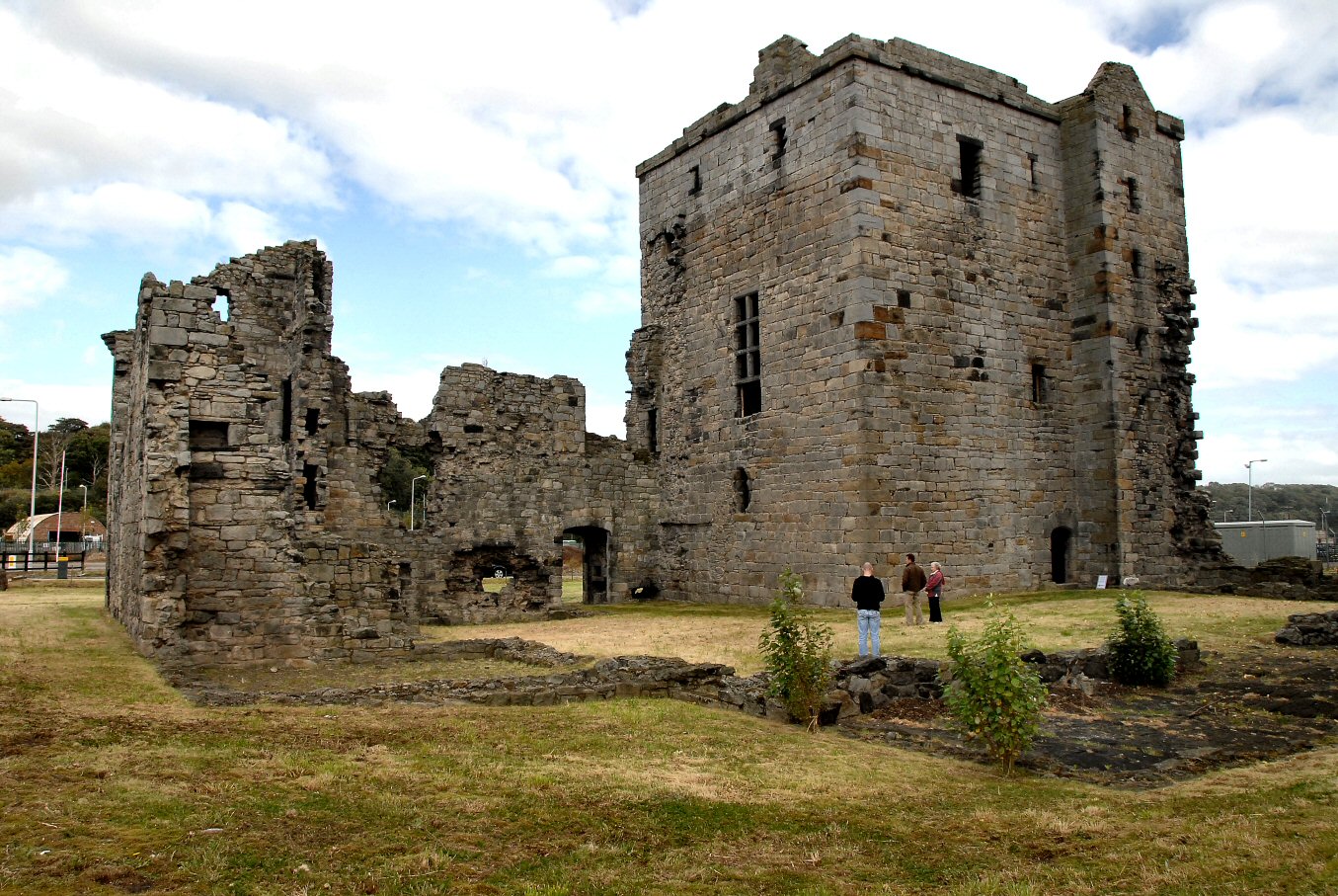
Castlandhill Woods is not only a haven for wildlife but also a place of historical significance. Ruins of an ancient castle, believed to date back to the 15th century, can be found within the woodland. These remnants offer a glimpse into the area's rich past and add an element of intrigue to the overall experience.

Overall, Castlandhill Woods is a true gem in the heart of Fife, offering a blend of natural beauty, recreational opportunities, and historical interest. Whether you're seeking a peaceful stroll, a birdwatching adventure, or a glimpse into the past, this woodland has something to offer for everyone.

If you have any feedback on the listing, please let us know in the comments section below.

Castlandhill Woods Images

Images are sourced within 2km of 56.023223/-3.4131981 or Grid Reference NT1282. Thanks to Geograph Open Source API. All images are credited.

Terraced houses on Admiralty Road, Rosyth
Housing on Admiralty Road, Rosyth
Admiralty Road, Rosyth
Former constructor's yard Beyond the light-controlled crossing on King Malcolm Drive is a large constructor's yard formerly used by contractors engaged on the construction of the Queensferry Crossing, now apparently disused.
Former constructor's yard
Beyond the light-controlled crossing on King Malcolm Drive is a large constructor's yard formerly used by contractors engaged on the construction of the Queensferry Crossing, now apparently disused.
Entrance to the Doubletree by Hilton Hotel. Occupying a stunning site overlooking the bridge over the Forth, the large notice advertises:
"FABULOUS WEDDINGS
Stunning Wedding Suite
Views of the Forth and Famous Bridges
Fantastic Packages and Incentives available"
One can't help wondering - if incentives of any sort are needed, should the couple really be getting married at all?
Entrance to the Doubletree by Hilton Hotel.
Occupying a stunning site overlooking the bridge over the Forth, the large notice advertises: "FABULOUS WEDDINGS Stunning Wedding Suite Views of the Forth and Famous Bridges Fantastic Packages and Incentives available" One can't help wondering - if incentives of any sort are needed, should the couple really be getting married at all?
North Queensferry and the Forth Bridge Seen through an arch on the approach to the Forth Road Bridge from the B981. The houses of North Queensferry in the foreground.
North Queensferry and the Forth Bridge
Seen through an arch on the approach to the Forth Road Bridge from the B981. The houses of North Queensferry in the foreground.
Under the arches of the Forth Road Bridge Seen from the B981.
Under the arches of the Forth Road Bridge
Seen from the B981.
Access steps to the eastern footway/cycleway on the Forth Road Bridge From the B981. OK for pedestrians, but a tough call for cyclists.
Access steps to the eastern footway/cycleway on the Forth Road Bridge
From the B981. OK for pedestrians, but a tough call for cyclists.
Cable anchor points for the Forth Road Bridge Seen from Ferry Road. The Queensferry Crossing beyond.
Cable anchor points for the Forth Road Bridge
Seen from Ferry Road. The Queensferry Crossing beyond.
Flight of steps Connecting the Ferry Road housing estate to the B981 above.
Flight of steps
Connecting the Ferry Road housing estate to the B981 above.
Access road to old ferry landing Road leading to the pier  from which the Queensferry Passage ferry operated. The ferry closed in 1964 when the Forth Road Bridge opened.
Access road to old ferry landing
Road leading to the pier from which the Queensferry Passage ferry operated. The ferry closed in 1964 when the Forth Road Bridge opened.
Disused railway to Rosyth Dockyard Railway from Inverkeithing to Rosyth Dockyard, apparently in use until  1988. At the Inverkeithing end, the track has been removed.
Disused railway to Rosyth Dockyard
Railway from Inverkeithing to Rosyth Dockyard, apparently in use until 1988. At the Inverkeithing end, the track has been removed.
Queensferry Crossing New road bridge over the Firth of Forth opened in 2017. The bridge replaces the original Forth Road Bridge (opened in 1964, visible to the left) which is retained solely for use by public transport.
Queensferry Crossing
New road bridge over the Firth of Forth opened in 2017. The bridge replaces the original Forth Road Bridge (opened in 1964, visible to the left) which is retained solely for use by public transport.
St Margaret's Marsh On the shore of the Firth of Forth. Rosyth Europarc <a href="https://www.geograph.org.uk/gridref/NT1081">NT1081</a> can be seen beyond.
St Margaret's Marsh
On the shore of the Firth of Forth. Rosyth Europarc NT1081 can be seen beyond.
Driveway to Castlandhill House There are plans for a major redevelopment of the site of Castlandhill House to build 200 houses, a hotel and a Country Park.
Driveway to Castlandhill House
There are plans for a major redevelopment of the site of Castlandhill House to build 200 houses, a hotel and a Country Park.
North Queensferry Waste Water Treatment Works On a site bounded by the Ferry Toll Road, the B981 and the Queensferry Crossing (seen in the background).
North Queensferry Waste Water Treatment Works
On a site bounded by the Ferry Toll Road, the B981 and the Queensferry Crossing (seen in the background).
Reed beds at Cult Ness These reedbeds appear to be part of the North Queensferry Waste Water Treatment Works. Beyond are the Queensferry Crossing and the original Forth Road Bridge.
Reed beds at Cult Ness
These reedbeds appear to be part of the North Queensferry Waste Water Treatment Works. Beyond are the Queensferry Crossing and the original Forth Road Bridge.
North end of the Queensferry Crossing Western limb of the roundabout on Junction 1b on the M90.In the background is the rocky knoll through which a railway cutting has been made.
North end of the Queensferry Crossing
Western limb of the roundabout on Junction 1b on the M90.In the background is the rocky knoll through which a railway cutting has been made.
Show me another place!

Castlandhill Woods is located at Grid Ref: NT1282 (Lat: 56.023223, Lng: -3.4131981)

Unitary Authority: Fife

Police Authority: Fife

What 3 Words

///quickly.head.collides. Near Inverkeithing, Fife

Related Wikis

Jamestown, Fife

Jamestown is a hamlet in Fife, Scotland, on the south side of Inverkeithing's Inner Bay. The nearby Jamestown Viaduct carries the Fife Circle Line over...

Rosyth Castle

Rosyth Castle is a fifteenth-century ruined tower house on the perimeter of Rosyth Naval Dockyard, Fife, Scotland. It originally stood on a small island...

Inverkeithing Town House

Inverkeithing Town House is a municipal building in the Townhall Street, Inverkeithing, Fife, Scotland. The structure, which is used as a base by members...

Inverkeithing

Inverkeithing ( ; Scottish Gaelic: Inbhir Chèitinn) is a coastal town, parish and historic Royal burgh in Fife, Scotland, on the Firth of Forth, 9½ miles...

Nearby Amenities

Located within 500m of 56.023223,-3.4131981
Crossing
Crossing: traffic_signals
Crossing Ref: toucan
Source: survey
Lat/Long: 56.0227786/-3.4053912
Post Box
Brand: Royal Mail
Brand Wikidata: Q638098
Collection Times: Mo-Fr 17:15; Sa 11:45
Operator: Royal Mail
Operator Wikidata: Q638098
Post Box Type: lamp
Ref: KY11 73
Royal Cypher: scottish_crown
Source: survey
Lat/Long: 56.0226077/-3.4061399
Traffic Signals
Source: survey
Lat/Long: 56.021067/-3.4133071
Bicycle Parking
Bicycle Parking: lockers
Covered: yes
Lat/Long: 56.0227378/-3.4064149
Traffic Signals
Traffic Signals: signal
Lat/Long: 56.0219587/-3.4071602
Traffic Signals
Traffic Signals: signal
Lat/Long: 56.0213391/-3.4104335
Mini Roundabout
Lat/Long: 56.0214371/-3.4171183
Bus Stop
Ferrytoll Park & Ride (Stance 2)
Bench: yes
Bin: yes
Bus: yes
Lit: yes
Local Ref: Ferrytoll Park & Ride
Naptan AtcoCode: 6500D1707
Naptan CommonName: Park & Ride
Naptan Indicator: Stance 2
Naptan Landmark: Ferrytoll Park & Ride
Naptan NaptanCode: 34349496
Naptan Street: Hope Street
Public Transport: platform
Ref: 34349496
Shelter: no
Tactile Paving: no
Lat/Long: 56.0225807/-3.4062731
Entrance: yes
Lat/Long: 56.0235657/-3.4057042
Traffic Signals
Traffic Signals: signal
Lat/Long: 56.0212492/-3.4104093
Traffic Signals
Traffic Signals: signal
Lat/Long: 56.022391/-3.405335
Crossing
Bicycle: yes
Crossing: traffic_signals
Crossing Ref: toucan
Kerb: flush
Tactile Paving: yes
Lat/Long: 56.0220998/-3.4070838
Motorway Junction
Ferrytoll
Ref: 1B
Lat/Long: 56.0262217/-3.4078808
Traffic Signals
Lat/Long: 56.0207948/-3.4074383
Crossing
Bicycle: yes
Crossing: traffic_signals
Crossing Ref: toucan
Kerb: flush
Source: survey
Tactile Paving: yes
Lat/Long: 56.0215224/-3.4104353
Crossing
Crossing: traffic_signals
Kerb: flush
Tactile Paving: yes
Lat/Long: 56.0211493/-3.4134687
Crossing
Bicycle: yes
Button Operated: yes
Crossing: traffic_signals
Crossing Ref: toucan
Kerb: flush
Source: survey
Tactile Paving: yes
Lat/Long: 56.0208421/-3.4130944
Crossing
Bicycle: yes
Crossing: traffic_signals
Crossing Ref: toucan
Kerb: flush
Source: survey
Tactile Paving: yes
Lat/Long: 56.0212194/-3.4107382
Crossing
Bicycle: yes
Crossing: traffic_signals
Crossing Ref: toucan
Kerb: flush
Source: survey
Tactile Paving: yes
Lat/Long: 56.0213007/-3.4108778
Crossing
Bicycle: yes
Crossing: traffic_signals
Crossing Ref: toucan
Kerb: flush
Source: survey
Tactile Paving: yes
Lat/Long: 56.0222008/-3.4085226
Traffic Signals
Traffic Signals: signal
Lat/Long: 56.0224417/-3.4055226
Crossing
Crossing: traffic_signals
Kerb: flush
Tactile Paving: yes
Lat/Long: 56.0209148/-3.4137376
Parking Entrance
Parking: multi-storey
Lat/Long: 56.0234646/-3.4057935
Parking Entrance
Parking: multi-storey
Lat/Long: 56.0235514/-3.406749
Bus Stop
Ferrytoll Park & Ride (Stance 1)
Bench: yes
Bin: yes
Bus: yes
Lit: yes
Local Ref: Ferrytoll Park & Ride
Naptan AtcoCode: 6500D1064
Naptan CommonName: Park & Ride
Naptan Indicator: Stance 1
Naptan Landmark: Ferrytoll Park & Ride
Naptan NaptanCode: 34323249
Naptan Street: Hope Street
Public Transport: platform
Ref: 34323249
Shelter: yes
Tactile Paving: no
Lat/Long: 56.0225668/-3.405857
Bus Stop
Ferrytoll Park & Ride (Stance 3)
Bench: yes
Bin: yes
Bus: yes
Lit: yes
Local Ref: Ferrytoll Park & Ride
Naptan AtcoCode: 6500D1709
Naptan CommonName: Park & Ride
Naptan Indicator: Stance 4
Naptan NaptanCode: 34353657
Naptan Street: Hope Street
Public Transport: platform
Ref: 34353657
Shelter: yes
Tactile Paving: no
Lat/Long: 56.0223553/-3.4067299
Charging Station
Lat/Long: 56.0228821/-3.4058465
Bus Stop
Ferrytoll Park & Ride (Stance 4)
Bench: yes
Bin: no
Bus: yes
Lit: yes
Local Ref: Ferrytoll Park & Ride
Naptan AtcoCode: 6500DB007
Naptan CommonName: Park & Ride
Naptan Indicator: entrance
Naptan Landmark: Bus Turning Circle
Naptan Street: Hope Street
Public Transport: platform
Shelter: no
Tactile Paving: no
Lat/Long: 56.0221502/-3.4064275
Crossing
Crossing: traffic_signals
Kerb: flush
Tactile Paving: yes
Lat/Long: 56.0209964/-3.4138726
Traffic Signals
Source: survey
Lat/Long: 56.0209806/-3.4131871
Traffic Signals
Traffic Signals: signal
Lat/Long: 56.0210401/-3.4135144
Traffic Signals
Source: survey
Lat/Long: 56.020955/-3.4133888
Crossing
Bicycle: yes
Button Operated: yes
Crossing: traffic_signals
Crossing Ref: toucan
Kerb: flush
Source: survey
Tactile Paving: yes
Lat/Long: 56.0208561/-3.4132745
Crossing
Crossing: traffic_signals
Kerb: flush
Tactile Paving: yes
Lat/Long: 56.021155/-3.4136584
Crossing
Bicycle: yes
Button Operated: yes
Crossing: traffic_signals
Crossing Ref: toucan
Kerb: flush
Tactile Paving: yes
Lat/Long: 56.0221894/-3.4069977
Toilets
Access: yes
Changing Table: yes
Check Date: 2023-01-19
Fee: no
Level: 0
Toilets Disposal: flush
Wheelchair: yes
Lat/Long: 56.0226502/-3.4064071
Vending Machine
Check Date: 2023-01-19
Indoor: yes
Payment Credit Cards: yes
Payment Debit Cards: yes
Payment Mastercard: yes
Payment Visa: yes
Vending: drinks;food;coffee
Lat/Long: 56.0226885/-3.4064013
Traffic Signals
Traffic Signals: signal
Lat/Long: 56.0209185/-3.4073767
Traffic Signals
Traffic Signals: crossing
Lat/Long: 56.0221668/-3.408518
Traffic Signals
Traffic Signals: signal
Lat/Long: 56.0221291/-3.4071144
Traffic Signals
Traffic Signals: signal
Lat/Long: 56.0222187/-3.407035
The data included in this document is from www.openstreetmap.org. The data is made available under ODbL.

Have you been to Castlandhill Woods?

Leave your review of Castlandhill Woods below (or comments, questions and feedback).