Buckland Down

Settlement in Somerset Mendip

England

Buckland Down

Direction Sign – Signpost on the B3139 in Kilmersdon parish Located on the west side of the junction of the B3139 and Knobsbury Hill in Kilmersdon parish. 4 arms and pyramid finial.

Milestone Society National ID: SO_ST7052B
Direction Sign – Signpost on the B3139 in Kilmersdon parish Credit: J Dowding

Buckland Down is a picturesque rural village located in Somerset, England. Situated on the southern edge of the Mendip Hills, it offers stunning views of the surrounding countryside. Nestled in a valley, the village is known for its tranquil and idyllic setting.

The village of Buckland Down is small, with a population of approximately 500 residents. The community is tightly-knit, creating a friendly and welcoming atmosphere for both locals and visitors. The village boasts traditional stone-built houses, giving it a charming and historic feel.

One of the notable features of Buckland Down is its close proximity to several natural attractions. The Mendip Hills Area of Outstanding Natural Beauty is just a stone's throw away, offering ample opportunities for outdoor activities such as hiking, cycling, and wildlife spotting. The village is also situated near the Cheddar Gorge and Caves, a popular tourist destination known for its stunning limestone cliffs and underground caves.

In terms of amenities, Buckland Down has a village hall that serves as a hub for various community events and gatherings. There is also a local pub, providing a cozy spot for residents and visitors to socialize and enjoy a pint.

Overall, Buckland Down in Somerset is a charming and tranquil village, offering a peaceful escape from the hustle and bustle of city life. Its stunning natural surroundings and welcoming community make it an ideal place for those seeking a rural retreat.

If you have any feedback on the listing, please let us know in the comments section below.

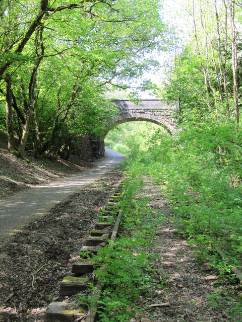
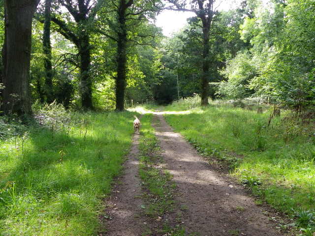
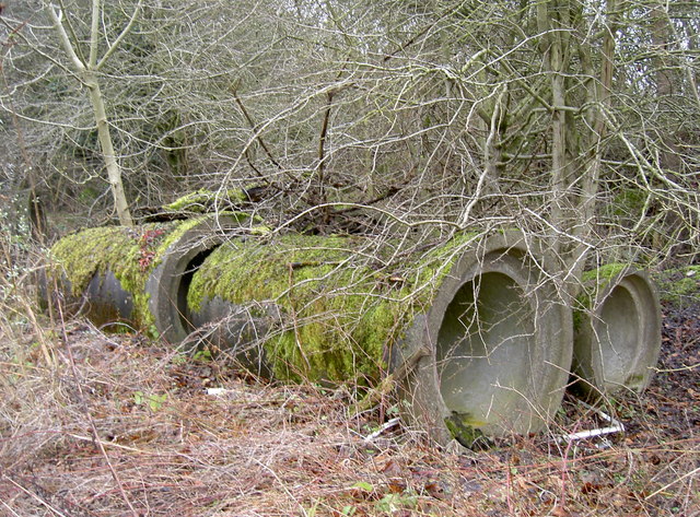
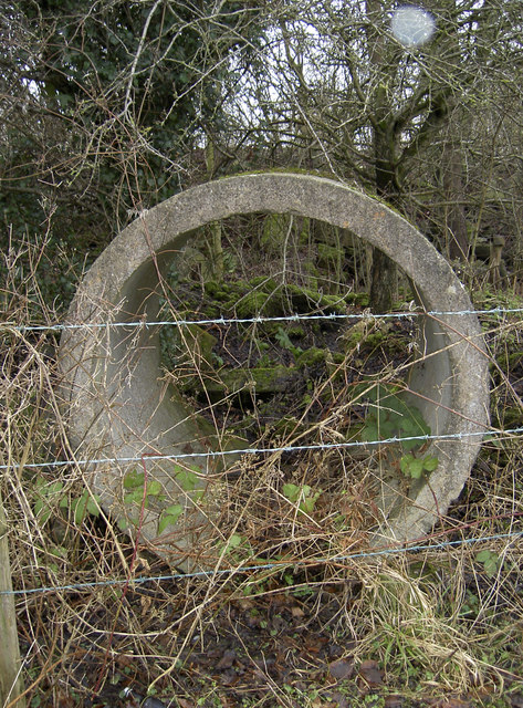
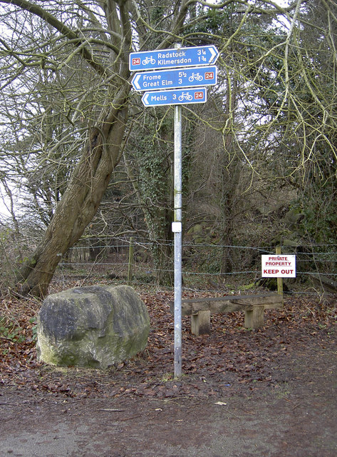
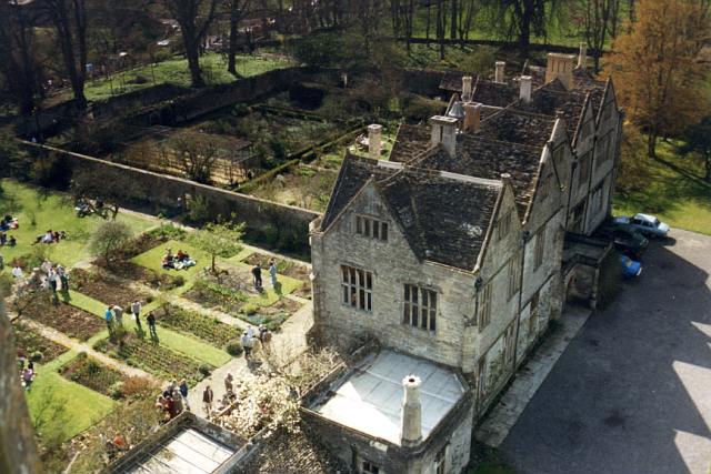
Buckland Down Images

Images are sourced within 2km of 51.266135/-2.398146 or Grid Reference ST7251. Thanks to Geograph Open Source API. All images are credited.

Direction Sign – Signpost on the B3139 in Kilmersdon parish Located on the west side of the junction of the B3139 and Knobsbury Hill in Kilmersdon parish. 4 arms and pyramid finial.

Milestone Society National ID: SO_ST7052B
Direction Sign – Signpost on the B3139 in Kilmersdon parish
Located on the west side of the junction of the B3139 and Knobsbury Hill in Kilmersdon parish. 4 arms and pyramid finial. Milestone Society National ID: SO_ST7052B
Direction Sign – Signpost on the B3139, Frome Road, A366 and A362 crossroads in Hemington parish Located on the west side of the crossroads of the B3139, Frome Road, A366 and A362 in Hemington parish. 6 arms and lost finial.

Milestone Society National ID: SO_ST7153
Direction Sign – Signpost on the B3139, Frome Road, A366 and A362 crossroads in Hemington parish
Located on the west side of the crossroads of the B3139, Frome Road, A366 and A362 in Hemington parish. 6 arms and lost finial. Milestone Society National ID: SO_ST7153
Old Milestone by A362, Buckland Down, North of Lodge to Ammerdown Park The Milestone is located on grass verge on the West of the road.  Parish of Hemington (Mendip  District). Metal plate attached to stone post, Radstock iron plate design, erected by the Radstock turnpike trust in the 18th century. Re-erected after being uprooted in 2001; repainted by a member of the public. An earlier photograph can be found here: <a title="https://www.geograph.org.uk/photo/6060915" href="https://www.geograph.org.uk/photo/6060915">Link</a> 

Inscription reads:-   
FROME / 5 / RADSTOCK / 3 

Grade II listed. List Entry Number: 1175774 <span class="nowrap"><a title="https://historicengland.org.uk/listing/the-list/list-entry/1175774" rel="nofollow ugc noopener" href="https://historicengland.org.uk/listing/the-list/list-entry/1175774">Link</a><img style="margin-left:2px;" alt="External link" title="External link - shift click to open in new window" src="https://s1.geograph.org.uk/img/external.png" width="10" height="10"/></span> 

Milestone Society National ID: SO_FRRS05
Old Milestone by A362, Buckland Down, North of Lodge to Ammerdown Park
The Milestone is located on grass verge on the West of the road.  Parish of Hemington (Mendip District). Metal plate attached to stone post, Radstock iron plate design, erected by the Radstock turnpike trust in the 18th century. Re-erected after being uprooted in 2001; repainted by a member of the public. An earlier photograph can be found here: Link  Inscription reads:- FROME / 5 / RADSTOCK / 3 Grade II listed. List Entry Number: 1175774 LinkExternal link Milestone Society National ID: SO_FRRS05
Brick Kiln Farm Bridge Bridge carrying Wanwards Lane across the Frome to Radstock railway (closed to passenger traffic in 1959, and to goods in 1968). It now crosses The Colliers Way (part of National Cycle Network Route 24), though the overgrown railway tracks are still in place.
Brick Kiln Farm Bridge
Bridge carrying Wanwards Lane across the Frome to Radstock railway (closed to passenger traffic in 1959, and to goods in 1968). It now crosses The Colliers Way (part of National Cycle Network Route 24), though the overgrown railway tracks are still in place.
Track, Napp Wood The woodland, part of the Ammerdown Estate is open for the public.
Track, Napp Wood
The woodland, part of the Ammerdown Estate is open for the public.
St Mary's church, Hardington Bampfylde - Bampfylde monument This fine wall monument to Colonel Warwick Bampfylde (†1694) in the chancel stands 12 feet tall. As well as the Colonel, the memorial inscription also commemorates three further generations of the Bampfylde family.
St Mary's church, Hardington Bampfylde - Bampfylde monument
This fine wall monument to Colonel Warwick Bampfylde (†1694) in the chancel stands 12 feet tall. As well as the Colonel, the memorial inscription also commemorates three further generations of the Bampfylde family.
Blessed Virgin Mary, Hemington
Cornish's Grave Projecting Bracket An old style of survey marker in the structure of a railway bridge near Kilmersdon. These were fairly short-lived, being used from the Second Geodetic Levelling from 1912 but replaced by Flush Brackets. Most surviving examples are often found along railway lines, like this one. See <a href="https://www.geograph.org.uk/photo/3328686">ST7151 : Cornish's Grave bridge</a> for a wider view and <span class="nowrap"><a title="http://www.bench-marks.org.uk/bm2509" rel="nofollow ugc noopener" href="http://www.bench-marks.org.uk/bm2509">Link</a><img style="margin-left:2px;" alt="External link" title="External link - shift click to open in new window" src="https://s1.geograph.org.uk/img/external.png" width="10" height="10"/></span> for the listing in the Benchmark Database and nearby ones too.
Cornish's Grave Projecting Bracket
An old style of survey marker in the structure of a railway bridge near Kilmersdon. These were fairly short-lived, being used from the Second Geodetic Levelling from 1912 but replaced by Flush Brackets. Most surviving examples are often found along railway lines, like this one. See ST7151 : Cornish's Grave bridge for a wider view and LinkExternal link for the listing in the Benchmark Database and nearby ones too.
Cornish's Grave bridge Once the old colliers' line saw trains running along the tracks but today is now National Cycle Network Route 24. A projecting bracket can be found low down on the corner of the wall to the left of shot - see <a href="https://www.geograph.org.uk/photo/3328661">ST7151 : Cornish's Grave Projecting Bracket</a>.
Cornish's Grave bridge
Once the old colliers' line saw trains running along the tracks but today is now National Cycle Network Route 24. A projecting bracket can be found low down on the corner of the wall to the left of shot - see ST7151 : Cornish's Grave Projecting Bracket.
Benchmark on Conduit Bridge An old cutmark, as listed in the Benchmark Database: <span class="nowrap"><a title="http://www.bench-marks.org.uk/bm31101" rel="nofollow ugc noopener" href="http://www.bench-marks.org.uk/bm31101">Link</a><img style="margin-left:2px;" alt="External link" title="External link - shift click to open in new window" src="https://s1.geograph.org.uk/img/external.png" width="10" height="10"/></span> , on the east wall of the old railway bridge. See <a href="https://www.geograph.org.uk/photo/3328696">ST7350 : A choice of routes</a> for a wider view and <a href="https://www.geograph.org.uk/photo/3328700">ST7350 : Lost!</a> for where an old projecting bracket used to be below.
Benchmark on Conduit Bridge
An old cutmark, as listed in the Benchmark Database: LinkExternal link , on the east wall of the old railway bridge. See ST7350 : A choice of routes for a wider view and ST7350 : Lost! for where an old projecting bracket used to be below.
A choice of routes The small road bridge over the old railway not leads down to the cycle path. A benchmark can be found on the eastern wall of the bridge - see <a href="https://www.geograph.org.uk/photo/3328688">ST7350 : Benchmark on Conduit Bridge</a> - but a projecting bracket in the structure of the bridge itself has not enjoyed a similar fate. See <a href="https://www.geograph.org.uk/photo/3328700">ST7350 : Lost!</a>.
A choice of routes
The small road bridge over the old railway not leads down to the cycle path. A benchmark can be found on the eastern wall of the bridge - see ST7350 : Benchmark on Conduit Bridge - but a projecting bracket in the structure of the bridge itself has not enjoyed a similar fate. See ST7350 : Lost!.
Lost! This scar in the stonework of the railway bridge appears to be the remains of an old projecting bracket. It has clearly been removed, by fair means or foul! This part of the old Colliers' Way railway has become a popular cycle path and has a number of these types dotted along it - see <span class="nowrap"><a title="http://www.bench-marks.org.uk/bm2507" rel="nofollow ugc noopener" href="http://www.bench-marks.org.uk/bm2507">Link</a><img style="margin-left:2px;" alt="External link" title="External link - shift click to open in new window" src="https://s1.geograph.org.uk/img/external.png" width="10" height="10"/></span> for the listing in the Benchmark Database and <a href="https://www.geograph.org.uk/photo/3328716">ST7350 : Conduit Bridge</a> for a wider view of the bridge.
Lost!
This scar in the stonework of the railway bridge appears to be the remains of an old projecting bracket. It has clearly been removed, by fair means or foul! This part of the old Colliers' Way railway has become a popular cycle path and has a number of these types dotted along it - see LinkExternal link for the listing in the Benchmark Database and ST7350 : Conduit Bridge for a wider view of the bridge.
Conduit Bridge The Colliers Way - Route 24 of Sustrans National Cycle Network - is part of the route that links Midsomer Norton to Frome. Originally it was the Somersetshire Coal Canal before the railway took over, but today is a popular and peaceful cyclepath. A benchmark used to be in the stonework of the left abutment but has been lost now - see <a href="https://www.geograph.org.uk/photo/3328700">ST7350 : Lost!</a>. 
Also see <span class="nowrap"><a title="http://www.colliersway.co.uk/index.php" rel="nofollow ugc noopener" href="http://www.colliersway.co.uk/index.php">Link</a><img style="margin-left:2px;" alt="External link" title="External link - shift click to open in new window" src="https://s1.geograph.org.uk/img/external.png" width="10" height="10"/></span> for the local information.
Conduit Bridge
The Colliers Way - Route 24 of Sustrans National Cycle Network - is part of the route that links Midsomer Norton to Frome. Originally it was the Somersetshire Coal Canal before the railway took over, but today is a popular and peaceful cyclepath. A benchmark used to be in the stonework of the left abutment but has been lost now - see ST7350 : Lost!. Also see LinkExternal link for the local information.
Is it me? Along the old coal railway line from Radstock to Frome are a number of bridges. Having been closed to traffic in 1988, the line was converted into National Cycle Network Route 24 and artists Elizabeth Turrell and Imi Murf have placed artworks into the high arches in order to recount the days of steam. These enamel fingers are arranged differently at each bridge. See <a href="https://www.geograph.org.uk/photo/3328686">ST7151 : Cornish's Grave bridge</a> for a view of the bridge and <a href="https://www.geograph.org.uk/photo/3330196">ST7549 : A curious mixture</a> for another example further down the line.
Is it me?
Along the old coal railway line from Radstock to Frome are a number of bridges. Having been closed to traffic in 1988, the line was converted into National Cycle Network Route 24 and artists Elizabeth Turrell and Imi Murf have placed artworks into the high arches in order to recount the days of steam. These enamel fingers are arranged differently at each bridge. See ST7151 : Cornish's Grave bridge for a view of the bridge and ST7549 : A curious mixture for another example further down the line.
Simple art The Colliers Way is illuminated by frequent artworks of a more practical nature. Here a solid bench by Yumiko Aoyagi stands next to a boulder by Elizabeth Turrell and Imi Maufe, which has names of old apple and pear varieties set into it.
Simple art
The Colliers Way is illuminated by frequent artworks of a more practical nature. Here a solid bench by Yumiko Aoyagi stands next to a boulder by Elizabeth Turrell and Imi Maufe, which has names of old apple and pear varieties set into it.
Undercover pipes Actually perhaps these should be under the ground? Some of the products of the concrete works nearby have clearly been misappropriated. See <a href="https://www.geograph.org.uk/photo/3329152">ST7151 : Open both ends</a> for another inadvertent wildlife refuge.
Undercover pipes
Actually perhaps these should be under the ground? Some of the products of the concrete works nearby have clearly been misappropriated. See ST7151 : Open both ends for another inadvertent wildlife refuge.
Open both ends Another large concrete pipe section, lying forlorn and not looking like it is going to be removed any time soon. See <a href="https://www.geograph.org.uk/photo/3329150">ST7151 : Undercover pipes</a> for more pipes along side the old railway line.
Open both ends
Another large concrete pipe section, lying forlorn and not looking like it is going to be removed any time soon. See ST7151 : Undercover pipes for more pipes along side the old railway line.
It's flat all the way Route 24 markers beside a building called 'The Halt'. Opposite (and behind the private property sign) is a concrete works.
It's flat all the way
Route 24 markers beside a building called 'The Halt'. Opposite (and behind the private property sign) is a concrete works.
Show me another place!

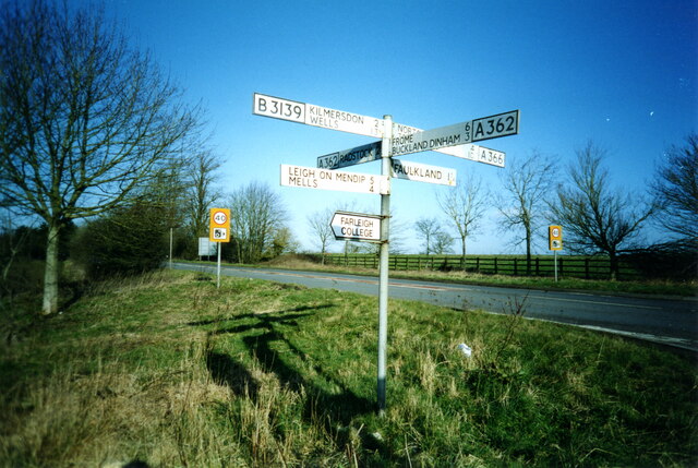
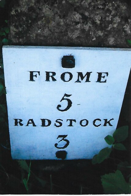
Buckland Down is located at Grid Ref: ST7251 (Lat: 51.266135, Lng: -2.398146)

Administrative County: Somerset

District: Mendip

Police Authority: Avon and Somerset

What 3 Words

///passports.dishing.dads. Near Radstock, Somerset

Related Wikis

Kingsdown Camp

Kingsdown Camp is an Iron Age hillfort at Buckland Dinham 4.5 kilometres (3 mi) South East of Radstock, Somerset, England. It is a Scheduled Monument.It...

St Mary's Church, Hemington

St. Mary's Hemington is an Anglican church in Hemington, Somerset, England. The Norman church underwent major renovation in the 14th, 15th, 17th and 19th...

Mells Road railway station

Mells Road railway station served the village of Mells, Somerset, England from 1875 to 1959 linking Radstock to Frome, Somerset on the Heart of Wessex...

Hemington, Somerset

Hemington is a village and civil parish 5.5 miles (8.9 km) north west of Frome, in the Mendip district of Somerset, England. It is located just off the...

Ammerdown House, Kilmersdon

Ammerdown House in Kilmersdon, Somerset, England, was built in 1788. It has been designated as Grade I listed building.It was built as a country house...

Babington, Somerset

Babington is a small village between Radstock and Frome, Somerset, England, which has now largely disappeared. == History == In 1233 or 1234 much of the...

Babington House

Babington House is a Grade II* listed manor house, located in the village of Babington, between Radstock and Frome, in the county of Somerset, England...

Mells Manor

Mells Manor at Mells, Somerset, England, was built in the 16th century for Edward Horner, altered in the 17th century, partially demolished around 1780...

Nearby Amenities

Located within 500m of 51.266135,-2.398146
Barrier: horse_stile
Lat/Long: 51.2648223/-2.403124
The data included in this document is from www.openstreetmap.org. The data is made available under ODbL.

Have you been to Buckland Down?

Leave your review of Buckland Down below (or comments, questions and feedback).