Polwarth

Settlement in Berwickshire

Scotland

Polwarth

Farm track near Polwarth
Farm track near Polwarth Credit: Steven Brown

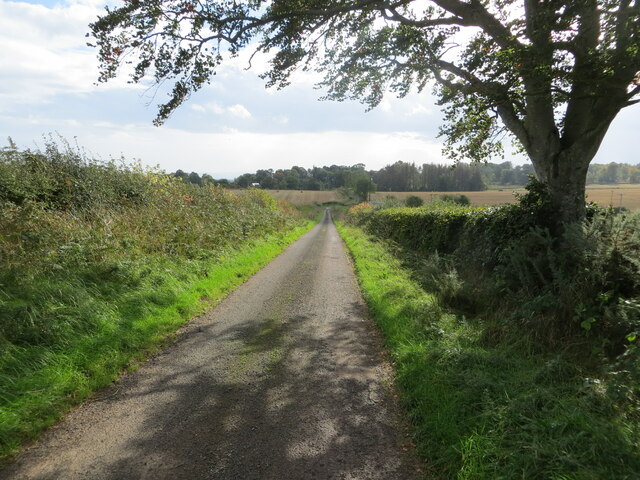
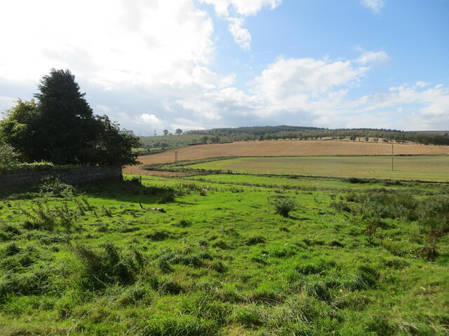
Polwarth is a small village located in the Scottish Borders region of Berwickshire. Situated approximately 5 miles southeast of the town of Duns, Polwarth is surrounded by picturesque countryside and rolling hills, creating a serene and tranquil atmosphere.

The village is home to a close-knit community, with a population of around 150 residents. Polwarth boasts a rich historical background, with records dating back to the 12th century. Its name is derived from the Old English word "pol" meaning pool or pond, and "worth" meaning an enclosure or settlement.

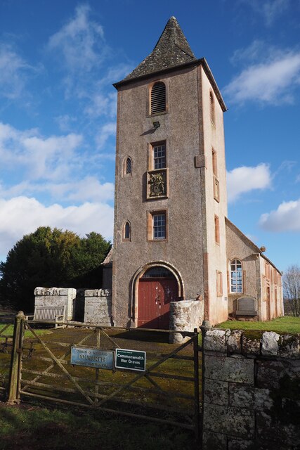
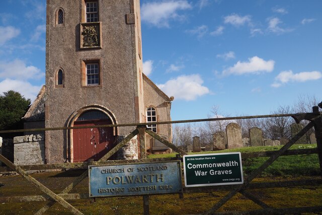
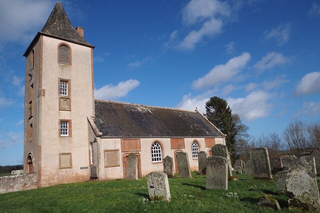
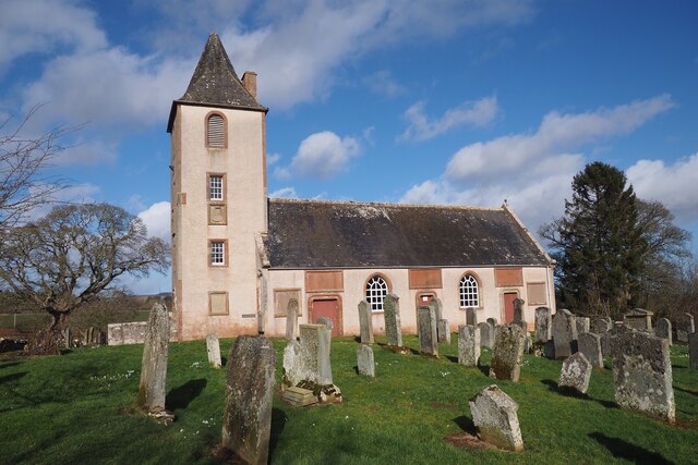
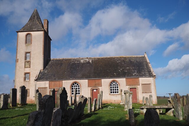
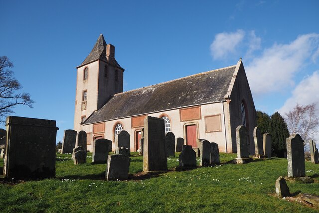
The centerpiece of the village is Polwarth Parish Church, a beautiful sandstone building constructed in the 19th century. The church is a prominent landmark and serves as a gathering place for local worshipers. Additionally, the village features a primary school, providing education for young children within the area.

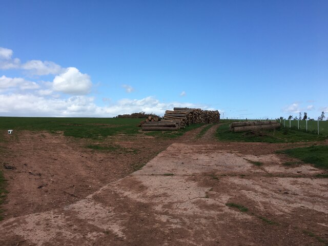
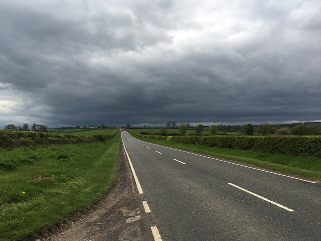
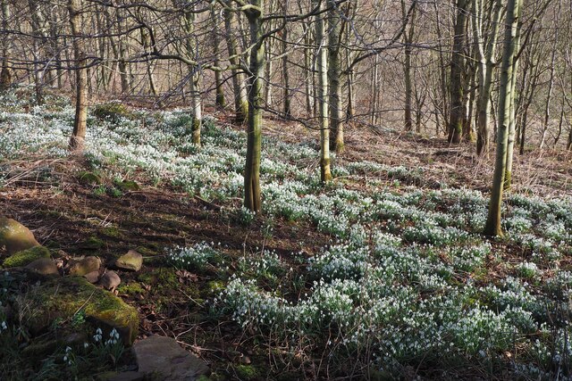
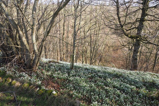
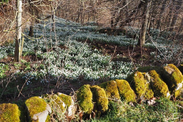
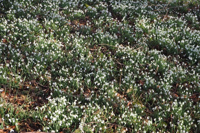
Polwarth is blessed with stunning natural beauty, making it an ideal location for outdoor enthusiasts. The surrounding countryside offers opportunities for walking, cycling, and exploring the nearby woods and farmland. The village is also renowned for its vibrant wildlife, with sightings of various bird species and mammals being common.

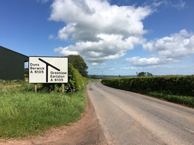
While Polwarth may be a small village, it is well-connected to neighboring areas. The town of Duns provides a range of amenities including shops, restaurants, and leisure facilities. Furthermore, the nearby A6105 road allows easy access to larger towns and cities such as Edinburgh and Berwick-upon-Tweed.

Overall, Polwarth is a charming village with a close community spirit and an abundance of natural beauty, making it a delightful place to live or visit.

If you have any feedback on the listing, please let us know in the comments section below.

Polwarth Images

Images are sourced within 2km of 55.744815/-2.4055344 or Grid Reference NT7450. Thanks to Geograph Open Source API. All images are credited.

Farm track near Polwarth
B6456 near its junction with the A6105
A6105 towards Greenlaw
End of the public road at Polwarth Rhodes Looking north-eastwards.
End of the public road at Polwarth Rhodes
Looking north-eastwards.
Hedge-lined minor road between Polwarth Mill and Polwarth Looking south-eastward.
Hedge-lined minor road between Polwarth Mill and Polwarth
Looking south-eastward.
Rough pasture and arable fields at Polwarth Mill Looking south-westward.
Rough pasture and arable fields at Polwarth Mill
Looking south-westward.
Polwarth Kirk It is claimed there has been a church here since 900 AD. The present building was built in 1703 by Patrick Hume 1st Earl of Marchmont.
Polwarth Kirk
It is claimed there has been a church here since 900 AD. The present building was built in 1703 by Patrick Hume 1st Earl of Marchmont.
Polwarth Kirk This present building was constructed in 1703 by Sir Patrick Hume 1st Earl of Marchmont. It is believed there was a church here by 900 AD.  The church and graveyard sit on top of a little hill overlooking much of the parish.
Polwarth Kirk
This present building was constructed in 1703 by Sir Patrick Hume 1st Earl of Marchmont. It is believed there was a church here by 900 AD. The church and graveyard sit on top of a little hill overlooking much of the parish.
Polwarth Kirk Apparently a church was dedicated here at Polwarth by 900AD. This present building was constructed in 1703 by Sir Patrick Hume 1st Earl of Marchmont. It also has a crypt where Sir Patrick, a Covenanter, had to hide for a month in the 1680's before escaping to Europe. He returned in 1688 with William of Orange.
The Kirk and graveyard sit on top of a small mound, overlooking most of the parish.
Polwarth Kirk closed for use in 2004 and is now privately owned by the Letts family who live in the adjacent Polwarth Manse. It can be hired for weddings.
Polwarth Kirk
Apparently a church was dedicated here at Polwarth by 900AD. This present building was constructed in 1703 by Sir Patrick Hume 1st Earl of Marchmont. It also has a crypt where Sir Patrick, a Covenanter, had to hide for a month in the 1680's before escaping to Europe. He returned in 1688 with William of Orange. The Kirk and graveyard sit on top of a small mound, overlooking most of the parish. Polwarth Kirk closed for use in 2004 and is now privately owned by the Letts family who live in the adjacent Polwarth Manse. It can be hired for weddings.
Polwarth Kirk There was a church dedicated here by 900AD. This present building was constructed in 1703 but the tower was added later. It sits upon a little hill overlooking most of the parish.
Polwarth Kirk closed for use in 2004 and is now privately owned by the Letts family who live in the adjacent Polwarth Manse but it is still available for weddings.
Polwarth Kirk
There was a church dedicated here by 900AD. This present building was constructed in 1703 but the tower was added later. It sits upon a little hill overlooking most of the parish. Polwarth Kirk closed for use in 2004 and is now privately owned by the Letts family who live in the adjacent Polwarth Manse but it is still available for weddings.
Polwarth Kirk A church was dedicated here by 900AD. This present building was constructed in 1703 by Sir Patrick Hume, 1st Earl of Marchmont. It stand on top of a little knoll and looks over much of the parish. 
It closed for use in 2004 and is now privately owned but it's still available for weddings.
Polwarth Kirk
A church was dedicated here by 900AD. This present building was constructed in 1703 by Sir Patrick Hume, 1st Earl of Marchmont. It stand on top of a little knoll and looks over much of the parish. It closed for use in 2004 and is now privately owned but it's still available for weddings.
Polwarth WWI Memorial Plaque at Polwarth Church To the Glory of God and in memory of the men from this parish
Who died for their King and Country in the Great War

John Elder                        A McLeish
AW Inglis         1914-1919       A McLeish
D Jamieson                        Thomas Scott
JRD McEwen                        CC Watt
Polwarth WWI Memorial Plaque at Polwarth Church
To the Glory of God and in memory of the men from this parish Who died for their King and Country in the Great War John Elder A McLeish AW Inglis 1914-1919 A McLeish D Jamieson Thomas Scott JRD McEwen CC Watt
Names of those buried in the Vault at Polwarth Church This plaque is on the gable end wall of Polwarth Kirk and names those buried here in the 1700's.
Names of those buried in the Vault at Polwarth Church
This plaque is on the gable end wall of Polwarth Kirk and names those buried here in the 1700's.
A Million Snowdrops at Polwarth A million snowdrops grow in the woods over the wall at Polwarth Kirk.
A Million Snowdrops at Polwarth
A million snowdrops grow in the woods over the wall at Polwarth Kirk.
A Million Snowdrops in the Woods at Polwarth Just over the Polwarth Church wall was this amazing sight of snowdrops as far as the eye could see!
A Million Snowdrops in the Woods at Polwarth
Just over the Polwarth Church wall was this amazing sight of snowdrops as far as the eye could see!
A Million Snowdrops at Polwarth Just over the wall at Polwarth Kirk were masses of beautiful snowdrops as far as the eye could see.
A Million Snowdrops at Polwarth
Just over the wall at Polwarth Kirk were masses of beautiful snowdrops as far as the eye could see.
A Million Snowdrops at Polwarth A million snowdrops grow in the woods beside Polwarth Kirk. What an amazing sight.
A Million Snowdrops at Polwarth
A million snowdrops grow in the woods beside Polwarth Kirk. What an amazing sight.
Polwarth Kirk A church was dedicated here at Polwarth by 900 AD. This present building was constructed in 1703.
Polwarth Kirk closed for use in 2004 and is now privately owned but is still available for weddings.
Polwarth Kirk
A church was dedicated here at Polwarth by 900 AD. This present building was constructed in 1703. Polwarth Kirk closed for use in 2004 and is now privately owned but is still available for weddings.
Show me another place!

Polwarth is located at Grid Ref: NT7450 (Lat: 55.744815, Lng: -2.4055344)

Unitary Authority: The Scottish Borders

Police Authority: The Lothians and Scottish Borders

What 3 Words

///most.eyepieces.plotter. Near Duns, Scottish Borders

Related Wikis

Polwarth, Scottish Borders

Polwarth (Scots: Polart) is a village and parish in the Scottish Borders area of Scotland. It is located at grid reference NT745502, between Greenlaw and...

Polwarth Castle

Polwarth Castle was a castle, located near Polwarth, Scottish Borders in Scotland. == History == Held by the Polwarth family it passed by marriage of Elizabeth...

Polwarth Parish Church

Polwarth Parish Church was a member church (Scots: kirk) of the Church of Scotland before closing in 2004. It is situated atop a mound off a minor...

Marchmont railway station

Marchmont railway station served the estate of Marchmont, Scottish Borders, Scotland from 1863 to 1948 on the North British Railway. == History == The...

Nearby Amenities

Located within 500m of 55.744815,-2.4055344
Bus Stop
Polwarth Road End
Bench: yes
Bus: yes
Departures Board: no
Lit: no
Local Ref: opp
Naptan AtcoCode: 69001274
Naptan Bearing: NE
Naptan CommonName: Road End
Naptan Indicator: opp
Naptan Landmark: Road End
Naptan NaptanCode: 72727292
Naptan Street: A6105
Naptan Verified: yes
Public Transport: platform
Ref: 69001274
Shelter: no
Source: survey;NaPTAN
Lat/Long: 55.74783/-2.4086936
Bus Stop
Polwarth Road End
Bus: yes
Local Ref: AT
Naptan AtcoCode: 69001275
Naptan Bearing: SW
Naptan CommonName: Road End
Naptan Indicator: at
Naptan Landmark: Road End
Naptan NaptanCode: 72726728
Naptan Street: A6105
Naptan Verified: yes
Public Transport: platform
Ref: 69001275
Source: NaPTAN
Lat/Long: 55.747894/-2.4083598
Polwarth
Place: village
Lat/Long: 55.7452082/-2.4064791
Noexit: yes
Lat/Long: 55.7456074/-2.4106478
Polwarth Rhodes
Place: hamlet
Lat/Long: 55.7461184/-2.397999
Give Way
Direction: forward
Lat/Long: 55.7429615/-2.4036777
Power: pole
Lat/Long: 55.7489767/-2.4035838
Power: pole
Lat/Long: 55.7488786/-2.404587
Power: pole
Lat/Long: 55.7489299/-2.4060649
Power: pole
Lat/Long: 55.7489888/-2.407473
Power: pole
Lat/Long: 55.7490432/-2.4079183
Power: pole
Lat/Long: 55.7479094/-2.4087015
Material: wood
Power: pole
Lat/Long: 55.747292/-2.4091896
Material: wood
Power: pole
Lat/Long: 55.7467515/-2.4097449
Power: pole
Lat/Long: 55.7457544/-2.410972
Power: pole
Lat/Long: 55.7460208/-2.4050094
Power: pole
Lat/Long: 55.7454471/-2.4043617
Power: pole
Lat/Long: 55.7448727/-2.403734
Power: pole
Lat/Long: 55.7441895/-2.4033786
Power: pole
Lat/Long: 55.7435305/-2.4030447
Power: pole
Lat/Long: 55.7428835/-2.4027027
Power: pole
Lat/Long: 55.7422011/-2.4023581
Power: pole
Lat/Long: 55.7416552/-2.4020791
Power: pole
Lat/Long: 55.7411819/-2.4018377
Power: pole
Lat/Long: 55.7458896/-2.4057422
Power: pole
Lat/Long: 55.7464104/-2.4063903
Power: pole
Lat/Long: 55.7469251/-2.4070064
Power: pole
Lat/Long: 55.745298/-2.4067762
Power: pole
Lat/Long: 55.745814/-2.4062006
Power: pole
Lat/Long: 55.7462196/-2.4038449
Power: pole
Lat/Long: 55.7464283/-2.4026767
Power: pole
Lat/Long: 55.7466899/-2.4014381
Power: pole
Lat/Long: 55.7469539/-2.4001633
Power: pole
Lat/Long: 55.7472131/-2.3989119
The data included in this document is from www.openstreetmap.org. The data is made available under ODbL.

Have you been to Polwarth?

Leave your review of Polwarth below (or comments, questions and feedback).