Poltonhall

Settlement in Midlothian

Scotland

Poltonhall

Poltonhall Recreation Park Across the pitches to the all weather pitches administered by Bonnyrigg Rose, the local football club.
Poltonhall Recreation Park Credit: Richard Webb

Poltonhall is a small residential area located in Midlothian, Scotland. Situated approximately 7 miles southeast of Edinburgh city center, it is part of the larger town of Bonnyrigg. Poltonhall is bordered by other neighborhoods including Polton, Lasswade, and Eskbank.

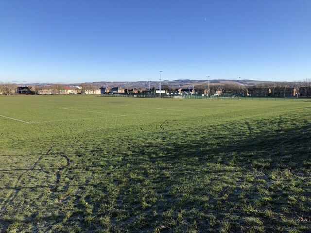
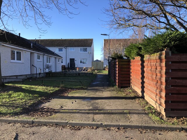
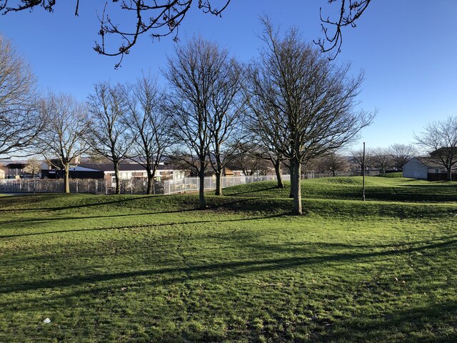
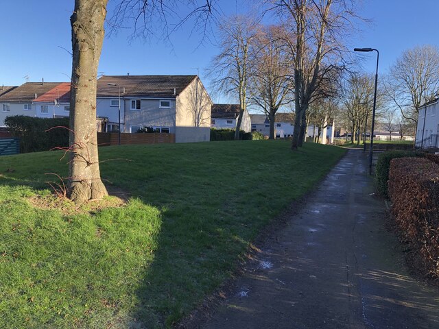
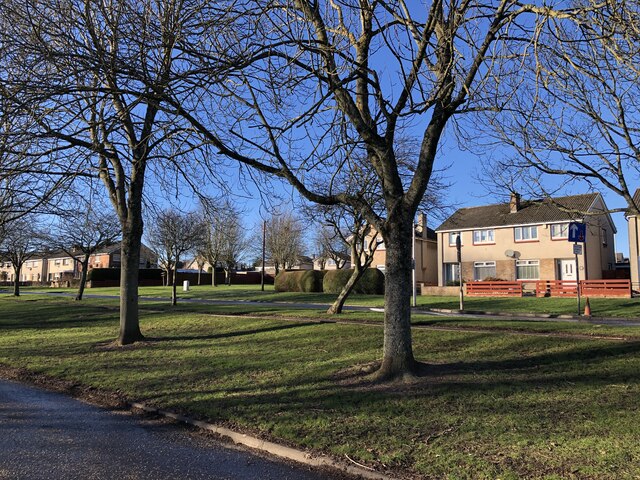
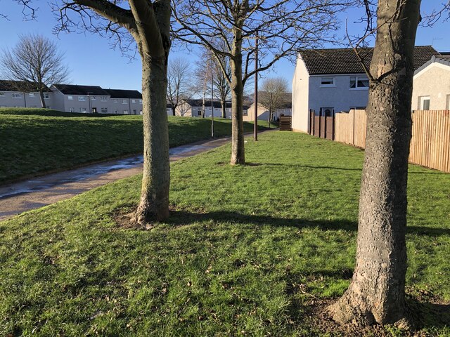
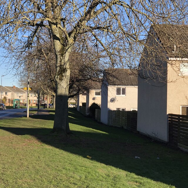
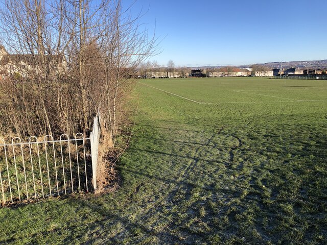
Primarily a residential area, Poltonhall offers a mix of housing options, including detached houses, semi-detached houses, and apartment complexes. The community is known for its tranquil atmosphere and family-friendly environment. It benefits from its proximity to beautiful green spaces, such as Poltonhall Park and Dalkeith Country Park, which provide residents with opportunities for outdoor activities and leisure.

Poltonhall is well-served by public transportation, with regular bus services connecting it to neighboring towns and Edinburgh city center. The area also enjoys easy access to major road networks, including the A7 and A720, making it convenient for commuters.

Residents of Poltonhall have access to a range of amenities within the local area, including a primary school, shops, cafes, and a community center. For additional services and facilities, the nearby town of Bonnyrigg offers a wider selection of shops, supermarkets, and leisure centers.

Overall, Poltonhall is a peaceful and well-connected residential area that provides a welcoming community for its residents. Its close proximity to both natural landscapes and urban amenities makes it an attractive place to live for individuals and families alike.

If you have any feedback on the listing, please let us know in the comments section below.
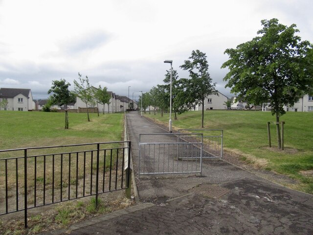
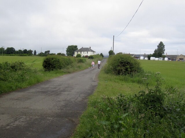
Poltonhall Images

Images are sourced within 2km of 55.871387/-3.12515 or Grid Reference NT2964. Thanks to Geograph Open Source API. All images are credited.

Poltonhall Recreation Park Across the pitches to the all weather pitches administered by Bonnyrigg Rose, the local football club.
Poltonhall Recreation Park
Across the pitches to the all weather pitches administered by Bonnyrigg Rose, the local football club.
Argyll Place, Polton
Green space, Polton Looking towards Hawthornden Primary School from one of the mounds in an informal open space amongst houses.
Green space, Polton
Looking towards Hawthornden Primary School from one of the mounds in an informal open space amongst houses.
Path, Polton A typical Lothians housing estate, lots of paths from car parks and open spaces.
Path, Polton
A typical Lothians housing estate, lots of paths from car parks and open spaces.
Polton Road West
Polton Road West
Behind Gordon Avenue, Polton Houses surrounding green spaces.
Behind Gordon Avenue, Polton
Houses surrounding green spaces.
Beside Polton Road West
Dropping off shipping containers Builder's storage. Scaffolders were at work in the estate.
Dropping off shipping containers
Builder's storage. Scaffolders were at work in the estate.
Poltonhall Recreation Park Sports pitches including an all weather football pitch and rugby ground. The enclosure surrounds a balance pond.
Poltonhall Recreation Park
Sports pitches including an all weather football pitch and rugby ground. The enclosure surrounds a balance pond.
Andy Kelly View, Polton A more recent addition to the housing estate between Polton Road West and Poltonhall Recreation Ground.
Andy Kelly View, Polton
A more recent addition to the housing estate between Polton Road West and Poltonhall Recreation Ground.
Path, Bonnyrigg To the Auld Coal residential streets recently built to the south.
Path, Bonnyrigg
To the Auld Coal residential streets recently built to the south.
Penicuik to Musselburgh Path
Danger! The tar changed colour! Because the Heras did not block the road many people braved the hazardous colour.  (A section was resurfaced and the signs had not been fully removed)
Danger!
The tar changed colour! Because the Heras did not block the road many people braved the hazardous colour. (A section was resurfaced and the signs had not been fully removed)
Castell Maynes Crescent New houses by the rails to trails path, Bonnyrigg.
Castell Maynes Crescent
New houses by the rails to trails path, Bonnyrigg.
Penicuik to Musselburgh Path Passing Castell Maynes Crescent.
Penicuik to Musselburgh Path
Passing Castell Maynes Crescent.
Field, Dalhousie Chesters For how much longer? There are boreholes and it is within a bypass.
Field, Dalhousie Chesters
For how much longer? There are boreholes and it is within a bypass.
Penicuik to Musselburgh Path
Road from Dalhousie Chesters Agricultural, but within a bypass and there have been cores bored here.
Road from Dalhousie Chesters
Agricultural, but within a bypass and there have been cores bored here.
Show me another place!

Poltonhall is located at Grid Ref: NT2964 (Lat: 55.871387, Lng: -3.12515)

Unitary Authority: Midlothian

Police Authority: The Lothians and Scottish Borders

What 3 Words

///lakeside.ecologist.camcorder. Near Bonnyrigg, Midlothian

Nearby Locations

Poltonhall

Related Wikis

Lasswade High School Centre

Lasswade High School is a non-denominational secondary state school in Bonnyrigg, Midlothian, Scotland. == History == A parish school was first established...

Polton

Polton is a village located in Lasswade parish, Midlothian, Scotland, anciently a superiority of the Ramsay family, cadets of Dalhousie. In 1618 David...

Polton railway station

Polton railway station served the village of Polton, Midlothian, Scotland from 1867 to 1964 on the Esk Valley Railway. == History == The station opened...

Mavisbank House

Mavisbank is a country house outside Loanhead, south of Edinburgh in Midlothian, Scotland. It was designed by architect William Adam in collaboration with...

Nearby Amenities

Located within 500m of 55.871387,-3.12515
Polton
Place: village
Source: npe
Wikidata: Q7226042
Wikipedia: en:Polton
Lat/Long: 55.870243/-3.1270883
Traffic Calming: table
Lat/Long: 55.8680842/-3.1244576
Traffic Calming: cushion
Lat/Long: 55.8735319/-3.1200802
Traffic Calming: table
Lat/Long: 55.8674647/-3.123141
Traffic Calming: table
Lat/Long: 55.8678346/-3.1213644
Recycling
Lat/Long: 55.8683362/-3.1279737
Barrier: cycle_barrier
Bicycle: yes
Foot: yes
Lat/Long: 55.8689661/-3.1195401
Post Box
Post Box Type: lamp
Ref: EH19 334
Royal Cypher: scottish_crown
Lat/Long: 55.8696429/-3.1229638
Give Way
Direction: backward
Lat/Long: 55.8717265/-3.1218137
Bus Stop
Farm Avenue
Bench: yes
Bin: no
Bus: yes
Naptan AdministrativeAreaCode: 130
Naptan Area Name: Midlothian
Naptan AtcoAreaCode: 628
Naptan AtcoCode: 6280301810
Naptan Bearing: SW
Naptan CommonName: Farm Avenue
Naptan Indicator: opp
Naptan Landmark: -
Naptan LocalityName: Poltonhall
Naptan NaptanCode: 64324392
Naptan NptgLocalityCode: ES003048
Naptan SourceLocalityType: U
Naptan StopAreaCode: 628G326000
Naptan StopAreaType: GPBS
Naptan StopArea Name: Farm Avenue
Naptan Street: Polton Road West
Naptan Verified: yes
Passenger Information Display: no
Public Transport: platform
Shelter: yes
Source: NaPTAN + Survey
Lat/Long: 55.8719307/-3.1238088
Crossing
Crossing: uncontrolled
Crossing Island: yes
Kerb: lowered
Lanes: 1
Tactile Paving: yes
Traffic Calming: choker
Lat/Long: 55.871757/-3.1243832
Post Box
Collection Times: Mo-Fr 15:45; Sa 10:30
Operator: Royal Mail
Post Box Design: type_m
Post Box Type: lamp
Ref: EH18 71
Royal Cypher: scottish_crown
Lat/Long: 55.8718228/-3.1261358
Bus Stop
St Annes Avenue
Bus: yes
Naptan AdministrativeAreaCode: 130
Naptan Area Name: Midlothian
Naptan AtcoAreaCode: 628
Naptan AtcoCode: 6280301815
Naptan Bearing: SW
Naptan CommonName: St Annes Avenue
Naptan Indicator: opp
Naptan Landmark: Cameron Crescent
Naptan LocalityName: Poltonhall
Naptan NaptanCode: 64324396
Naptan NptgLocalityCode: ES003048
Naptan SourceLocalityType: U
Naptan StopAreaCode: 628G325880
Naptan StopAreaType: GPBS
Naptan StopArea Name: St Annes Avenue
Naptan Street: Polton Road West
Naptan Verified: yes
Public Transport: platform
Source: NaPTAN + Survey
Lat/Long: 55.8694129/-3.1282835
Bus Stop
St Annes Avenue
Bin: yes
Bus: yes
Naptan AdministrativeAreaCode: 130
Naptan Area Name: Midlothian
Naptan AtcoAreaCode: 628
Naptan AtcoCode: 6280325880
Naptan Bearing: NE
Naptan CommonName: St Annes Avenue
Naptan Indicator: at
Naptan Landmark: DeQuincy Path
Naptan LocalityName: Poltonhall
Naptan NaptanCode: 64324397
Naptan NptgLocalityCode: ES003048
Naptan SourceLocalityType: U
Naptan StopAreaCode: 628G325880
Naptan StopAreaType: GPBS
Naptan StopArea Name: St Annes Avenue
Naptan Street: Polton Road West
Naptan Verified: yes
Public Transport: platform
Shelter: yes
Source: NaPTAN + Survey
Lat/Long: 55.8700688/-3.1278571
Bus Stop
Farm Avenue
Bus: yes
Naptan AdministrativeAreaCode: 130
Naptan Area Name: Midlothian
Naptan AtcoAreaCode: 628
Naptan AtcoCode: 6280326000
Naptan Bearing: NE
Naptan CommonName: Farm Avenue
Naptan Indicator: at
Naptan Landmark: Polton Bank
Naptan LocalityName: Poltonhall
Naptan NaptanCode: 64324393
Naptan NptgLocalityCode: ES003048
Naptan SourceLocalityType: U
Naptan StopAreaCode: 628G326000
Naptan StopAreaType: GPBS
Naptan StopArea Name: Farm Avenue
Naptan Street: Polton Road West
Naptan Verified: yes
Public Transport: platform
Shelter: yes
Source: NaPTAN + Survey
Lat/Long: 55.8716366/-3.1247698
Bus Stop
Pentland Road
Bus: yes
Naptan AdministrativeAreaCode: 130
Naptan Area Name: Midlothian
Naptan AtcoAreaCode: 628
Naptan AtcoCode: 6280325910
Naptan Bearing: SE
Naptan CommonName: Pentland Road
Naptan Indicator: at
Naptan Landmark: -
Naptan LocalityName: Poltonhall
Naptan NaptanCode: 64324394
Naptan NptgLocalityCode: ES003048
Naptan SourceLocalityType: U
Naptan Street: Polton Avenue Road
Naptan Verified: yes
Public Transport: platform
Shelter: yes
Source: NaPTAN + Survey
Lat/Long: 55.8721861/-3.1224422
Bus Stop
Dalhousie Drive
Bench: yes
Bin: no
Bus: yes
Lit: yes
Naptan AdministrativeAreaCode: 130
Naptan Area Name: Midlothian
Naptan AtcoAreaCode: 628
Naptan AtcoCode: 6280301760
Naptan Bearing: NW
Naptan CommonName: Dalhousie Drive
Naptan Indicator: opp
Naptan Landmark: Hawthornden Primary School
Naptan LocalityName: Poltonhall
Naptan NaptanCode: 64324387
Naptan NptgLocalityCode: ES003048
Naptan SourceLocalityType: U
Naptan StopAreaCode: 628G325920
Naptan StopAreaType: GPBS
Naptan StopArea Name: Dalhousie Drive
Naptan Street: Polton Avenue Road
Naptan Verified: yes
Public Transport: platform
Shelter: yes
Source: NaPTAN + Survey
Tactile Paving: no
Lat/Long: 55.8703022/-3.119198
Bus Stop
Dalhousie Drive
Bench: yes
Bin: no
Bus: yes
Naptan AdministrativeAreaCode: 130
Naptan Area Name: Midlothian
Naptan AtcoAreaCode: 628
Naptan AtcoCode: 6280325920
Naptan Bearing: SE
Naptan CommonName: Dalhousie Drive
Naptan Indicator: at
Naptan Landmark: Hawthornden Primary School
Naptan LocalityName: Poltonhall
Naptan NaptanCode: 64324389
Naptan NptgLocalityCode: ES003048
Naptan SourceLocalityType: U
Naptan StopAreaCode: 628G325920
Naptan StopAreaType: GPBS
Naptan StopArea Name: Dalhousie Drive
Naptan Street: Polton Avenue Road
Naptan Verified: yes
Public Transport: platform
Shelter: yes
Source: NaPTAN + Survey
Tactile Paving: no
Lat/Long: 55.8701335/-3.1186692
Bus Stop
Cameron Crescent
Bus: yes
Naptan AdministrativeAreaCode: 130
Naptan Area Name: Midlothian
Naptan AtcoAreaCode: 628
Naptan AtcoCode: 6280325870
Naptan Bearing: NW
Naptan CommonName: Cameron Crescent
Naptan Indicator: at
Naptan Landmark: Springfield Farm
Naptan LocalityName: Poltonhall
Naptan NaptanCode: 64324386
Naptan NptgLocalityCode: ES003048
Naptan SourceLocalityType: U
Naptan Street: Cameron Crescent
Naptan Verified: yes
Public Transport: platform
Shelter: yes
Source: NaPTAN + Survey
Lat/Long: 55.8685136/-3.1288348
Give Way
Lat/Long: 55.8729348/-3.1207448
Traffic Calming: cushion
Lat/Long: 55.8730688/-3.1206456
Traffic Calming: cushion
Lat/Long: 55.8723772/-3.1191984
Traffic Calming: cushion
Lat/Long: 55.872575/-3.1197492
Traffic Calming: cushion
Lat/Long: 55.8728901/-3.1206264
Traffic Calming: cushion
Lat/Long: 55.8718455/-3.1200418
Traffic Calming: cushion
Lat/Long: 55.8721563/-3.1207112
Traffic Calming: cushion
Lat/Long: 55.8724084/-3.1212541
Traffic Calming: cushion
Lat/Long: 55.8726655/-3.1211686
Give Way
Lat/Long: 55.8724643/-3.1213745
Give Way
Lat/Long: 55.8720124/-3.1221101
Traffic Calming: cushion
Lat/Long: 55.8721945/-3.1218231
Traffic Calming: cushion
Lat/Long: 55.8720965/-3.1223758
Traffic Calming: cushion
Lat/Long: 55.8716734/-3.1216089
Traffic Calming: cushion
Lat/Long: 55.87123/-3.1207902
Traffic Calming: cushion
Lat/Long: 55.8709337/-3.12024
Traffic Calming: cushion
Lat/Long: 55.8702037/-3.118918
Traffic Calming: cushion
Lat/Long: 55.8705093/-3.1194717
Traffic Calming: choker
Lat/Long: 55.8732593/-3.1217748
Crossing
Crossing: uncontrolled
Crossing Island: yes
Kerb: yes
Tactile Paving: no
Traffic Calming: island
Lat/Long: 55.8740175/-3.1209205
Give Way
Direction: backward
Lat/Long: 55.8717967/-3.1243028
Location: outdoor
Power: substation
Substation: minor_distribution
Lat/Long: 55.8724311/-3.1268013
Give Way
Lat/Long: 55.8719771/-3.1261604
Crossing
Crossing: uncontrolled
Kerb: raised
Lat/Long: 55.8714825/-3.1253269
Give Way
Direction: forward
Lat/Long: 55.8693807/-3.1285074
Traffic Calming: cushion
Lat/Long: 55.8694414/-3.1287189
Traffic Calming: cushion
Lat/Long: 55.8697156/-3.1296754
Traffic Calming: cushion
Lat/Long: 55.8699898/-3.1306315
Give Way
Direction: backward
Lat/Long: 55.8700483/-3.1308355
Give Way
Direction: backward
Lat/Long: 55.8697505/-3.1299435
Give Way
Direction: backward
Lat/Long: 55.8703743/-3.1303659
Location: outdoor
Power: substation
Substation: minor_distribution
Lat/Long: 55.8706813/-3.129458
Give Way
Direction: backward
Lat/Long: 55.8706849/-3.1281799
Traffic Calming: cushion
Lat/Long: 55.8710092/-3.1293906
Give Way
Direction: backward
Lat/Long: 55.8710664/-3.1291987
Traffic Calming: cushion
Lat/Long: 55.8715534/-3.1285568
Traffic Calming: cushion
Lat/Long: 55.8722373/-3.1279707
Give Way
Direction: backward
Lat/Long: 55.8723833/-3.1279573
Give Way
Direction: forward
Lat/Long: 55.8707904/-3.1263346
Give Way
Direction: forward
Lat/Long: 55.8718973/-3.1280954
Give Way
Direction: forward
Lat/Long: 55.8714134/-3.125198
Give Way
Direction: backward
Lat/Long: 55.8685759/-3.1231722
Crossing
Crossing: uncontrolled
Kerb: flush
Tactile Paving: yes
Lat/Long: 55.8680319/-3.124453
Power: pole
Lat/Long: 55.8672583/-3.1226049
Power: pole
Lat/Long: 55.8675096/-3.1236825
Power: pole
Lat/Long: 55.8678708/-3.1253046
Power: pole
Lat/Long: 55.8682035/-3.1260636
Location: outdoor
Power: substation
Substation: minor_distribution
Lat/Long: 55.8687403/-3.1259155
Give Way
Direction: backward
Lat/Long: 55.868647/-3.1290399
Traffic Calming: cushion
Lat/Long: 55.8699025/-3.1183716
Power: pole
Lat/Long: 55.8673949/-3.1268146
The data included in this document is from www.openstreetmap.org. The data is made available under ODbL.

Have you been to Poltonhall?

Leave your review of Poltonhall below (or comments, questions and feedback).