Polwheveral

Settlement in Cornwall

England

Polwheveral

Farmland, Constantine Daffodil bulbs had been lifted and were drying in a field crossed by two footpaths to the east of High Cross.
Farmland, Constantine Credit: Andrew Smith

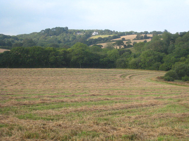
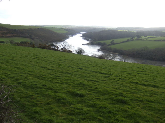
Polwheveral is a small village located in the county of Cornwall, England. Situated about 5 miles northeast of Truro, it is nestled in a picturesque rural setting surrounded by rolling hills and lush green fields.

The village is known for its tranquil and idyllic atmosphere, making it a popular destination for those seeking a peaceful retreat away from the hustle and bustle of city life. The surrounding countryside offers ample opportunities for hiking, cycling, and exploring nature, with numerous scenic trails and pathways to be discovered.

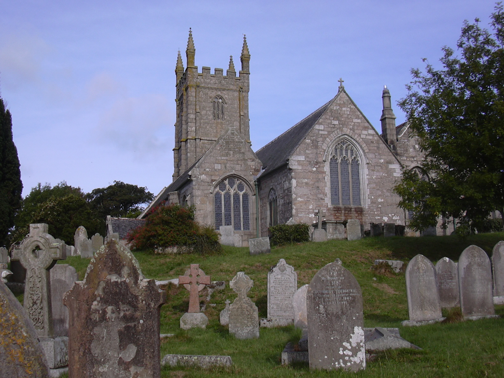
Polwheveral is also home to a number of historic landmarks and buildings that showcase its rich heritage. One of the most notable is the Polwheveral Manor, a Grade II listed manor house dating back to the 16th century. This beautiful building is steeped in history and features stunning architecture, making it a must-see for history enthusiasts.

Despite its small size, the village is well-served by amenities such as a local pub, a village hall, and a small convenience store. The warm and welcoming community spirit is evident in the numerous events and activities organized throughout the year, including village fairs and summer festivals.

Overall, Polwheveral offers a charming and serene escape for visitors, with its natural beauty, historic charm, and friendly community making it a hidden gem in the heart of Cornwall.

If you have any feedback on the listing, please let us know in the comments section below.

Polwheveral Images

Images are sourced within 2km of 50.113791/-5.164661 or Grid Reference SW7328. Thanks to Geograph Open Source API. All images are credited.

Farmland, Constantine Daffodil bulbs had been lifted and were drying in a field crossed by two footpaths to the east of High Cross.
Farmland, Constantine
Daffodil bulbs had been lifted and were drying in a field crossed by two footpaths to the east of High Cross.
Farmland, Constantine A crop of spring barley just coming into flower to the south of Treviades.
Farmland, Constantine
A crop of spring barley just coming into flower to the south of Treviades.
Farmland, Constantine A cut silage field descends to Polwheveral Creek with Scott's Wood in the background.
Farmland, Constantine
A cut silage field descends to Polwheveral Creek with Scott's Wood in the background.
Pasture, Constantine Cattle beside the footpath passing to the north of Nanjarrow.
Pasture, Constantine
Cattle beside the footpath passing to the north of Nanjarrow.
Farmland, Constantine Officially the bridleway descending to Goongillings; stone stiles, in effect, limit it to being a footpath.
Farmland, Constantine
Officially the bridleway descending to Goongillings; stone stiles, in effect, limit it to being a footpath.
Grassland and wood, Constantine Scott's Wood is seen from the footpath descending to Scott's Quay.
Grassland and wood, Constantine
Scott's Wood is seen from the footpath descending to Scott's Quay.
St Constantine's Church
The Tolmen Centre
The Tolmen Centre
Old Guide Stone in Constantine Fingerstone by the UC road, in parish of Constantine (Kerrier District), opposite Old Vicarage and Church, junction of Bowling Green Road and Vicarage Terrace, by metal rails at junction.

Grade II listed.
List Entry Number: 1310987 <span class="nowrap"><a title="https://historicengland.org.uk/listing/the-list/list-entry/1310987" rel="nofollow ugc noopener" href="https://historicengland.org.uk/listing/the-list/list-entry/1310987">Link</a><img style="margin-left:2px;" alt="External link" title="External link - shift click to open in new window" src="https://s1.geograph.org.uk/img/external.png" width="10" height="10"/></span>

Surveyed

Milestone Society National ID: CW_GWLZ
Old Guide Stone in Constantine
Fingerstone by the UC road, in parish of Constantine (Kerrier District), opposite Old Vicarage and Church, junction of Bowling Green Road and Vicarage Terrace, by metal rails at junction. Grade II listed. List Entry Number: 1310987 LinkExternal link Surveyed Milestone Society National ID: CW_GWLZ
Pasture, Constantine A footpath passes to the west of Trengilly Farm.
Pasture, Constantine
A footpath passes to the west of Trengilly Farm.
Farmland, Constantine A footpath approaches the electricity substation near Brill.
Farmland, Constantine
A footpath approaches the electricity substation near Brill.
Grassland, Constantine Trevaney Farm is seen in the background from Tresahor Veor.
Grassland, Constantine
Trevaney Farm is seen in the background from Tresahor Veor.
Porth Navas Creek Seen at high tide - an altogether different scene when the tide is out.
Porth Navas Creek
Seen at high tide - an altogether different scene when the tide is out.
Porth Navas Regatta 2011 The blindfold rowing race.
Porth Navas Regatta 2011
The blindfold rowing race.
Regatta Day at Porth Navas  An annual village event with water and land based fun for all.
Regatta Day at Porth Navas
An annual village event with water and land based fun for all.
Boats in Porth Navas Creek on Regatta Day
Porth Navas Creek at high tide
Recently harvested field at Trewince Looking towards houses at High Cross.
Recently harvested field at Trewince
Looking towards houses at High Cross.
Show me another place!

Polwheveral is located at Grid Ref: SW7328 (Lat: 50.113791, Lng: -5.164661)

Unitary Authority: Cornwall

Police Authority: Devon and Cornwall

What 3 Words

///caressing.workflow.pastels. Near Wendron, Cornwall

Related Wikis

Polwheveral

Polwheveral (Cornish: Poll Hwevrer, meaning lively creek) is a hamlet near Constantine in Cornwall, England. Polwheveral is at the head of a creek of the...

Ponjeravah

Ponjeravah (Cornish: Pons a Revedh, meaning wonder bridge) is a hamlet near to and east of Constantine in Cornwall, England. == References ==

Constantine, Cornwall

Constantine () (Cornish: Lann Gostentin, meaning church enclosure of St Constantine) is a village and civil parish in Cornwall, England, United Kingdom...

Nancenoy

Nancenoy (Cornish: Nans Noy, meaning Noah's valley) is a hamlet near Constantine in west Cornwall, England, UK.The Trengilly Wartha Inn is a pub and restaurant...

Nearby Amenities

Located within 500m of 50.113791,-5.164661
Source: PGS
Lat/Long: 50.1101853/-5.162384
Source: PGS
Lat/Long: 50.1106712/-5.1628089
Source: PGS
Lat/Long: 50.1112262/-5.1630935
Source: PGS
Lat/Long: 50.112346/-5.1650787
Source: PGS
Lat/Long: 50.1117792/-5.1623933
Source: PGS
Lat/Long: 50.1105682/-5.1610201
Barrier: stile
Foot: yes
Lat/Long: 50.11107/-5.1691479
Barrier: stile
Foot: yes
Lat/Long: 50.1132806/-5.1700568
Barrier: stile
Foot: yes
Lat/Long: 50.1146601/-5.1705774
Barrier: stile
Foot: yes
Lat/Long: 50.1118317/-5.1695277
Bench
Lat/Long: 50.1151766/-5.1709424
Porthwheveral
Is In County: Cornwall
Place: hamlet
Source: NPE;OS_OpenData_StreetView
Lat/Long: 50.1131124/-5.1649994
Barrier: stile
Foot: yes
Lat/Long: 50.1096684/-5.1674209
Gweal Mellin
Place: hamlet
Lat/Long: 50.1146518/-5.1598858
Power: pole
Lat/Long: 50.1122412/-5.1702049
Power: pole
Lat/Long: 50.1135768/-5.1688457
Power: pole
Lat/Long: 50.1127477/-5.1696772
Power: pole
Lat/Long: 50.114131/-5.1689315
Power: pole
Lat/Long: 50.1159447/-5.1683448
Power: pole
Lat/Long: 50.1167686/-5.167923
Power: pole
Lat/Long: 50.1172338/-5.1677104
Power: pole
Lat/Long: 50.1175808/-5.1675428
Power: pole
Lat/Long: 50.1157636/-5.16732
Power: pole
Lat/Long: 50.1146758/-5.1689923
Power: pole
Lat/Long: 50.1153543/-5.1686504
Power: pole
Lat/Long: 50.1158178/-5.1693008
Power: pole
Transformer: distribution
Lat/Long: 50.1163905/-5.1701484
Power: pole
Lat/Long: 50.1118082/-5.1700223
Power: pole
Lat/Long: 50.112025/-5.1688662
Power: pole
Lat/Long: 50.1119992/-5.1684558
Power: pole
Lat/Long: 50.1124085/-5.1671013
Power: pole
Lat/Long: 50.1130776/-5.1577619
Power: pole
Lat/Long: 50.113831/-5.1583654
Power: pole
Lat/Long: 50.1144657/-5.1589769
Power: pole
Lat/Long: 50.1151072/-5.1595697
Power: pole
Lat/Long: 50.1159861/-5.1599801
Power: pole
Lat/Long: 50.1167515/-5.159398
Gweal Mellin Cider Co
Addr City: Falmouth
Addr Housename: Bungalow Polwheveral
Addr Postcode: TR11 5RW
Craft: brewery
Email: sales@gwealmellincider.co.uk
Phone: +44 7518 249789
Product: cider
Website: https://www.gwealmellincider.co.uk/contact/
Lat/Long: 50.1145546/-5.1606648
The data included in this document is from www.openstreetmap.org. The data is made available under ODbL.

Have you been to Polwheveral?

Leave your review of Polwheveral below (or comments, questions and feedback).