Polwheveral Wood

Wood, Forest in Cornwall

England

Polwheveral Wood

Farmland, Constantine Daffodil bulbs had been lifted and were drying in a field crossed by two footpaths to the east of High Cross.
Farmland, Constantine Credit: Andrew Smith

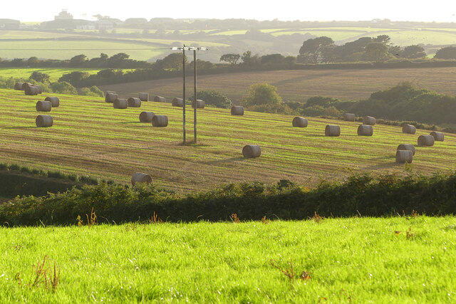
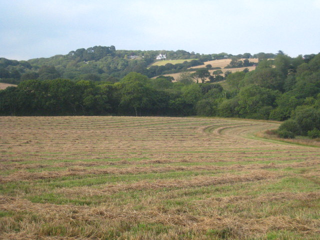
Polwheveral Wood is a picturesque woodland located in Cornwall, England. Covering an area of approximately 20 acres, it is a stunning example of the region's natural beauty and is often frequented by locals and tourists alike.

The wood is primarily composed of a mixture of deciduous and coniferous trees, creating a diverse and vibrant canopy. Oak, beech, and ash trees dominate the landscape, providing a habitat for a variety of wildlife. Bluebells carpet the forest floor in spring, creating a breathtaking display of color.

Walking through Polwheveral Wood, visitors are greeted by a network of well-maintained trails that wind their way through the trees. These paths offer a peaceful and serene atmosphere, allowing visitors to immerse themselves in nature and enjoy the tranquil surroundings.

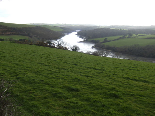
The wood is also home to a small stream, which adds to the overall charm of the area. The babbling water and the rustling leaves create a soothing soundtrack, further enhancing the sense of tranquility.

Polwheveral Wood is a popular destination for nature lovers, hikers, and birdwatchers. The diverse range of flora and fauna attracts a wide array of bird species, including woodpeckers, nuthatches, and various woodland songbirds. Visitors may also be lucky enough to spot deer or other small mammals.

Overall, Polwheveral Wood is a hidden gem in Cornwall, offering a peaceful retreat from the hustle and bustle of everyday life. Its natural beauty and diverse ecosystem make it a must-visit destination for anyone seeking a connection with nature.

If you have any feedback on the listing, please let us know in the comments section below.

Polwheveral Wood Images

Images are sourced within 2km of 50.114941/-5.1675856 or Grid Reference SW7328. Thanks to Geograph Open Source API. All images are credited.

Farmland, Constantine Daffodil bulbs had been lifted and were drying in a field crossed by two footpaths to the east of High Cross.
Farmland, Constantine
Daffodil bulbs had been lifted and were drying in a field crossed by two footpaths to the east of High Cross.
Farmland, Constantine A crop of spring barley just coming into flower to the south of Treviades.
Farmland, Constantine
A crop of spring barley just coming into flower to the south of Treviades.
Farmland, Constantine A cut silage field descends to Polwheveral Creek with Scott's Wood in the background.
Farmland, Constantine
A cut silage field descends to Polwheveral Creek with Scott's Wood in the background.
Pasture, Constantine Cattle beside the footpath passing to the north of Nanjarrow.
Pasture, Constantine
Cattle beside the footpath passing to the north of Nanjarrow.
Farmland, Constantine Officially the bridleway descending to Goongillings; stone stiles, in effect, limit it to being a footpath.
Farmland, Constantine
Officially the bridleway descending to Goongillings; stone stiles, in effect, limit it to being a footpath.
Grassland and wood, Constantine Scott's Wood is seen from the footpath descending to Scott's Quay.
Grassland and wood, Constantine
Scott's Wood is seen from the footpath descending to Scott's Quay.
St Constantine's Church
The Tolmen Centre
The Tolmen Centre
Old Guide Stone in Constantine Fingerstone by the UC road, in parish of Constantine (Kerrier District), opposite Old Vicarage and Church, junction of Bowling Green Road and Vicarage Terrace, by metal rails at junction.

Grade II listed.
List Entry Number: 1310987 <span class="nowrap"><a title="https://historicengland.org.uk/listing/the-list/list-entry/1310987" rel="nofollow ugc noopener" href="https://historicengland.org.uk/listing/the-list/list-entry/1310987">Link</a><img style="margin-left:2px;" alt="External link" title="External link - shift click to open in new window" src="https://s1.geograph.org.uk/img/external.png" width="10" height="10"/></span>

Surveyed

Milestone Society National ID: CW_GWLZ
Old Guide Stone in Constantine
Fingerstone by the UC road, in parish of Constantine (Kerrier District), opposite Old Vicarage and Church, junction of Bowling Green Road and Vicarage Terrace, by metal rails at junction. Grade II listed. List Entry Number: 1310987 LinkExternal link Surveyed Milestone Society National ID: CW_GWLZ
Farmland, Constantine With baled straw in a field to the south-west of Mount View.
Farmland, Constantine
With baled straw in a field to the south-west of Mount View.
Pasture, Constantine A footpath passes to the west of Trengilly Farm.
Pasture, Constantine
A footpath passes to the west of Trengilly Farm.
Farmland, Constantine A footpath approaches the electricity substation near Brill.
Farmland, Constantine
A footpath approaches the electricity substation near Brill.
Farmland, Constantine Silage bales and a boulder in a field to the north-east of Trewardreva.
Farmland, Constantine
Silage bales and a boulder in a field to the north-east of Trewardreva.
Grassland, Constantine Trevaney Farm is seen in the background from Tresahor Veor.
Grassland, Constantine
Trevaney Farm is seen in the background from Tresahor Veor.
Porth Navas Creek Seen at high tide - an altogether different scene when the tide is out.
Porth Navas Creek
Seen at high tide - an altogether different scene when the tide is out.
Recently harvested field at Trewince Looking towards houses at High Cross.
Recently harvested field at Trewince
Looking towards houses at High Cross.
Fore Street, Constantine
Porth Navas
Porth Navas
Show me another place!

Polwheveral Wood is located at Grid Ref: SW7328 (Lat: 50.114941, Lng: -5.1675856)

Unitary Authority: Cornwall

Police Authority: Devon and Cornwall

What 3 Words

///hiked.synthetic.placed. Near Wendron, Cornwall

Related Wikis

Polwheveral

Polwheveral (Cornish: Poll Hwevrer, meaning lively creek) is a hamlet near Constantine in Cornwall, England. Polwheveral is at the head of a creek of the...

Ponjeravah

Ponjeravah (Cornish: Pons a Revedh, meaning wonder bridge) is a hamlet near to and east of Constantine in Cornwall, England. == References ==

Constantine, Cornwall

Constantine () (Cornish: Lann Gostentin, meaning church enclosure of St Constantine) is a village and civil parish in Cornwall, England, United Kingdom...

Nancenoy

Nancenoy (Cornish: Nans Noy, meaning Noah's valley) is a hamlet near Constantine in west Cornwall, England, UK.The Trengilly Wartha Inn is a pub and restaurant...

Nearby Amenities

Located within 500m of 50.114941,-5.1675856
Source: PGS
Lat/Long: 50.112346/-5.1650787
Barrier: stile
Foot: yes
Lat/Long: 50.11107/-5.1691479
Barrier: stile
Foot: yes
Lat/Long: 50.1132806/-5.1700568
Barrier: stile
Foot: yes
Lat/Long: 50.1146601/-5.1705774
Barrier: stile
Foot: yes
Lat/Long: 50.1118317/-5.1695277
Bench
Lat/Long: 50.1151766/-5.1709424
Porthwheveral
Is In County: Cornwall
Place: hamlet
Source: NPE;OS_OpenData_StreetView
Lat/Long: 50.1131124/-5.1649994
Post Box
Brand: Royal Mail
Brand Wikidata: Q638098
Collection Times: Mo-Fr 16:00; Sa 11:00; Su off
Drive Through: no
Operator: Royal Mail
Operator Wikidata: Q638098
Post Box Mounting: building
Post Box Type: lamp
Ref: TR11 64
Royal Cypher: EIIR
Royal Cypher Wikidata: Q33102113
Source: survey;streetlevel imagery;aerial imagery
Lat/Long: 50.1178135/-5.1728052
Natural: spring
Lat/Long: 50.1126642/-5.1716886
Ponjeravah
Place: hamlet
Wikidata: Q7227860
Lat/Long: 50.1184428/-5.1669949
Power: pole
Lat/Long: 50.1122412/-5.1702049
Power: pole
Lat/Long: 50.1135768/-5.1688457
Power: pole
Lat/Long: 50.1127477/-5.1696772
Power: pole
Lat/Long: 50.114131/-5.1689315
Power: pole
Lat/Long: 50.1159447/-5.1683448
Power: pole
Lat/Long: 50.1167686/-5.167923
Power: pole
Lat/Long: 50.1172338/-5.1677104
Power: pole
Lat/Long: 50.1175808/-5.1675428
Location Transition: yes
Power: pole
Lat/Long: 50.1181514/-5.1672839
Power: pole
Lat/Long: 50.1157636/-5.16732
Power: pole
Lat/Long: 50.1146758/-5.1689923
Power: pole
Lat/Long: 50.1153543/-5.1686504
Power: pole
Lat/Long: 50.1158178/-5.1693008
Power: pole
Transformer: distribution
Lat/Long: 50.1163905/-5.1701484
Location Transition: yes
Power: pole
Lat/Long: 50.1188246/-5.1665567
Power: pole
Lat/Long: 50.1191987/-5.1657486
Power: pole
Lat/Long: 50.1155372/-5.1735386
Power: pole
Lat/Long: 50.1148785/-5.1736325
Power: pole
Lat/Long: 50.1138276/-5.1734179
Power: pole
Lat/Long: 50.1120508/-5.1717442
Power: pole
Lat/Long: 50.1124447/-5.1724979
Power: pole
Lat/Long: 50.1124292/-5.1731282
Power: pole
Lat/Long: 50.1118082/-5.1700223
Power: pole
Lat/Long: 50.112025/-5.1688662
Power: pole
Lat/Long: 50.1119992/-5.1684558
Power: pole
Lat/Long: 50.1124085/-5.1671013
Power: pole
Lat/Long: 50.1115623/-5.1709208
Gweal Mellin Cider Co
Addr City: Falmouth
Addr Housename: Bungalow Polwheveral
Addr Postcode: TR11 5RW
Craft: brewery
Email: sales@gwealmellincider.co.uk
Phone: +44 7518 249789
Product: cider
Website: https://www.gwealmellincider.co.uk/contact/
Lat/Long: 50.1145546/-5.1606648
Post Box
Brand: Royal Mail
Brand Wikidata: Q638098
Collection Times: Mo-Fr 09:00; Sa 07:00; Su off
Drive Through: no
Operator: Royal Mail
Operator Wikidata: Q638098
Post Box Mounting: pier
Post Box Type: lamp
Ref: TR11 92D
Source: survey;streetlevel imagery;aerial imagery
Lat/Long: 50.1173094/-5.1706341
Post Box
Brand: Royal Mail
Brand Wikidata: Q638098
Collection Times: Mo-Fr 09:00; Sa 07:00; Su off
Drive Through: no
Operator: Royal Mail
Operator Wikidata: Q638098
Post Box Mounting: stone_wall
Post Box Type: wall
Ref: TR11 49D
Royal Cypher: EVIIR
Royal Cypher Wikidata: Q33102324
Source: survey;streetlevel imagery;aerial imagery
Lat/Long: 50.1184112/-5.1666622
The data included in this document is from www.openstreetmap.org. The data is made available under ODbL.

Have you been to Polwheveral Wood?

Leave your review of Polwheveral Wood below (or comments, questions and feedback).