Partan Craig
Island in East Lothian
Scotland
Partan Craig
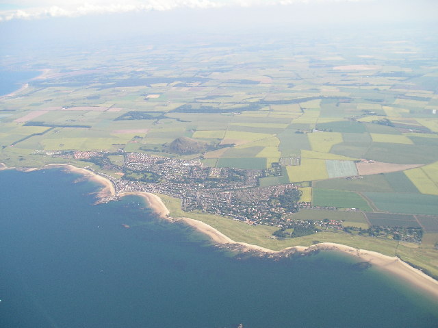
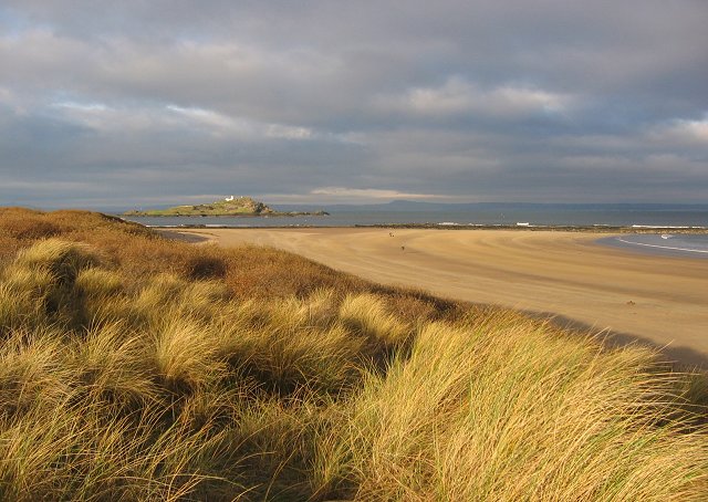
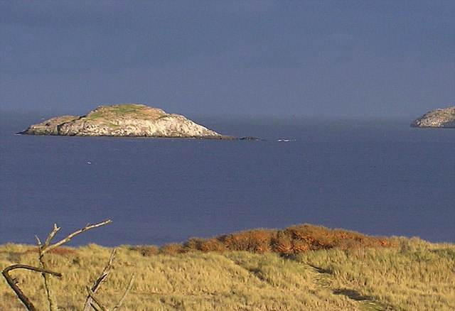
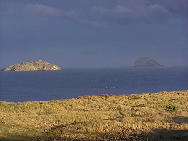
Partan Craig is a small island located off the coast of East Lothian, Scotland. Situated in the Firth of Forth, it is part of a group of islands known as the Firth of Forth Islands Nature Reserve. Partan Craig measures approximately 0.6 hectares in size and is predominantly rocky and rugged, with no permanent vegetation.
The island is named after the Scottish word "partan," which means crab. This is due to the abundance of crabs found in the surrounding waters. Partan Craig is known for its diverse marine life, making it a popular spot for snorkeling and diving enthusiasts. The surrounding waters are home to various species of fish, crustaceans, and other marine creatures, providing a rich ecosystem for exploration.
Access to Partan Craig is limited, as it is only accessible by boat or kayak. The island does not have any permanent structures or facilities, making it a remote and untouched destination. Visitors to the island can expect stunning views of the surrounding coastline and the opportunity to observe a wide range of seabirds, including gulls, puffins, and cormorants.
Partan Craig is also of historical significance, with archaeological evidence suggesting human activity on the island dating back to the Neolithic period. The remains of ancient structures, such as stone circles and burial sites, have been discovered, adding to the island's allure for history enthusiasts.
Overall, Partan Craig offers a unique and picturesque experience for nature lovers, adventurers, and history buffs alike.
If you have any feedback on the listing, please let us know in the comments section below.
Partan Craig Images
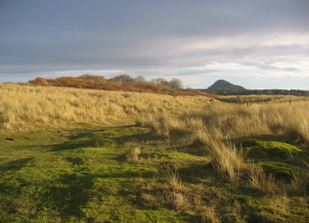
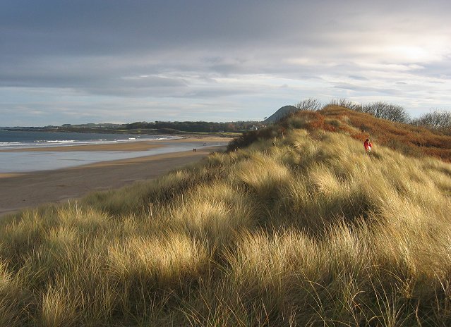
Images are sourced within 2km of 56.063318/-2.748334 or Grid Reference NT5385. Thanks to Geograph Open Source API. All images are credited.

Partan Craig is located at Grid Ref: NT5385 (Lat: 56.063318, Lng: -2.748334)
Unitary Authority: East Lothian
Police Authority: The Lothians and Scottish Borders
What 3 Words
///unfit.rejoin.kickbacks. Near North Berwick, East Lothian
Nearby Locations
Related Wikis

Lamb (island)
Lamb, sometimes called Lamb Island or The Lamb, is a small uninhabited island measuring approximately 100 by 50 metres (330 ft × 160 ft), between the islands...

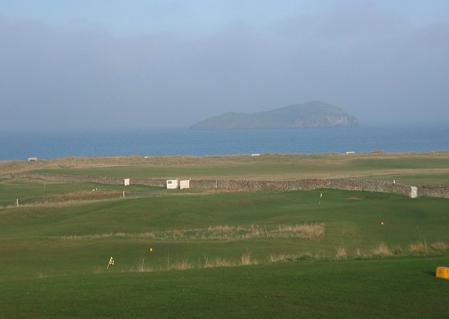
North Berwick West Links
One of two golf courses within North Berwick, the West Links is by far the more renowned. It regularly holds various championships and is used as a qualifying...

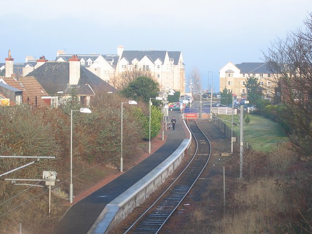
North Berwick railway station
North Berwick railway station is a railway station serving the seaside town of North Berwick in East Lothian, Scotland. It is the terminus of the Edinburgh...

Williamstown railway station (East Lothian)
Williamstown railway station was a railway station on the North Berwick Branch of the North British Railway in East Lothian, Scotland. This short-lived...
Nearby Amenities
Located within 500m of 56.063318,-2.748334Have you been to Partan Craig?
Leave your review of Partan Craig below (or comments, questions and feedback).