North Dog

Island in East Lothian

Scotland

North Dog

North Berwick and East Fortune Taken from a microlight at about 6000 ft
North Berwick and East Fortune Credit: Alex Cosser

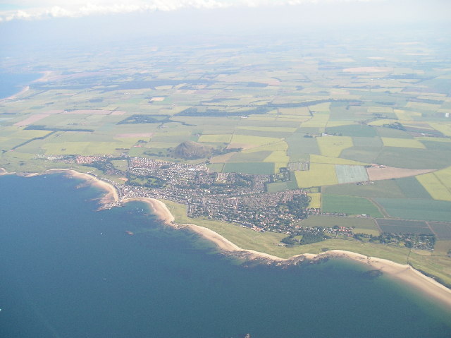
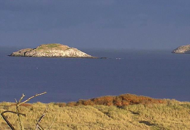
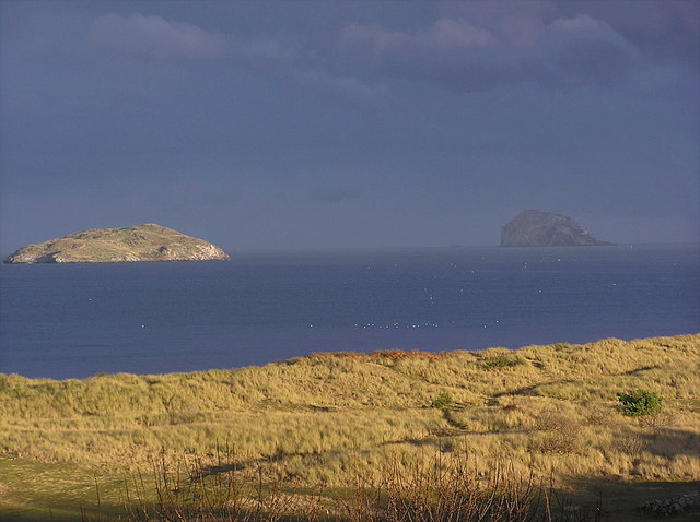
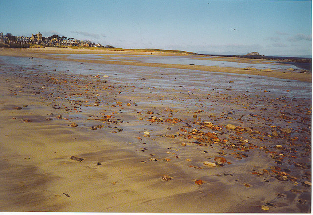
North Dog is a small island located off the coast of East Lothian, Scotland. It lies in the North Sea, approximately 4 kilometers northeast of the town of Dunbar. The island is part of the Firth of Forth and is situated within the boundaries of the John Muir Country Park.

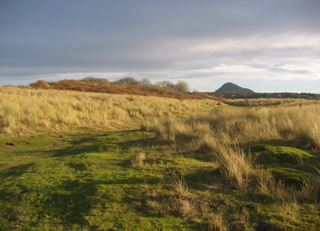
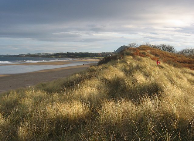
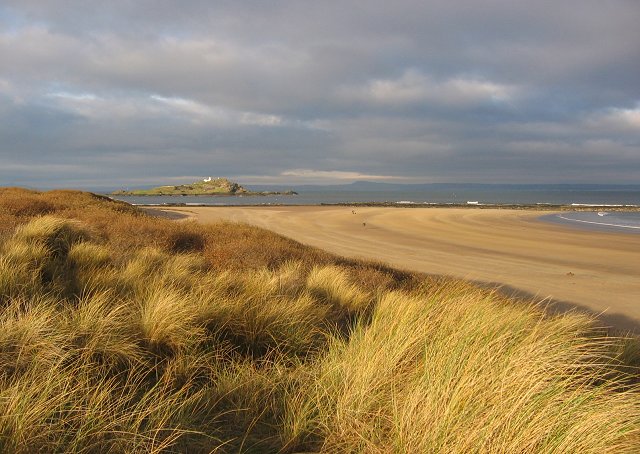
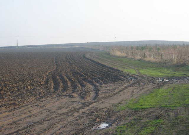
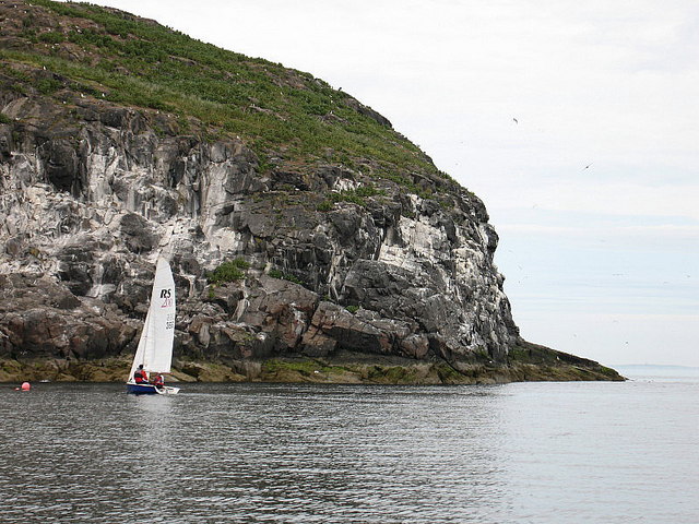
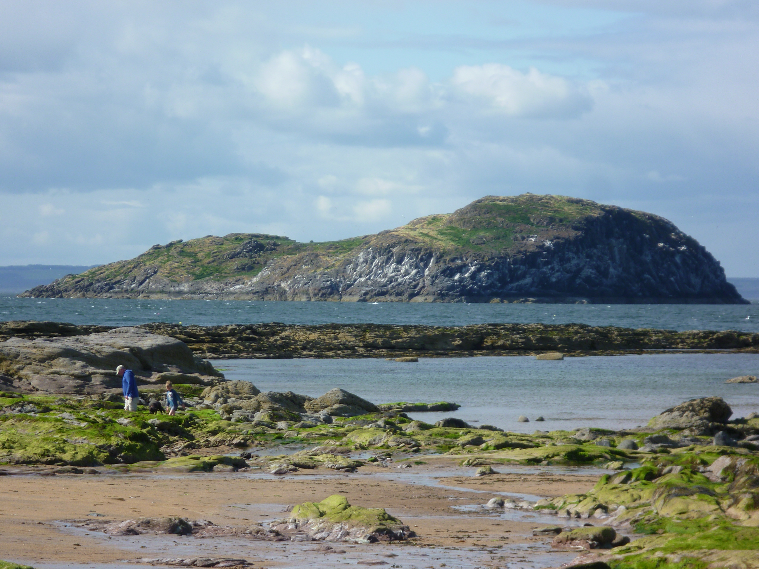
North Dog covers an area of about 8 hectares and is mostly comprised of rugged coastal terrain. It is known for its rocky cliffs and diverse bird populations, making it a popular spot for birdwatching and wildlife enthusiasts. The island is home to various species, including seabirds such as puffins, guillemots, and razorbills.

Access to North Dog is limited due to its status as a nature reserve. Visitors are required to obtain permission from the appropriate authorities before landing on the island. This is done to protect the delicate ecosystem and ensure the preservation of its natural inhabitants.

The island's isolation and untouched beauty make it an ideal location for those seeking tranquility and a close-to-nature experience. The surrounding waters offer opportunities for fishing and boating, with some organized tours available for visitors.

Overall, North Dog Island is an ecologically significant area within East Lothian, offering a unique and unspoiled environment for wildlife and nature enthusiasts to explore and appreciate.

If you have any feedback on the listing, please let us know in the comments section below.

North Dog Images

Images are sourced within 2km of 56.070522/-2.748586 or Grid Reference NT5386. Thanks to Geograph Open Source API. All images are credited.

North Berwick and East Fortune Taken from a microlight at about 6000 ft
North Berwick and East Fortune
Taken from a microlight at about 6000 ft
East Links Looking east along the links towards North Berwick Law.  A patch of rabbit grazed links land. Presume the name means Dirleton's East Links, move a little to the east and you arrive at (North Berwick's) West links.
East Links
Looking east along the links towards North Berwick Law. A patch of rabbit grazed links land. Presume the name means Dirleton's East Links, move a little to the east and you arrive at (North Berwick's) West links.
Broad Sands. Beach and dunes just west of North Berwick. Looking east.
Broad Sands.
Beach and dunes just west of North Berwick. Looking east.
Broad Sands. View north west along the beach towards Fidra.
Broad Sands.
View north west along the beach towards Fidra.
Ferrygate Newly ploughed sandy soil, looking south. There is a new small woodland to the right.
Ferrygate
Newly ploughed sandy soil, looking south. There is a new small woodland to the right.
West Links. With Craigleith offshore.
West Links.
With Craigleith offshore.
Carlekemp. Big house across the West Links. Formerly the preparatory school for St Augustus Abbey.
Carlekemp.
Big house across the West Links. Formerly the preparatory school for St Augustus Abbey.
Golf Hotel, North Berwick Amongst a lot of big houses on the road into North Berwick from the west.
Golf Hotel, North Berwick
Amongst a lot of big houses on the road into North Berwick from the west.
New houses, North Berwick. North Berwick, with its surviving railway link is one of the most expensive places to live in Scotland.
New houses, North Berwick.
North Berwick, with its surviving railway link is one of the most expensive places to live in Scotland.
North Berwick The railway station, with a frequent service to Edinburgh. There have been many attempts at closure, but now ex intercity trains are sometimes used because of the number of passengers.
North Berwick
The railway station, with a frequent service to Edinburgh. There have been many attempts at closure, but now ex intercity trains are sometimes used because of the number of passengers.
The Lamb There are several islands in the Firth of Forth, this one is 'The Lamb' from Yellowcraigs. These islands are volcanic plugs.
The Lamb
There are several islands in the Firth of Forth, this one is 'The Lamb' from Yellowcraigs. These islands are volcanic plugs.
Craigleith These are a couple of islands in the Firth of Forth. Craigleith is the near one with the Bass Rock further away. Picture taken from Yellowcraigs. The islands are volcanic plugs, with the Bass Rock being the biggest gannetry in Europe.
Craigleith
These are a couple of islands in the Firth of Forth. Craigleith is the near one with the Bass Rock further away. Picture taken from Yellowcraigs. The islands are volcanic plugs, with the Bass Rock being the biggest gannetry in Europe.
North Berwick Bay. Low tide unveils a sandy, shallow bay. The island is Lamb and the hills in the far distance are the Lomond Hills of Fife.
North Berwick Bay.
Low tide unveils a sandy, shallow bay. The island is Lamb and the hills in the far distance are the Lomond Hills of Fife.
Craigleith A small island off the East Lothian coast, Craigleith lies near the mouth of  the Firth of Forth 1 mile north of North Berwick harbour. It rises to 24m and was purchased by Sir Hew Dalrymple from North Berwick Town Council in 1814. Craigleith is noted for its seabirds, including cormorants, shag, guillemot and puffins. Geologically, Craigleith is a laccolith, a dome-shape igneous intrusion, composed of essexite. View of the southeast of the island from a safety boat for North Berwick Regatta.
Craigleith
A small island off the East Lothian coast, Craigleith lies near the mouth of the Firth of Forth 1 mile north of North Berwick harbour. It rises to 24m and was purchased by Sir Hew Dalrymple from North Berwick Town Council in 1814. Craigleith is noted for its seabirds, including cormorants, shag, guillemot and puffins. Geologically, Craigleith is a laccolith, a dome-shape igneous intrusion, composed of essexite. View of the southeast of the island from a safety boat for North Berwick Regatta.
Hummel Ridges Taken from a RIB.
Hummel Ridges
Taken from a RIB.
The Lamb Lamb Island , or 'The Lamb' is a volcanic plug sticking out of the North Sea a mile or so from the harbour at North Berwick. The area is very tidal, up to some 15 -18 feet. The island is only approximately 100 metres long and 50 metres wide, and it is just rocks. View of the north of the island from a safety boat for North Berwick Regatta.
The Lamb
Lamb Island , or 'The Lamb' is a volcanic plug sticking out of the North Sea a mile or so from the harbour at North Berwick. The area is very tidal, up to some 15 -18 feet. The island is only approximately 100 metres long and 50 metres wide, and it is just rocks. View of the north of the island from a safety boat for North Berwick Regatta.
Craigleith A small island off the East Lothian coast, Craigleith lies near the mouth of the Firth of Forth 1 mile north of North Berwick harbour. It rises to 24m and was purchased by Sir Hew Dalrymple from North Berwick Town Council in 1814. Craigleith is noted for its seabirds, including comorants, shag, guillemot and puffins. Geologically, Craigleith is a laccolith, a dome-shape igneous intrusion, composed of essexite.
Craigleith
A small island off the East Lothian coast, Craigleith lies near the mouth of the Firth of Forth 1 mile north of North Berwick harbour. It rises to 24m and was purchased by Sir Hew Dalrymple from North Berwick Town Council in 1814. Craigleith is noted for its seabirds, including comorants, shag, guillemot and puffins. Geologically, Craigleith is a laccolith, a dome-shape igneous intrusion, composed of essexite.
Craigleith A small island off the East Lothian coast, Craigleith lies near the mouth of  the Firth of Forth 1 mile north of North Berwick harbour. It rises to 24m and was purchased by Sir Hew Dalrymple from North Berwick Town Council in 1814. Craigleith is noted for its seabirds, including cormorants, shag, guillemot and puffins. Geologically, Craigleith is a laccolith, a dome-shape igneous intrusion, composed of essexite. View of the south of the island from a safety boat for North Berwick Regatta.
Craigleith
A small island off the East Lothian coast, Craigleith lies near the mouth of the Firth of Forth 1 mile north of North Berwick harbour. It rises to 24m and was purchased by Sir Hew Dalrymple from North Berwick Town Council in 1814. Craigleith is noted for its seabirds, including cormorants, shag, guillemot and puffins. Geologically, Craigleith is a laccolith, a dome-shape igneous intrusion, composed of essexite. View of the south of the island from a safety boat for North Berwick Regatta.
Show me another place!

North Dog is located at Grid Ref: NT5386 (Lat: 56.070522, Lng: -2.748586)

Unitary Authority: East Lothian

Police Authority: The Lothians and Scottish Borders

What 3 Words

///respond.fabric.head. Near North Berwick, East Lothian

Related Wikis

Lamb (island)

Lamb, sometimes called Lamb Island or The Lamb, is a small uninhabited island measuring approximately 100 by 50 metres (330 ft × 160 ft), between the islands...

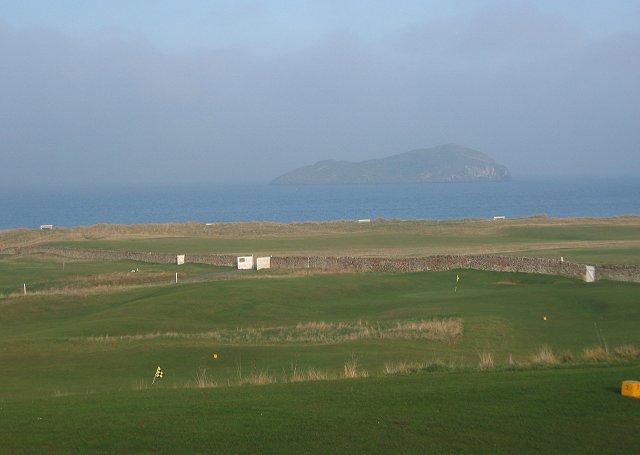
North Berwick West Links

One of two golf courses within North Berwick, the West Links is by far the more renowned. It regularly holds various championships and is used as a qualifying...

Yellowcraig

Yellowcraig, also known as Broad Sands Beach, is a coastal area of forest, beach and grassland in East Lothian, south-east Scotland. Yellowcraig is partly...

Craigleith

Craigleith (Scottish Gaelic: Creag Lìte) is a small island in the Firth of Forth off North Berwick in East Lothian, Scotland. Its name comes from the Scottish...

Nearby Amenities

Located within 500m of 56.070522,-2.748586
The Lamb
Natural: peak
Lat/Long: 56.0700339/-2.7485169
The data included in this document is from www.openstreetmap.org. The data is made available under ODbL.

Have you been to North Dog?

Leave your review of North Dog below (or comments, questions and feedback).