The Rock and Spindle

Island in Fife

Scotland

The Rock and Spindle

Kittock's Den With the North Sea in the background.
Kittock's Den Credit: James Allan

The Rock and Spindle is a small island located off the coast of Fife, Scotland. With an area of approximately 0.3 hectares, it is one of the tiniest islands in the region. The island gets its name from the unique rock formation found on its shores, resembling a large spindle or spinning top.

Situated in the Firth of Forth, the Rock and Spindle is largely uninhabited, with no permanent residents or structures. The island is privately owned and serves primarily as a nature reserve, providing a sanctuary for various bird species. It is particularly known for being home to a colony of nesting seabirds, including guillemots, razorbills, and puffins. The island's rocky cliffs and ledges provide ideal nesting sites and protection from predators.

Access to the Rock and Spindle is restricted to protect the delicate ecosystem and the wildlife that inhabits it. However, visitors can observe the island and its wildlife from a distance by boat or from the nearby coastal areas. Birdwatchers and nature enthusiasts often visit the island during the breeding season, hoping to catch a glimpse of the diverse birdlife.

Although small in size, the Rock and Spindle offers a fascinating natural spectacle and serves as an important habitat for seabirds in the Firth of Forth. Its unique rock formation and abundant wildlife make it a popular attraction for those seeking to immerse themselves in the beauty and tranquility of Scotland's coastal landscapes.

If you have any feedback on the listing, please let us know in the comments section below.

The Rock and Spindle Images

Images are sourced within 2km of 56.330527/-2.7474753 or Grid Reference NO5315. Thanks to Geograph Open Source API. All images are credited.

Kittock's Den With the North Sea in the background.
Kittock's Den
With the North Sea in the background.
Milepost near Brownhills The milepost stands at the junction of the A917 and the B9139.
Milepost near Brownhills
The milepost stands at the junction of the A917 and the B9139.
Road junction near Brownhills The junction of the B9131 and the B917.  There is a milepost just behind the seat on the right hand verge.  For a closer view <a href="https://www.geograph.org.uk/photo/2718384">NO5215 : Milepost near Brownhills</a>
Road junction near Brownhills
The junction of the B9131 and the B917. There is a milepost just behind the seat on the right hand verge. For a closer view NO5215 : Milepost near Brownhills
Milestone near Brownhills The milestone stands at the junction of the A917 and the road to the sewage works.

Milestones are the original roadside heritage features with many dating back hundreds of years and these historic items are under threat from highway developments.
Milestone near Brownhills
The milestone stands at the junction of the A917 and the road to the sewage works. Milestones are the original roadside heritage features with many dating back hundreds of years and these historic items are under threat from highway developments.
Milestone near Brownhills The milestone stands at the junction of the A917 and the road to the sewage works.

Milestones did not come into general use until the Turnpike Act of 1766 made them compulsory on turnpike roads, these roads were built by private enterprise under licence from the Government and maintained by tolls on those who used them.  Before this Act milestones were put up occasionally, often as charitable acts and commemorations.   Many Turnpike Act stones still exist.  They are usually 2-3 ft high, with the initial letter or abbreviation of the nearest market town shown on two faces, and the distance from it.

There is an Ordnance Survey bench mark on the side of the stone.
Milestone near Brownhills
The milestone stands at the junction of the A917 and the road to the sewage works. Milestones did not come into general use until the Turnpike Act of 1766 made them compulsory on turnpike roads, these roads were built by private enterprise under licence from the Government and maintained by tolls on those who used them. Before this Act milestones were put up occasionally, often as charitable acts and commemorations. Many Turnpike Act stones still exist. They are usually 2-3 ft high, with the initial letter or abbreviation of the nearest market town shown on two faces, and the distance from it. There is an Ordnance Survey bench mark on the side of the stone.
Bench Mark, milestone near Brownhills The Ordnance Survey bench mark is to be found on the side of the milestone.  For a wider view of the milestone <a href="https://www.geograph.org.uk/photo/2754890">NO5314 : Milestone near Brownhills</a> and for further information on the cut mark and others in the area <span class="nowrap"><a title="http://www.bench-marks.org.uk/bm34448" rel="nofollow ugc noopener" href="http://www.bench-marks.org.uk/bm34448">Link</a><img style="margin-left:2px;" alt="External link" title="External link - shift click to open in new window" src="https://s1.geograph.org.uk/img/external.png" width="10" height="10"/></span>
Bench Mark, milestone near Brownhills
The Ordnance Survey bench mark is to be found on the side of the milestone. For a wider view of the milestone NO5314 : Milestone near Brownhills and for further information on the cut mark and others in the area LinkExternal link
Tending the land, Prior Muir I am not totally sure be I think the tractor is planting seed then harrowing it into the soil.
Tending the land, Prior Muir
I am not totally sure be I think the tractor is planting seed then harrowing it into the soil.
Milestone, Thornbank The milestone stands beside the A917.

Milestones are the original roadside heritage features with many dating back hundreds of years and these historic items are under threat from highway developments.
Milestone, Thornbank
The milestone stands beside the A917. Milestones are the original roadside heritage features with many dating back hundreds of years and these historic items are under threat from highway developments.
Milestone and bench mark, Thornbank The Ordnance Survey bench mark is to be found on the side of the milestone.  For a wider view of the stone <a href="https://www.geograph.org.uk/photo/2754944">NO5414 : Milestone, Thornbank</a> and for further information on the cut mark and others in the area <span class="nowrap"><a title="http://www.bench-marks.org.uk/bm34452" rel="nofollow ugc noopener" href="http://www.bench-marks.org.uk/bm34452">Link</a><img style="margin-left:2px;" alt="External link" title="External link - shift click to open in new window" src="https://s1.geograph.org.uk/img/external.png" width="10" height="10"/></span>
Milestone and bench mark, Thornbank
The Ordnance Survey bench mark is to be found on the side of the milestone. For a wider view of the stone NO5414 : Milestone, Thornbank and for further information on the cut mark and others in the area LinkExternal link
Milestone, Thornbank For a view of the other side of the milestone <a href="https://www.geograph.org.uk/photo/2754952">NO5414 : Milestone and bench mark, Thornbank</a> and a wider view <a href="https://www.geograph.org.uk/photo/2754944">NO5414 : Milestone, Thornbank</a> .

Milestones did not come into general use until the Turnpike Act of 1766 made them compulsory on turnpike roads, these roads were built by private enterprise under licence from the Government and maintained by tolls on those who used them.  Before this Act milestones were put up occasionally, often as charitable acts and commemorations.   Many Turnpike Act stones still exist.  They are usually 2-3 ft high, with the initial letter or abbreviation of the nearest market town shown on two faces, and the distance from it.
Milestone, Thornbank
For a view of the other side of the milestone NO5414 : Milestone and bench mark, Thornbank and a wider view NO5414 : Milestone, Thornbank . Milestones did not come into general use until the Turnpike Act of 1766 made them compulsory on turnpike roads, these roads were built by private enterprise under licence from the Government and maintained by tolls on those who used them. Before this Act milestones were put up occasionally, often as charitable acts and commemorations. Many Turnpike Act stones still exist. They are usually 2-3 ft high, with the initial letter or abbreviation of the nearest market town shown on two faces, and the distance from it.
Seed Drilling The tractor with a variety of machines attached is seed drilling.
Seed Drilling
The tractor with a variety of machines attached is seed drilling.
View from Maiden Rock Looking across the shore at low tide and across to St Andrews
View from Maiden Rock
Looking across the shore at low tide and across to St Andrews
View towards St Andrews This section of the Fife Coastal Path can't be walked at high tide, so the view from the path towards St Andrews is punctuated by rocks jutting out from the shore line
View towards St Andrews
This section of the Fife Coastal Path can't be walked at high tide, so the view from the path towards St Andrews is punctuated by rocks jutting out from the shore line
Wait here at high tide The absence of any prior warning would make this sign particularly unhelpful for those intent on reaching St Andrews within a reasonable timeframe. Having encountered it before, we checked the tide times before planning today's walk on this stretch of the Fife Coastal Path.
Wait here at high tide
The absence of any prior warning would make this sign particularly unhelpful for those intent on reaching St Andrews within a reasonable timeframe. Having encountered it before, we checked the tide times before planning today's walk on this stretch of the Fife Coastal Path.
Kinkell Braes caravan site Overlooking the sea on the outskirts of St Andrews.
Kinkell Braes caravan site
Overlooking the sea on the outskirts of St Andrews.
Go fly a kite Near the low tide mark on East Sands, St Andrews.
Go fly a kite
Near the low tide mark on East Sands, St Andrews.
Easy walking On a grassy section of the Fife Coastal Path alongside the Castle golf course.
Easy walking
On a grassy section of the Fife Coastal Path alongside the Castle golf course.
Basalt rocks Near Kinkell Ness.
Basalt rocks
Near Kinkell Ness.
Show me another place!

The Rock and Spindle is located at Grid Ref: NO5315 (Lat: 56.330527, Lng: -2.7474753)

Unitary Authority: Fife

Police Authority: Fife

What 3 Words

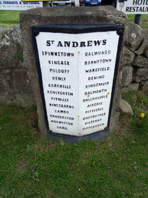
///winters.encourage.skill. Near St Andrews, Fife

Related Wikis

Kinkell, Fife

Kinkell was an estate to the east of St Andrews in Scotland. In the Middle Ages it was the site of a chapel, hospital, dovecote and a castle or manor house...

Fairmont St Andrews

The Fairmont St Andrews Bay is a 5-star resort hotel situated 2 miles (3.2 km) outside the town of St. Andrews in Fife, Scotland. The hotel is managed...

Scottish Championship (golf)

The Scottish Championship was a professional golf tournament that was held 15–18 October 2020 at Fairmont St Andrews, in Fife, Scotland. The principal...

Hero Open

The Hero Open was a professional golf tournament played on the European Tour. The event was created as part of the tour's overhaul in response to the COVID...

Related Videos

#ValentinesDay #2023 #hotel #stay #travel #vacation #happy #couple #love #life #enjoy #reels #vlog

I love you even when I'm really really Hangry! Happy Valentine's Day my favourite human. . #HappyValentinesDay ...

Spring Easter Holiday Weekend Panorama On History Visit To St Andrews Fife Scotland

Tour Scotland short 4K Spring Easter Holiday Weekend travel video clip of a panorama view on ancestry, genealogy, family ...

#anniversary #celebration #travel #love #staycation #happy #couple #enjoy #fun #live #life #reels

Cheers to a lifetime of amazing adventures, treasured memories and happy anniversaries! #HappyAnniversary #Fairmont ...

Papa Johns at St Andrews Holiday Park (delivery to your holiday home or pitch)

If you're at St Andrews Holiday Park or St Monans Holiday Park don't forget that we can deliver Papa Johns pizza direct to your ...

Nearby Amenities

Located within 500m of 56.330527,-2.7474753
Mini Roundabout
Direction: clockwise
Lat/Long: 56.3301723/-2.7509891
Name En: Rock & spindle
Tourism: attraction
Lat/Long: 56.3305659/-2.7481784
The data included in this document is from www.openstreetmap.org. The data is made available under ODbL.

Have you been to The Rock and Spindle?

Leave your review of The Rock and Spindle below (or comments, questions and feedback).