Papi Geo

Coastal Feature, Headland, Point in Caithness

Scotland

Papi Geo

North Baths, Wick The North Baths was officially opened on 7th Sept 1904. The pool continued in use for the next 60 plus years until it was abandoned in favour of the new indoor pool. The baths fell into dereliction until its restoration in 2004.
See Link: <span class="nowrap"><a title="http://www.caithness.org/community/environment/friendstrinkienorthbaths/index.htm" rel="nofollow ugc noopener" href="http://www.caithness.org/community/environment/friendstrinkienorthbaths/index.htm">Link</a><img style="margin-left:2px;" alt="External link" title="External link - shift click to open in new window" src="https://s1.geograph.org.uk/img/external.png" width="10" height="10"/></span>
North Baths, Wick Credit: Jean Aldridge

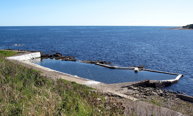
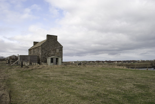
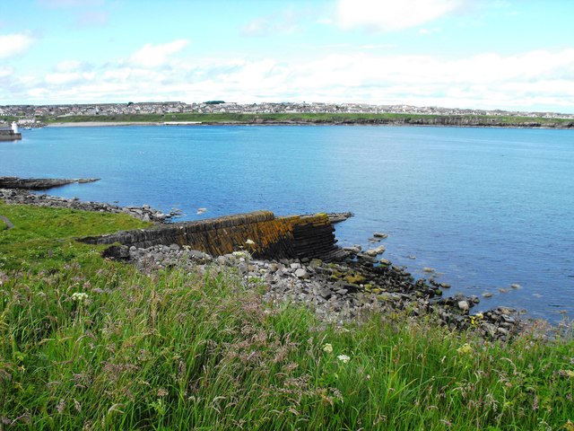
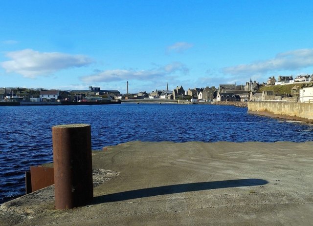
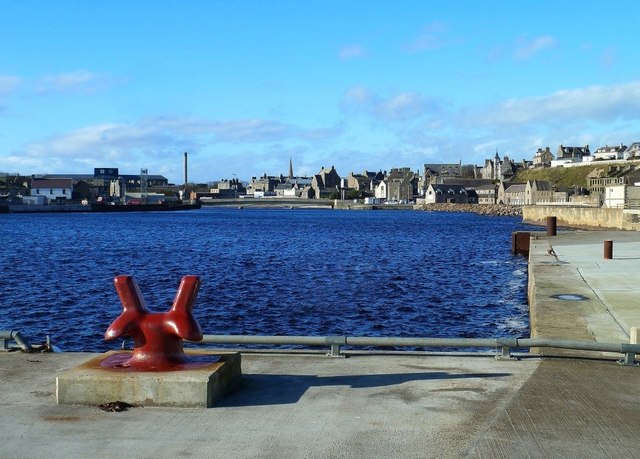
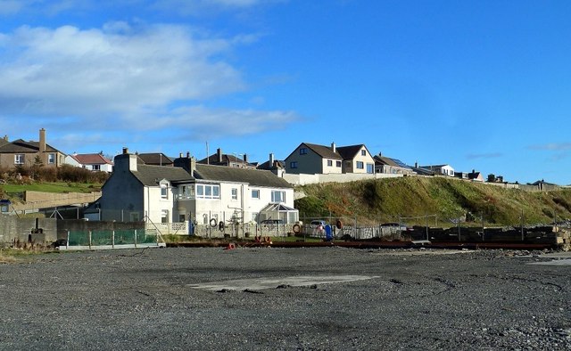
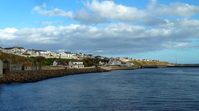
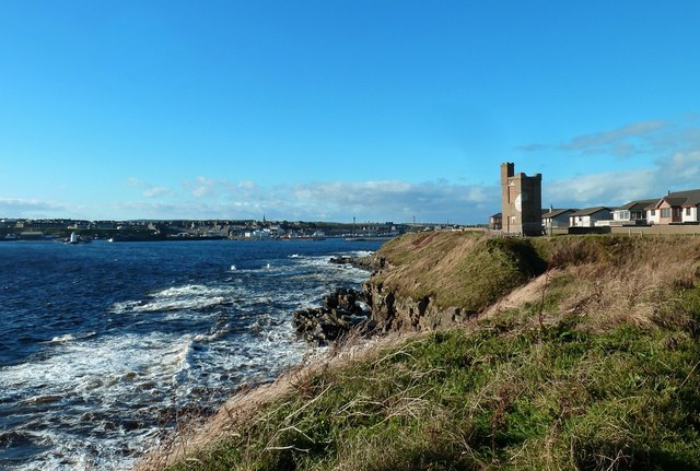
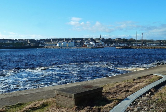
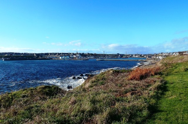
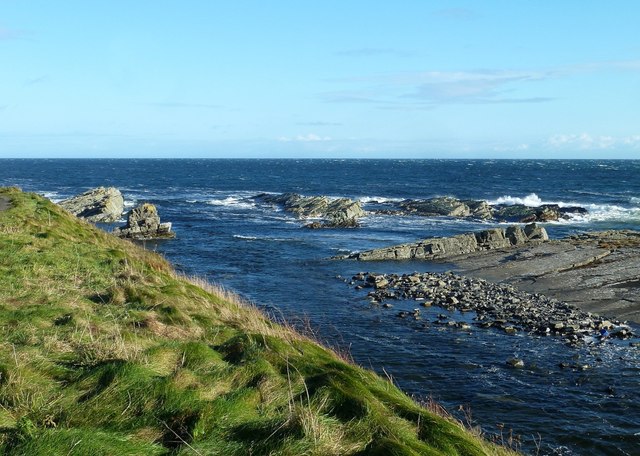
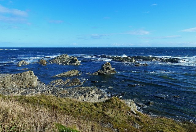
Papi Geo is a prominent coastal feature located in the county of Caithness, Scotland. It is situated on the northeastern coast of the country, specifically in the area known as John o' Groats. Papi Geo is widely recognized as a headland or point that juts out into the North Sea, offering breathtaking views of the surrounding landscape.

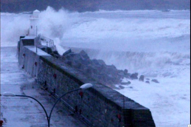
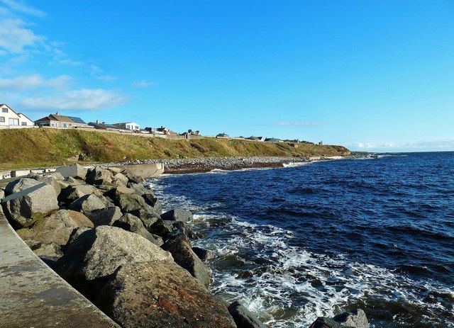
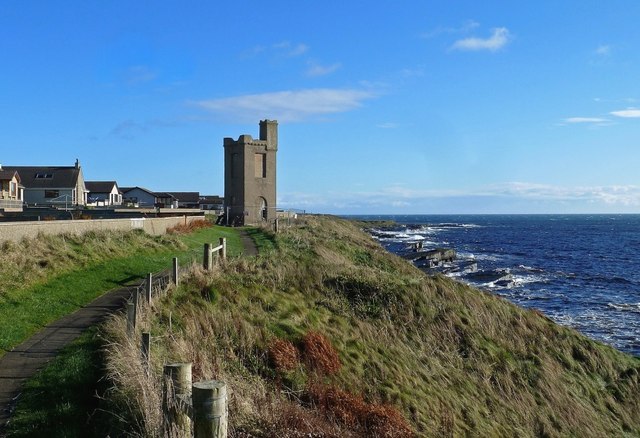
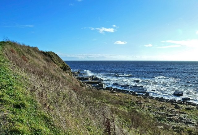
This coastal feature is characterized by its rugged cliffs, which rise steeply from the sea, and its distinctive rock formations. The cliffs at Papi Geo are composed mainly of sedimentary rocks, including sandstone and shale, which have been shaped by erosion over thousands of years. The constant battering of the waves has created caves and gullies along the coastline, adding to the geological interest of the area.

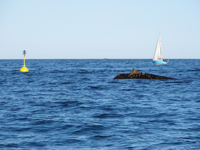
Papi Geo is also renowned for its rich biodiversity. The surrounding waters are home to a variety of marine life, including seals, dolphins, and numerous species of seabirds. The cliffs themselves provide nesting sites for seabird colonies, such as guillemots and kittiwakes, making Papi Geo an important location for birdwatching enthusiasts.

The area surrounding Papi Geo is popular among tourists and outdoor enthusiasts due to its scenic beauty and opportunities for outdoor activities. Visitors can hike along the cliff-top trails, taking in the panoramic views of the North Sea and the surrounding coastline. Additionally, the rocky shorelines offer opportunities for exploration and rock pooling during low tide.

Overall, Papi Geo is a captivating coastal feature in Caithness, offering a unique blend of geological wonders, diverse wildlife, and stunning natural beauty.

If you have any feedback on the listing, please let us know in the comments section below.

Papi Geo Images

Images are sourced within 2km of 58.44897/-3.0538437 or Grid Reference ND3851. Thanks to Geograph Open Source API. All images are credited.

North Baths, Wick The North Baths was officially opened on 7th Sept 1904. The pool continued in use for the next 60 plus years until it was abandoned in favour of the new indoor pool. The baths fell into dereliction until its restoration in 2004.
See Link: <span class="nowrap"><a title="http://www.caithness.org/community/environment/friendstrinkienorthbaths/index.htm" rel="nofollow ugc noopener" href="http://www.caithness.org/community/environment/friendstrinkienorthbaths/index.htm">Link</a><img style="margin-left:2px;" alt="External link" title="External link - shift click to open in new window" src="https://s1.geograph.org.uk/img/external.png" width="10" height="10"/></span>
North Baths, Wick
The North Baths was officially opened on 7th Sept 1904. The pool continued in use for the next 60 plus years until it was abandoned in favour of the new indoor pool. The baths fell into dereliction until its restoration in 2004. See Link: LinkExternal link
Old building by Broad Haven
Ruined Breakwater All that remains of the ill fated Stevenson built breakwater, which was destroyed in a storm before it was completed
Ruined Breakwater
All that remains of the ill fated Stevenson built breakwater, which was destroyed in a storm before it was completed
Navigation Buoy This buoy was installed to replace the storm damaged fixed beacon which marked the end of the ruined Stevenson breakwater. This was known locally as "The Flaggie". The picture was taken during a very low spring tide and the original fixing of the original can be seen in the picture. It is fairly rare to be able to see so much of this rock and it only visible for about an hour when the tide is so low.
Navigation Buoy
This buoy was installed to replace the storm damaged fixed beacon which marked the end of the ruined Stevenson breakwater. This was known locally as "The Flaggie". The picture was taken during a very low spring tide and the original fixing of the original can be seen in the picture. It is fairly rare to be able to see so much of this rock and it only visible for about an hour when the tide is so low.
Storm at Wick Harbour Picture shows the storm battered lighthouse at the harbour entrance.
Storm at Wick Harbour
Picture shows the storm battered lighthouse at the harbour entrance.
Wick Airport - 1987 Wick Airport.
The runway was crossed by a public road, which was blocked by traffic-lights, when a plane started or landed - unthinkable under today's safety regulations, but it worked in 1987.
Wick Airport - 1987
Wick Airport. The runway was crossed by a public road, which was blocked by traffic-lights, when a plane started or landed - unthinkable under today's safety regulations, but it worked in 1987.
Wick River Basin Looking upstream at high tide on a bright and breezy late-October day.
Wick River Basin
Looking upstream at high tide on a bright and breezy late-October day.
Wick River Basin View Looking upstream at high tide. This part of the outer harbour awaits development.
Wick River Basin View
Looking upstream at high tide. This part of the outer harbour awaits development.
Development Site at Wick Harbour Development is awaited at this site on the north side of Wick River Basin. The new houses in the background lie in the next square.
Development Site at Wick Harbour
Development is awaited at this site on the north side of Wick River Basin. The new houses in the background lie in the next square.
North Pier View Looking towards the Black Rocks from the start of Wick's North River Pier on a breezy day with the tide well in.
North Pier View
Looking towards the Black Rocks from the start of Wick's North River Pier on a breezy day with the tide well in.
River Basin View Looking downstream from the road bridge towards Wick Harbour's North River Pier.
River Basin View
Looking downstream from the road bridge towards Wick Harbour's North River Pier.
Military Monument This monument commemorates several military campaigns of the 19th century. Sadly, access is not allowed now due to its poor condition.
Military Monument
This monument commemorates several military campaigns of the 19th century. Sadly, access is not allowed now due to its poor condition.
Military Monument at Wick This monument commemorates several military campaigns of the 19th century. Located on a spectacular but windswept site, access is not allowed now due to its poor condition.
Military Monument at Wick
This monument commemorates several military campaigns of the 19th century. Located on a spectacular but windswept site, access is not allowed now due to its poor condition.
Outdoor Bathing Pool Tidal pools like this were a common feature of our coastal towns in the 20th century but few are in good condition nowadays. The frothy water in the foreground shows the pool outline.  For more information, see <a href="https://www.geograph.org.uk/photo/2318677">ND3750 : North Baths, Wick</a>
Outdoor Bathing Pool
Tidal pools like this were a common feature of our coastal towns in the 20th century but few are in good condition nowadays. The frothy water in the foreground shows the pool outline. For more information, see ND3750 : North Baths, Wick
Wick Bay View Wick's rocky shoreline viewed from the footpath leading towards North Head.
Wick Bay View
Wick's rocky shoreline viewed from the footpath leading towards North Head.
Wick From The North Head Path Looking back to Wick Harbour from the footpath leading towards North Head.
Wick From The North Head Path
Looking back to Wick Harbour from the footpath leading towards North Head.
North Head View High tide on a bright and breezy late-October day at Wick's North Head.
North Head View
High tide on a bright and breezy late-October day at Wick's North Head.
North Head High tide on a bright and breezy late-October day at Wick's North Head.
North Head
High tide on a bright and breezy late-October day at Wick's North Head.
Show me another place!

Papi Geo is located at Grid Ref: ND3851 (Lat: 58.44897, Lng: -3.0538437)

Unitary Authority: Highland

Police Authority: Highlands and Islands

What 3 Words

///denote.pheasants.paints. Near Wick, Highland

Related Wikis

Papigoe

Papigoe is a village on the east coast of Caithness, at the head of Broad Haven Bay in the Scottish Highlands and is in the Scottish council area of Highland...

Staxigoe

Staxigoe is a former fishing village, located 2 miles east of Wick on the north-eastern coast of the former county of Caithness, Scottish Highlands and...

Wick, Caithness

Wick (Scottish Gaelic: Inbhir Ùige [ˈinivɪɾʲˈuːkʲə]; Scots: Week) is a town and royal burgh in Caithness, in the far north of Scotland. The town straddles...

County Offices, Wick

County Offices, formerly Stafford Place, is a municipal structure in the High Street, Wick, Caithness, Scotland. The façade of the building, which was...

Nearby Amenities

Located within 500m of 58.44897,-3.0538437
Bus Stop
Broadhaven Road
Naptan AtcoCode: 6700600209
Naptan Bearing: SW
Naptan CommonName: Broadhaven Road
Naptan Indicator: at Mowat Place
Naptan Landmark: Mowat Place
Naptan NaptanCode: 45326363
Naptan Street: Broadhaven Road
Naptan Verified: no
Source: naptan_import
Lat/Long: 58.4476514/-3.0616896
Bus Stop
Broadhaven Road
Naptan AtcoCode: 6700600210
Naptan Bearing: SW
Naptan CommonName: Broadhaven Road
Naptan Indicator: at Pilot Row
Naptan Landmark: Pilot Row
Naptan NaptanCode: 45326364
Naptan Street: Broadhaven Road
Naptan Verified: no
Source: naptan_import
Lat/Long: 58.4502212/-3.0572263
Papigoe
Place: village
Wikidata: Q7132835
Wikipedia: en:Papigoe
Lat/Long: 58.4492843/-3.0571606
Generator Method: photovoltaic
Generator Output Electricity: yes
Generator Source: solar
Generator Type: solar_photovoltaic_panel
Location: roof
Power: generator
Lat/Long: 58.4472963/-3.0601993
Give Way
Direction: backward
Lat/Long: 58.4477443/-3.0615431
The data included in this document is from www.openstreetmap.org. The data is made available under ODbL.

Have you been to Papi Geo?

Leave your review of Papi Geo below (or comments, questions and feedback).