Whale's Hole

Sea, Estuary, Creek in Caithness

Scotland

Whale's Hole

Cliff Face Cliff face at South Head, below the old Coastguard Station
Cliff Face Credit: John MacKenzie

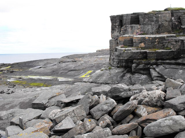
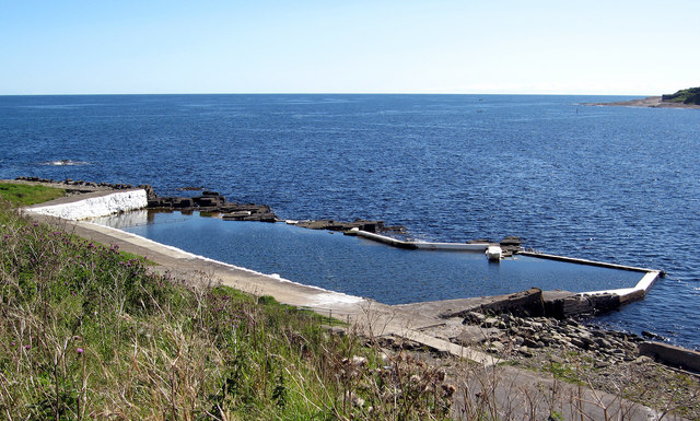
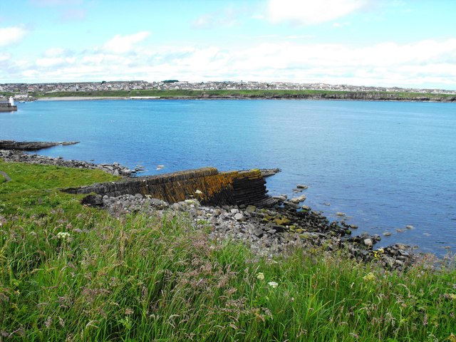
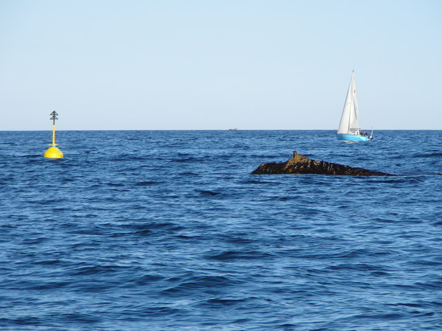
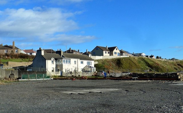
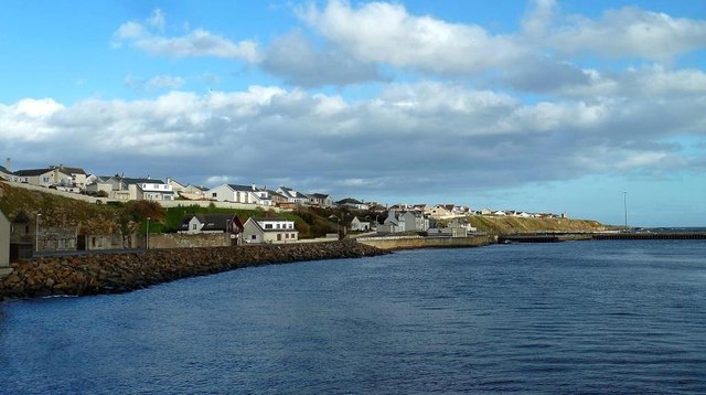
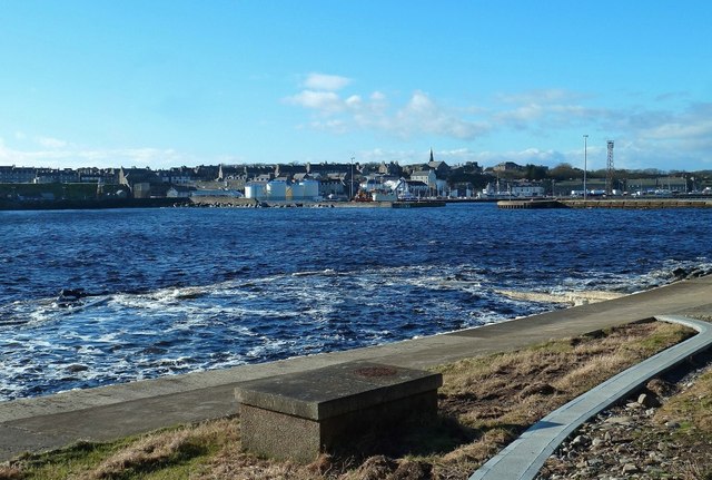
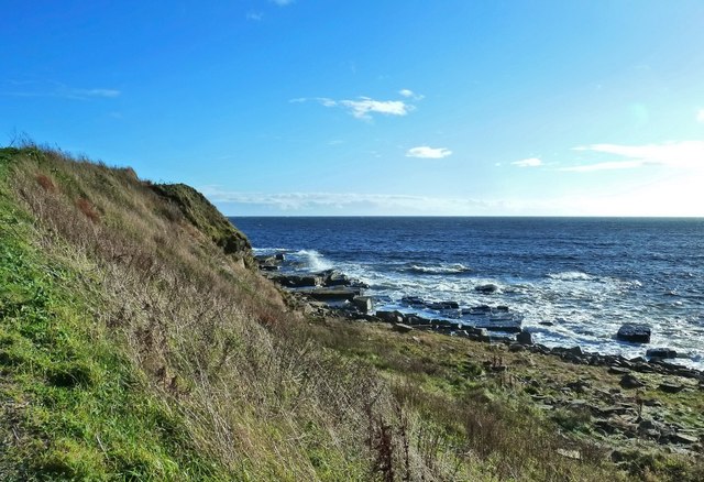
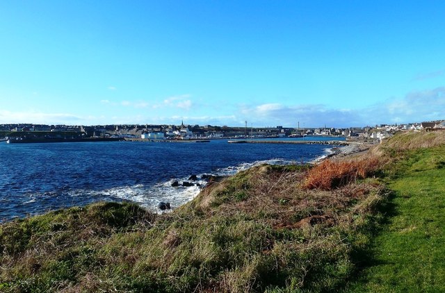
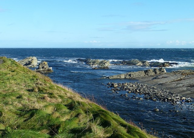
Whale's Hole is a picturesque coastal feature located in Caithness, a county in the northernmost part of mainland Scotland. Situated along the North Sea, Whale's Hole is an estuary or creek that offers stunning views and natural beauty.

The estuary is named after the local legend that suggests it was once a gathering place for whales. Although whales are rarely spotted in the area today, the name has stuck due to its historical significance. The site attracts nature enthusiasts, photographers, and tourists who are captivated by its charm.

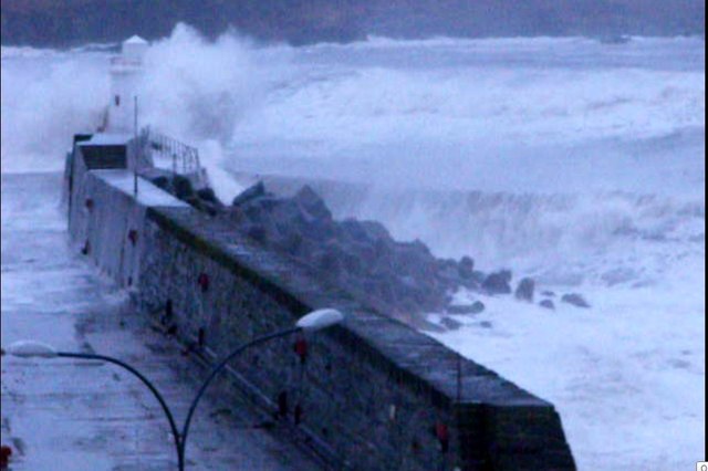
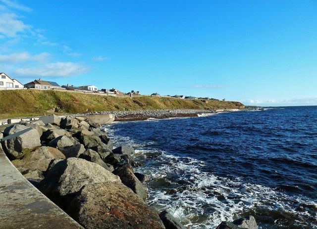
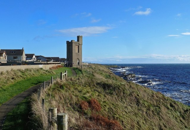
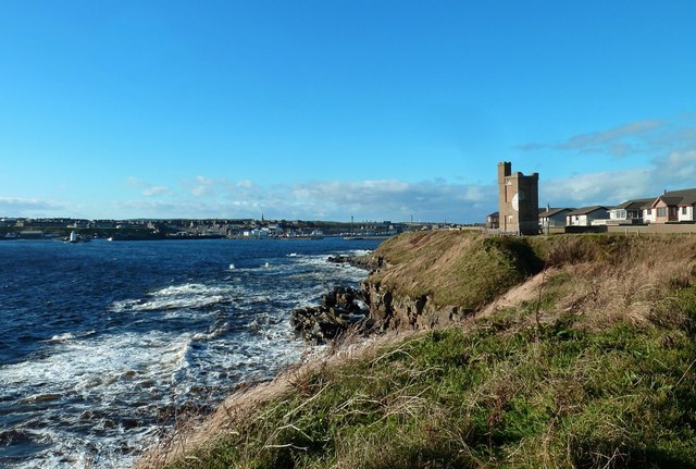
The estuary is surrounded by dramatic cliffs, providing a breathtaking backdrop to the serene waters below. The rugged coastline and rocky terrain add to the area's wild and untouched allure. The estuary is also home to a diverse ecosystem, with various species of birds, marine life, and plant species thriving in its waters and along its shores.

Visitors to Whale's Hole can enjoy a range of activities. Nature lovers can take leisurely walks along the shoreline, capturing the beauty of the landscape and observing the abundant birdlife. The estuary is also a popular spot for fishing, offering opportunities to catch a variety of fish species.

Whale's Hole provides a peaceful retreat from the hustle and bustle of everyday life. Its untouched beauty and natural surroundings make it an ideal destination for those seeking tranquility and a connection to nature. Whether you are exploring the cliffs, watching birds soar above the water, or simply taking in the breathtaking views, Whale's Hole is sure to leave a lasting impression on all who visit.

If you have any feedback on the listing, please let us know in the comments section below.

Whale's Hole Images

Images are sourced within 2km of 58.446655/-3.0513246 or Grid Reference ND3851. Thanks to Geograph Open Source API. All images are credited.

Cliff Face Cliff face at South Head, below the old Coastguard Station
Cliff Face
Cliff face at South Head, below the old Coastguard Station
View across the entrance to Wick Bay With a fishing boat entering port past South Head.
View across the entrance to Wick Bay
With a fishing boat entering port past South Head.
View over Wick Bay From near the Coastguard Lookout, with a fishing boat entering harbour.
View over Wick Bay
From near the Coastguard Lookout, with a fishing boat entering harbour.
North Baths, Wick The North Baths was officially opened on 7th Sept 1904. The pool continued in use for the next 60 plus years until it was abandoned in favour of the new indoor pool. The baths fell into dereliction until its restoration in 2004.
See Link: <span class="nowrap"><a title="http://www.caithness.org/community/environment/friendstrinkienorthbaths/index.htm" rel="nofollow ugc noopener" href="http://www.caithness.org/community/environment/friendstrinkienorthbaths/index.htm">Link</a><img style="margin-left:2px;" alt="External link" title="External link - shift click to open in new window" src="https://s1.geograph.org.uk/img/external.png" width="10" height="10"/></span>
North Baths, Wick
The North Baths was officially opened on 7th Sept 1904. The pool continued in use for the next 60 plus years until it was abandoned in favour of the new indoor pool. The baths fell into dereliction until its restoration in 2004. See Link: LinkExternal link
Old building by Broad Haven
Ruined Breakwater All that remains of the ill fated Stevenson built breakwater, which was destroyed in a storm before it was completed
Ruined Breakwater
All that remains of the ill fated Stevenson built breakwater, which was destroyed in a storm before it was completed
Navigation Buoy This buoy was installed to replace the storm damaged fixed beacon which marked the end of the ruined Stevenson breakwater. This was known locally as "The Flaggie". The picture was taken during a very low spring tide and the original fixing of the original can be seen in the picture. It is fairly rare to be able to see so much of this rock and it only visible for about an hour when the tide is so low.
Navigation Buoy
This buoy was installed to replace the storm damaged fixed beacon which marked the end of the ruined Stevenson breakwater. This was known locally as "The Flaggie". The picture was taken during a very low spring tide and the original fixing of the original can be seen in the picture. It is fairly rare to be able to see so much of this rock and it only visible for about an hour when the tide is so low.
Storm at Wick Harbour Picture shows the storm battered lighthouse at the harbour entrance.
Storm at Wick Harbour
Picture shows the storm battered lighthouse at the harbour entrance.
Monument to James Bremner, Wick James Bremner (1784-1856) was a naval architect, ship builder, harbour builder and ship-raiser. The monument was erected in 1903 and overlooks Wick harbour.
Monument to James Bremner, Wick
James Bremner (1784-1856) was a naval architect, ship builder, harbour builder and ship-raiser. The monument was erected in 1903 and overlooks Wick harbour.
Development Site at Wick Harbour Development is awaited at this site on the north side of Wick River Basin. The new houses in the background lie in the next square.
Development Site at Wick Harbour
Development is awaited at this site on the north side of Wick River Basin. The new houses in the background lie in the next square.
North Pier View Looking towards the Black Rocks from the start of Wick's North River Pier on a breezy day with the tide well in.
North Pier View
Looking towards the Black Rocks from the start of Wick's North River Pier on a breezy day with the tide well in.
River Basin View Looking downstream from the road bridge towards Wick Harbour's North River Pier.
River Basin View
Looking downstream from the road bridge towards Wick Harbour's North River Pier.
Military Monument This monument commemorates several military campaigns of the 19th century. Sadly, access is not allowed now due to its poor condition.
Military Monument
This monument commemorates several military campaigns of the 19th century. Sadly, access is not allowed now due to its poor condition.
Military Monument at Wick This monument commemorates several military campaigns of the 19th century. Located on a spectacular but windswept site, access is not allowed now due to its poor condition.
Military Monument at Wick
This monument commemorates several military campaigns of the 19th century. Located on a spectacular but windswept site, access is not allowed now due to its poor condition.
Outdoor Bathing Pool Tidal pools like this were a common feature of our coastal towns in the 20th century but few are in good condition nowadays. The frothy water in the foreground shows the pool outline.  For more information, see <a href="https://www.geograph.org.uk/photo/2318677">ND3750 : North Baths, Wick</a>
Outdoor Bathing Pool
Tidal pools like this were a common feature of our coastal towns in the 20th century but few are in good condition nowadays. The frothy water in the foreground shows the pool outline. For more information, see ND3750 : North Baths, Wick
Wick Bay View Wick's rocky shoreline viewed from the footpath leading towards North Head.
Wick Bay View
Wick's rocky shoreline viewed from the footpath leading towards North Head.
Wick From The North Head Path Looking back to Wick Harbour from the footpath leading towards North Head.
Wick From The North Head Path
Looking back to Wick Harbour from the footpath leading towards North Head.
North Head View High tide on a bright and breezy late-October day at Wick's North Head.
North Head View
High tide on a bright and breezy late-October day at Wick's North Head.
Show me another place!

Whale's Hole is located at Grid Ref: ND3851 (Lat: 58.446655, Lng: -3.0513246)

Unitary Authority: Highland

Police Authority: Highlands and Islands

What 3 Words

///teaching.ripen.croutons. Near Wick, Highland

Related Wikis

Papigoe

Papigoe is a village on the east coast of Caithness, at the head of Broad Haven Bay in the Scottish Highlands and is in the Scottish council area of Highland...

Staxigoe

Staxigoe is a former fishing village, located 2 miles east of Wick on the north-eastern coast of the former county of Caithness, Scottish Highlands and...
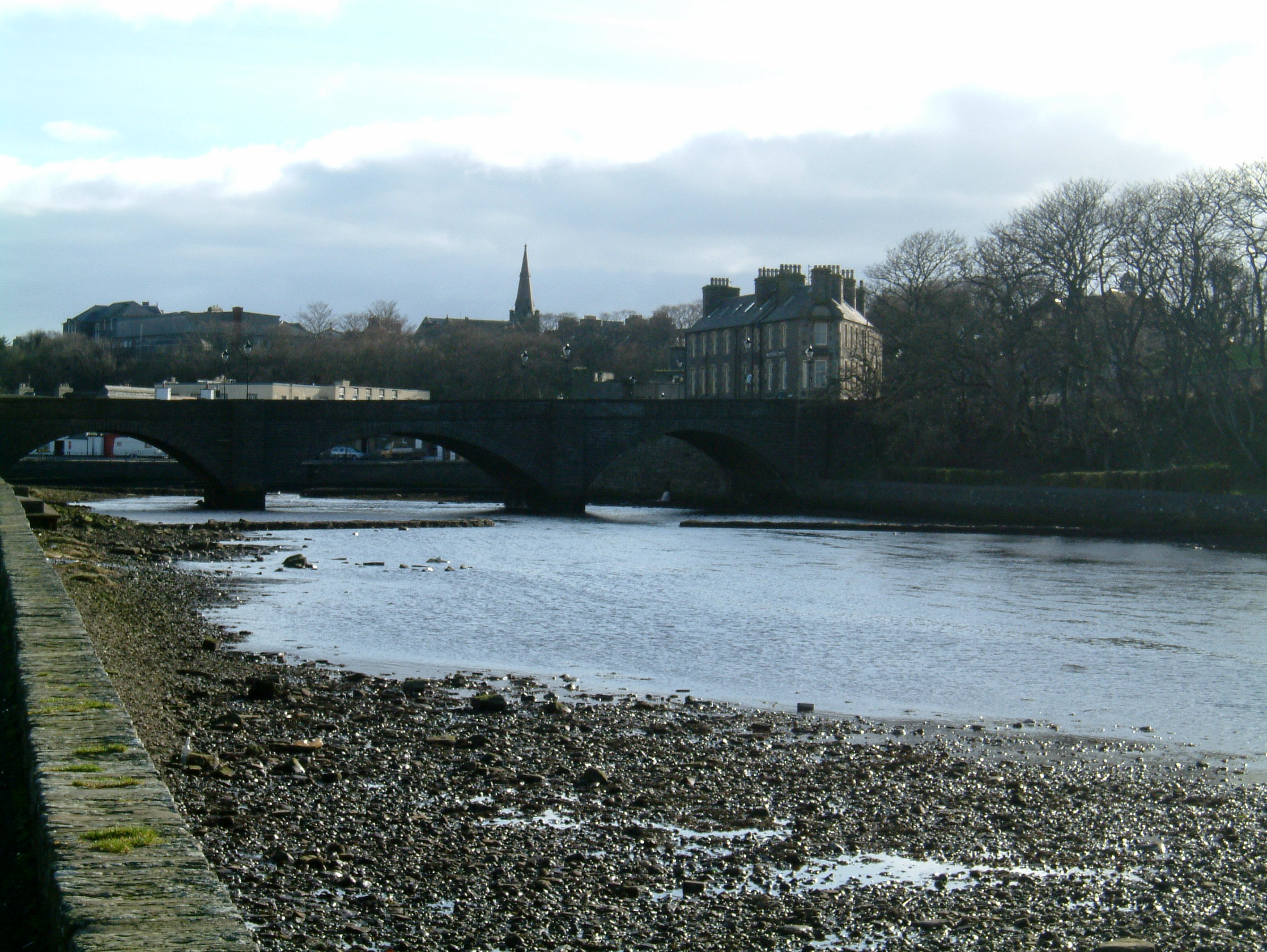
Wick, Caithness

Wick (Scottish Gaelic: Inbhir Ùige [ˈinivɪɾʲˈuːkʲə]; Scots: Week) is a town and royal burgh in Caithness, in the far north of Scotland. The town straddles...

Pulteneytown Parish Church

Pulteneytown Parish Church is located in Argyle Square, Pulteneytown, Wick, Caithness, Scotland. It is a congregation in the Church of Scotland. The church...

Nearby Amenities

Located within 500m of 58.446655,-3.0513246
Papigoe
Place: village
Wikidata: Q7132835
Wikipedia: en:Papigoe
Lat/Long: 58.4492843/-3.0571606
The data included in this document is from www.openstreetmap.org. The data is made available under ODbL.

Have you been to Whale's Hole?

Leave your review of Whale's Hole below (or comments, questions and feedback).