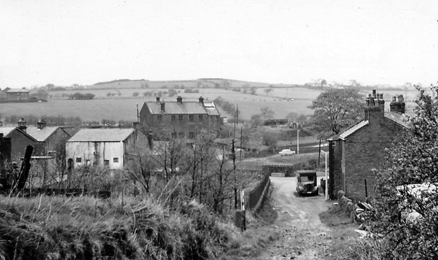
Abbey Village

Settlement in Lancashire Chorley

England

Abbey Village

A675, Edge End
A675, Edge End Credit: Richard Webb

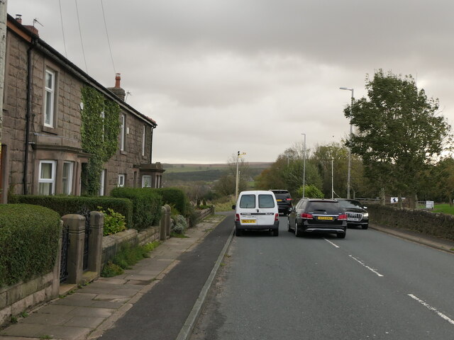
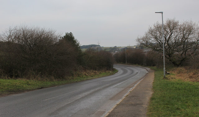
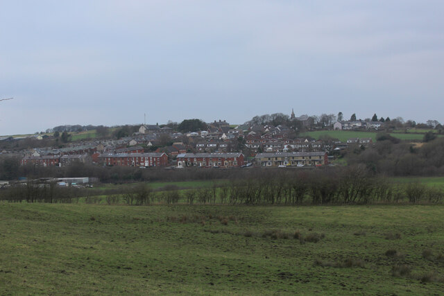
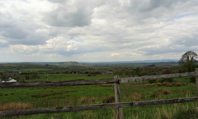
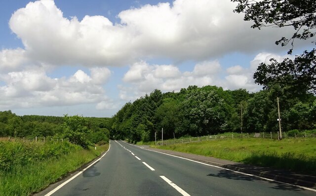
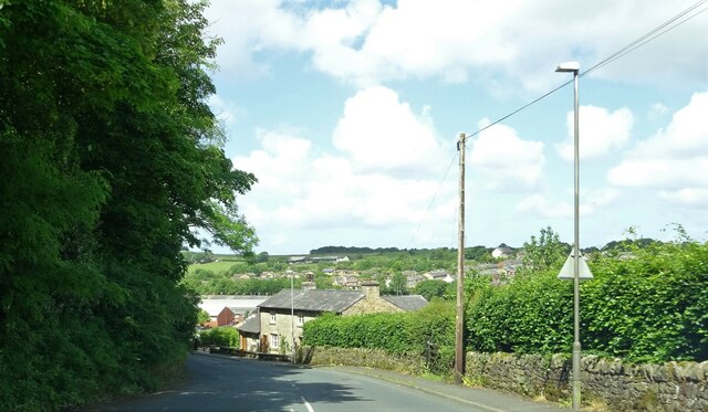
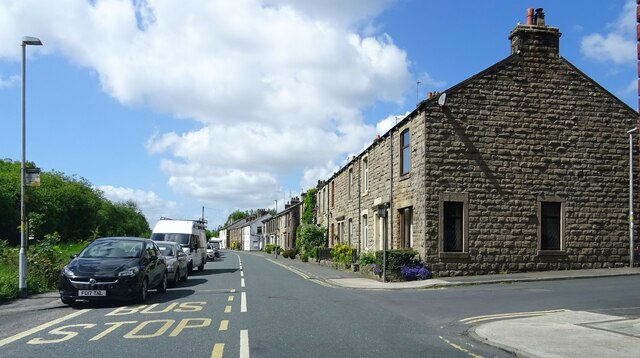
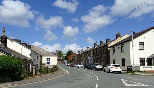
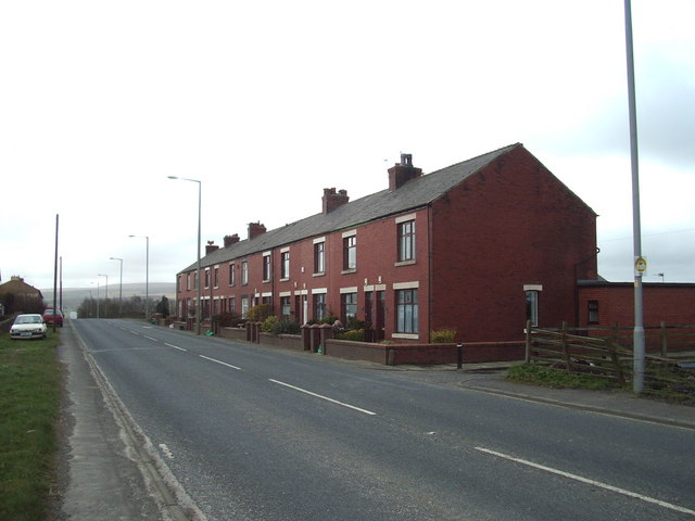
Abbey Village is a small village located in the borough of Chorley, within the county of Lancashire, England. Situated in the heart of the West Pennine Moors, it is surrounded by picturesque countryside, offering stunning views and a tranquil atmosphere. The village is positioned approximately four miles east of Chorley town center and is conveniently located near major transportation links, including the M61 motorway.

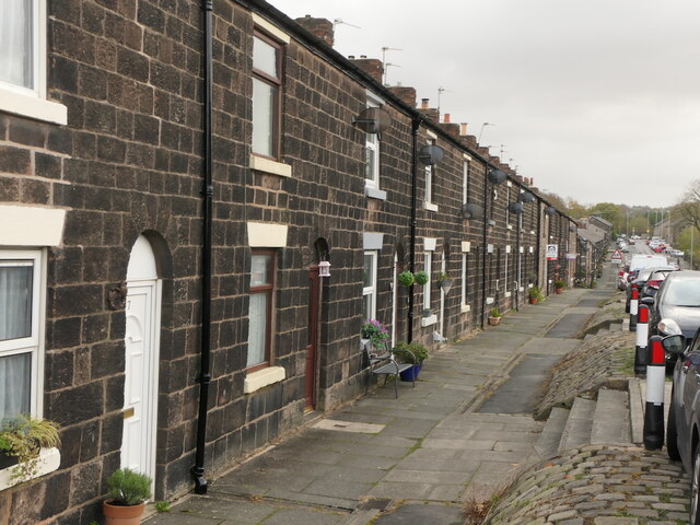
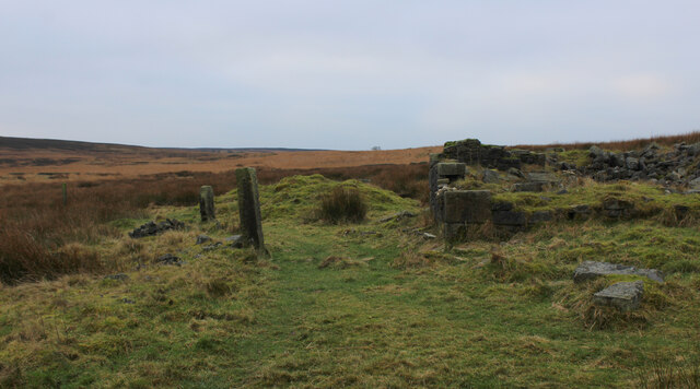
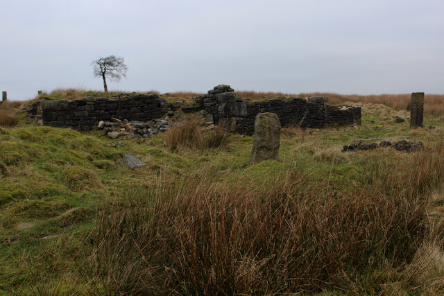
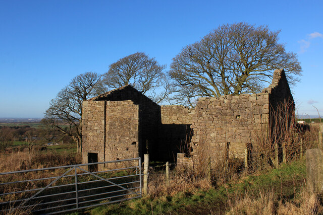
Abbey Village has a rich history, with its origins dating back to the medieval era. The village takes its name from Whalley Abbey, a Cistercian monastery that once owned the land. While the abbey itself no longer exists, remnants of its influence can still be found in the local architecture, including the Grade II listed Abbey Village School.

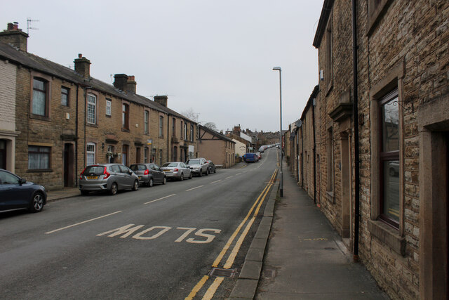
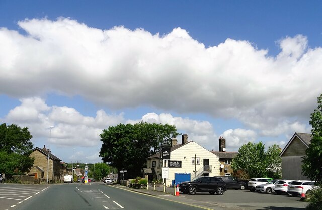
The village is home to a close-knit community and offers a range of amenities to its residents. These include a local primary school, a village hall, and a post office. Additionally, there are several pubs and restaurants in the area that provide opportunities for socializing and dining.

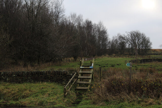
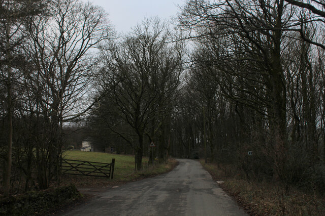
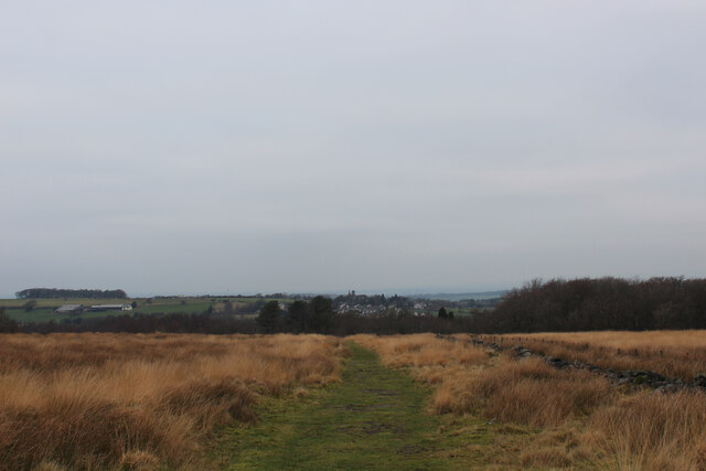
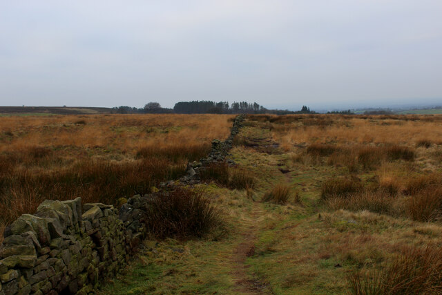
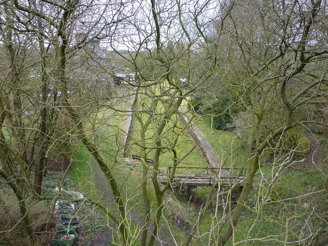
For outdoor enthusiasts, Abbey Village offers ample opportunities for exploration and recreation. The surrounding moorland provides a network of footpaths and trails, perfect for hiking and cycling. Nearby attractions include the picturesque Anglezarke Reservoir and the scenic White Coppice cricket ground.

Overall, Abbey Village is a charming, rural community that offers residents a peaceful and idyllic lifestyle. Its natural beauty, historical significance, and convenient location make it an attractive place to live for those seeking a quieter pace of life amidst Lancashire's stunning countryside.

If you have any feedback on the listing, please let us know in the comments section below.

Abbey Village Images

Images are sourced within 2km of 53.700062/-2.545952 or Grid Reference SD6422. Thanks to Geograph Open Source API. All images are credited.

A675, Edge End
A675, Edge End
Gritstone terrace, Abbey Village
Ladder Stile off Dole Lane The path ascends beside the now abandoned Central Quarry near Abbey Village
Ladder Stile off Dole Lane
The path ascends beside the now abandoned Central Quarry near Abbey Village
Road between Withnell and Abbey Village
Twistmoor Lane The lane heads for Withnell Quarry, before becoming Butterworth Brow and descending into the village of Brinscall
Twistmoor Lane
The lane heads for Withnell Quarry, before becoming Butterworth Brow and descending into the village of Brinscall
Moorland Track on Millstone Edge Heading north towards Twistmoor Lane
Moorland Track on Millstone Edge
Heading north towards Twistmoor Lane
Ruin on Withnell Moor (1) The remains of a substantial building, probably a farmhouse lay isolated on Withnell Moor.
There are several such features on these West Pennine moors.
<a href="https://www.geograph.org.uk/photo/7050750">SD6420 : Ruin on Withnell Moor (2)</a>
Ruin on Withnell Moor (1)
The remains of a substantial building, probably a farmhouse lay isolated on Withnell Moor. There are several such features on these West Pennine moors. SD6420 : Ruin on Withnell Moor (2)
Ruin on Withnell Moor (2) Very little remains of what looked like a substantial farmhouse. There are several such features like this in the vicinity.
<a href="https://www.geograph.org.uk/photo/7050728">SD6420 : Ruin on Withnell Moor (1)</a>
Ruin on Withnell Moor (2)
Very little remains of what looked like a substantial farmhouse. There are several such features like this in the vicinity. SD6420 : Ruin on Withnell Moor (1)
Footpath on Withnell Moor Travelling west the map shows the footpath runs to the left of the wall, while in reality the route appears on the opposite side.
Footpath on Withnell Moor
Travelling west the map shows the footpath runs to the left of the wall, while in reality the route appears on the opposite side.
Brinscall Looking up School Lane in the village of Brinscall
Brinscall
Looking up School Lane in the village of Brinscall
View towards Withnell
Ruins of a Barn near Snape's Heights Farm Abandoned stone barn passed by on the footpath between Snape's Heights Farm and Brinscall Village
Ruins of a Barn near Snape's Heights Farm
Abandoned stone barn passed by on the footpath between Snape's Heights Farm and Brinscall Village
A view from Tockholes Looking towards Edge Hill.
A view from Tockholes
Looking towards Edge Hill.
Approaching Abbey Village On the A675.
Approaching Abbey Village
On the A675.
Abbey Village A ribbon village on the A675 roughly equidistant from Bolton and Preston.
Abbey Village
A ribbon village on the A675 roughly equidistant from Bolton and Preston.
Approaching Brinscall On Norcross Brow.
Approaching Brinscall
On Norcross Brow.
Railway Road in Brinscall
Bury Lane in Brinscall
Show me another place!

Abbey Village is located at Grid Ref: SD6422 (Lat: 53.700062, Lng: -2.545952)

Administrative County: Lancashire

District: Chorley

Police Authority: Lancashire

What 3 Words

///snippets.stealing.losses. Near Brinscall, Lancashire

Related Wikis

Withnell railway station

Withnell railway station was a railway station that served Abbey Village and Withnell, in Lancashire, England. == History == The station was opened by...

Abbey Village

Abbey Village is a village in the English county of Lancashire and the constituency of Chorley. It is located on the A675 road, six miles (10 km) from...

Abbey Village Reservoir

The reservoir north of Abbey Village on the River Roddlesworth - known as Close House Reservoir - is the latest addition to the reservoirs around this...

Rake Brook Reservoir

Rake Brook Reservoir is a reservoir fed by two streams, including the eponymous Rake Brook, a tributary of the River Roddlesworth in Lancashire, England...

Lower Roddlesworth Reservoir

Lower Roddlesworth Reservoir is a reservoir on the River Roddlesworth close to Abbey Village in Lancashire, England. The reservoir is close to Upper Roddlesworth...

Withnell

Withnell is a village and civil parish in the Borough of Chorley, Lancashire, England. According to the census of 2001, it had a population of 3,631, reducing...

Brinscall railway station

Brinscall railway station was a railway station that served the village of Brinscall, Lancashire, England. == History == The station was opened by the...

Roddlesworth

Roddlesworth is a hamlet in the parish of Withnell in Lancashire, England. It lies on the road connecting Preston with Bolton. The name is first encountered...

Nearby Amenities

Located within 500m of 53.700062,-2.545952
Abbey Village
Place: village
Source: npe
Wikidata: Q4664068
Wikipedia: en:Abbey Village
Lat/Long: 53.6994923/-2.5451839
Withnell
End Date: 1960-01
Historic Railway: station
Railway: site
Source: npe
Wikidata: Q8028212
Wikipedia: en:Withnell railway station
Lat/Long: 53.7005234/-2.5481802
Barrier: cattle_grid
Foot: yes
Lat/Long: 53.7003339/-2.5387894
Turning Circle
Lat/Long: 53.6994601/-2.5477965
Turning Circle
Lat/Long: 53.6987921/-2.5461465
Turning Circle
Lat/Long: 53.6982876/-2.5470464
Pub
Hare and Hounds
Addr City: Chorley
Addr Postcode: PR6 8DP
Addr Street: Bolton Road
Addr Village: Abbey Village
Outdoor Seating: yes
Lat/Long: 53.6969223/-2.5421655
Barrier: cattle_grid
Lat/Long: 53.7011797/-2.5469162
Post Box
Operator: Royal Mail
Post Box Type: lamp
Ref: PR6 86
Source: survey
Lat/Long: 53.6987073/-2.5447471
Bus Stop
Primary School
Bus: yes
Naptan AtcoCode: 250010005
Naptan CommonName: Primary School
Naptan Indicator: o/s
Naptan NaptanCode: lanadadt
Naptan Verified: no
Public Transport: platform
Lat/Long: 53.6983298/-2.5444901
Bus Stop
Station Terrace
Bench: no
Bin: no
Bus: yes
Lit: yes
Naptan AtcoCode: 250010004
Naptan CommonName: Station Terrace
Naptan Indicator: opp
Naptan NaptanCode: lanadadp
Naptan Verified: no
Public Transport: platform
Shelter: no
Tactile Paving: no
Lat/Long: 53.7000723/-2.546724
Bus Stop
Primary School
Bus: yes
Naptan AtcoCode: 250010003
Naptan CommonName: Primary School
Naptan Indicator: opp
Naptan NaptanCode: lanadadm
Naptan Verified: no
Public Transport: platform
Lat/Long: 53.6985274/-2.5445229
Bus Stop
East View Terrace
Bench: no
Bin: no
Bus: yes
Lit: no
Naptan AtcoCode: 250010001
Naptan CommonName: East View Terrace
Naptan Indicator: o/s
Naptan NaptanCode: lanadadj
Naptan Verified: no
Public Transport: platform
Shelter: no
Tactile Paving: no
Lat/Long: 53.7021652/-2.5489929
Bus Stop
Hare and Hounds
Bench: no
Bus: yes
Naptan AtcoCode: 2500ABY00001
Naptan CommonName: Hare and Hounds
Naptan Indicator: opp
Naptan NaptanCode: lanpamta
Naptan Verified: no
Public Transport: platform
Shelter: no
Lat/Long: 53.6964774/-2.542679
Bus Stop
Hare and Hounds
Bench: no
Bin: no
Bus: yes
Naptan AtcoCode: 2500498
Naptan CommonName: Hare and Hounds
Naptan Indicator: o/s
Naptan NaptanCode: lanawjwm
Naptan Verified: no
Public Transport: platform
Shelter: no
Lat/Long: 53.6965593/-2.5423171
Bus Stop
Station Terrace
Bus: yes
Naptan AtcoCode: 2500LAA16713
Naptan CommonName: Station Terrace
Naptan Indicator: by
Naptan NaptanCode: lanpatam
Naptan Verified: no
Public Transport: platform
Lat/Long: 53.7006275/-2.5471856
Benson's Farm
Place: farm
Lat/Long: 53.7007899/-2.5387953
New Close Farm
Place: farm
Lat/Long: 53.7043569/-2.5442523
Crossing
Crossing: uncontrolled
Crossing Island: no
Crossing Ref: zebra
Kerb: lowered
Tactile Paving: yes
Lat/Long: 53.6978249/-2.5437421
Parking
Hare & Hounds
Access: customers
Capacity: 20
Parking: surface
Surface: compacted
Lat/Long: 53.6967835/-2.542073
Direction: SE
Generator Method: photovoltaic
Generator Output Electricity: yes
Generator Solar Modules: 8
Generator Source: solar
Generator Type: solar_photovoltaic_panel
Location: roof
Power: generator
Lat/Long: 53.6992806/-2.5479403
Direction: SE
Generator Method: photovoltaic
Generator Output Electricity: yes
Generator Solar Modules: 4
Generator Source: solar
Generator Type: solar_photovoltaic_panel
Location: roof
Power: generator
Lat/Long: 53.698986/-2.5482253
Direction: SW
Generator Method: photovoltaic
Generator Output Electricity: yes
Generator Solar Modules: 16
Generator Source: solar
Generator Type: solar_photovoltaic_panel
Location: roof
Power: generator
Lat/Long: 53.6996792/-2.5465938
Restaurant
The Litle Tiger
Addr City: Chorley
Addr Postcode: PR6 8DA
Addr Street: Bolton Road
Addr Subdistrict: Withnell
Addr Village: Abbey Village
Cuisine: indian
Lat/Long: 53.7001468/-2.5470096
Victoria Terrace
Place: neighbourhood
Lat/Long: 53.6999713/-2.5466931
South Terrace
Place: neighbourhood
Lat/Long: 53.6978999/-2.5446157
Lower Close House Farm
Place: neighbourhood
Lat/Long: 53.7039052/-2.5472067
The data included in this document is from www.openstreetmap.org. The data is made available under ODbL.

Have you been to Abbey Village?

Leave your review of Abbey Village below (or comments, questions and feedback).