Benson's Wood

Wood, Forest in Lancashire Chorley

England

Benson's Wood

Abbey Mill Former cotton mill located in Abbey Village near Blackburn, now split up into individual industrial units
Abbey Mill Credit: Chris Heaton

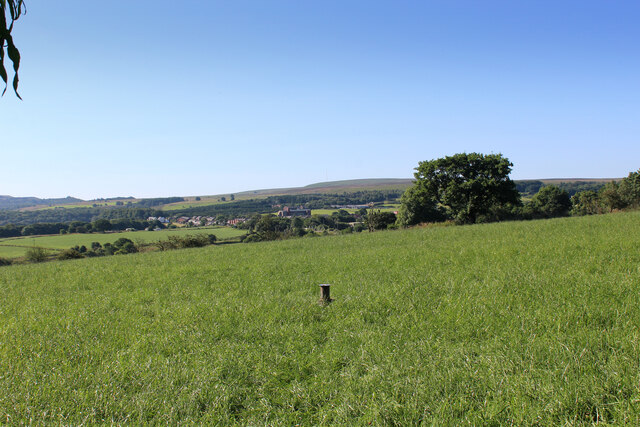
Benson's Wood is a picturesque forest located in the rural county of Lancashire, England. Covering an area of approximately 100 acres, this wood is known for its rich biodiversity and scenic beauty. It is a popular destination for nature lovers, hikers, and wildlife enthusiasts.

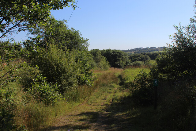
The wood is characterized by its dense canopy of towering oak, beech, and birch trees, which provide a haven for a variety of bird species. The forest floor is carpeted with vibrant wildflowers and ferns, creating a serene and enchanting atmosphere. The air is filled with the sweet scent of pine, adding to the overall tranquility of the surroundings.

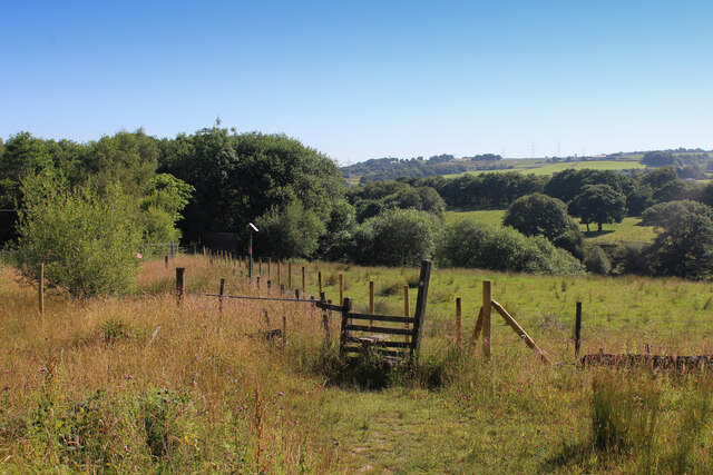
Benson's Wood boasts an extensive network of well-maintained walking trails, offering visitors the opportunity to explore its hidden gems. These trails wind through the forest, allowing visitors to immerse themselves in the natural beauty and observe the diverse wildlife that inhabits the area. Squirrels, deer, and rabbits are commonly spotted within the wood, while lucky visitors may even catch a glimpse of the elusive red fox or the beautiful tawny owl.

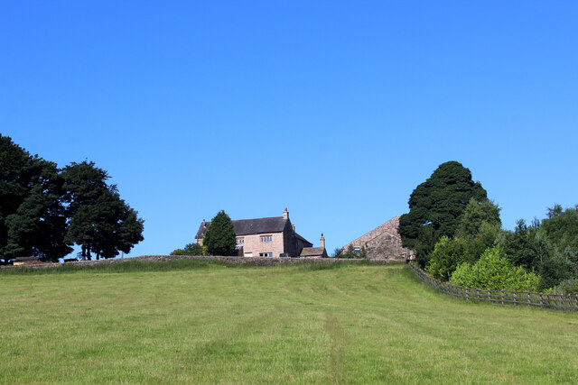
For those seeking solitude and relaxation, Benson's Wood provides secluded picnic areas and benches, allowing visitors to unwind and enjoy the peaceful ambiance of the forest. It is also an ideal spot for photography enthusiasts, as the wood offers countless opportunities to capture stunning shots of the flora and fauna.

In conclusion, Benson's Wood in Lancashire is a captivating forest that provides a refuge for nature enthusiasts, offering breathtaking landscapes, abundant wildlife, and a tranquil atmosphere. It is a must-visit destination for anyone seeking a connection with nature in the heart of Lancashire.

If you have any feedback on the listing, please let us know in the comments section below.

Benson's Wood Images

Images are sourced within 2km of 53.698141/-2.5362179 or Grid Reference SD6422. Thanks to Geograph Open Source API. All images are credited.

Abbey Mill Former cotton mill located in Abbey Village near Blackburn, now split up into individual industrial units
Abbey Mill
Former cotton mill located in Abbey Village near Blackburn, now split up into individual industrial units
Terraced Houses in Abbey Village Long lines of terraced houses run along both sides of Bolton Road in the linear community of Abbey Village.
Terraced Houses in Abbey Village
Long lines of terraced houses run along both sides of Bolton Road in the linear community of Abbey Village.
St. Paul's Church, Withnell This church dates back to 1841.
St. Paul's Church, Withnell
This church dates back to 1841.
Approaching Abbey Village On the footpath between Withnell and Abbey Village
Approaching Abbey Village
On the footpath between Withnell and Abbey Village
Looking towards the Village of Withnell As seen from the footpath to Abbey Village
Looking towards the Village of Withnell
As seen from the footpath to Abbey Village
Track heading towards Abbey Village Section of footpath between the communities of Abbey Village and Withnell
Track heading towards Abbey Village
Section of footpath between the communities of Abbey Village and Withnell
East View Terrace on Bolton Road Terraced housing on the A675 between Abbey Village and the M65.
East View Terrace on Bolton Road
Terraced housing on the A675 between Abbey Village and the M65.
Access Lane leading up to the A675 at Edge End Farm
Looking South over Countryside from near Edge End Farm Looking towards Abbey Village.
Looking South over Countryside from near Edge End Farm
Looking towards Abbey Village.
Stile and Footpath above the Stanworth Valley About to enter some woods that shades the River Roddlesworth in the Stanworth Valley
Stile and Footpath above the Stanworth Valley
About to enter some woods that shades the River Roddlesworth in the Stanworth Valley
Footpath heading towards the Stanworth Valley
Ascending towards Stanworth Farm Climbing through this pasture towards the farm, with the M65 as a companion - just out of shot to the right.
This shows the view in the opposite direction <a href="https://www.geograph.org.uk/photo/6904525">SM8602 : Pele Tower</a>
Ascending towards Stanworth Farm
Climbing through this pasture towards the farm, with the M65 as a companion - just out of shot to the right. This shows the view in the opposite direction SM8602 : Pele Tower
M65 crossing the Stanworth Valley The motorway crossing above the wooded trench, which conceals the River Roddlesworth - on the Stanworth Valley Viaduct.
This shows the view in the opposite direction <a href="https://www.geograph.org.uk/photo/6904510">SD6424 : Ascending towards Stanworth Farm</a>
M65 crossing the Stanworth Valley
The motorway crossing above the wooded trench, which conceals the River Roddlesworth - on the Stanworth Valley Viaduct. This shows the view in the opposite direction SD6424 : Ascending towards Stanworth Farm
Under the M65 Concrete supports that carry the M65 over the wooded valley that conceals the River Roddlesworth from view - otherwise known as the Stanworth Valley Viaduct.
The Witton Weavers Way long distance footpath also passes under this structure.
Under the M65
Concrete supports that carry the M65 over the wooded valley that conceals the River Roddlesworth from view - otherwise known as the Stanworth Valley Viaduct. The Witton Weavers Way long distance footpath also passes under this structure.
Beside a Patch of Woodland above Stanworth Farm The reservoir indicated by the fingerpost is on the other side of the motorway.
Beside a Patch of Woodland above Stanworth Farm
The reservoir indicated by the fingerpost is on the other side of the motorway.
Access Lane from Stanworth Farm Shows section of the access lane leading towards the A675
Access Lane from Stanworth Farm
Shows section of the access lane leading towards the A675
Bury Lane Runs from the village of Withnell to the A675, Chorley Road
Bury Lane
Runs from the village of Withnell to the A675, Chorley Road
Access Track to Moss Side Farm Adopted by a public footpath from Bury Lane
Access Track to Moss Side Farm
Adopted by a public footpath from Bury Lane
Show me another place!

Benson's Wood is located at Grid Ref: SD6422 (Lat: 53.698141, Lng: -2.5362179)

Administrative County: Lancashire

District: Chorley

Police Authority: Lancashire

What 3 Words

///mailers.jazzy.reclaim. Near Brinscall, Lancashire

Related Wikis

Abbey Village

Abbey Village is a village in the English county of Lancashire and the constituency of Chorley. It is located on the A675 road, six miles (10 km) from...

Rake Brook Reservoir

Rake Brook Reservoir is a reservoir fed by two streams, including the eponymous Rake Brook, a tributary of the River Roddlesworth in Lancashire, England...

Lower Roddlesworth Reservoir

Lower Roddlesworth Reservoir is a reservoir on the River Roddlesworth close to Abbey Village in Lancashire, England. The reservoir is close to Upper Roddlesworth...

Abbey Village Reservoir

The reservoir north of Abbey Village on the River Roddlesworth - known as Close House Reservoir - is the latest addition to the reservoirs around this...

Withnell railway station

Withnell railway station was a railway station that served Abbey Village and Withnell, in Lancashire, England. == History == The station was opened by...

Roddlesworth

Roddlesworth is a hamlet in the parish of Withnell in Lancashire, England. It lies on the road connecting Preston with Bolton. The name is first encountered...

Upper Roddlesworth Reservoir

Upper Roddlesworth Reservoir is a reservoir on the River Roddlesworth near Abbey Village in Lancashire, England. The reservoir is close to Lower Roddlesworth...

Withnell

Withnell is a village and civil parish in the Borough of Chorley, Lancashire, England. According to the census of 2001, it had a population of 3,631, reducing...

Nearby Amenities

Located within 500m of 53.698141,-2.5362179
Barrier: cattle_grid
Foot: yes
Lat/Long: 53.7003339/-2.5387894
Barrier: stile
Foot: yes
Lat/Long: 53.7007755/-2.538048
Roddlesworth Wood
Natural: wood
Source: OS_OpenData_StreetView
Lat/Long: 53.6971691/-2.5331338
Bensons Wood
Natural: wood
Source: OS_OpenData_StreetView
Lat/Long: 53.6987444/-2.5368889
Pub
Hare and Hounds
Addr City: Chorley
Addr Postcode: PR6 8DP
Addr Street: Bolton Road
Addr Village: Abbey Village
Outdoor Seating: yes
Lat/Long: 53.6969223/-2.5421655
Bus Stop
Hare and Hounds
Bench: no
Bus: yes
Naptan AtcoCode: 2500ABY00001
Naptan CommonName: Hare and Hounds
Naptan Indicator: opp
Naptan NaptanCode: lanpamta
Naptan Verified: no
Public Transport: platform
Shelter: no
Lat/Long: 53.6964774/-2.542679
Bus Stop
Hare and Hounds
Bench: no
Bin: no
Bus: yes
Naptan AtcoCode: 2500498
Naptan CommonName: Hare and Hounds
Naptan Indicator: o/s
Naptan NaptanCode: lanawjwm
Naptan Verified: no
Public Transport: platform
Shelter: no
Lat/Long: 53.6965593/-2.5423171
Benson's Farm
Place: farm
Lat/Long: 53.7007899/-2.5387953
Crossing
Crossing: uncontrolled
Crossing Island: no
Crossing Ref: zebra
Kerb: lowered
Tactile Paving: yes
Lat/Long: 53.6978249/-2.5437421
Parking
Hare & Hounds
Access: customers
Capacity: 20
Parking: surface
Surface: compacted
Lat/Long: 53.6967835/-2.542073
Red Lee Farm
Place: farm
Lat/Long: 53.7002175/-2.535055
Higher Red Lee Farm
Place: farm
Lat/Long: 53.7004461/-2.5355727
The data included in this document is from www.openstreetmap.org. The data is made available under ODbL.

Have you been to Benson's Wood?

Leave your review of Benson's Wood below (or comments, questions and feedback).