Aber Castell

Beach in Pembrokeshire

Wales

Aber Castell

Solva harbour Low tide at Solva harbour, lime kilns on the far shore.
Solva harbour Credit: E Gammie

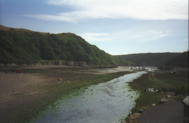
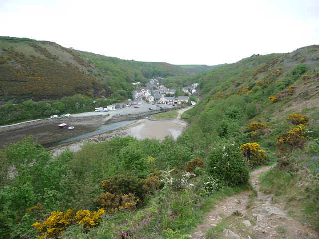
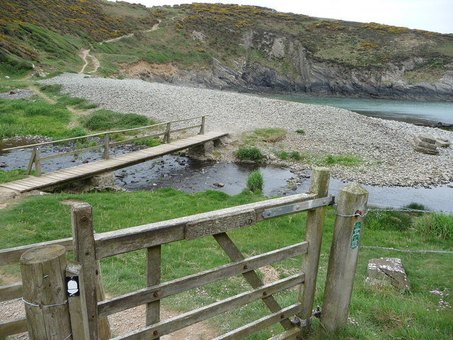
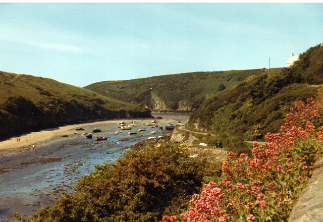
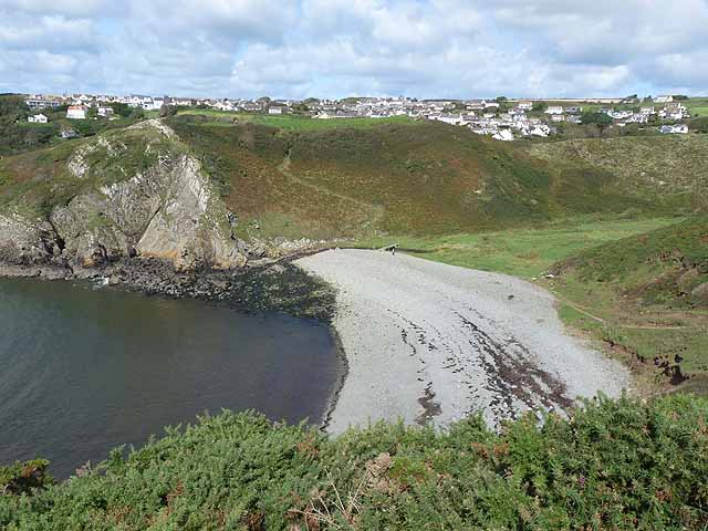
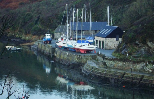
Aber Castell is a picturesque beach located in Pembrokeshire, Wales. Situated on the stunning Welsh coastline, this sandy beach offers visitors a peaceful and idyllic retreat. The beach is named after the nearby hill fort, Castell Coch, which translates to "Red Castle" in Welsh.

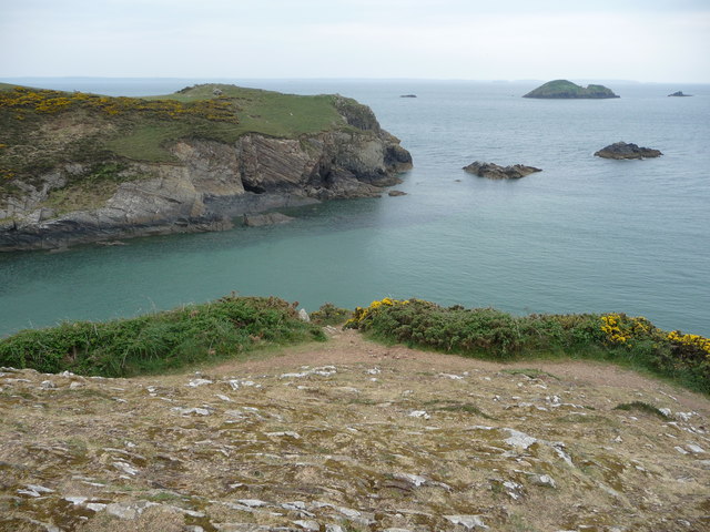
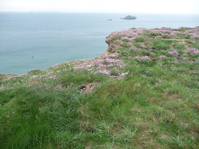
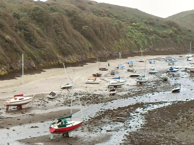
With its crystal-clear waters and golden sands, Aber Castell is a perfect spot for sunbathing and relaxation. The beach is relatively secluded, making it a tranquil destination away from the hustle and bustle of larger tourist areas. Visitors can enjoy leisurely walks along the shore, taking in the breathtaking views of the surrounding cliffs and the Irish Sea.

The beach is also popular among surfers, thanks to its consistent waves and favorable conditions. Surfing enthusiasts can catch some great breaks and enjoy the thrill of riding the waves. Additionally, Aber Castell is known for its excellent fishing opportunities, attracting anglers who can try their luck at catching a variety of fish species.

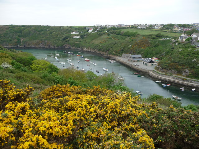
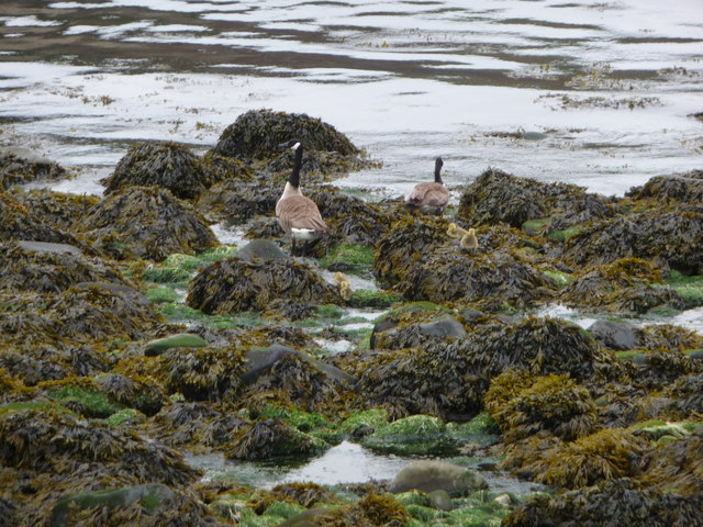
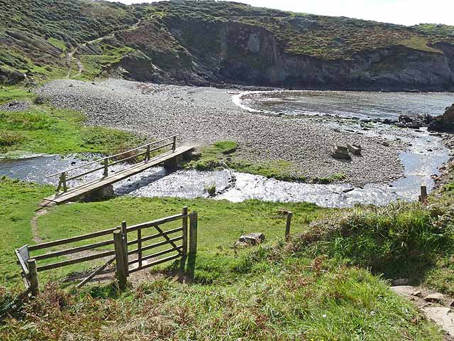
Aber Castell is surrounded by stunning natural beauty, including dramatic cliffs and rolling hills. Nature lovers will appreciate the rich biodiversity in the area, with various coastal plants and bird species inhabiting the beach and its surroundings.

Facilities at Aber Castell are limited, with no public toilets or lifeguards present. However, this adds to the beach's unspoiled and authentic charm. Visitors are advised to bring their own necessities and take necessary precautions while enjoying this beautiful beach.

If you have any feedback on the listing, please let us know in the comments section below.
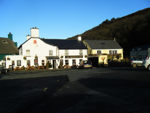
Aber Castell Images

Images are sourced within 2km of 51.871416/-5.2152398 or Grid Reference SM7824. Thanks to Geograph Open Source API. All images are credited.

Solva harbour Low tide at Solva harbour, lime kilns on the far shore.
Solva harbour
Low tide at Solva harbour, lime kilns on the far shore.
Lower Solva from Gribin Lower Solva lies behind Solva Harbour, which itself is in a 'fjord-like' inlet in the coastline here. Gribin is also known as the Cribyn ridge locally.
Lower Solva from Gribin
Lower Solva lies behind Solva Harbour, which itself is in a 'fjord-like' inlet in the coastline here. Gribin is also known as the Cribyn ridge locally.
Solva harbour from Gribin The houses of Upper Solva lie above the inlet, some overlooking the picturesque harbour.
Solva harbour from Gribin
The houses of Upper Solva lie above the inlet, some overlooking the picturesque harbour.
Rocks and islands off Solva harbour Beyond Penrhyn Head are St. Elvis' Rock and Black Rock and out to sea is larger Green Scar with The Mare and Black Scar each side. Quite a coastline.
Rocks and islands off Solva harbour
Beyond Penrhyn Head are St. Elvis' Rock and Black Rock and out to sea is larger Green Scar with The Mare and Black Scar each side. Quite a coastline.
Gate and footbridge at Gwadn The pebbly storm beach here is interesting and it's a lovely spot.
Gate and footbridge at Gwadn
The pebbly storm beach here is interesting and it's a lovely spot.
Canada Geese with goslings on Gwadn This little family waddled off seawards at my approach, just as well as a dog off its lead came in a few minutes later.
Canada Geese with goslings on Gwadn
This little family waddled off seawards at my approach, just as well as a dog off its lead came in a few minutes later.
Thrift growing on the cliff top near Solva Rabbits have colonised the fenced-off cliff edge and Thrift grows well here also, always a beautiful sight.
Thrift growing on the cliff top near Solva
Rabbits have colonised the fenced-off cliff edge and Thrift grows well here also, always a beautiful sight.
Solva 1971
Solva 1971
Lower Solva
Lower Solva
Footbridge at Gwadn Bay A steep descent on the Pembrokeshire Coast Path to cross this stream is immediately followed by a steep climb.
Footbridge at Gwadn Bay
A steep descent on the Pembrokeshire Coast Path to cross this stream is immediately followed by a steep climb.
Gwadn Bay A steep descent on the Pembrokeshire Coast Path to cross this deeply incised valley with stony beach is immediately followed by a steep climb. Solva village can be seen in the distance.
Gwadn Bay
A steep descent on the Pembrokeshire Coast Path to cross this deeply incised valley with stony beach is immediately followed by a steep climb. Solva village can be seen in the distance.
The River Solva at Solva Looking upstream.
The River Solva at Solva
Looking upstream.
Art cafe, Solva With many artworks outside, but closed and up for sale.
Art cafe, Solva
With many artworks outside, but closed and up for sale.
Lime Kilns, Solva harbour Group of limekilns dating from the time when limestone was imported by boat from the south of the county to be roasted here and then used to sweeten the more acid soils in this part of Pembrokeshire.
Lime Kilns, Solva harbour
Group of limekilns dating from the time when limestone was imported by boat from the south of the county to be roasted here and then used to sweeten the more acid soils in this part of Pembrokeshire.
Solva quay Solva quay was once busy with commercial traffic and fishing boats, but is now mainly concerned with pleasure craft.
Solva quay
Solva quay was once busy with commercial traffic and fishing boats, but is now mainly concerned with pleasure craft.
The Harbour Inn, Lower Solva
Boats at Solva Quay Awaiting their winter service
Boats at Solva Quay
Awaiting their winter service
Show me another place!

Aber Castell is located at Grid Ref: SM7824 (Lat: 51.871416, Lng: -5.2152398)

Unitary Authority: Pembrokeshire

Police Authority: Dyfed Powys

What 3 Words

///jetted.fracture.megawatt. Near St Davids, Pembrokeshire

Related Wikis

Dwrhyd Pit

Dwrhyd Pit is a Site of Special Scientific Interest (or SSSI) in Pembrokeshire, South Wales. It has been designated as a Site of Special Scientific Interest...

Whitchurch, Pembrokeshire

Whitchurch (Welsh: Tregroes, lit. "Town of the Cross") is a small village and parish (Plwy'r Groes, lit. "Parish of the Cross") in north-western Pembrokeshire...
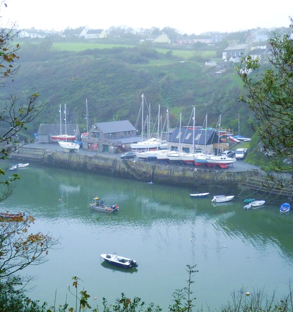
Solva

Solva (Welsh: Solfach) is a village, community and electoral ward in Pembrokeshire, Wales. The village comprises principally Lower Solva and Upper Solva...

RAF St Davids

Royal Air Force St Davids, or more simply RAF St Davids, is a former Royal Air Force station, near the city of St Davids, Pembrokeshire, Wales, in the...
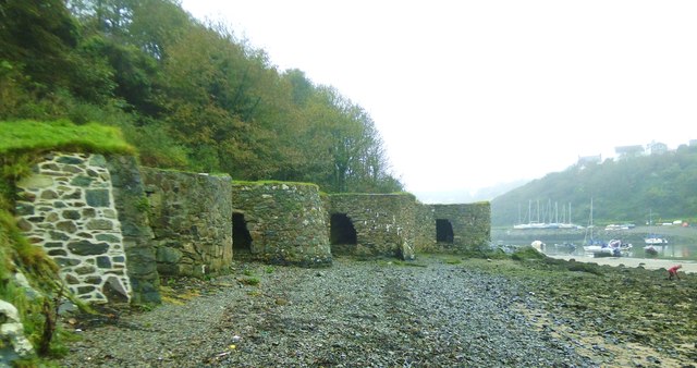
Solva limekilns

The Solva limekilns are a row of disused limekilns in the harbour of the village of Solva, Pembrokeshire, Wales. The kilns have a Grade II heritage listing...
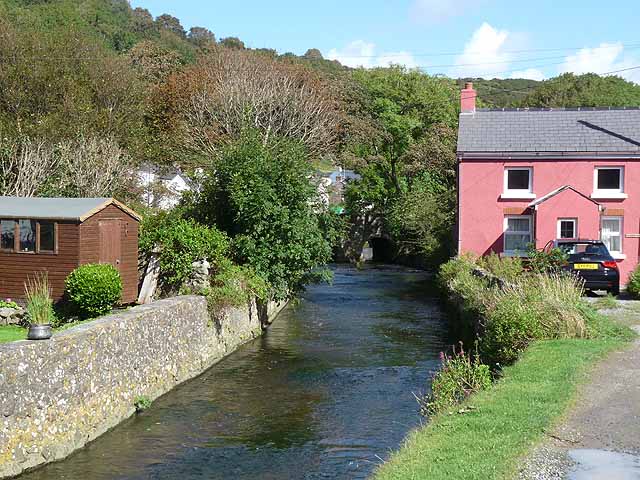
River Solva

The River Solva (Welsh: Afon Solfach) is a small river in Pembrokeshire, Wales. Its source is a few hundred metres southeast of Croesgoch and flows ten...

St Elvis, Pembrokeshire

St Elvis (Welsh: Llaneilfyw, [ɬanəilvəu]) is a parish in Pembrokeshire, Wales, about 4 miles (6 km) east of St David's. At 200 acres (81 ha) it is one...

Pembrokeshire Coast Path

The Pembrokeshire Coast Path (Welsh: Llwybr Arfordir Sir Benfro), often called the Pembrokeshire Coastal Path, is a designated National Trail in Pembrokeshire...

Nearby Amenities

Located within 500m of 51.871416,-5.2152398
Three tugs
Historic: wreck
Seamark Type: wreck
Wreck Visible At High Tide: yes
Wreck Visible At Low Tide: yes
Lat/Long: 51.8694467/-5.2143587
Source: OS_Opendata_Vectormap_District
Lat/Long: 51.8712523/-5.2144748
Source: OS_Opendata_Vectormap_District
Lat/Long: 51.8728603/-5.2172371
Source: OS_Opendata_Vectormap_District
Lat/Long: 51.873032/-5.2172303
Source: OS_Opendata_Vectormap_District
Lat/Long: 51.8729772/-5.2184569
Source: OS_Opendata_Vectormap_District
Lat/Long: 51.8731363/-5.2182131
Source: OS_Opendata_Vectormap_District
Lat/Long: 51.873183/-5.2171912
Source: OS_Opendata_Vectormap_District
Lat/Long: 51.8732291/-5.2179315
Source: OS_Opendata_Vectormap_District
Lat/Long: 51.8733432/-5.2177891
The Cradle
Place: locality
Lat/Long: 51.8675661/-5.2121147
The data included in this document is from www.openstreetmap.org. The data is made available under ODbL.

Have you been to Aber Castell?

Leave your review of Aber Castell below (or comments, questions and feedback).