Morfa and Nine Wells

Heritage Site in Pembrokeshire

Wales

Morfa and Nine Wells
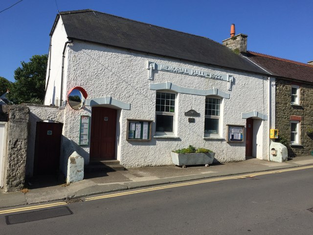
Memorial Hall Memorial Hall in Upper Solva.
Memorial Hall Credit: Alan Hughes

Morfa and Nine Wells is a historically significant heritage site located in Pembrokeshire, Wales. The site is known for its exceptional natural beauty and archaeological importance. It covers an area of approximately 95 hectares and is situated between Solva and St Davids.

The site comprises of a mix of different habitats, including wetlands, grasslands, and woodland. It is home to a diverse range of flora and fauna, making it a popular spot for nature enthusiasts. The wetlands are particularly notable, as they provide a vital habitat for a variety of bird species, including herons, curlews, and teal.

Archaeologically, Morfa and Nine Wells is of great significance. It contains several ancient monuments, including a well-preserved Iron Age hillfort, which is believed to have been occupied from the 1st century BC to the 1st century AD. The hillfort consists of multiple ramparts and ditches and provides insight into the region's ancient history.

Additionally, the site is home to a cluster of nine natural springs, known as the Nine Wells. These springs have been revered for centuries for their supposed healing properties and have attracted visitors seeking cures for various ailments. The springs are still accessible today and are a popular attraction for tourists.

Morfa and Nine Wells is managed by the National Trust, which ensures the preservation and conservation of the site. Visitors can explore the area through a network of footpaths, which provide stunning views of the surrounding landscape and opportunities for wildlife spotting. The site also offers educational programs and guided tours to promote awareness and understanding of its historical and ecological significance.

If you have any feedback on the listing, please let us know in the comments section below.

Morfa and Nine Wells Images

Images are sourced within 2km of 51.874/-5.226 or Grid Reference SM7824. Thanks to Geograph Open Source API. All images are credited.

Memorial Hall Memorial Hall in Upper Solva.
Memorial Hall
Memorial Hall in Upper Solva.
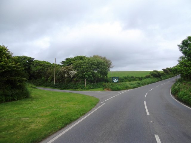
Road junction near St.David's A road junction, just within the grid square, with the A487 road leading to St.David's. The minor road on the left leads to Trelerw and Caer Bwdy Bay.
Road junction near St.David's
A road junction, just within the grid square, with the A487 road leading to St.David's. The minor road on the left leads to Trelerw and Caer Bwdy Bay.
Porth y rhaw Porth y Rhaw at sunset on New Year's Day 2012
Porth y rhaw
Porth y Rhaw at sunset on New Year's Day 2012
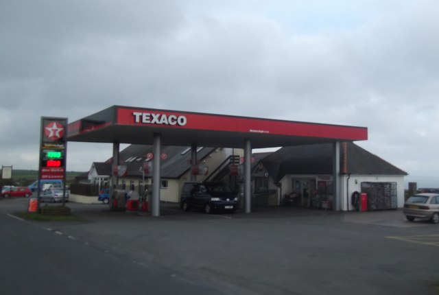
Ocean Haze Fuel Station
Pont Clegyr
Pont Clegyr
Concrete Block Building beside the A487 OS Map indicates a covered reservoir here
Concrete Block Building beside the A487
OS Map indicates a covered reservoir here
Entering Nine Wells
Entering Nine Wells
Junction for Llanungar-fach Caravan Park
A487 at Llanungar turn
A487 at Nine Wells village boundary
A487 at Fachelich turn
A487 at St David's city boundary
Solva Harbour From The Gribin, at low tide.
Solva Harbour
From The Gribin, at low tide.
St Aidans Church, Upper Solva
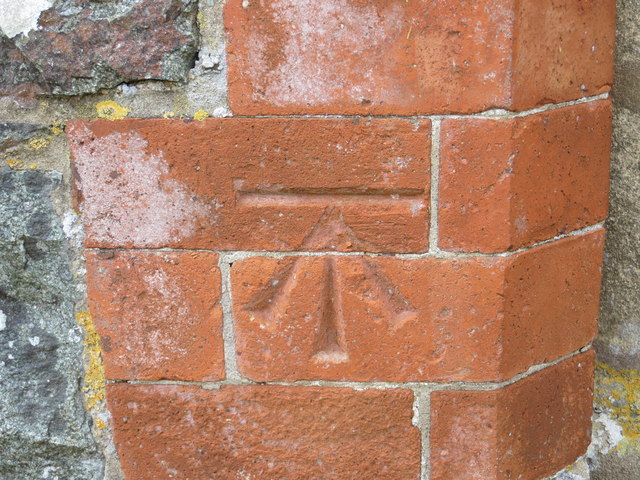
Ordnance Survey Flush Bracket 11512 This can be found on the wall of St Aidans Church.
For more detail see : <span class="nowrap"><a title="http://www.bench-marks.org.uk/bm22527" rel="nofollow ugc noopener" href="http://www.bench-marks.org.uk/bm22527">Link</a><img style="margin-left:2px;" alt="External link" title="External link - shift click to open in new window" src="https://s1.geograph.org.uk/img/external.png" width="10" height="10"/></span>
Ordnance Survey Flush Bracket 11512
This can be found on the wall of St Aidans Church. For more detail see : LinkExternal link
Ordnance Survey Cut Mark This can be found on the porch of St Aidans Church.
For more detail see : <span class="nowrap"><a title="http://www.bench-marks.org.uk/bm48759" rel="nofollow ugc noopener" href="http://www.bench-marks.org.uk/bm48759">Link</a><img style="margin-left:2px;" alt="External link" title="External link - shift click to open in new window" src="https://s1.geograph.org.uk/img/external.png" width="10" height="10"/></span>
Ordnance Survey Cut Mark
This can be found on the porch of St Aidans Church. For more detail see : LinkExternal link
Wreck and cliffs near Solva For the remains of the vessel years later, see <a href="https://www.geograph.org.uk/photo/3765269">SM7824 : Something interesting on the beach</a>.
Wreck and cliffs near Solva
For the remains of the vessel years later, see SM7824 : Something interesting on the beach.
Wreck and cliffs near Solva
Show me another place!

Morfa and Nine Wells is located at Grid Ref: SM7824 (Lat: 51.874, Lng: -5.226)

Unitary Authority: Pembrokeshire

Police Authority: Dyfed Powys

What 3 Words

///sticks.elbowing.prickly. Near St Davids, Pembrokeshire

Related Wikis

Dwrhyd Pit

Dwrhyd Pit is a Site of Special Scientific Interest (or SSSI) in Pembrokeshire, South Wales. It has been designated as a Site of Special Scientific Interest...

RAF St Davids

Royal Air Force St Davids, or more simply RAF St Davids, is a former Royal Air Force station, near the city of St Davids, Pembrokeshire, Wales, in the...

Whitchurch, Pembrokeshire

Whitchurch (Welsh: Tregroes, lit. "Town of the Cross") is a small village and parish (Plwy'r Groes, lit. "Parish of the Cross") in north-western Pembrokeshire...

Caerfai Bay

Caerfai Bay is a rocky cove on the north coast of St Brides Bay near St Davids in Pembrokeshire, West Wales. It is enclosed by steep varicoloured cliffs...

Nearby Amenities

Located within 500m of 51.874,-5.226
Source: OS_Opendata_Vectormap_District
Lat/Long: 51.8728601/-5.2304769
Source: OS_Opendata_Vectormap_District
Lat/Long: 51.8729022/-5.2305941
Source: OS_Opendata_Vectormap_District
Lat/Long: 51.8730095/-5.2308733
Source: OS_Opendata_Vectormap_District
Lat/Long: 51.8730426/-5.2308844
Source: OS_Opendata_Vectormap_District
Lat/Long: 51.873134/-5.2308839
Ogof Mwn
Natural: cave_entrance
Lat/Long: 51.8734263/-5.225596
Ogof y Ffos
Natural: cave_entrance
Lat/Long: 51.8732845/-5.2311593
Natural: cave_entrance
Lat/Long: 51.8731387/-5.2299898
The data included in this document is from www.openstreetmap.org. The data is made available under ODbL.

Have you been to Morfa and Nine Wells?

Leave your review of Morfa and Nine Wells below (or comments, questions and feedback).