Llandruidion

Settlement in Pembrokeshire

Wales

Llandruidion

Solva harbour Low tide at Solva harbour, lime kilns on the far shore.
Solva harbour Credit: E Gammie

Llandruidion is a small village located in the county of Pembrokeshire, Wales. Situated in the southwestern part of the country, it is surrounded by picturesque countryside and boasts a tranquil and rural setting. The village is positioned approximately 8 miles northeast of the town of Haverfordwest.

Llandruidion is characterized by its charming and traditional Welsh architecture, with many stone cottages and buildings dotting the landscape. The village is home to a close-knit community, with a small population of friendly and welcoming residents. This creates a warm and welcoming atmosphere for both locals and visitors alike.

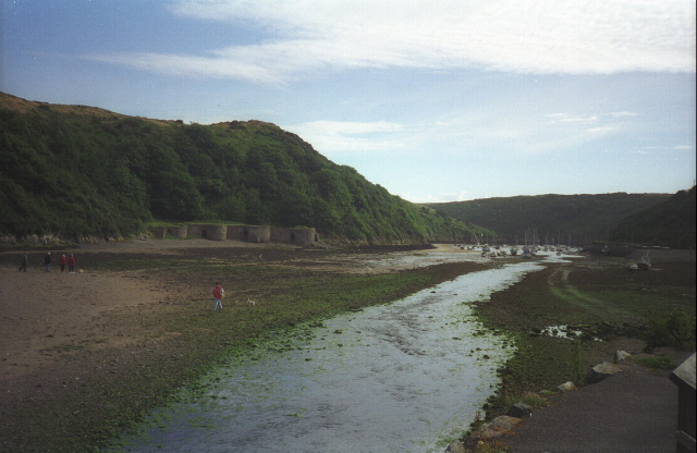
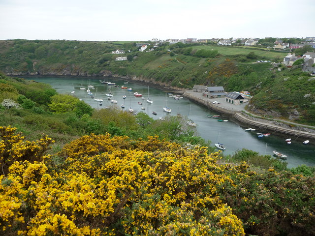
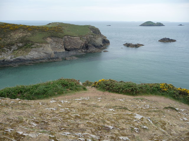
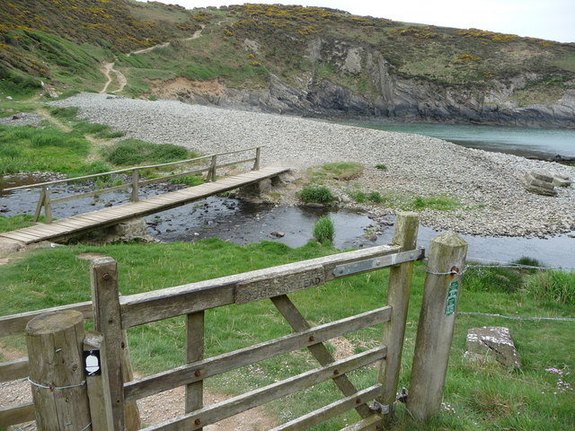
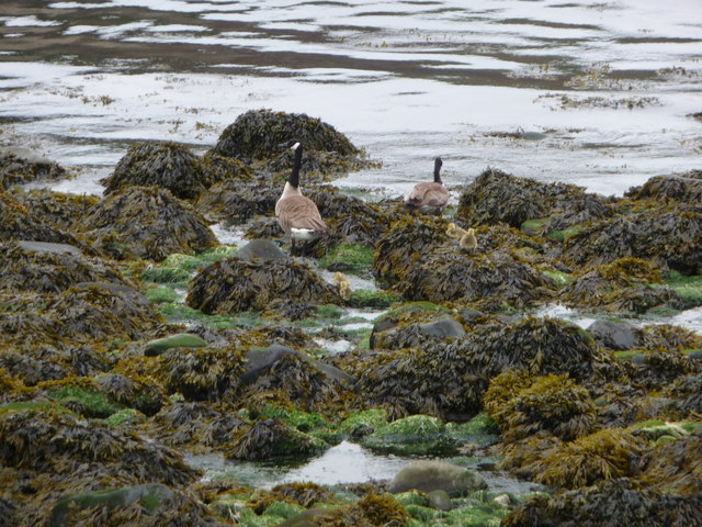
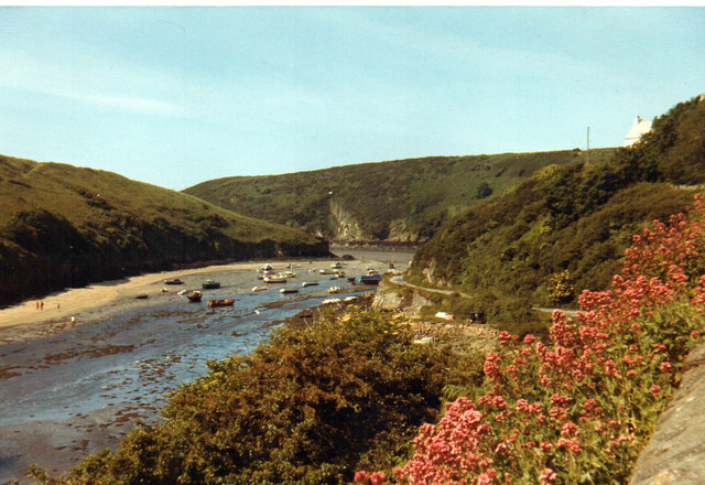
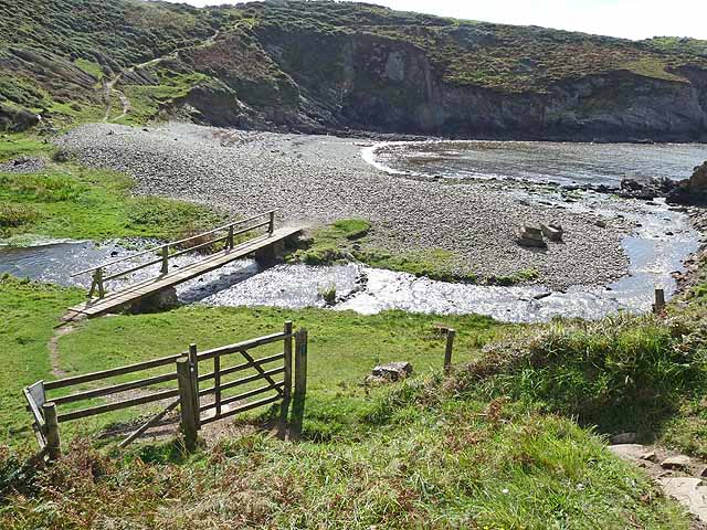
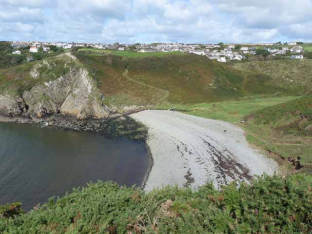
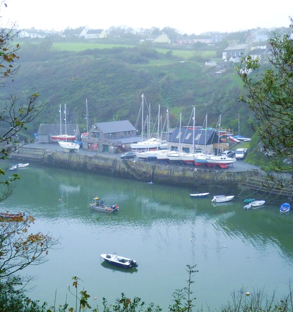
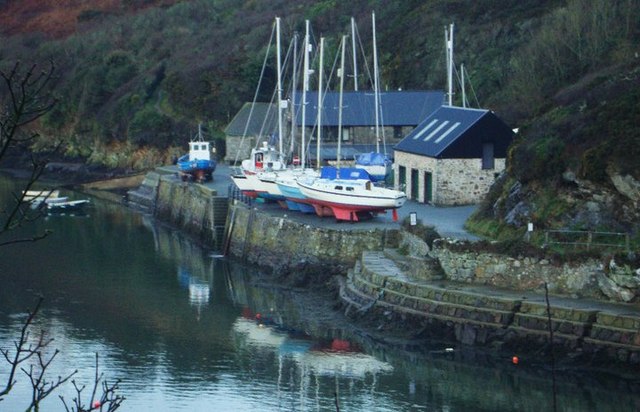
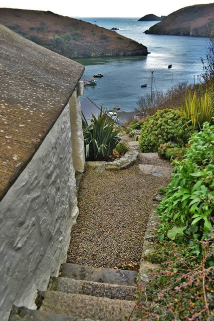
The village is known for its beautiful natural surroundings, offering stunning views of rolling hills and green pastures. It is an ideal location for outdoor enthusiasts, with numerous walking trails and cycling routes crisscrossing the area. The nearby coastline, including the Pembrokeshire Coast National Park, provides opportunities for coastal walks and water-based activities.

Despite its small size, Llandruidion has a rich history, with evidence of Bronze Age settlements in the area. The village also features a historic church, St. Brynach's Church, which dates back to the 12th century. This architectural gem is a popular attraction for those interested in heritage and culture.

While Llandruidion may be a peaceful and idyllic village, it is conveniently located within reach of larger towns and amenities. The nearby town of Haverfordwest offers a range of services, including shops, restaurants, and leisure facilities.

Overall, Llandruidion is a charming and tranquil village, perfect for those seeking a peaceful retreat in the heart of the Welsh countryside.

If you have any feedback on the listing, please let us know in the comments section below.

Llandruidion Images

Images are sourced within 2km of 51.87465/-5.219737 or Grid Reference SM7824. Thanks to Geograph Open Source API. All images are credited.

Solva harbour Low tide at Solva harbour, lime kilns on the far shore.
Solva harbour
Low tide at Solva harbour, lime kilns on the far shore.
Solva harbour from Gribin The houses of Upper Solva lie above the inlet, some overlooking the picturesque harbour.
Solva harbour from Gribin
The houses of Upper Solva lie above the inlet, some overlooking the picturesque harbour.
Rocks and islands off Solva harbour Beyond Penrhyn Head are St. Elvis' Rock and Black Rock and out to sea is larger Green Scar with The Mare and Black Scar each side. Quite a coastline.
Rocks and islands off Solva harbour
Beyond Penrhyn Head are St. Elvis' Rock and Black Rock and out to sea is larger Green Scar with The Mare and Black Scar each side. Quite a coastline.
Gate and footbridge at Gwadn The pebbly storm beach here is interesting and it's a lovely spot.
Gate and footbridge at Gwadn
The pebbly storm beach here is interesting and it's a lovely spot.
Canada Geese with goslings on Gwadn This little family waddled off seawards at my approach, just as well as a dog off its lead came in a few minutes later.
Canada Geese with goslings on Gwadn
This little family waddled off seawards at my approach, just as well as a dog off its lead came in a few minutes later.
Solva 1971
Solva 1971
Footbridge at Gwadn Bay A steep descent on the Pembrokeshire Coast Path to cross this stream is immediately followed by a steep climb.
Footbridge at Gwadn Bay
A steep descent on the Pembrokeshire Coast Path to cross this stream is immediately followed by a steep climb.
Gwadn Bay A steep descent on the Pembrokeshire Coast Path to cross this deeply incised valley with stony beach is immediately followed by a steep climb. Solva village can be seen in the distance.
Gwadn Bay
A steep descent on the Pembrokeshire Coast Path to cross this deeply incised valley with stony beach is immediately followed by a steep climb. Solva village can be seen in the distance.
Solva quay Solva quay was once busy with commercial traffic and fishing boats, but is now mainly concerned with pleasure craft.
Solva quay
Solva quay was once busy with commercial traffic and fishing boats, but is now mainly concerned with pleasure craft.
Boats at Solva Quay Awaiting their winter service
Boats at Solva Quay
Awaiting their winter service
The Gribin from Gwadn Beach Solva is a harbour at the end of a long narrow tidal inlet. At sometime in the past there must have been two parallel inlets separated by the steep headland of the Gribbin but the easternmost of these inlets, the one pictured here, has long since silted up and become a long narrow strip of flat grassland at the bottom of a steep valley.
The Gribin from Gwadn Beach
Solva is a harbour at the end of a long narrow tidal inlet. At sometime in the past there must have been two parallel inlets separated by the steep headland of the Gribbin but the easternmost of these inlets, the one pictured here, has long since silted up and become a long narrow strip of flat grassland at the bottom of a steep valley.
Part of Solva harbour at low tide The many boats here lie dormant awaiting the return of the sea.
Part of Solva harbour at low tide
The many boats here lie dormant awaiting the return of the sea.
Harbour from Penyraber On a glorious midwinter morning
Harbour from Penyraber
On a glorious midwinter morning
Rowing boats, Solva On the north side of the River Solva.
Rowing boats, Solva
On the north side of the River Solva.
The estuary of the River Solva at low tide Looking out onto St Brides Bay.
The estuary of the River Solva at low tide
Looking out onto St Brides Bay.
Kayaks, Solva Stored at Trinity Quay <a title="https://www.geograph.org.uk/photo/1534410" href="https://www.geograph.org.uk/photo/1534410">Link</a> .
Kayaks, Solva
Stored at Trinity Quay Link .
Yachts beside the River Solva at low tide
Bae Gwadn Bay Cerddwyr yn dringo lan o Fae Gwadn.

Walkers ascending from Gwadn Bay.
Bae Gwadn Bay
Cerddwyr yn dringo lan o Fae Gwadn. Walkers ascending from Gwadn Bay.
Show me another place!

Llandruidion is located at Grid Ref: SM7824 (Lat: 51.87465, Lng: -5.219737)

Unitary Authority: Pembrokeshire

Police Authority: Dyfed Powys

Also known as: Llandridian

What 3 Words

///parading.recount.motorist. Near St Davids, Pembrokeshire

Related Wikis

Dwrhyd Pit

Dwrhyd Pit is a Site of Special Scientific Interest (or SSSI) in Pembrokeshire, South Wales. It has been designated as a Site of Special Scientific Interest...

RAF St Davids

Royal Air Force St Davids, or more simply RAF St Davids, is a former Royal Air Force station, near the city of St Davids, Pembrokeshire, Wales, in the...

Whitchurch, Pembrokeshire

Whitchurch (Welsh: Tregroes, lit. "Town of the Cross") is a small village and parish (Plwy'r Groes, lit. "Parish of the Cross") in north-western Pembrokeshire...

Solva

Solva (Welsh: Solfach) is a village, community and electoral ward in Pembrokeshire, Wales. The village comprises principally Lower Solva and Upper Solva...

Nearby Amenities

Located within 500m of 51.87465,-5.219737
Source: OS_Opendata_Vectormap_District
Lat/Long: 51.8728603/-5.2172371
Source: OS_Opendata_Vectormap_District
Lat/Long: 51.873032/-5.2172303
Source: OS_Opendata_Vectormap_District
Lat/Long: 51.8729772/-5.2184569
Source: OS_Opendata_Vectormap_District
Lat/Long: 51.8731363/-5.2182131
Source: OS_Opendata_Vectormap_District
Lat/Long: 51.873183/-5.2171912
Source: OS_Opendata_Vectormap_District
Lat/Long: 51.8732291/-5.2179315
Source: OS_Opendata_Vectormap_District
Lat/Long: 51.8733432/-5.2177891
Ogof Mwn
Natural: cave_entrance
Lat/Long: 51.8734263/-5.225596
The data included in this document is from www.openstreetmap.org. The data is made available under ODbL.

Have you been to Llandruidion?

Leave your review of Llandruidion below (or comments, questions and feedback).