Maenporth

Beach in Cornwall

England

Maenporth

The Mexican tall ship 'Cuauhtemoc' Leaving Falmouth during the 2008 Funchal 500 Tall Ships Regatta.
The Mexican tall ship 'Cuauhtemoc' Credit: Rod Allday

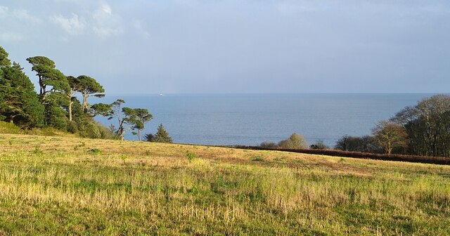
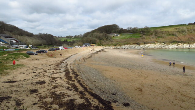
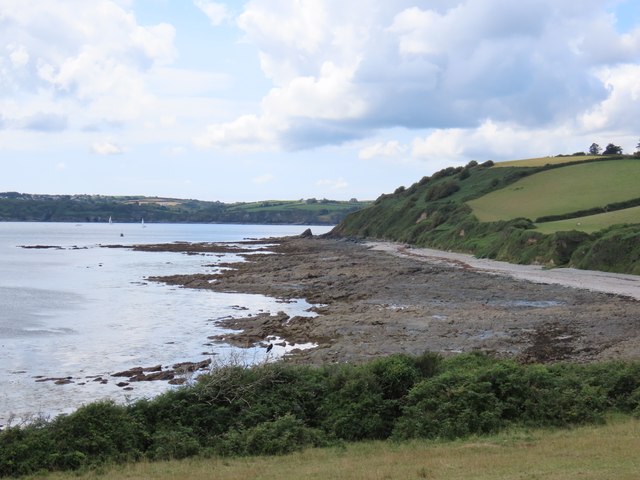
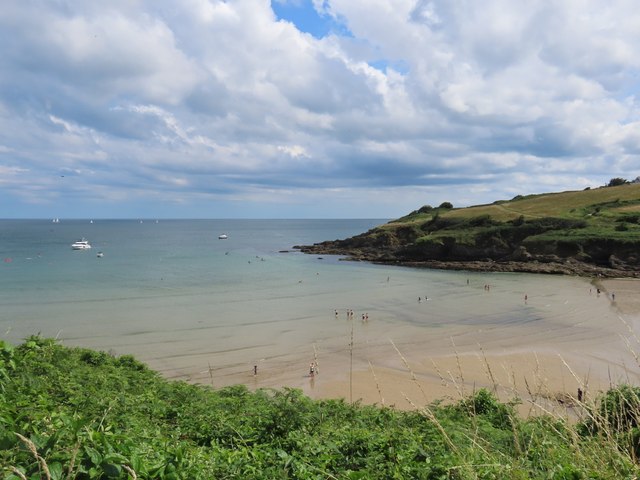
Maenporth is a picturesque beach located on the south coast of Cornwall, England. Situated just a few miles from the popular town of Falmouth, it is a favored destination for locals and tourists alike. The beach is set in a sheltered cove, surrounded by verdant cliffs and offering breathtaking views of the crystal-clear waters of the English Channel.

The sandy beach at Maenporth stretches for approximately 100 meters, providing ample space for sunbathing and relaxation. During low tide, rock pools are exposed, offering an opportunity for exploration and discovery of marine life. The beach is also popular for water sports enthusiasts, with kayaking, paddleboarding, and sailing being particularly enjoyed in the calm waters.

The beach is well-equipped with facilities, including a car park, toilets, and a café that serves refreshments and snacks. Lifeguards are present during peak seasons to ensure the safety of beachgoers, making it an ideal destination for families with children. Dogs are welcome on the beach year-round, but there are restrictions during the summer months.

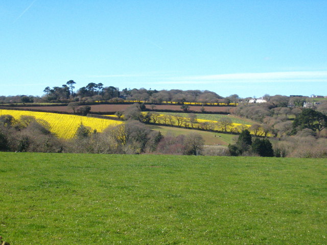
Maenporth is surrounded by stunning coastal walks, providing visitors with the opportunity to explore the beautiful countryside and enjoy panoramic views of the coastline. The nearby Helford River, with its charming creeks and estuaries, is also easily accessible and offers various activities such as boat trips and fishing.

Overall, Maenporth beach offers a tranquil and idyllic setting, combining natural beauty, recreational activities, and convenient amenities, making it a must-visit destination for those seeking a peaceful seaside experience in Cornwall.

If you have any feedback on the listing, please let us know in the comments section below.
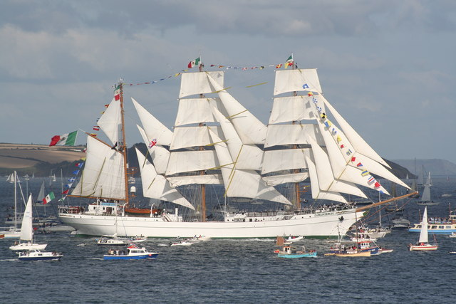
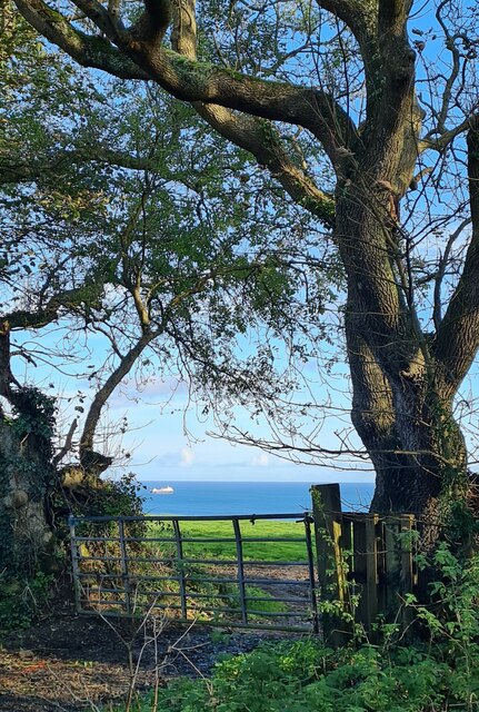
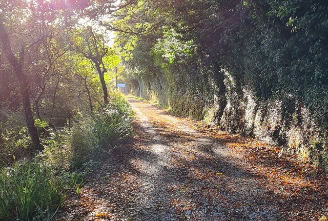
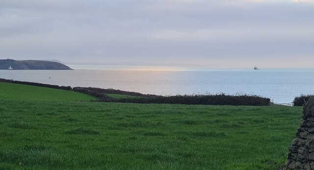
Maenporth Images

Images are sourced within 2km of 50.125462/-5.0924097 or Grid Reference SW7929. Thanks to Geograph Open Source API. All images are credited.

The Mexican tall ship 'Cuauhtemoc' Leaving Falmouth during the 2008 Funchal 500 Tall Ships Regatta.
The Mexican tall ship 'Cuauhtemoc'
Leaving Falmouth during the 2008 Funchal 500 Tall Ships Regatta.
Field gate at Meudon Farm
Autumn afternoon sun on the track in the valley at Maenporth
Field at Trerose Looking across Falmouth Bay to St Anthony Head.
Field at Trerose
Looking across Falmouth Bay to St Anthony Head.
Field lying fallow at Chenhalls This field has often been used for the growing of daffodils - see <a href="https://www.geograph.org.uk/photo/4325828">SW7828 : Rows of daffodils at Chenhalls</a>.
Field lying fallow at Chenhalls
This field has often been used for the growing of daffodils - see SW7828 : Rows of daffodils at Chenhalls.
The Proclamation of the Accession of His Majesty King Charles III at 6.00pm on Sunday 11th November 2022 in Mawnan Smith Declared by the Chairman of Mawnan Parish Council on the steps of the Great War Memorial Hall.
The Proclamation of the Accession of His Majesty King Charles III at 6.00pm on Sunday 11th November 2022 in Mawnan Smith
Declared by the Chairman of Mawnan Parish Council on the steps of the Great War Memorial Hall.
Western National bus on Maenporth Road Western National bus drivers would have been well used to steering full sized vehicles along narrow Cornish lanes - and usually did so at a brisk pace. Cars and pedestrians were well advised to just get out of the way and here the photographer has had to more or less bury himself in the hedgerow to avoid a Bristol RE storming up the hill from Maenporth beach. In 1977 the 564 ran this way three times a day as a summer only variant of the main service between Falmouth and Helford Passage. The bus itself, ATA764L, would have been about five years old at the time and remained with Western National until 1986 when it was sold to Chase of Chasetown in Staffordshire; it subsequently moved on to Express Motors of Bontnewydd before being scrapped following an accident in 1990.
Western National bus on Maenporth Road
Western National bus drivers would have been well used to steering full sized vehicles along narrow Cornish lanes - and usually did so at a brisk pace. Cars and pedestrians were well advised to just get out of the way and here the photographer has had to more or less bury himself in the hedgerow to avoid a Bristol RE storming up the hill from Maenporth beach. In 1977 the 564 ran this way three times a day as a summer only variant of the main service between Falmouth and Helford Passage. The bus itself, ATA764L, would have been about five years old at the time and remained with Western National until 1986 when it was sold to Chase of Chasetown in Staffordshire; it subsequently moved on to Express Motors of Bontnewydd before being scrapped following an accident in 1990.
Mawnan Smith The centre of this Cornish village is dominated by its thatched pub, the Red Lion. Here in the summer of 1977 it was decorated with a union flag and bunting to celebrate the silver jubilee of Queen Elizabeth II. Devenish owned a large estate of west Cornwall pubs in the 1970s - the beers were brewed at Redruth - but the company no longer exists. The road ahead through the village leads to Helford Passage. Note the Barclays Bank sign on the right of the picture; it seems hard to believe now, in an age when banks are closing branches in quite large towns, that they once had a presence in such rural places.
Mawnan Smith
The centre of this Cornish village is dominated by its thatched pub, the Red Lion. Here in the summer of 1977 it was decorated with a union flag and bunting to celebrate the silver jubilee of Queen Elizabeth II. Devenish owned a large estate of west Cornwall pubs in the 1970s - the beers were brewed at Redruth - but the company no longer exists. The road ahead through the village leads to Helford Passage. Note the Barclays Bank sign on the right of the picture; it seems hard to believe now, in an age when banks are closing branches in quite large towns, that they once had a presence in such rural places.
Beach at Maenporth near Falmouth
St. Edward the Confessor church
St Michael's Church
St Michael's Church
Mawnan Methodist Church
Rocky coast near Rosemullion Head
View along the coast from Rosemullion Head
Maenporth Beach
Maenporth Beach
Field at Roscarrack Looking across Maen Valley to daffodil fields at Budock.
Field at Roscarrack
Looking across Maen Valley to daffodil fields at Budock.
Sunny Cove Looking down from the coastal path towards Sunny Cove, backed by Newporth Head.  In the distance , left, is our first view of Rosemullion Head <a href="https://www.geograph.org.uk/gridref/SW7927">SW7927</a>
Sunny Cove
Looking down from the coastal path towards Sunny Cove, backed by Newporth Head. In the distance , left, is our first view of Rosemullion Head SW7927
Coast path at Newporth Head The three points in the distance are, from near to far, Rosemullion Head <a href="https://www.geograph.org.uk/gridref/SW7927">SW7927</a>, Nare Point <a href="https://www.geograph.org.uk/gridref/SW7925">SW7925</a> and Manacle Point <a href="https://www.geograph.org.uk/gridref/SW8121">SW8121</a>.  The kissing gate we are going through has a number of extra bands of metal to strengthen it.
Coast path at Newporth Head
The three points in the distance are, from near to far, Rosemullion Head SW7927, Nare Point SW7925 and Manacle Point SW8121. The kissing gate we are going through has a number of extra bands of metal to strengthen it.
Show me another place!

Maenporth is located at Grid Ref: SW7929 (Lat: 50.125462, Lng: -5.0924097)

Unitary Authority: Cornwall

Police Authority: Devon and Cornwall

What 3 Words

///pace.bands.tooth. Near Falmouth, Cornwall

Related Wikis

Maenporth

Maenporth (Cornish: Meyn Borth, meaning stones cove) is a cove and beach in west Cornwall, England. It is situated approximately two miles (3 km) south...

Bareppa

Bareppa is a hamlet in west Cornwall, England, United Kingdom, three miles (5 km) southwest of Falmouth. It is in the civil parish of Mawnan. == References... ==

Carlidnack

Carlidnack (or Carlinack) is a hamlet in the parish of Mawnan, Cornwall, England. Carlidnack lies 2.7 miles (4.3 km) south-west of Falmouth on a road...
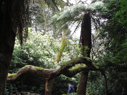
Penjerrick Garden

Penjerrick Garden -- often referred to as "Cornwall's true jungle garden"—lies between Budock Water and Mawnan Smith, near Falmouth, United Kingdom. Established...

Nearby Amenities

Located within 500m of 50.125462,-5.0924097
Maenporth
Is In: Cornwall, England, UK
Name Kw: Meynporth
Place: locality
Lat/Long: 50.1255304/-5.0915212
Barrier: kissing_gate
Foot: yes
Lat/Long: 50.1237684/-5.0933975
Cafe
Life's A Beach
Addr City: Falmouth
Addr Housename: Maenporth Beach Cafe
Addr Place: Maenporth
Addr Postcode: TR11 5HN
Fhrs Id: 1204632
Indoor Seating: yes
Outdoor Seating: yes
Source Addr: FHRS Open Data
Lat/Long: 50.1260196/-5.0943013
Restaurant
The Cove
Addr City: Falmouth
Addr Housename: The Cove Bar And Restaurant
Addr Place: Maenporth
Addr Postcode: TR11 5HN
Addr Street: Maenporth Estate
Cuisine: regional
Fhrs Id: 510835
Lat/Long: 50.125144/-5.0947747
Bench
Backrest: no
Material: wood
Lat/Long: 50.1227878/-5.0960433
Bench
Backrest: no
Material: wood
Survey Date: 2023-07-16
Lat/Long: 50.1239623/-5.0901941
Bus Stop
Maenporth Beach
Naptan AtcoCode: 0800COC56534
Naptan Bearing: S
Naptan CommonName: Maenporth Beach
Naptan NaptanCode: corgawap
Naptan Street: Maenporth Road
Naptan Verified: no
Source: naptan_import
Lat/Long: 50.1252206/-5.0942702
Toilets
Lat/Long: 50.1262727/-5.0944966
Post Box
Brand: Royal Mail
Brand Wikidata: Q638098
Collection Times: Mo-Fr 09:00, Sa 07:00; Su off
Drive Through: no
Operator: Royal Mail
Operator Wikidata: Q638098
Post Box Design: type_b
Post Box Type: pillar
Ref: TR11 69D
Royal Cypher: EIIR
Royal Cypher Wikidata: Q33102113
Source: survey;streetlevel imagery;aerial imagery
Lat/Long: 50.1252621/-5.094274
Bench
Lat/Long: 50.1244031/-5.0934837
WW2 Pillbox
Building: bunker
Bunker Type: pillbox
Military: bunker
Lat/Long: 50.1265675/-5.0929485
WW2 Pillbox
Building: bunker
Bunker Type: pillbox
Military: bunker
Lat/Long: 50.1237946/-5.0936164
WW2 Pillbox
Building: bunker
Bunker Type: pillbox
Military: bunker
Lat/Long: 50.12616/-5.0936969
Power: pole
Lat/Long: 50.1224853/-5.0965083
Power: pole
Lat/Long: 50.1236254/-5.0953764
Power: pole
Lat/Long: 50.1237957/-5.0945208
Power: pole
Lat/Long: 50.1237303/-5.0929919
Power: pole
Lat/Long: 50.1228842/-5.0929168
Life Ring
Emergency: life_ring
Survey Date: 2023-07-16
Lat/Long: 50.1258172/-5.0940345
Fire Hydrant
Emergency: fire_hydrant
Survey Date: 2023-07-16
Lat/Long: 50.1224052/-5.0931598
Waste Basket
Survey Date: 2023-07-16
Lat/Long: 50.1260081/-5.0945688
Fire Hydrant
Emergency: fire_hydrant
Survey Date: 2023-07-16
Lat/Long: 50.126203/-5.0946774
Life Ring
Emergency: life_ring
Survey Date: 2023-07-16
Lat/Long: 50.1253989/-5.0939053
Life Ring
Emergency: life_ring
Survey Date: 2023-07-16
Lat/Long: 50.1245242/-5.0933461
Waste Basket
Survey Date: 2023-07-16
Lat/Long: 50.1224095/-5.0932191
Fire Hydrant
Emergency: fire_hydrant
Survey Date: 2023-07-16
Lat/Long: 50.1242348/-5.0934159
Maenporth Beach
Natural: beach
Lat/Long: 50.1250925/-5.0937129
The data included in this document is from www.openstreetmap.org. The data is made available under ODbL.

Have you been to Maenporth?

Leave your review of Maenporth below (or comments, questions and feedback).