Bond Clough Hill

Hill, Mountain in Yorkshire

England

Bond Clough Hill

The Pennine Way near Duke Top
The Pennine Way near Duke Top Credit: Dave Kelly

Bond Clough Hill is a prominent natural feature located in the county of Yorkshire, England. Situated within the renowned Yorkshire Dales National Park, this hill offers stunning views and is a popular destination for outdoor enthusiasts and nature lovers alike.

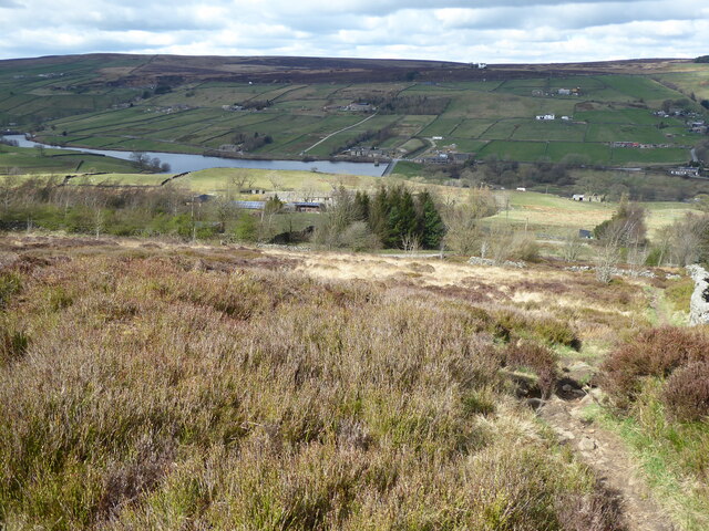
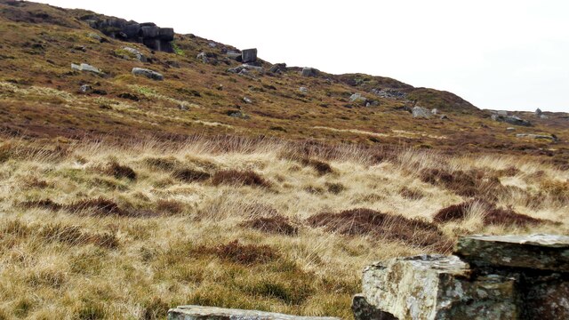
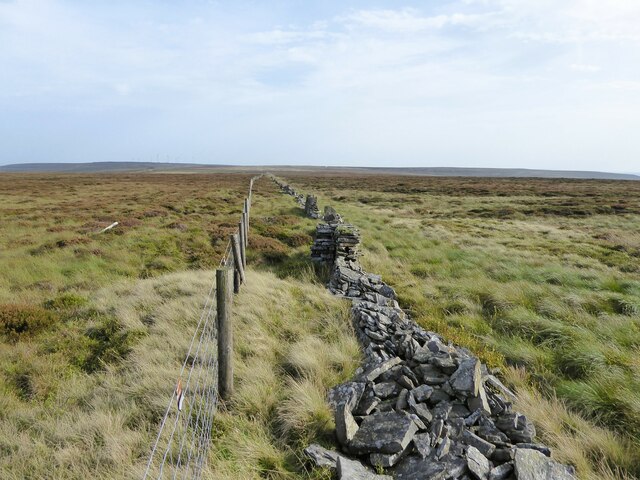
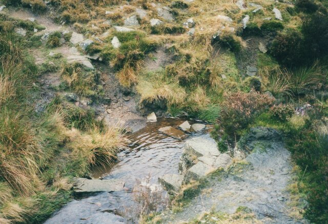
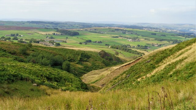
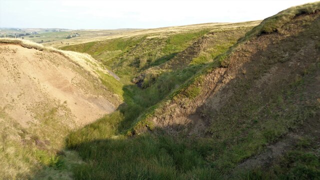
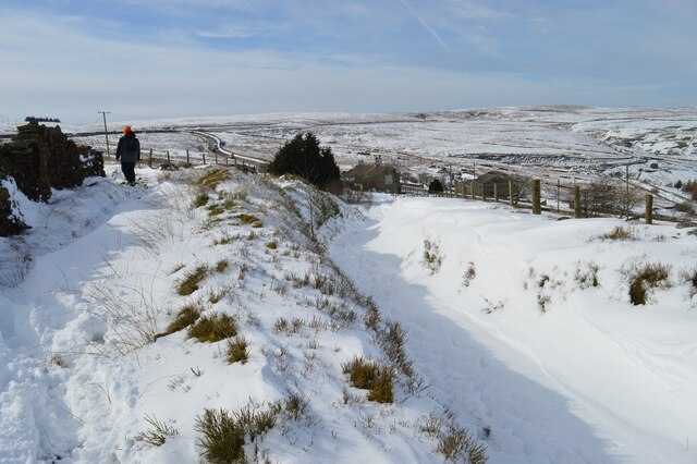
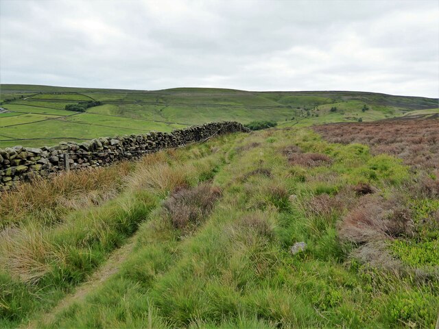
Rising to an elevation of approximately 437 meters (1,434 feet), Bond Clough Hill offers a challenging but rewarding climb to its summit. The hill is characterized by its steep slopes, which are covered with heather and grasses, creating a picturesque landscape. The surrounding area is also dotted with limestone outcrops and scattered trees, adding to its natural beauty.

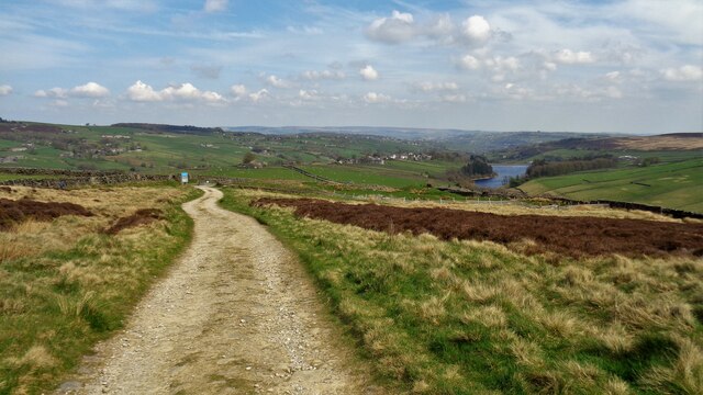
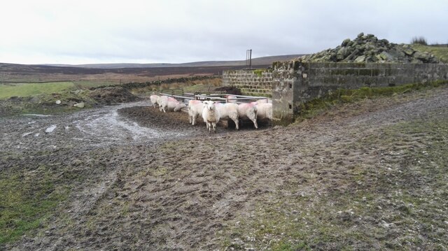
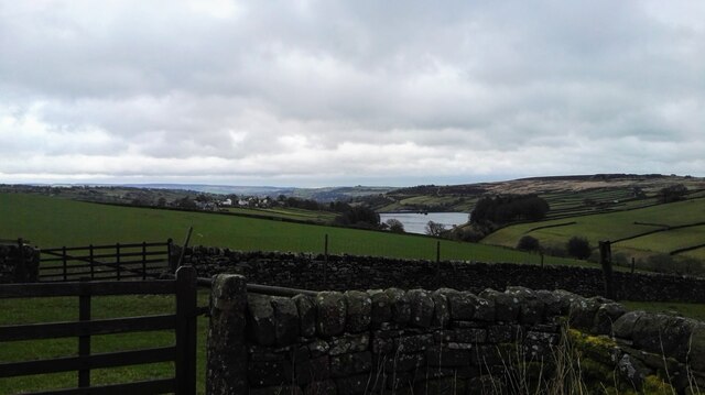
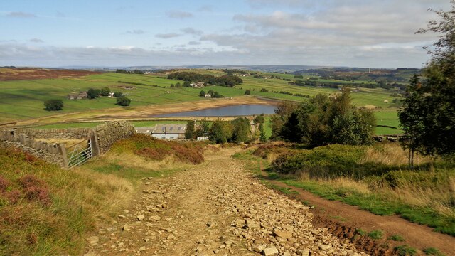
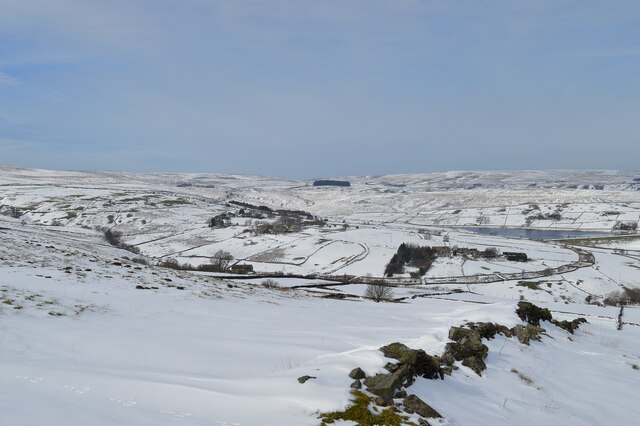
One of the highlights of Bond Clough Hill is the breathtaking panoramic views it offers from the top. On clear days, visitors can admire the vast expanse of the Yorkshire Dales, with its rolling hills, lush green valleys, and meandering rivers. The hill's elevated position also provides an ideal vantage point for observing the local wildlife, including various bird species and grazing sheep.

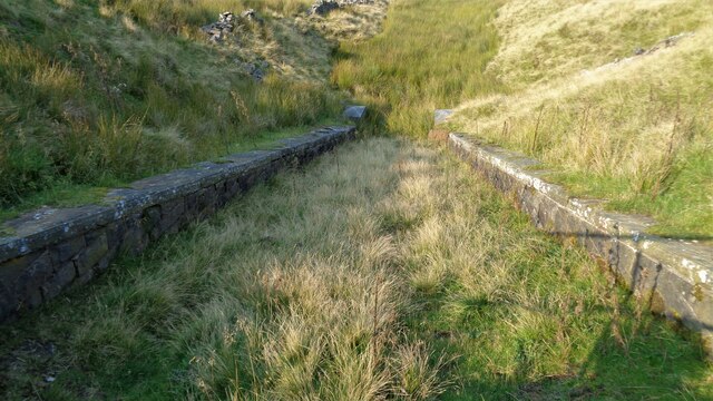
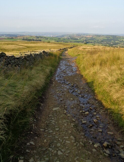
Hiking and walking are popular activities on Bond Clough Hill, with several well-marked trails leading to its summit. These trails cater to different fitness levels, making it accessible to both experienced hikers and beginners. Additionally, the hill is part of a wider network of footpaths and bridleways, allowing visitors to extend their exploration of the Yorkshire Dales.

Overall, Bond Clough Hill is a stunning natural landmark that offers a rewarding outdoor experience. Its challenging yet accessible trails, coupled with its breathtaking views, make it a must-visit destination for anyone seeking to immerse themselves in Yorkshire's rugged beauty.

If you have any feedback on the listing, please let us know in the comments section below.

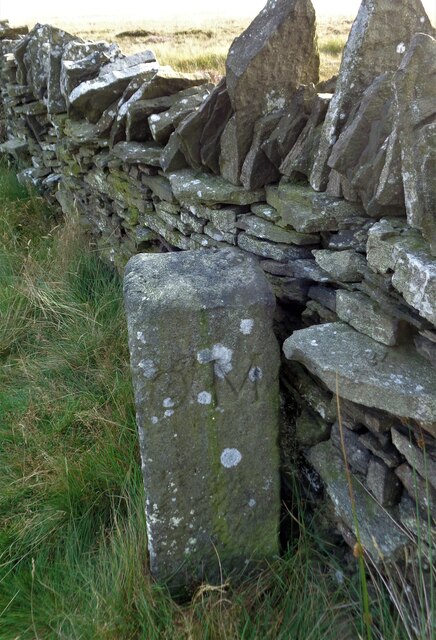
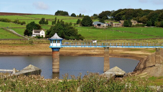
Bond Clough Hill Images

Images are sourced within 2km of 53.810011/-1.9982167 or Grid Reference SE0034. Thanks to Geograph Open Source API. All images are credited.

The Pennine Way near Duke Top
Track off The Height The access land finishes at the sign and gate
Track off The Height
The access land finishes at the sign and gate
Part of the Master Stones On Flaight Hill northern flank
Part of the Master Stones
On Flaight Hill northern flank
Shooters' Cabins Former railway van wagons used by shooters near Harbour Lodge
Shooters' Cabins
Former railway van wagons used by shooters near Harbour Lodge
The Deep Nitch and The Waste OS maps have the Deep Nitch to the left of the fence line and The Waste to the right in this view. To the right following the fence line is an unmarked path heading to Top of Stairs.
The Deep Nitch and The Waste
OS maps have the Deep Nitch to the left of the fence line and The Waste to the right in this view. To the right following the fence line is an unmarked path heading to Top of Stairs.
Crossing South Dean Beck Another photo taken 17 years later shows that a bridge had been provided since I came this way in 2002 <a href="https://www.geograph.org.uk/photo/6165153">SD9835 : Footbridges at Withens Foot, Haworth</a>.
Crossing South Dean Beck
Another photo taken 17 years later shows that a bridge had been provided since I came this way in 2002 SD9835 : Footbridges at Withens Foot, Haworth.
Sheep at Bully Trees Farm Sheep sheltering from the wind behind a wall at Bully Trees Farm above Lower Laithe Reservoir.
Sheep at Bully Trees Farm
Sheep sheltering from the wind behind a wall at Bully Trees Farm above Lower Laithe Reservoir.
Lower Laithe Reservoir Looking east from Back Lane just outside of Stanbury onto Lower Laithe Reservoir.
Lower Laithe Reservoir
Looking east from Back Lane just outside of Stanbury onto Lower Laithe Reservoir.
Grinding Stone Hole Viewed from Thornton Moor Reservoir conduit path
Grinding Stone Hole
Viewed from Thornton Moor Reservoir conduit path
Overflow into Sun Hill Clough From the Thornton Moor Reservoir conduit. Quite a steep masonry spillway
Overflow into Sun Hill Clough
From the Thornton Moor Reservoir conduit. Quite a steep masonry spillway
Deep Dyke from Stairs Lane A badly eroded valley
Deep Dyke from Stairs Lane
A badly eroded valley
View north down Stairs Lane The Thornton Moor Reservoir conduit path crosses where there is a ray of sunshine on the lane
View north down Stairs Lane
The Thornton Moor Reservoir conduit path crosses where there is a ray of sunshine on the lane
Stone Heap Stoop At the top of Stairs Lane, a boundary stone
Stone Heap Stoop
At the top of Stairs Lane, a boundary stone
Valve Tower, Leeshaw Reservoir Under drought conditions
Valve Tower, Leeshaw Reservoir
Under drought conditions
Bodkin Lane View from where the Stubden Reservoir Conduit crosses the lane in a culvert. Leeshaw Reservoir is in the distance
Bodkin Lane
View from where the Stubden Reservoir Conduit crosses the lane in a culvert. Leeshaw Reservoir is in the distance
Winter on the moors Looking towards Leeshawe Reservoir with Haworth Moor well beyond
Winter on the moors
Looking towards Leeshawe Reservoir with Haworth Moor well beyond
Winter on the moors Looking from Intake Lane across the Waggon and Horses pub to Hebden Bridge Road and Sun Hill beyond
Winter on the moors
Looking from Intake Lane across the Waggon and Horses pub to Hebden Bridge Road and Sun Hill beyond
Millennium Way on Haworth Moor A named walk viewed west of Drop Farm
Millennium Way on Haworth Moor
A named walk viewed west of Drop Farm
Show me another place!

Bond Clough Hill is located at Grid Ref: SE0034 (Lat: 53.810011, Lng: -1.9982167)

Division: West Riding

Unitary Authority: Bradford

Police Authority: West Yorkshire

What 3 Words

///reaction.emblem.shadowing. Near Oxenhope, West Yorkshire

Related Wikis

Top Withens

Top Withens (SD981353) (also known as Top Withins) is a ruined farmhouse near Haworth, West Yorkshire, England, which is said to have been the inspiration...

Stanbury

Stanbury is a village and former civil parish, now in the parish of Haworth and Stanbury, in the metropolitan borough of the City of Bradford in West Yorkshire...

Lower Laithe Reservoir

Lower Laithe Reservoir is a man-made upland reservoir that lies 1.2 miles (2 km) west of Haworth, West Yorkshire, England. The reservoir was initially...

Ponden Reservoir

Ponden Reservoir is an artificial upland lake in the Worth Valley, near Stanbury, West Yorkshire, England. Ponden was built as a compensation reservoir...

Ponden Hall

Ponden Hall is a farmhouse near Stanbury in West Yorkshire, England. It is famous for reputedly being the inspiration for Thrushcross Grange, the home...

Scar Top

Scar Top is a farming hamlet near the tourist village of Haworth in the City of Bradford metropolitan borough, West Yorkshire in England. It is in the...

Penistone Hill Country Park

Penistone Hill Country Park is an open space of moorland that is located to 0.31 miles (0.5 km) west of Haworth and 0.62 miles (1 km) north-west of Oxenhope...

Lumbfoot

Lumbfoot or Lumb Foot is a hamlet in the Haworth, Cross Roads and Stanbury civil parish, and the City of Bradford metropolitan district, England. It is...

Nearby Amenities

Located within 500m of 53.810011,-1.9982167
Man Made: boundary_stone
Lat/Long: 53.8101896/-2.0010815
Natural: spring
Lat/Long: 53.8135011/-1.9997715
Barrier: stile
Lat/Long: 53.8101591/-2.0009118
Information: guidepost
Route Ref: Millennium Way Circular Walk 7
Tourism: information
Lat/Long: 53.8101583/-2.0009668
Barrier: stile
Stile: stepover
Lat/Long: 53.8083822/-2.0045812
The data included in this document is from www.openstreetmap.org. The data is made available under ODbL.

Have you been to Bond Clough Hill?

Leave your review of Bond Clough Hill below (or comments, questions and feedback).