Brown Hill

Hill, Mountain in Northumberland

England

Brown Hill

Waterfall near Middleton Old Town The unnamed burn drains  through a short steep gorge into Coldgate Water.
Waterfall near Middleton Old Town Credit: Leanmeanmo

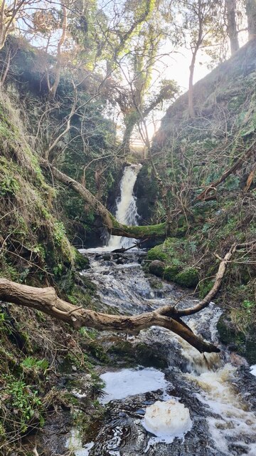
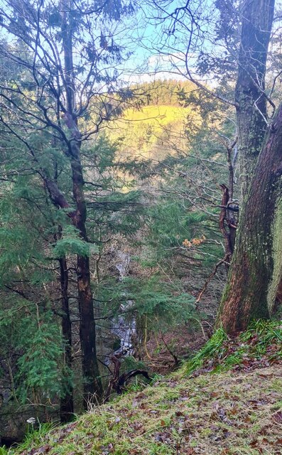
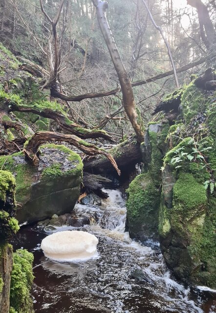
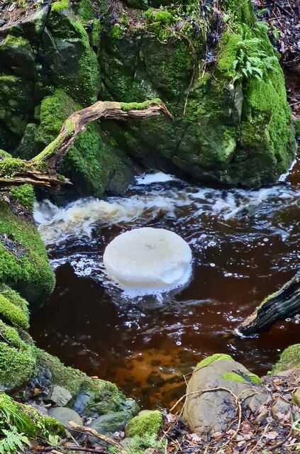
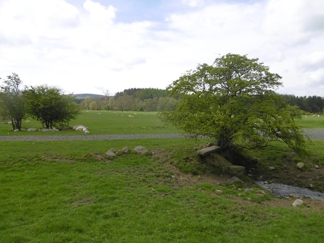
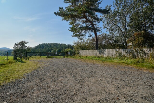
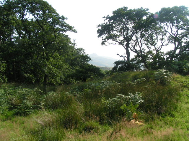
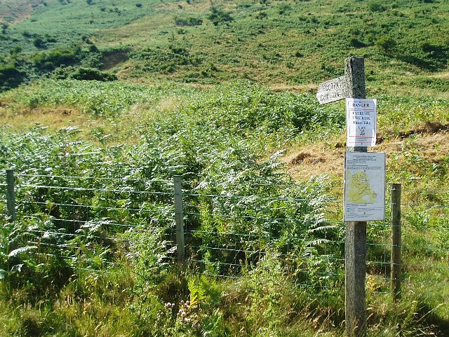
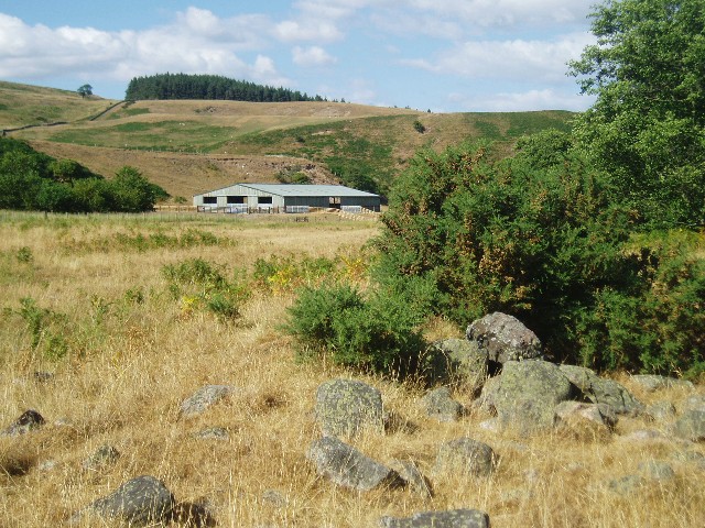
Brown Hill is a prominent hill located in the county of Northumberland, England. Situated in the northern part of the county, it forms part of the beautiful and rugged landscape of the North Pennines Area of Outstanding Natural Beauty. Rising to a height of approximately 495 meters (1,624 feet), Brown Hill offers stunning panoramic views of the surrounding countryside.

Covered in heather and grasses, the hill is known for its distinctive brownish hue, which gives it its name. It is primarily composed of sandstone and limestone, and its slopes are dotted with scattered rocks and boulders. The terrain is relatively gentle, making it accessible to hikers and outdoor enthusiasts of all levels.

The summit of Brown Hill provides an excellent vantage point from which to observe the surrounding landscape. On a clear day, one can see the rolling hills and valleys of Northumberland, as well as distant views of the Cheviot Hills to the northeast. The summit also offers a unique opportunity for birdwatching, with various species of birds, including raptors and songbirds, frequently spotted in the area.

The hill is a popular destination for outdoor activities, such as walking, hiking, and mountain biking. Several well-marked trails and footpaths traverse the hill, allowing visitors to explore its natural beauty and experience its tranquility. Brown Hill truly offers a peaceful retreat away from the hustle and bustle of urban life, providing an opportunity to immerse oneself in the stunning Northumberland countryside.

If you have any feedback on the listing, please let us know in the comments section below.

Brown Hill Images

Images are sourced within 2km of 55.520906/-2.0249969 or Grid Reference NT9825. Thanks to Geograph Open Source API. All images are credited.

Waterfall near Middleton Old Town The unnamed burn drains  through a short steep gorge into Coldgate Water.
Waterfall near Middleton Old Town
The unnamed burn drains through a short steep gorge into Coldgate Water.
Looking down gorge to Colgate Water An unnamed burn drains  through this short, deep, impressive gorge into Coldgate Water.
Looking down gorge to Colgate Water
An unnamed burn drains through this short, deep, impressive gorge into Coldgate Water.
Rotating foam pancake Created by an eddy on the unnamed burn that drains  through this short, deep gorge into Coldgate Water.
Rotating foam pancake
Created by an eddy on the unnamed burn that drains through this short, deep gorge into Coldgate Water.
Rotating foam pancake Created by an eddy on the unnamed burn that drains  through this short, deep gorge into Coldgate Water.
Rotating foam pancake
Created by an eddy on the unnamed burn that drains through this short, deep gorge into Coldgate Water.
Typical Northumbrian gate latch Not sure they're unique to Northumberland.  The two 'ears' are folded up to release the catch, gravity returns them to their rest position.
Typical Northumbrian gate latch
Not sure they're unique to Northumberland. The two 'ears' are folded up to release the catch, gravity returns them to their rest position.
Service  Station  on  A697  southbound  at  Haugh  Head The buildings beyond the garage are on Glendale Business Park
Service Station on A697 southbound at Haugh Head
The buildings beyond the garage are on Glendale Business Park
Minor  road  junction  to  Lilburn  Hill The buildings and Farmhouse on the left beyond the junction is Haugh Head Farm
Minor road junction to Lilburn Hill
The buildings and Farmhouse on the left beyond the junction is Haugh Head Farm
Ordnance Survey Cut Mark This OS cut mark can be found on the garage at North Middleton Farm. It marks a point 126.968m above mean sea level.
Ordnance Survey Cut Mark
This OS cut mark can be found on the garage at North Middleton Farm. It marks a point 126.968m above mean sea level.
The showground The Glendale Show is held on this field. Once a railway passed here.
The showground
The Glendale Show is held on this field. Once a railway passed here.
Filling station, Haugh Head Three years after <a href="https://www.geograph.org.uk/photo/3449803">NU0026 : Haugh Head</a>.
Filling station, Haugh Head
Three years after NU0026 : Haugh Head.
Jet station on A697 Heading towards Wooler.
Jet station on A697
Heading towards Wooler.
Ilderton : Track A track heads off the A697 and into the field.
Ilderton : Track
A track heads off the A697 and into the field.
Haugh Head : A697 Looking north on the A697.
Haugh Head : A697
Looking north on the A697.
Haugh Head : Lane A small lane heads off the A697.
Haugh Head : Lane
A small lane heads off the A697.
Haugh Head : A697 Looking north on the A697.
Haugh Head : A697
Looking north on the A697.
In the shelter of The Cheviot Roadside view as you enter the Harthope Valley.
In the shelter of The Cheviot
Roadside view as you enter the Harthope Valley.
Fire risk sign The extremely dry summer of 2006 has led to the risk of fire in many areas.  In this photo, a signpost pointing to the footpath to Cold Law has an extra sign pinned to it: "Danger   Extreme Fire Risk   Please take care".
Fire risk sign
The extremely dry summer of 2006 has led to the risk of fire in many areas. In this photo, a signpost pointing to the footpath to Cold Law has an extra sign pinned to it: "Danger Extreme Fire Risk Please take care".
In the Harthope Valley View from the west bank of the Harthope Burn, south-west of Wooler.
In the Harthope Valley
View from the west bank of the Harthope Burn, south-west of Wooler.
Show me another place!

Brown Hill is located at Grid Ref: NT9825 (Lat: 55.520906, Lng: -2.0249969)

Unitary Authority: Northumberland

Police Authority: Northumbria

What 3 Words

///cubed.tinny.scribble. Near Wooler, Northumberland

Related Wikis

Earle, Northumberland

Earle is a village and civil parish in county of Northumberland, England. It has around 20 inhabitants and is about 2 miles (3 km) from Wooler (where from...

Wooler

Wooler ( WUUL-ə) is a town in Northumberland, England. It lies on the edge of the Northumberland National Park, near the Cheviot Hills. It is a popular...

St Ninian's Catholic Church, Wooler

St Ninian’s church is a Catholic place of worship situated on Burnhouse Road in the town of Wooler in Northumberland, England. It is a Grade II listed...

Cheviot Fringe

Cheviot Fringe ( CHEE-vee-ət) is a geographical region and a Natural England designated National Character Area (or NCA) located in the county Northumberland...

Wooler railway station

Wooler railway station was a stone-built railway station serving the town of Wooler in Northumberland. It was on the Alnwick to Cornhill Branch which ran...

Humbleton Hill

Humbleton Hill is a hill in Northumberland, England, about 1.5 miles (2.4 km) west of Wooler. It is the location of the Battle of Homildon Hill of 1402...

Ilderton railway station

Ilderton railway station served the village of Ilderton, Northumberland, England from 1887 to 1953 on the Cornhill Branch. == History == The station opened...

Lilburn Tower

Lilburn Tower is a privately owned 19th-century mansion house at Lilburn, near Wooler, Northumberland. The property is a Grade II* listed building and...

Nearby Amenities

Located within 500m of 55.520906,-2.0249969
Middleton Hall
Place: locality
Lat/Long: 55.5227553/-2.0199723
Brown Hill
Place: locality
Lat/Long: 55.5209883/-2.0239262
Grimping Haugh
Place: locality
Lat/Long: 55.5186386/-2.0288173
The Park
Place: locality
Lat/Long: 55.5209206/-2.0202562
Firwood Country Bed & Breakfast
Addr City: Middleton Hall
Addr Postcode: NE71 6RD
Phone: +44 1668 283699
Tourism: guest_house
Website: www.firwoodhouse.co.uk
Lat/Long: 55.5242614/-2.0201254
Post Box
Ref: NE71 32
Lat/Long: 55.5234511/-2.0190365
Direction: WSW
Generator Method: photovoltaic
Generator Output Electricity: yes
Generator Solar Modules: 12
Generator Source: solar
Generator Type: solar_photovoltaic_panel
Location: roof
Power: generator
Lat/Long: 55.5233775/-2.019926
Ford: yes
Lat/Long: 55.5188987/-2.026166
The data included in this document is from www.openstreetmap.org. The data is made available under ODbL.

Have you been to Brown Hill?

Leave your review of Brown Hill below (or comments, questions and feedback).