Horseshoe Hill

Hill, Mountain in Durham

England

Horseshoe Hill

Moorland road above Stanhope Car heading to Castleside.  To the right is Stanhope and to the left is Endundbyers
Moorland road above Stanhope Credit: Les Hull

Horseshoe Hill, also known as Durham Hill, is a prominent geographical feature located in Durham, a historic city in County Durham, England. This hill is part of the larger Pennines range, a series of rugged uplands that stretches across northern England.

Standing at an elevation of approximately 275 meters (900 feet) above sea level, Horseshoe Hill offers breathtaking panoramic views of the surrounding countryside. Its distinctive horseshoe shape, from which it derives its name, is a result of glacial action during the last Ice Age. The hill is composed mainly of sandstone and limestone, giving it a unique geological character.

Horseshoe Hill is a popular destination for outdoor enthusiasts, hikers, and nature lovers. Several footpaths and trails traverse the hill, providing opportunities for exploration and adventure. The hill's diverse flora and fauna further add to its appeal, with heather, bracken, and various wildflowers dotting the landscape.

In addition to its natural beauty, Horseshoe Hill also holds historical significance. The remains of an Iron Age hillfort, known as Maiden Castle, can be found at the summit. These ancient earthworks offer a glimpse into the region's rich past and attract archaeology enthusiasts.

Overall, Horseshoe Hill in Durham is a captivating natural landmark that offers both scenic beauty and historical intrigue. Whether one seeks sweeping vistas, outdoor activities, or a glimpse into the past, this hill has something to offer for everyone.

If you have any feedback on the listing, please let us know in the comments section below.

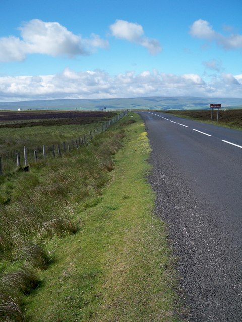
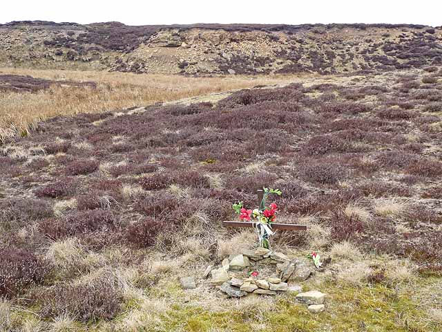
Horseshoe Hill Images

Images are sourced within 2km of 54.798924/-2.0243581 or Grid Reference NY9844. Thanks to Geograph Open Source API. All images are credited.

Moorland road above Stanhope Car heading to Castleside.  To the right is Stanhope and to the left is Endundbyers
Moorland road above Stanhope
Car heading to Castleside. To the right is Stanhope and to the left is Endundbyers
Moorland road near Hisehope Head
Edmondbyers Cross (remains of) Possibly.
Edmondbyers Cross (remains of)
Possibly.
Roadside verge on the B6278
The valley of Feldon Burn
Shallow quarry east of Horseshoe Hill This shallow and largely overgrown quarry lies immediately west of the B6278 at its junction with the road from Castleside; apparently sandstone was taken.
Shallow quarry east of Horseshoe Hill
This shallow and largely overgrown quarry lies immediately west of the B6278 at its junction with the road from Castleside; apparently sandstone was taken.
Disused quarry on Stanhope Moor A small memorial cross has been erected close to the road which crosses Stanhope Moor.
Disused quarry on Stanhope Moor
A small memorial cross has been erected close to the road which crosses Stanhope Moor.
Access road to Waskerley Reservoir This access road runs down from the summit of the B6278 on Stanhope Moor.
Access road to Waskerley Reservoir
This access road runs down from the summit of the B6278 on Stanhope Moor.
Muggleswick Common (2) Looking across the cleugh of Feldon Burn, The Middles and the cleugh of Eudon Burn towards <a href="https://www.geograph.org.uk/photo/2460658">NY9848 : Pedam's Oak</a>.
Muggleswick Common (2)
Looking across the cleugh of Feldon Burn, The Middles and the cleugh of Eudon Burn towards NY9848 : Pedam's Oak.
Feldon Plain The buildings just below the horizon (centre) are those at <a href="https://www.geograph.org.uk/photo/2460680">NY9747 : Belmount</a>.
Feldon Plain
The buildings just below the horizon (centre) are those at NY9747 : Belmount.
Road Junction on the B6278 The road straight ahead leads to Consett while the minor road to the right leads to Castleside.
Road Junction on the B6278
The road straight ahead leads to Consett while the minor road to the right leads to Castleside.
Road from Waskerley approaching the B6278
Wetland, scrub and moor with Waskerly Park at rear
Snowpoles on the B6278 The high moorland road from Stanhope to Edmundbyers over Muggleswick Common.
Snowpoles on the B6278
The high moorland road from Stanhope to Edmundbyers over Muggleswick Common.
Heather slope descending towards fields The fields surround the farm at Steward Shield Meadow; they in turn are surrounded by heather moorland. The image was recorded from the route of a high level railway close to the access road for the farm.
Heather slope descending towards fields
The fields surround the farm at Steward Shield Meadow; they in turn are surrounded by heather moorland. The image was recorded from the route of a high level railway close to the access road for the farm.
Road at Dead Friar's bank
Edmondbyers Common from Dead Friar's
View from Horseshoe Hill Triangulation Pillar Looking south-eastward.
View from Horseshoe Hill Triangulation Pillar
Looking south-eastward.
Show me another place!

Horseshoe Hill is located at Grid Ref: NY9844 (Lat: 54.798924, Lng: -2.0243581)

Unitary Authority: County Durham

Police Authority: Durham

What 3 Words

///timer.sprinter.feasted. Near Stanhope, Co. Durham

Nearby Locations

Horseshoe Hill

Related Wikis

Blanchland railway station

Blanchland railway station served the village of Blanchland, Northumberland, England, from 1845 to 1965 on the Stanhope and Tyne Railway. == History... ==

Muggleswick, Stanhope and Edmundbyers Commons and Blanchland Moor

Muggleswick, Stanhope and Edmundbyers Commons and Blanchland Moor is a Site of Special Scientific Interest in County Durham and Northumberland, England...

Weardale Rural District

Weardale was a rural district in County Durham, England from 1894 to 1974. It was formed under the Local Government Act 1894 as a successor to the Weardale...

Heathery Burn Cave

Heathery Burn Cave is a cave near Stanhope, County Durham, England, in which a large collection of Late Bronze Age weapons and tools was discovered and...

Nearby Amenities

Located within 500m of 54.798924,-2.0243581
Horsehoe Hill
Created By: xybot
Layer: 5
Natural: peak
Source: npe
Lat/Long: 54.7987577/-2.0244908
Power: pole
Lat/Long: 54.7961564/-2.0280125
Man Made: mast
Note: On site of former trig mast NY86I011
Lat/Long: 54.7988872/-2.0262708
Barrier: swing_gate
Wikimedia Commons: File:Access road on Horseshoe Hill - geograph.org.uk - 907491.jpg
Lat/Long: 54.7961629/-2.0240645
Power: pole
Lat/Long: 54.7956924/-2.0274507
Power: pole
Lat/Long: 54.7950593/-2.0266841
Horsehoe Hill
Ele: 519.8
Man Made: survey_point
Ref: NY86T037
Website: https://trigpointing.uk/trig/4025
Wikimedia Commons: File:Trig Pillar, Horseshoe Hill - geograph.org.uk - 1746468.jpg
Lat/Long: 54.7989192/-2.0244952
The data included in this document is from www.openstreetmap.org. The data is made available under ODbL.

Have you been to Horseshoe Hill?

Leave your review of Horseshoe Hill below (or comments, questions and feedback).