The Park

Downs, Moorland in Northumberland

England

The Park

Waterfall near Middleton Old Town The unnamed burn drains  through a short steep gorge into Coldgate Water.
Waterfall near Middleton Old Town Credit: Leanmeanmo

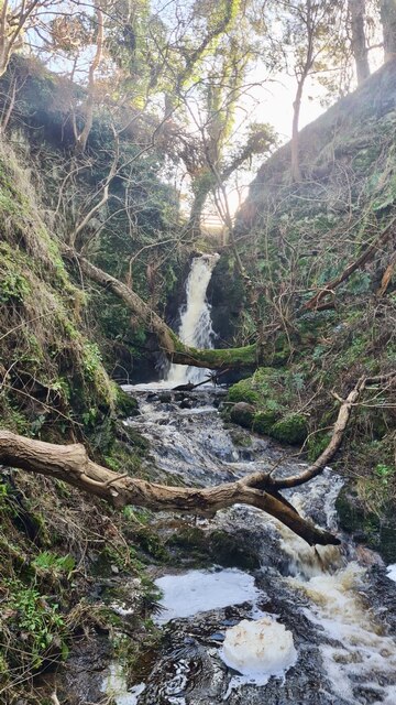
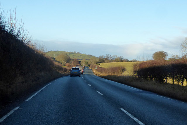
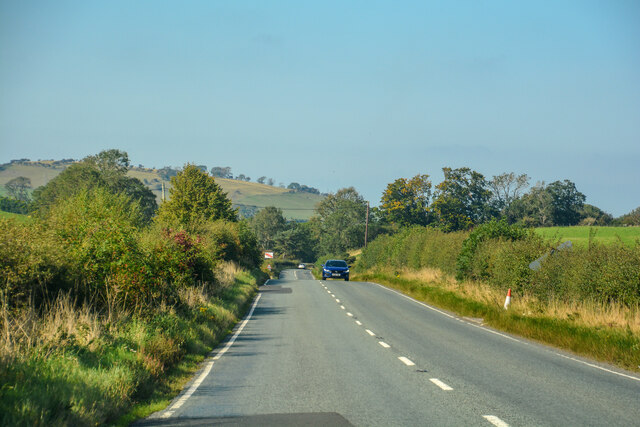
The Park, located in Northumberland, is a stunning natural reserve that encompasses a diverse landscape of downs and moorland. Spanning over a vast area, it is recognized for its outstanding beauty, making it a popular destination for nature enthusiasts and visitors seeking tranquility.

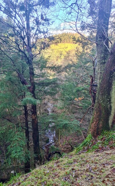
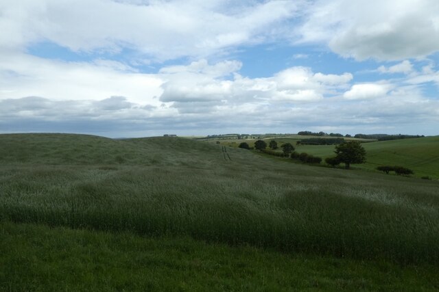
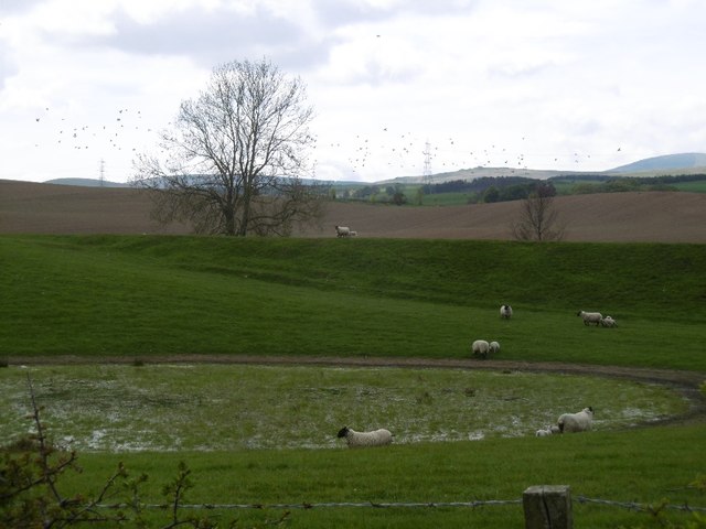
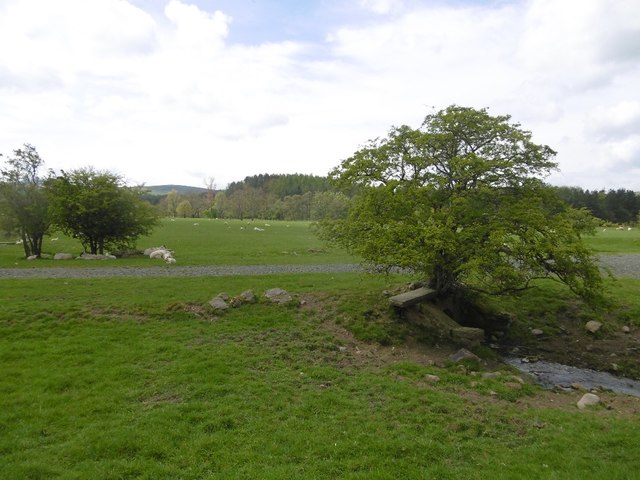
The downs in The Park offer breathtaking panoramic views, characterized by gently rolling hills and expansive grasslands. These open spaces provide a perfect habitat for a variety of flora and fauna, including wildflowers, grasses, and numerous bird species. The downs are also home to several grazing animals, such as sheep and deer, which add to the park's picturesque scenery.

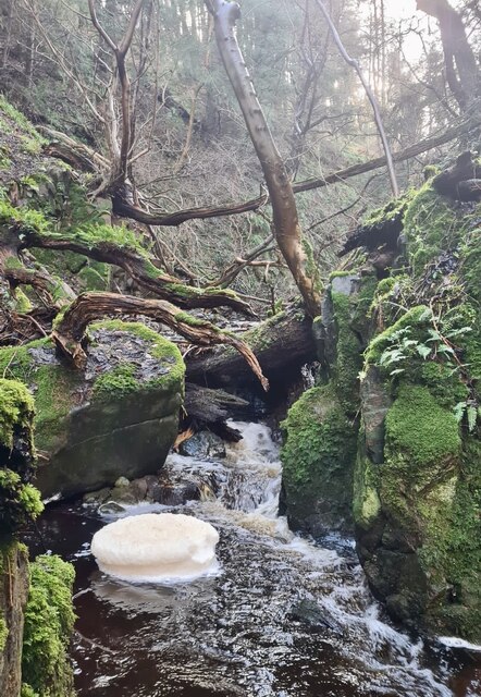
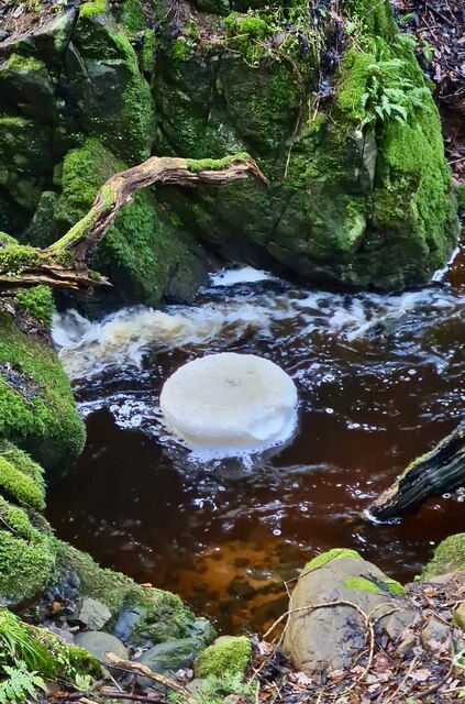
The moorland within The Park is equally captivating. With its heather-covered hills and rugged terrain, it presents a more rugged and untamed aspect of the landscape. Moorland birds, including grouse and curlews, thrive in this environment, while the occasional sighting of a majestic red kite soaring above adds to the area's allure.

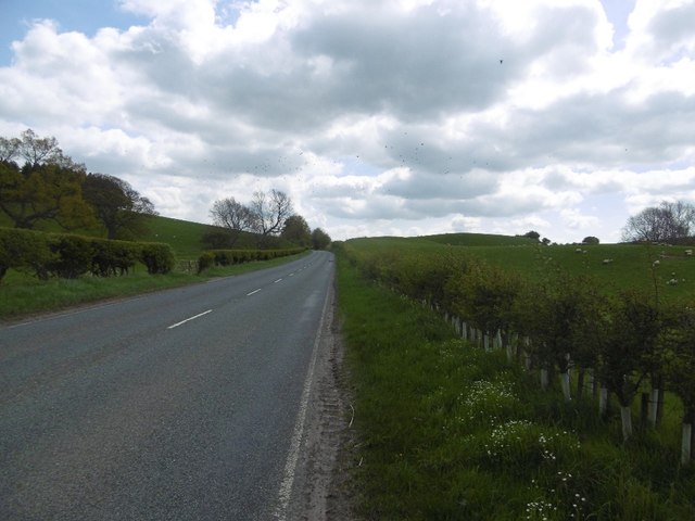
Visitors to The Park can enjoy a range of activities, such as hiking, bird-watching, and photography. There are well-maintained trails and paths that lead through both the downs and moorland, allowing visitors to explore the area at their own pace. Additionally, the park offers educational programs and guided tours to enhance visitors' understanding of the local ecosystem and conservation efforts.

Overall, The Park in Northumberland offers a captivating blend of downs and moorland, providing a haven for nature lovers and a unique experience of the region's natural beauty.

If you have any feedback on the listing, please let us know in the comments section below.
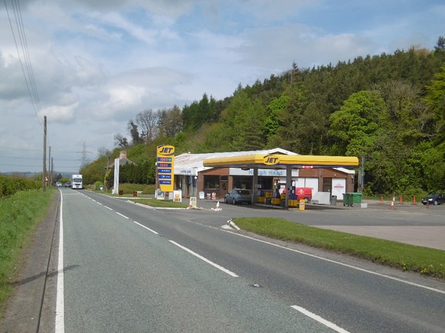
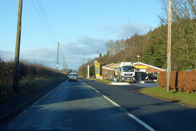
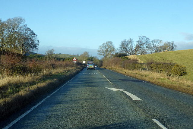
The Park Images

Images are sourced within 2km of 55.520611/-2.0197227 or Grid Reference NT9825. Thanks to Geograph Open Source API. All images are credited.

Waterfall near Middleton Old Town The unnamed burn drains  through a short steep gorge into Coldgate Water.
Waterfall near Middleton Old Town
The unnamed burn drains through a short steep gorge into Coldgate Water.
Looking down gorge to Colgate Water An unnamed burn drains  through this short, deep, impressive gorge into Coldgate Water.
Looking down gorge to Colgate Water
An unnamed burn drains through this short, deep, impressive gorge into Coldgate Water.
Rotating foam pancake Created by an eddy on the unnamed burn that drains  through this short, deep gorge into Coldgate Water.
Rotating foam pancake
Created by an eddy on the unnamed burn that drains through this short, deep gorge into Coldgate Water.
Rotating foam pancake Created by an eddy on the unnamed burn that drains  through this short, deep gorge into Coldgate Water.
Rotating foam pancake
Created by an eddy on the unnamed burn that drains through this short, deep gorge into Coldgate Water.
Typical Northumbrian gate latch Not sure they're unique to Northumberland.  The two 'ears' are folded up to release the catch, gravity returns them to their rest position.
Typical Northumbrian gate latch
Not sure they're unique to Northumberland. The two 'ears' are folded up to release the catch, gravity returns them to their rest position.
Fields beside the road to North Middleton Looking across the rolling fields to the west of the A697.
Fields beside the road to North Middleton
Looking across the rolling fields to the west of the A697.
Service  Station  on  A697  southbound  at  Haugh  Head The buildings beyond the garage are on Glendale Business Park
Service Station on A697 southbound at Haugh Head
The buildings beyond the garage are on Glendale Business Park
Minor  road  junction  to  Lilburn  Hill The buildings and Farmhouse on the left beyond the junction is Haugh Head Farm
Minor road junction to Lilburn Hill
The buildings and Farmhouse on the left beyond the junction is Haugh Head Farm
Ordnance Survey Cut Mark This OS cut mark can be found on the garage at North Middleton Farm. It marks a point 126.968m above mean sea level.
Ordnance Survey Cut Mark
This OS cut mark can be found on the garage at North Middleton Farm. It marks a point 126.968m above mean sea level.
Wet depression A vegetated pond in a kettle hole.  The background slope is not a kame, but a former railway embankment on the Cornhill Branch of the North Eastern Railway.
Wet depression
A vegetated pond in a kettle hole. The background slope is not a kame, but a former railway embankment on the Cornhill Branch of the North Eastern Railway.
A697 South of Wooler.
A697
South of Wooler.
The showground The Glendale Show is held on this field. Once a railway passed here.
The showground
The Glendale Show is held on this field. Once a railway passed here.
Filling station, Haugh Head Three years after <a href="https://www.geograph.org.uk/photo/3449803">NU0026 : Haugh Head</a>.
Filling station, Haugh Head
Three years after NU0026 : Haugh Head.
Old Milepost by the A697, north of Haugh Head, Wooler parish Cast iron post by the A697, in parish of Wooler (Berwick upon Tweed District), North of Haugh Head, on grass verge, on East side of road. MOR/COR iron post, erected by the Percy's Cross to Millfield turnpike trust in the 19th century. 

Inscription reads:-
: MOR / 30 : : L / 317 : : E / 61 : : COR / 14 :
(To Morpeth, London, Edinburgh, Cornhill) 

Grade II listed.
List Entry Number: 1042329 <span class="nowrap"><a title="https://historicengland.org.uk/listing/the-list/list-entry/1042329" rel="nofollow ugc noopener" href="https://historicengland.org.uk/listing/the-list/list-entry/1042329">Link</a><img style="margin-left:2px;" alt="External link" title="External link - shift click to open in new window" src="https://s1.geograph.org.uk/img/external.png" width="10" height="10"/></span>

Milestone Society National ID: NB_MPCH30
Old Milepost by the A697, north of Haugh Head, Wooler parish
Cast iron post by the A697, in parish of Wooler (Berwick upon Tweed District), North of Haugh Head, on grass verge, on East side of road. MOR/COR iron post, erected by the Percy's Cross to Millfield turnpike trust in the 19th century. Inscription reads:- : MOR / 30 : : L / 317 : : E / 61 : : COR / 14 : (To Morpeth, London, Edinburgh, Cornhill) Grade II listed. List Entry Number: 1042329 LinkExternal link Milestone Society National ID: NB_MPCH30
Jet station on A697 Heading towards Wooler.
Jet station on A697
Heading towards Wooler.
A697 towards Wooler
A697 towards Wooler
A697 towards Wooler
A697 towards Wooler
Lilburn : A697 Looking north on the A697.
Lilburn : A697
Looking north on the A697.
Show me another place!

The Park is located at Grid Ref: NT9825 (Lat: 55.520611, Lng: -2.0197227)

Unitary Authority: Northumberland

Police Authority: Northumbria

What 3 Words

///petal.remover.remainder. Near Wooler, Northumberland

Related Wikis

Earle, Northumberland

Earle is a village and civil parish in county of Northumberland, England. It has around 20 inhabitants and is about 2 miles (3 km) from Wooler (where from...

Wooler

Wooler ( WUUL-ə) is a town in Northumberland, England. It lies on the edge of the Northumberland National Park, near the Cheviot Hills. It is a popular...

St Ninian's Catholic Church, Wooler

St Ninian’s church is a Catholic place of worship situated on Burnhouse Road in the town of Wooler in Northumberland, England. It is a Grade II listed...

Cheviot Fringe

Cheviot Fringe ( CHEE-vee-ət) is a geographical region and a Natural England designated National Character Area (or NCA) located in the county Northumberland...

Wooler railway station

Wooler railway station was a stone-built railway station serving the town of Wooler in Northumberland. It was on the Alnwick to Cornhill Branch which ran...

Ilderton railway station

Ilderton railway station served the village of Ilderton, Northumberland, England from 1887 to 1953 on the Cornhill Branch. == History == The station opened...

Lilburn Tower

Lilburn Tower is a privately owned 19th-century mansion house at Lilburn, near Wooler, Northumberland. The property is a Grade II* listed building and...

Humbleton Hill

Humbleton Hill is a hill in Northumberland, England, about 1.5 miles (2.4 km) west of Wooler. It is the location of the Battle of Homildon Hill of 1402...

Nearby Amenities

Located within 500m of 55.520611,-2.0197227
Middleton Hall
Place: locality
Lat/Long: 55.5227553/-2.0199723
Broom Crook
Place: locality
Lat/Long: 55.517098/-2.018949
Brown Hill
Place: locality
Lat/Long: 55.5209883/-2.0239262
The Park
Place: locality
Lat/Long: 55.5209206/-2.0202562
Firwood Country Bed & Breakfast
Addr City: Middleton Hall
Addr Postcode: NE71 6RD
Phone: +44 1668 283699
Tourism: guest_house
Website: www.firwoodhouse.co.uk
Lat/Long: 55.5242614/-2.0201254
Post Box
Ref: NE71 32
Lat/Long: 55.5234511/-2.0190365
Direction: WSW
Generator Method: photovoltaic
Generator Output Electricity: yes
Generator Solar Modules: 12
Generator Source: solar
Generator Type: solar_photovoltaic_panel
Location: roof
Power: generator
Lat/Long: 55.5233775/-2.019926
Ford: yes
Lat/Long: 55.5188987/-2.026166
The data included in this document is from www.openstreetmap.org. The data is made available under ODbL.

Have you been to The Park?

Leave your review of The Park below (or comments, questions and feedback).