Brownhill Plantation

Wood, Forest in Northumberland

England

Brownhill Plantation

In the shelter of The Cheviot Roadside view as you enter the Harthope Valley.
In the shelter of The Cheviot Credit: Richard Armstrong

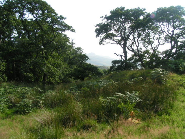
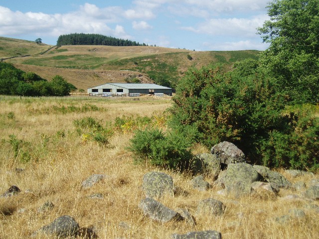
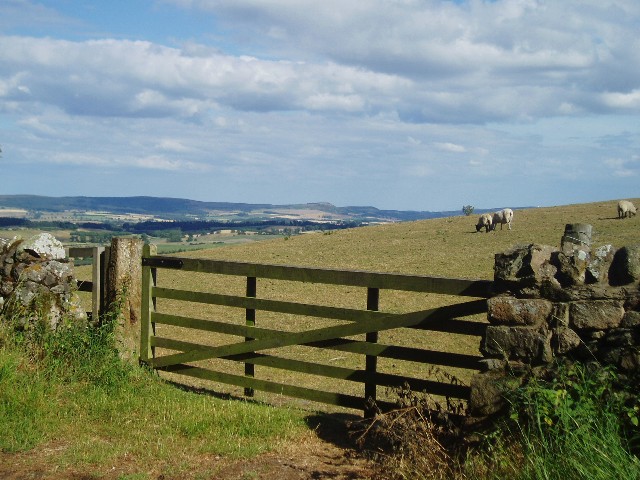
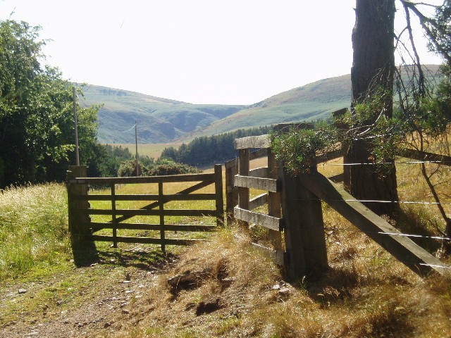
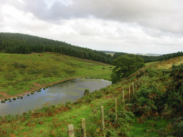
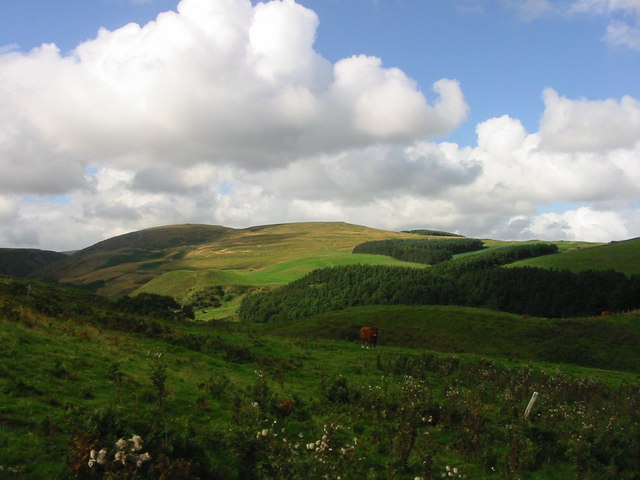
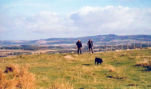
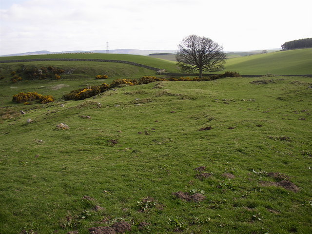
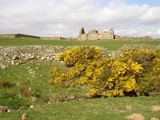
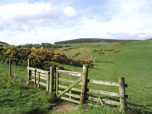
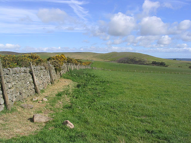
Brownhill Plantation is a picturesque woodland area located in the county of Northumberland, England. Covering an expansive area of approximately 400 acres, the plantation is renowned for its abundant natural beauty and diverse range of flora and fauna.

The woodland is predominantly composed of various species of deciduous and coniferous trees, including oak, beech, and pine, creating a rich tapestry of colors throughout the year. The lush vegetation provides a haven for numerous bird species, such as woodpeckers, thrushes, and owls, making it a popular destination for birdwatchers and nature enthusiasts.

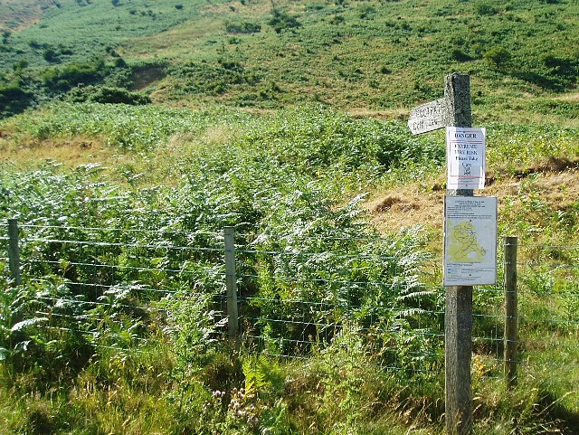
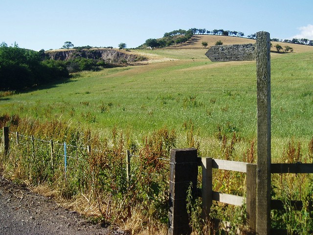
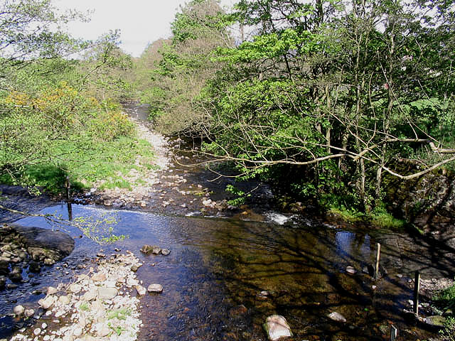
Traversing through Brownhill Plantation, visitors can enjoy a network of well-maintained walking trails that meander through the enchanting woodland. These paths offer opportunities for leisurely strolls, invigorating hikes, and even cycling adventures. Along the way, visitors may stumble upon serene ponds, charming streams, and hidden clearings, adding to the magical ambiance of the plantation.

With its idyllic setting, Brownhill Plantation serves as a peaceful retreat for locals and tourists alike. The tranquil atmosphere and natural serenity make it an ideal destination for those seeking solace and relaxation in the heart of nature. Moreover, the plantation provides an excellent opportunity for outdoor education, wildlife observation, and environmental studies.

Managed and maintained by the local authorities, Brownhill Plantation is open to the public year-round, with no entrance fee. It is a cherished gem in the Northumberland region, offering a glimpse into the region's rich natural heritage.

If you have any feedback on the listing, please let us know in the comments section below.

Brownhill Plantation Images

Images are sourced within 2km of 55.520284/-2.0331847 or Grid Reference NT9825. Thanks to Geograph Open Source API. All images are credited.

In the shelter of The Cheviot Roadside view as you enter the Harthope Valley.
In the shelter of The Cheviot
Roadside view as you enter the Harthope Valley.
Fire risk sign The extremely dry summer of 2006 has led to the risk of fire in many areas.  In this photo, a signpost pointing to the footpath to Cold Law has an extra sign pinned to it: "Danger   Extreme Fire Risk   Please take care".
Fire risk sign
The extremely dry summer of 2006 has led to the risk of fire in many areas. In this photo, a signpost pointing to the footpath to Cold Law has an extra sign pinned to it: "Danger Extreme Fire Risk Please take care".
In the Harthope Valley View from the west bank of the Harthope Burn, south-west of Wooler.
In the Harthope Valley
View from the west bank of the Harthope Burn, south-west of Wooler.
Sheep grazing near Wooler View from the minor road which leads to Langleeford
Sheep grazing near Wooler
View from the minor road which leads to Langleeford
Cheviot countryside Looking west to the Cheviot Hills from the Wooler-Langleeford road.
Cheviot countryside
Looking west to the Cheviot Hills from the Wooler-Langleeford road.
Red trailer with pylons A field near Middleton Hall, south of Wooler.
Red trailer with pylons
A field near Middleton Hall, south of Wooler.
Barleyfield near Wooler Field beside a minor road to the south of Wooler
Barleyfield near Wooler
Field beside a minor road to the south of Wooler
Signpost to Waud House Start of the track leading to Waud House, near Wooler.  The disused quarry in the background is just on the northern edge of the square.
Signpost to Waud House
Start of the track leading to Waud House, near Wooler. The disused quarry in the background is just on the northern edge of the square.
Lake near Coldgate Water This is on the footpath between Carey Burn Bridge and the Happy Valley near Wooler Northumberland
Lake near Coldgate Water
This is on the footpath between Carey Burn Bridge and the Happy Valley near Wooler Northumberland
View from footpath above Carey Burn Bridge near Middleton Northumberland This view is from the footpath between Carey Burn Bridge and Happy Valley
View from footpath above Carey Burn Bridge near Middleton Northumberland
This view is from the footpath between Carey Burn Bridge and Happy Valley
Walkerwalls This building - originally several cottages now knocked into one - is used as a base for group field trips and the like.  It's used by schools mainly.
Walkerwalls
This building - originally several cottages now knocked into one - is used as a base for group field trips and the like. It's used by schools mainly.
Deeply incised valley of the Carey Burn This steep sided valley, complete with scree slopes below Hart Heugh, would appear to be a glacial overflow channel.
Deeply incised valley of the Carey Burn
This steep sided valley, complete with scree slopes below Hart Heugh, would appear to be a glacial overflow channel.
Heading into the hills above Middleton Old Town On the eastern edge of the Northumberland National Park and with an excellent view to the sandstone hills further east.
Heading into the hills above Middleton Old Town
On the eastern edge of the Northumberland National Park and with an excellent view to the sandstone hills further east.
Site of Settlements at Middleton Old Town
Derelict farm at Old Middleton
Ford at the Coldgate Water The ford at Coldgate Mill viewed from a footbridge.
Ford at the Coldgate Water
The ford at Coldgate Mill viewed from a footbridge.
Public bridleway to Wooler Common Also part of the St Cuthbert's Way with Earlehillhead Farm on the far left.
Public bridleway to Wooler Common
Also part of the St Cuthbert's Way with Earlehillhead Farm on the far left.
Hill farmland near Wooler Pasture fields viewed from the public bridleway near Wooler Common with Coldberry Hill centre right in the distance.
Hill farmland near Wooler
Pasture fields viewed from the public bridleway near Wooler Common with Coldberry Hill centre right in the distance.
Show me another place!

Brownhill Plantation is located at Grid Ref: NT9825 (Lat: 55.520284, Lng: -2.0331847)

Unitary Authority: Northumberland

Police Authority: Northumbria

What 3 Words

///education.accusing.automatic. Near Wooler, Northumberland

Related Wikis

Earle, Northumberland

Earle is a village and civil parish in county of Northumberland, England. It has around 20 inhabitants and is about 2 miles (3 km) from Wooler (where from...

Wooler

Wooler ( WUUL-ə) is a town in Northumberland, England. It lies on the edge of the Northumberland National Park, near the Cheviot Hills. It is a popular...

St Ninian's Catholic Church, Wooler

St Ninian’s church is a Catholic place of worship situated on Burnhouse Road in the town of Wooler in Northumberland, England. It is a Grade II listed...

Humbleton Hill

Humbleton Hill is a hill in Northumberland, England, about 1.5 miles (2.4 km) west of Wooler. It is the location of the Battle of Homildon Hill of 1402...

Cheviot Fringe

Cheviot Fringe ( CHEE-vee-ət) is a geographical region and a Natural England designated National Character Area (or NCA) located in the county Northumberland...

Wooler railway station

Wooler railway station was a stone-built railway station serving the town of Wooler in Northumberland. It was on the Alnwick to Cornhill Branch which ran...

Ilderton railway station

Ilderton railway station served the village of Ilderton, Northumberland, England from 1887 to 1953 on the Cornhill Branch. == History == The station opened...

Battle of Homildon Hill

The Battle of Holmedon Hill or Battle of Homildon Hill was a conflict between English and Scottish armies on 14 September 1402 in Northumberland, England...

Nearby Amenities

Located within 500m of 55.520284,-2.0331847
Information: guidepost
Tourism: information
Lat/Long: 55.5164422/-2.0320224
Parking
Lat/Long: 55.518639/-2.0391308
Armour Bank
Place: locality
Lat/Long: 55.5197584/-2.0378532
Grimping Haugh
Place: locality
Lat/Long: 55.5186386/-2.0288173
Switcher
Place: locality
Lat/Long: 55.5212696/-2.0381976
Ford: yes
Lat/Long: 55.5188987/-2.026166
The data included in this document is from www.openstreetmap.org. The data is made available under ODbL.

Have you been to Brownhill Plantation?

Leave your review of Brownhill Plantation below (or comments, questions and feedback).