Earle Hill

Hill, Mountain in Northumberland

England

Earle Hill

Service  Station  on  A697  southbound  at  Haugh  Head The buildings beyond the garage are on Glendale Business Park
Service Station on A697 southbound at Haugh Head Credit: Martin Dawes

Earle Hill, located in Northumberland, England, is a prominent hill that offers breathtaking views across the surrounding countryside. Rising to an elevation of approximately 1,000 feet, it forms part of the picturesque North Pennines Area of Outstanding Natural Beauty. The hill is situated near the village of Blanchland and lies within close proximity to the popular tourist destination of Hadrian's Wall.

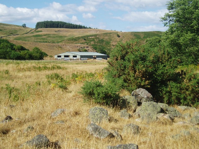
Earle Hill boasts a unique geological composition, primarily consisting of limestone and sandstone. This distinctive blend creates a striking visual contrast, with the limestone cliffs providing a dramatic backdrop against the softer sandstone slopes. The hill is known for its rich flora and fauna, with a diverse range of plant species, including heather, gorse, and bilberry, covering its slopes.

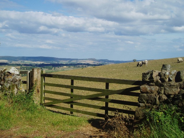
The summit of Earle Hill offers panoramic vistas, making it a popular destination for hikers and nature enthusiasts. On clear days, visitors can enjoy sweeping views of the Northumberland countryside, with rolling hills, lush valleys, and distant moorlands stretching out as far as the eye can see. The hill is also a haven for wildlife, home to a variety of bird species, such as curlews, lapwings, and red grouse.

Access to Earle Hill is provided by a network of footpaths and trails, ensuring that visitors can explore its beauty at their own pace. Additionally, the hill serves as a starting point for numerous walking routes, allowing adventurers to embark on longer hikes and discover the surrounding natural wonders.

Overall, Earle Hill is a remarkable natural landmark in Northumberland, offering a captivating blend of geological features, stunning views, and abundant wildlife, making it a must-visit destination for outdoor enthusiasts and nature lovers alike.

If you have any feedback on the listing, please let us know in the comments section below.
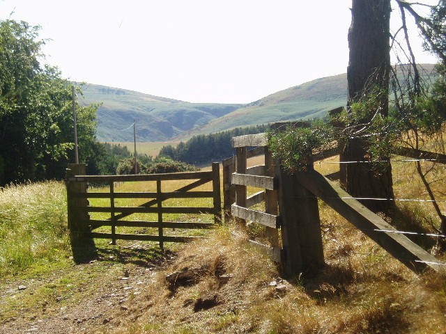
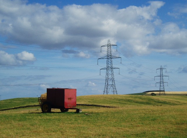
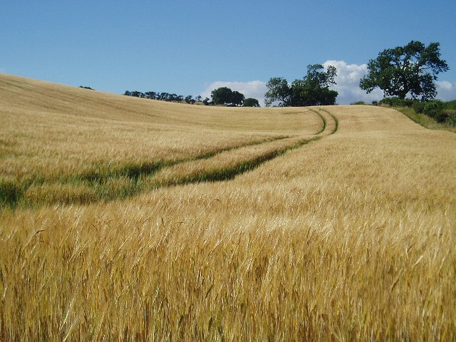
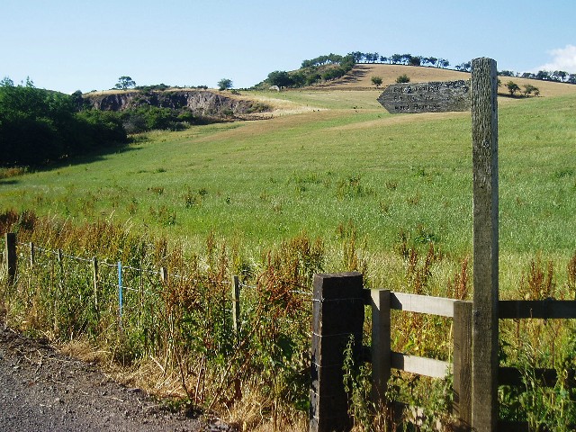
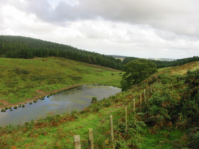
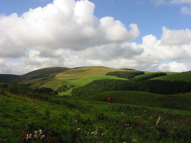
Earle Hill Images

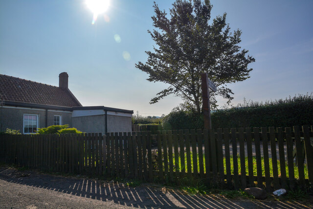
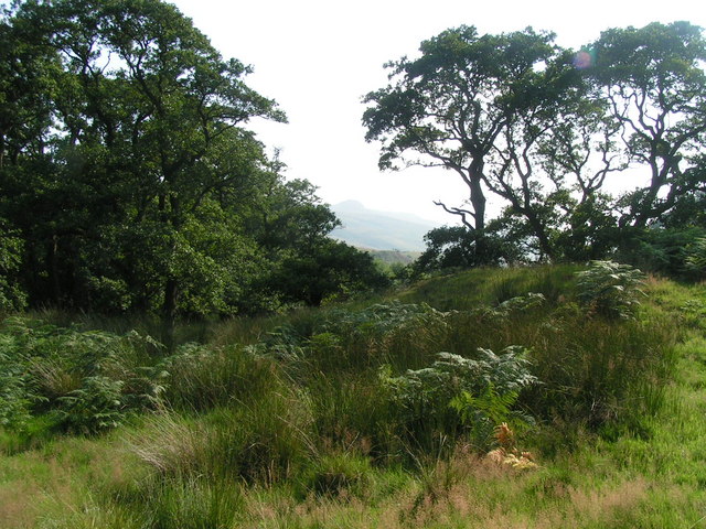
Images are sourced within 2km of 55.526009/-2.0283108 or Grid Reference NT9825. Thanks to Geograph Open Source API. All images are credited.

Service  Station  on  A697  southbound  at  Haugh  Head The buildings beyond the garage are on Glendale Business Park
Service Station on A697 southbound at Haugh Head
The buildings beyond the garage are on Glendale Business Park
Minor  road  junction  to  Lilburn  Hill The buildings and Farmhouse on the left beyond the junction is Haugh Head Farm
Minor road junction to Lilburn Hill
The buildings and Farmhouse on the left beyond the junction is Haugh Head Farm
Filling station, Haugh Head Three years after <a href="https://www.geograph.org.uk/photo/3449803">NU0026 : Haugh Head</a>.
Filling station, Haugh Head
Three years after NU0026 : Haugh Head.
Old Milepost by the A697, north of Haugh Head, Wooler parish Cast iron post by the A697, in parish of Wooler (Berwick upon Tweed District), North of Haugh Head, on grass verge, on East side of road. MOR/COR iron post, erected by the Percy's Cross to Millfield turnpike trust in the 19th century. 

Inscription reads:-
: MOR / 30 : : L / 317 : : E / 61 : : COR / 14 :
(To Morpeth, London, Edinburgh, Cornhill) 

Grade II listed.
List Entry Number: 1042329 <span class="nowrap"><a title="https://historicengland.org.uk/listing/the-list/list-entry/1042329" rel="nofollow ugc noopener" href="https://historicengland.org.uk/listing/the-list/list-entry/1042329">Link</a><img style="margin-left:2px;" alt="External link" title="External link - shift click to open in new window" src="https://s1.geograph.org.uk/img/external.png" width="10" height="10"/></span>

Milestone Society National ID: NB_MPCH30
Old Milepost by the A697, north of Haugh Head, Wooler parish
Cast iron post by the A697, in parish of Wooler (Berwick upon Tweed District), North of Haugh Head, on grass verge, on East side of road. MOR/COR iron post, erected by the Percy's Cross to Millfield turnpike trust in the 19th century. Inscription reads:- : MOR / 30 : : L / 317 : : E / 61 : : COR / 14 : (To Morpeth, London, Edinburgh, Cornhill) Grade II listed. List Entry Number: 1042329 LinkExternal link Milestone Society National ID: NB_MPCH30
Jet station on A697 Heading towards Wooler.
Jet station on A697
Heading towards Wooler.
Haugh Head : A697 Looking north on the A697.
Haugh Head : A697
Looking north on the A697.
Haugh Head : Lane A small lane heads off the A697.
Haugh Head : Lane
A small lane heads off the A697.
Haugh Head : A697 Looking north on the A697.
Haugh Head : A697
Looking north on the A697.
Haugh Head : Toll Cottage Looking towards Toll Cottage off the A697.
Haugh Head : Toll Cottage
Looking towards Toll Cottage off the A697.
In the shelter of The Cheviot Roadside view as you enter the Harthope Valley.
In the shelter of The Cheviot
Roadside view as you enter the Harthope Valley.
In the Harthope Valley View from the west bank of the Harthope Burn, south-west of Wooler.
In the Harthope Valley
View from the west bank of the Harthope Burn, south-west of Wooler.
Sheep grazing near Wooler View from the minor road which leads to Langleeford
Sheep grazing near Wooler
View from the minor road which leads to Langleeford
Cheviot countryside Looking west to the Cheviot Hills from the Wooler-Langleeford road.
Cheviot countryside
Looking west to the Cheviot Hills from the Wooler-Langleeford road.
Red trailer with pylons A field near Middleton Hall, south of Wooler.
Red trailer with pylons
A field near Middleton Hall, south of Wooler.
Barleyfield near Wooler Field beside a minor road to the south of Wooler
Barleyfield near Wooler
Field beside a minor road to the south of Wooler
Signpost to Waud House Start of the track leading to Waud House, near Wooler.  The disused quarry in the background is just on the northern edge of the square.
Signpost to Waud House
Start of the track leading to Waud House, near Wooler. The disused quarry in the background is just on the northern edge of the square.
Lake near Coldgate Water This is on the footpath between Carey Burn Bridge and the Happy Valley near Wooler Northumberland
Lake near Coldgate Water
This is on the footpath between Carey Burn Bridge and the Happy Valley near Wooler Northumberland
View from footpath above Carey Burn Bridge near Middleton Northumberland This view is from the footpath between Carey Burn Bridge and Happy Valley
View from footpath above Carey Burn Bridge near Middleton Northumberland
This view is from the footpath between Carey Burn Bridge and Happy Valley
Show me another place!

Earle Hill is located at Grid Ref: NT9825 (Lat: 55.526009, Lng: -2.0283108)

Unitary Authority: Northumberland

Police Authority: Northumbria

What 3 Words

///birds.narrate.profited. Near Wooler, Northumberland

Related Wikis

Earle, Northumberland

Earle is a village and civil parish in county of Northumberland, England. It has around 20 inhabitants and is about 2 miles (3 km) from Wooler (where from...

Wooler

Wooler ( WUUL-ə) is a town in Northumberland, England. It lies on the edge of the Northumberland National Park, near the Cheviot Hills. It is a popular...

St Ninian's Catholic Church, Wooler

St Ninian’s church is a Catholic place of worship situated on Burnhouse Road in the town of Wooler in Northumberland, England. It is a Grade II listed...

Cheviot Fringe

Cheviot Fringe ( CHEE-vee-ət) is a geographical region and a Natural England designated National Character Area (or NCA) located in the county Northumberland...

Nearby Amenities

Located within 500m of 55.526009,-2.0283108
Walkerwalls
Place: locality
Lat/Long: 55.5264696/-2.0234189
Power: pole
Lat/Long: 55.5285538/-2.0236394
Power: pole
Lat/Long: 55.5302415/-2.026247
Power: pole
Lat/Long: 55.5298296/-2.0279203
Power: pole
Lat/Long: 55.5267112/-2.0214885
Power: pole
Lat/Long: 55.5276066/-2.0223956
Power: pole
Lat/Long: 55.5261965/-2.0209559
Power: pole
Lat/Long: 55.5299195/-2.0309796
Power: pole
Lat/Long: 55.5288657/-2.0240398
The data included in this document is from www.openstreetmap.org. The data is made available under ODbL.

Have you been to Earle Hill?

Leave your review of Earle Hill below (or comments, questions and feedback).