Hog Lowe Pike

Hill, Mountain in Lancashire

England

Hog Lowe Pike

Rossendale Way below Nab Hill A 41 mile circular high level route that roughly follows the boundary of Rossendale Borough.
Yellow indicators stamped with an "RW" logo in green leads the walker around the environs of Bacup, Rawtenstall, Haslingden and Whitworth.
Rossendale Way below Nab Hill Credit: Chris Heaton

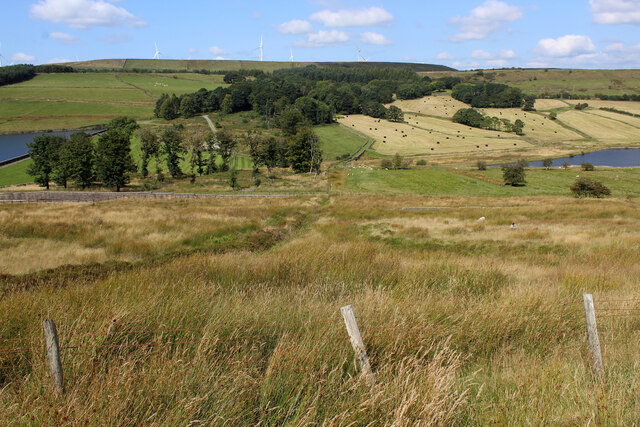
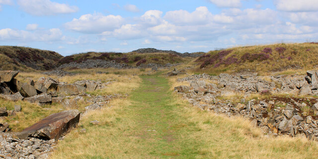
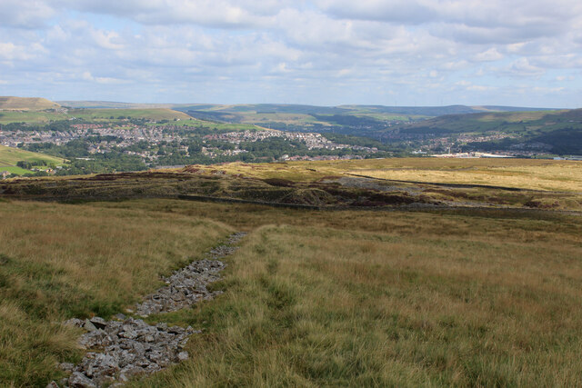
Hog Lowe Pike is a prominent hill located in the county of Lancashire, England. Situated in the southern part of the county, it forms part of the beautiful West Pennine Moors, a designated Area of Outstanding Natural Beauty. With an elevation of approximately 407 meters (1,335 feet), it offers stunning panoramic views of the surrounding countryside.

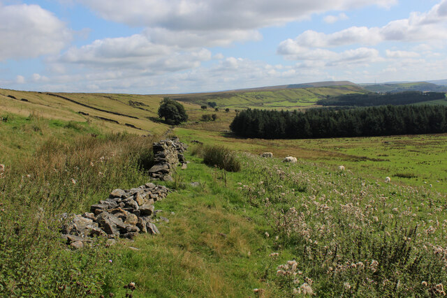
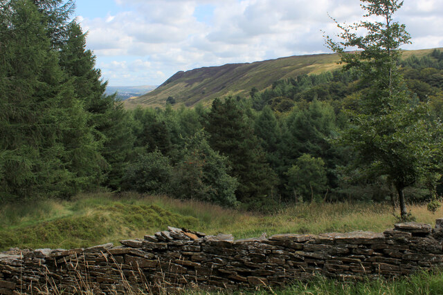
The hill is characterized by its gentle slopes and undulating terrain, covered in patches of heather, grasses, and scattered trees. It is a popular destination for hikers and nature enthusiasts, who are drawn to its tranquil atmosphere and abundant wildlife. Visitors to Hog Lowe Pike can often spot various bird species, such as curlews and lapwings, as well as small mammals like rabbits and foxes.

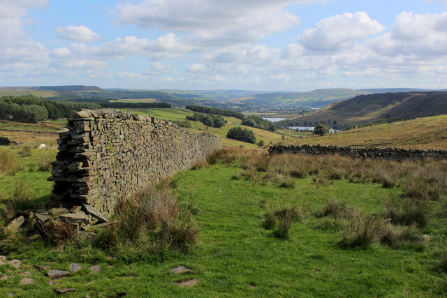
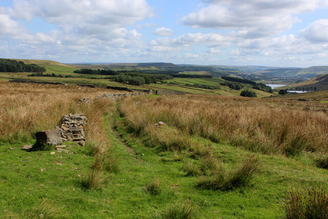
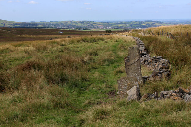
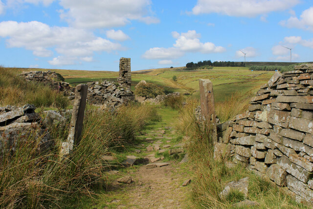
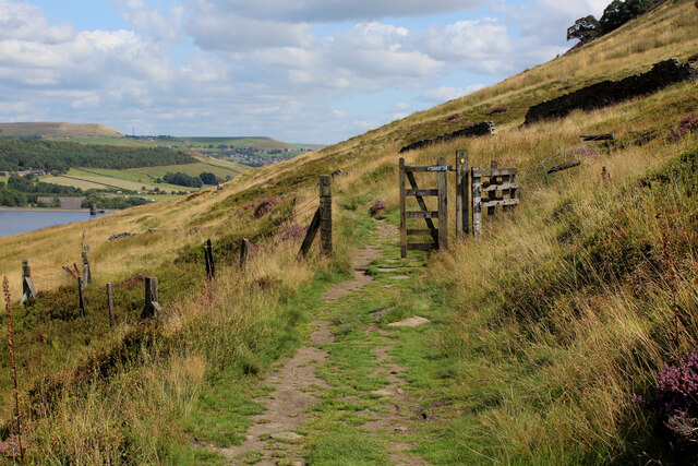
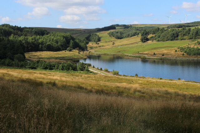
The hill is easily accessible via a network of footpaths and trails that crisscross the area, providing opportunities for leisurely walks or more challenging hikes. A particular highlight is the panoramic view from the summit, which offers breathtaking vistas of the surrounding Lancashire countryside, including nearby reservoirs and rolling hills.

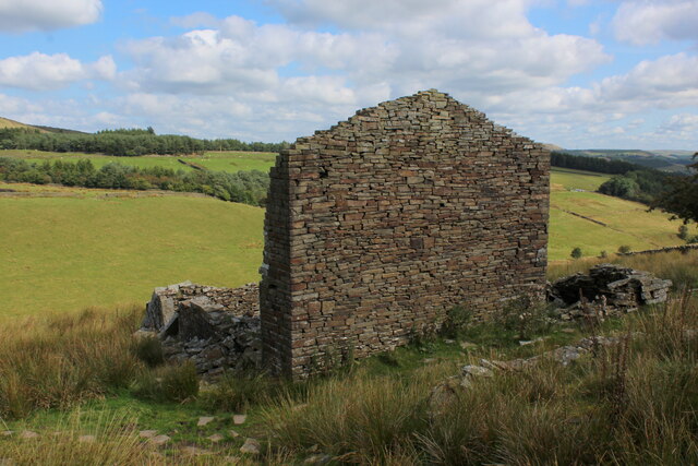
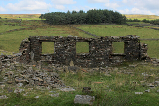
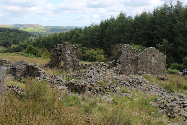
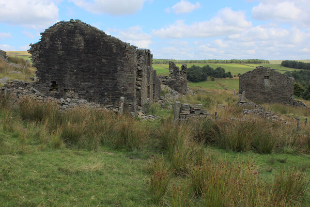
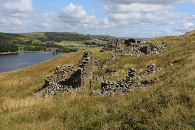
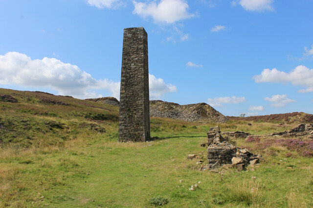
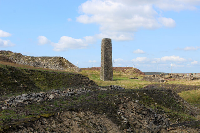
Hog Lowe Pike is also steeped in history, with evidence of ancient settlements and industrial activity in the area. Ruins of old farmsteads and stone walls can still be seen, serving as a reminder of the region's past.

Overall, Hog Lowe Pike is a picturesque hill that combines natural beauty, recreational opportunities, and a rich historical heritage, making it a must-visit destination for outdoor enthusiasts and those seeking to explore the stunning landscapes of Lancashire.

If you have any feedback on the listing, please let us know in the comments section below.

Hog Lowe Pike Images

Images are sourced within 2km of 53.68849/-2.3833073 or Grid Reference SD7421. Thanks to Geograph Open Source API. All images are credited.

Rossendale Way below Nab Hill A 41 mile circular high level route that roughly follows the boundary of Rossendale Borough.
Yellow indicators stamped with an "RW" logo in green leads the walker around the environs of Bacup, Rawtenstall, Haslingden and Whitworth.
Rossendale Way below Nab Hill
A 41 mile circular high level route that roughly follows the boundary of Rossendale Borough. Yellow indicators stamped with an "RW" logo in green leads the walker around the environs of Bacup, Rawtenstall, Haslingden and Whitworth.
Descending into the Grane Valley (1) Public footpath follows the substantial wall into the head of the Grane Valley - which contains the River Ogden.
Descending into the Grane Valley (1)
Public footpath follows the substantial wall into the head of the Grane Valley - which contains the River Ogden.
Descending into the Grane Valley (2) Footpath descending into the head of the Grane Valley, although it is not visible on the ground - so attention needs to be concentrated on the map.
Descending into the Grane Valley (2)
Footpath descending into the head of the Grane Valley, although it is not visible on the ground - so attention needs to be concentrated on the map.
Footpath heading towards Broadhead Road
Ruins of Peak House, Haslingden Grane Part of Grane Village, once a thriving community of over a thousand souls involved with farming, quarrying and illicit whisky distillation.
The construction of the 3 reservoirs sounded the death knell, depopulating the valley and leaving behind many ruined buildings
Ruins of Peak House, Haslingden Grane
Part of Grane Village, once a thriving community of over a thousand souls involved with farming, quarrying and illicit whisky distillation. The construction of the 3 reservoirs sounded the death knell, depopulating the valley and leaving behind many ruined buildings
Rossendale Way in Haslingden Grane The long distance footpath in the deserted ruins of Grane Village, a once thriving community depopulated after the construction of the three reservoirs.
Rossendale Way in Haslingden Grane
The long distance footpath in the deserted ruins of Grane Village, a once thriving community depopulated after the construction of the three reservoirs.
Ruins of Close Bottom, Haslingden Grane One of many ruins dotted hereabouts, that once made up the community of Grane Village.
Now abandoned and deserted, after the construction of 3 reservoirs along the River Ogden.
Ruins of Close Bottom, Haslingden Grane
One of many ruins dotted hereabouts, that once made up the community of Grane Village. Now abandoned and deserted, after the construction of 3 reservoirs along the River Ogden.
Ruins of Top o' th' Knoll, Haslingden Grane (1) Once substantial premises in the now abandoned Grane Village, passed by on the Rossendale Way.
Ruins of Top o' th' Knoll, Haslingden Grane (1)
Once substantial premises in the now abandoned Grane Village, passed by on the Rossendale Way.
Ruins of Top o' th' Knoll, Haslingden Grane (2) Part of the now deserted community of the once thriving Grane Village - a former farming, quarrying and illicit whisky distillation centre in the upper Ogden Valley
Ruins of Top o' th' Knoll, Haslingden Grane (2)
Part of the now deserted community of the once thriving Grane Village - a former farming, quarrying and illicit whisky distillation centre in the upper Ogden Valley
Grane Head In the plantations above Calf Hey Reservoir
Grane Head
In the plantations above Calf Hey Reservoir
Rossendale Way above Calf Hey Reservoir The long distance footpath in the Ogden Valley
Rossendale Way above Calf Hey Reservoir
The long distance footpath in the Ogden Valley
Calf Hey Reservoir The uppermost of three reservoirs in the Ogden Valley, as seen from the Rossendale Way.
Calf Hey Reservoir
The uppermost of three reservoirs in the Ogden Valley, as seen from the Rossendale Way.
Looking across the Ogden Valley Looking north from the Rossendale Way
Looking across the Ogden Valley
Looking north from the Rossendale Way
Ruins of Upper Heights Farm Above Ogden Reservoir, and passed by on the Rossendale Way long distance footpath are the sad abandoned remains of Upper Heights Farm
Ruins of Upper Heights Farm
Above Ogden Reservoir, and passed by on the Rossendale Way long distance footpath are the sad abandoned remains of Upper Heights Farm
Chimney on Musbury Heights (1) Found in the disused quarry on Musbury Heights, this chimney was restored in 2004. Lower Haslingden Flag was removed from here, concerned with the production of kerbstone, cobbles and flagstones.
Chimney on Musbury Heights (1)
Found in the disused quarry on Musbury Heights, this chimney was restored in 2004. Lower Haslingden Flag was removed from here, concerned with the production of kerbstone, cobbles and flagstones.
Chimney on Musbury Heights (2) Restored chimney amongst the spoil heaps in the disused quarry on Musbury Heights.
Lower Haslingden Flag, utilised for cobbles, kerbstones and flagstones were excavated from here.
Chimney on Musbury Heights (2)
Restored chimney amongst the spoil heaps in the disused quarry on Musbury Heights. Lower Haslingden Flag, utilised for cobbles, kerbstones and flagstones were excavated from here.
Rossendale Way on Musbury Heights The long distance footpath makes its way between spoil heaps and discarded flagstones.
Rossendale Way on Musbury Heights
The long distance footpath makes its way between spoil heaps and discarded flagstones.
Musbury Heights
Musbury Heights
Show me another place!

Hog Lowe Pike is located at Grid Ref: SD7421 (Lat: 53.68849, Lng: -2.3833073)

Unitary Authority: Blackburn with Darwen

Police Authority: Lancashire

What 3 Words

///formed.spice.ivory. Near Haslingden, Lancashire

Related Wikis

Calf Hey Reservoir

Calf Hey Reservoir is a reservoir in Haslingden Grane, close to the town of Haslingden, in the Borough of Rossendale, England. It was the first of three...

Haslingden Grane

Haslingden Grane is the glaciated upper portion of the valley of the River Ogden, which lies west of Haslingden and is in the north east section of the...

Musbury Valley

The Musbury Valley is a small valley in the Helmshore area of Rossendale Valley, Lancashire. Musbury Brook flows through its length, and its south side...

Musbury Tor

Musbury Tor or Tor Hill is a flat-topped hill in south-east Lancashire, England. It overlooks the village of Helmshore and separates Alden Valley to its...

Yate and Pickup Bank

Yate and Pickup Bank is a civil parish in the borough of Blackburn with Darwen, Lancashire, England. The population of the civil parish taken at the census...

Alden Valley

The Alden Valley is a small valley on the eastern edge of the West Pennine Moors, west of Helmshore in Rossendale, Lancashire, England. In the 14th century...

Helmshore Mills Textile Museum

Helmshore Mills are two mills built on the River Ogden in Helmshore, Lancashire. Higher Mill was built in 1796 for William Turner, and Whitaker's Mill...
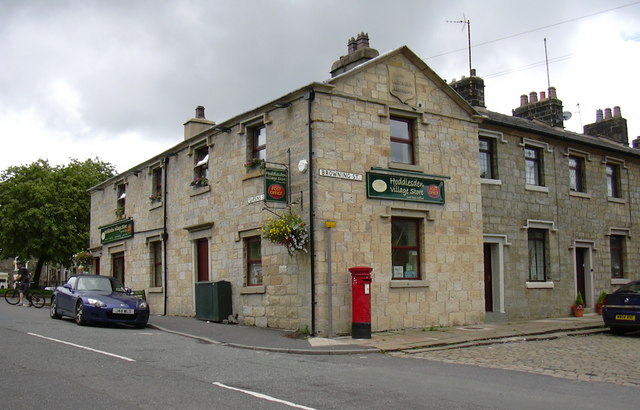
Hoddlesden

Hoddlesden is a village in the borough of Blackburn with Darwen, in Lancashire, England. The village population at the 2011 census was 1,239. It is in...

Nearby Amenities

Located within 500m of 53.68849,-2.3833073
Man Made: survey_point
Survey Point Structure: pillar
Lat/Long: 53.6885104/-2.3833255
Barrier: stile
Material: wood
Stile: stepover
Lat/Long: 53.6885282/-2.3833286
The data included in this document is from www.openstreetmap.org. The data is made available under ODbL.

Have you been to Hog Lowe Pike?

Leave your review of Hog Lowe Pike below (or comments, questions and feedback).