Kays o' th' Moss

Downs, Moorland in Lancashire Rossendale

England

Kays o' th' Moss

Rossendale Way below Nab Hill A 41 mile circular high level route that roughly follows the boundary of Rossendale Borough.
Yellow indicators stamped with an "RW" logo in green leads the walker around the environs of Bacup, Rawtenstall, Haslingden and Whitworth.
Rossendale Way below Nab Hill Credit: Chris Heaton

Located in Lancashire, England, Kays o' th' Moss is a picturesque region known for its stunning downs and moorland. With an area spanning approximately several square miles, this enchanting landscape offers a wide range of natural features and attractions.

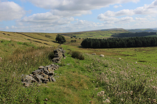
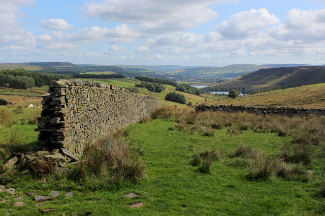
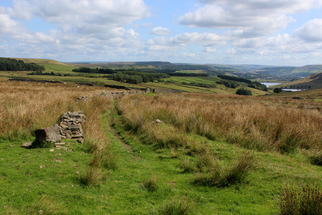
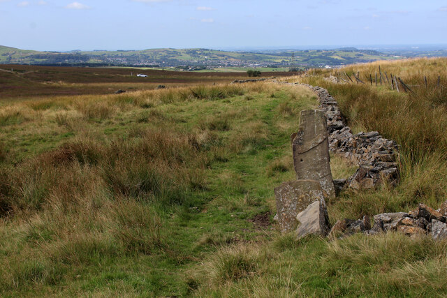
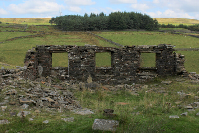
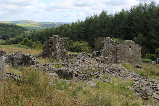
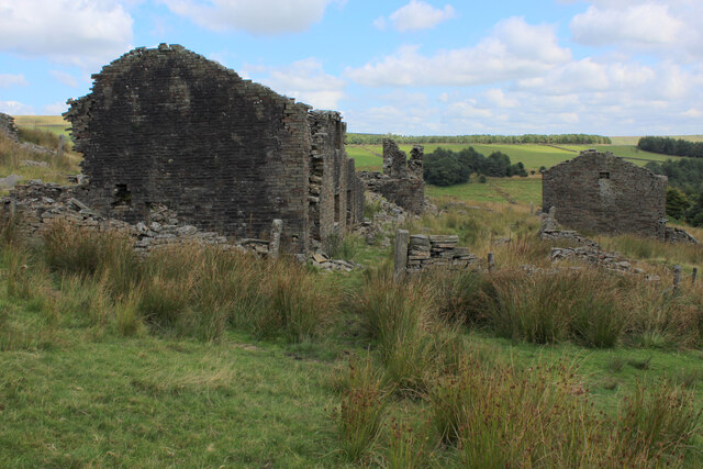
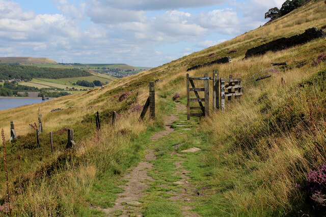
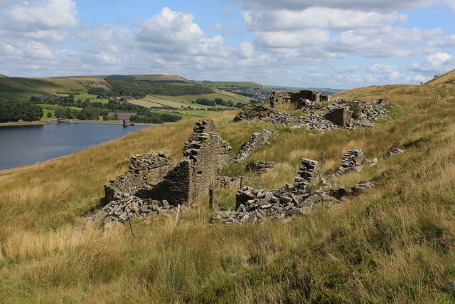
The downs of Kays o' th' Moss are characterized by gently rolling hills covered in lush green grass. These hills provide a mesmerizing backdrop for visitors to explore and admire. The area is home to several species of flora and fauna, including heather, gorse, and various wildflowers. The downs are also scattered with ancient stone formations, adding an element of mystery and history to the landscape.

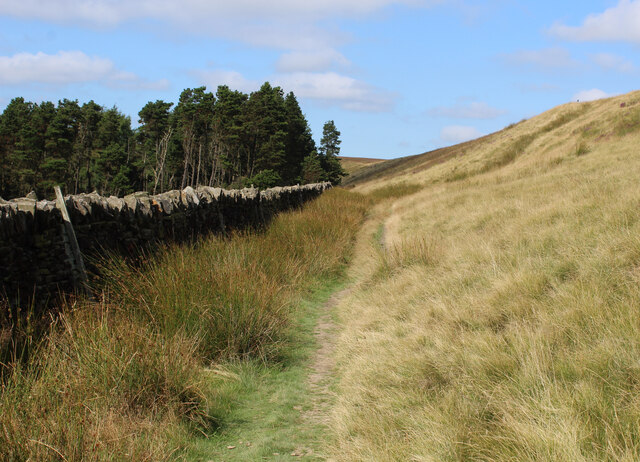
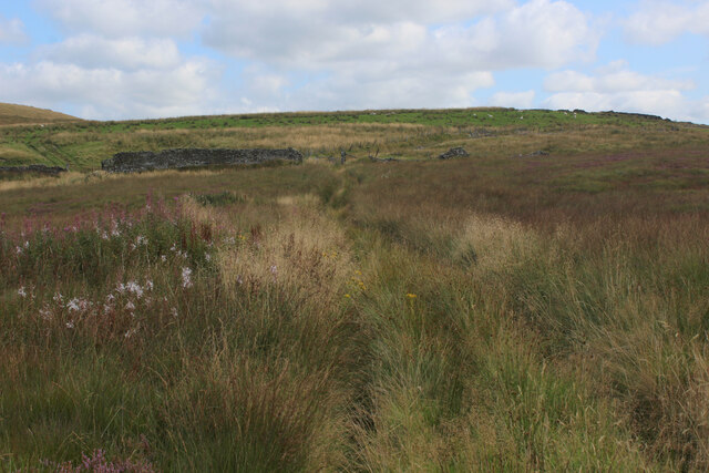
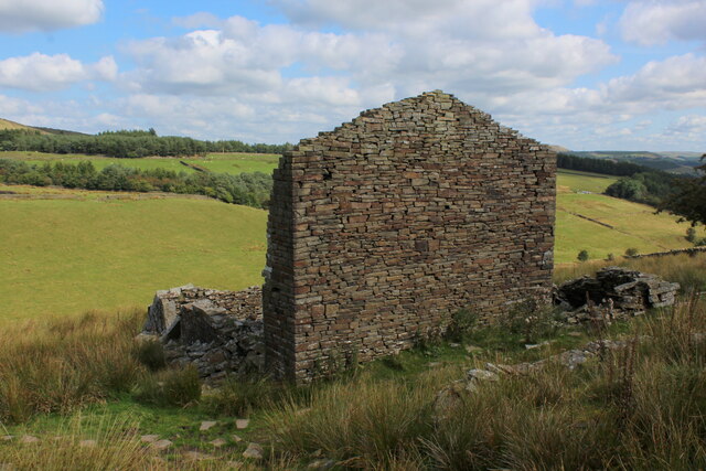
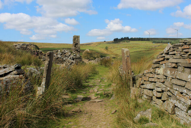
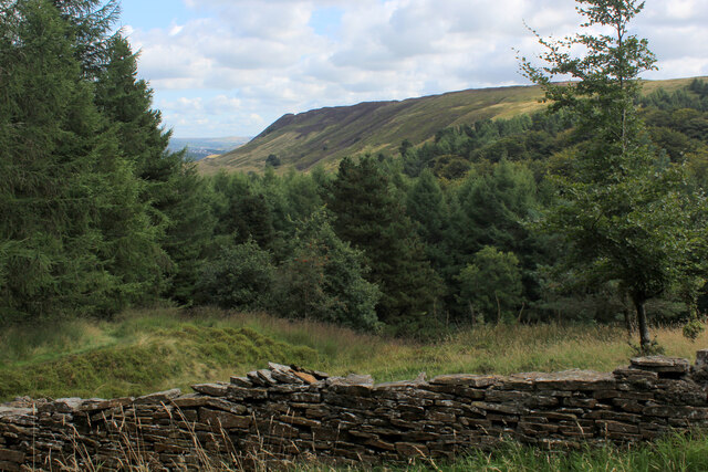
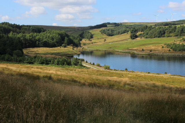
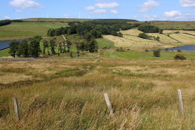
Adjacent to the downs lies the moorland of Kays o' th' Moss, with its rugged and wild terrain. The moorland is dominated by vast expanses of heather, creating a stunning purple carpet during the blooming season. Walking through this untamed landscape, visitors can discover hidden streams, cascading waterfalls, and secluded pools. The moorland is also known for its diverse bird population, making it a haven for birdwatchers and nature enthusiasts.

Kays o' th' Moss offers various recreational activities for visitors to enjoy. From hiking and cycling to horseback riding and birdwatching, there is something for everyone to appreciate in this natural wonderland. Additionally, several walking trails and picnic spots are scattered across the area, providing ample opportunities for relaxation and outdoor enjoyment.

In conclusion, Kays o' th' Moss in Lancashire is a captivating destination that showcases the beauty of downs and moorland landscapes. Its rich biodiversity, stunning vistas, and recreational offerings make it a must-visit location for nature lovers and outdoor enthusiasts alike.

If you have any feedback on the listing, please let us know in the comments section below.

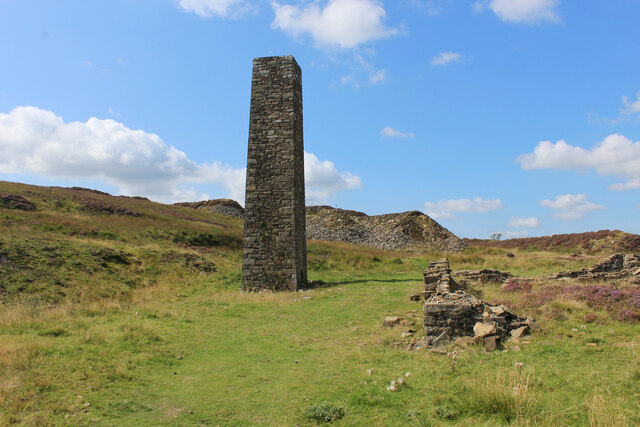
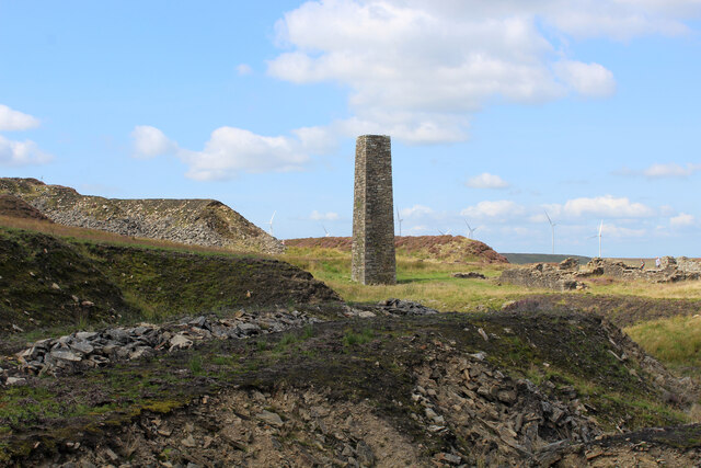
Kays o' th' Moss Images

Images are sourced within 2km of 53.68896/-2.3880967 or Grid Reference SD7421. Thanks to Geograph Open Source API. All images are credited.

Rossendale Way below Nab Hill A 41 mile circular high level route that roughly follows the boundary of Rossendale Borough.
Yellow indicators stamped with an "RW" logo in green leads the walker around the environs of Bacup, Rawtenstall, Haslingden and Whitworth.
Rossendale Way below Nab Hill
A 41 mile circular high level route that roughly follows the boundary of Rossendale Borough. Yellow indicators stamped with an "RW" logo in green leads the walker around the environs of Bacup, Rawtenstall, Haslingden and Whitworth.
Approaching Plantation below Nab Hill Following the Rossendale Way long distance footpath westwards in the upper reaches of Grane Valley.
Approaching Plantation below Nab Hill
Following the Rossendale Way long distance footpath westwards in the upper reaches of Grane Valley.
Descending into the Grane Valley (1) Public footpath follows the substantial wall into the head of the Grane Valley - which contains the River Ogden.
Descending into the Grane Valley (1)
Public footpath follows the substantial wall into the head of the Grane Valley - which contains the River Ogden.
Descending into the Grane Valley (2) Footpath descending into the head of the Grane Valley, although it is not visible on the ground - so attention needs to be concentrated on the map.
Descending into the Grane Valley (2)
Footpath descending into the head of the Grane Valley, although it is not visible on the ground - so attention needs to be concentrated on the map.
Footpath heading towards Broadhead Road
Track leading away from Broadhead Road The public footpath concealed and smothered by vegetation
Track leading away from Broadhead Road
The public footpath concealed and smothered by vegetation
Ruins of Peak House, Haslingden Grane Part of Grane Village, once a thriving community of over a thousand souls involved with farming, quarrying and illicit whisky distillation.
The construction of the 3 reservoirs sounded the death knell, depopulating the valley and leaving behind many ruined buildings
Ruins of Peak House, Haslingden Grane
Part of Grane Village, once a thriving community of over a thousand souls involved with farming, quarrying and illicit whisky distillation. The construction of the 3 reservoirs sounded the death knell, depopulating the valley and leaving behind many ruined buildings
Rossendale Way in Haslingden Grane The long distance footpath in the deserted ruins of Grane Village, a once thriving community depopulated after the construction of the three reservoirs.
Rossendale Way in Haslingden Grane
The long distance footpath in the deserted ruins of Grane Village, a once thriving community depopulated after the construction of the three reservoirs.
Ruins of Close Bottom, Haslingden Grane One of many ruins dotted hereabouts, that once made up the community of Grane Village.
Now abandoned and deserted, after the construction of 3 reservoirs along the River Ogden.
Ruins of Close Bottom, Haslingden Grane
One of many ruins dotted hereabouts, that once made up the community of Grane Village. Now abandoned and deserted, after the construction of 3 reservoirs along the River Ogden.
Ruins of Top o' th' Knoll, Haslingden Grane (1) Once substantial premises in the now abandoned Grane Village, passed by on the Rossendale Way.
Ruins of Top o' th' Knoll, Haslingden Grane (1)
Once substantial premises in the now abandoned Grane Village, passed by on the Rossendale Way.
Ruins of Top o' th' Knoll, Haslingden Grane (2) Part of the now deserted community of the once thriving Grane Village - a former farming, quarrying and illicit whisky distillation centre in the upper Ogden Valley
Ruins of Top o' th' Knoll, Haslingden Grane (2)
Part of the now deserted community of the once thriving Grane Village - a former farming, quarrying and illicit whisky distillation centre in the upper Ogden Valley
Grane Head In the plantations above Calf Hey Reservoir
Grane Head
In the plantations above Calf Hey Reservoir
Rossendale Way above Calf Hey Reservoir The long distance footpath in the Ogden Valley
Rossendale Way above Calf Hey Reservoir
The long distance footpath in the Ogden Valley
Calf Hey Reservoir The uppermost of three reservoirs in the Ogden Valley, as seen from the Rossendale Way.
Calf Hey Reservoir
The uppermost of three reservoirs in the Ogden Valley, as seen from the Rossendale Way.
Looking across the Ogden Valley Looking north from the Rossendale Way
Looking across the Ogden Valley
Looking north from the Rossendale Way
Ruins of Upper Heights Farm Above Ogden Reservoir, and passed by on the Rossendale Way long distance footpath are the sad abandoned remains of Upper Heights Farm
Ruins of Upper Heights Farm
Above Ogden Reservoir, and passed by on the Rossendale Way long distance footpath are the sad abandoned remains of Upper Heights Farm
Chimney on Musbury Heights (1) Found in the disused quarry on Musbury Heights, this chimney was restored in 2004. Lower Haslingden Flag was removed from here, concerned with the production of kerbstone, cobbles and flagstones.
Chimney on Musbury Heights (1)
Found in the disused quarry on Musbury Heights, this chimney was restored in 2004. Lower Haslingden Flag was removed from here, concerned with the production of kerbstone, cobbles and flagstones.
Chimney on Musbury Heights (2) Restored chimney amongst the spoil heaps in the disused quarry on Musbury Heights.
Lower Haslingden Flag, utilised for cobbles, kerbstones and flagstones were excavated from here.
Chimney on Musbury Heights (2)
Restored chimney amongst the spoil heaps in the disused quarry on Musbury Heights. Lower Haslingden Flag, utilised for cobbles, kerbstones and flagstones were excavated from here.
Show me another place!

Kays o' th' Moss is located at Grid Ref: SD7421 (Lat: 53.68896, Lng: -2.3880967)

Administrative County: Lancashire

District: Rossendale

Police Authority: Lancashire

What 3 Words

///profile.promising.formation. Near Haslingden, Lancashire

Related Wikis

Calf Hey Reservoir

Calf Hey Reservoir is a reservoir in Haslingden Grane, close to the town of Haslingden, in the Borough of Rossendale, England. It was the first of three...

Haslingden Grane

Haslingden Grane is the glaciated upper portion of the valley of the River Ogden, which lies west of Haslingden and is in the north east section of the...

Yate and Pickup Bank

Yate and Pickup Bank is a civil parish in the borough of Blackburn with Darwen, Lancashire, England. The population of the civil parish taken at the census...

Musbury Valley

The Musbury Valley is a small valley in the Helmshore area of Rossendale Valley, Lancashire. Musbury Brook flows through its length, and its south side...

Nearby Amenities

Located within 500m of 53.68896,-2.3880967
Man Made: survey_point
Survey Point Structure: pillar
Lat/Long: 53.6885104/-2.3833255
Barrier: stile
Material: wood
Stile: stepover
Lat/Long: 53.6885282/-2.3833286
The data included in this document is from www.openstreetmap.org. The data is made available under ODbL.

Have you been to Kays o' th' Moss?

Leave your review of Kays o' th' Moss below (or comments, questions and feedback).