Whinberry Pasture

Downs, Moorland in Lancashire

England

Whinberry Pasture

Descending into the Grane Valley (1) Public footpath follows the substantial wall into the head of the Grane Valley - which contains the River Ogden.
Descending into the Grane Valley (1) Credit: Chris Heaton

Whinberry Pasture is a picturesque area located in the county of Lancashire, England. Nestled amidst the stunning landscape of the Lancashire Downs and Moorland, this region is known for its natural beauty and tranquil environment.

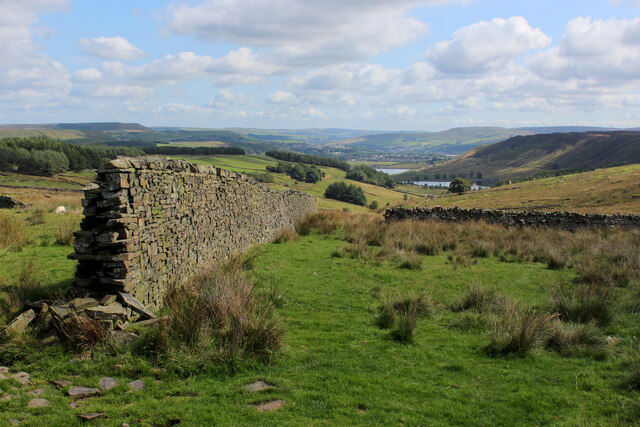
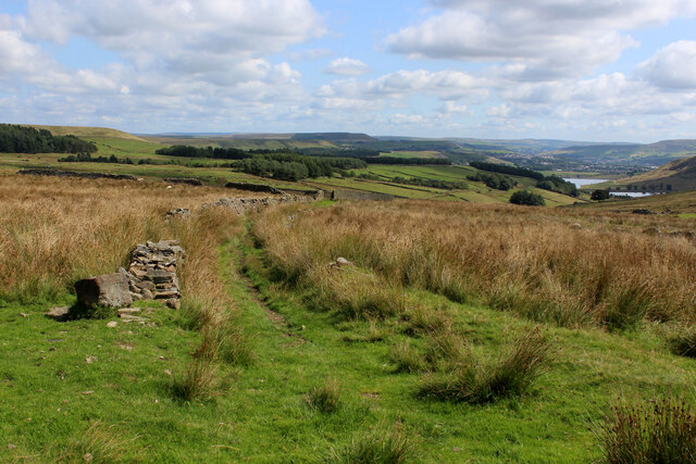
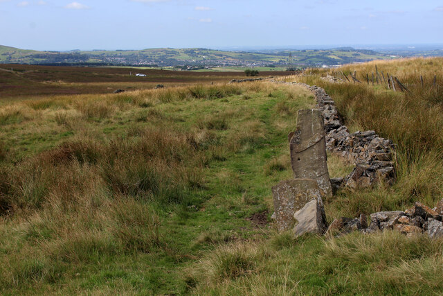
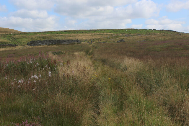
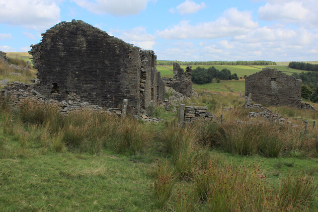
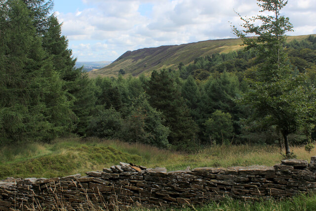
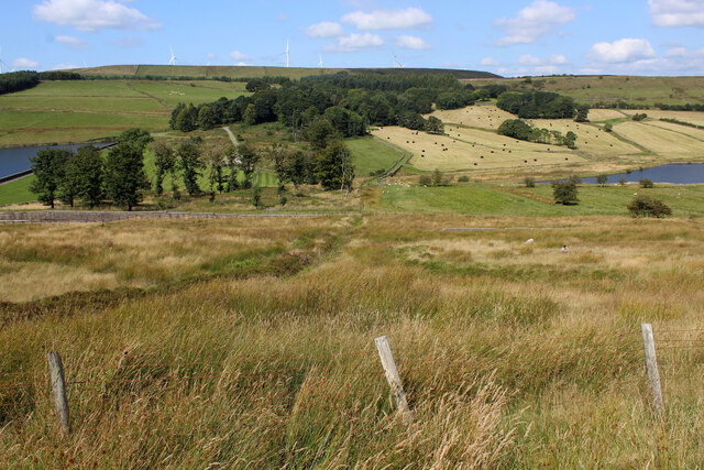
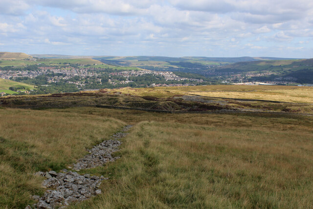
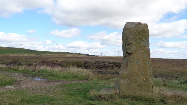
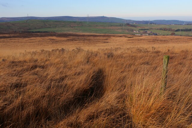
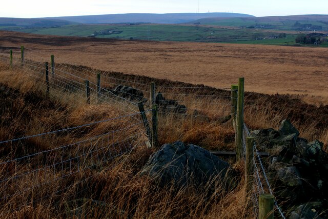
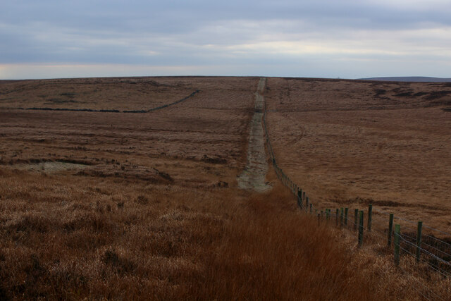
The main feature of Whinberry Pasture is its expansive moorland, characterized by vast stretches of heather and grasses. The moorland is scattered with scattered rocky outcrops and occasional groves of trees, adding to its charm. This rugged terrain is ideal for outdoor enthusiasts, attracting hikers, walkers, and nature lovers from far and wide.

The area is also home to an abundance of wildlife, making it a haven for birdwatchers and wildlife enthusiasts. Visitors can spot a variety of bird species, such as the red grouse, curlew, and kestrel, as well as mammals like rabbits and deer.

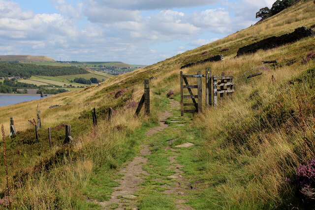
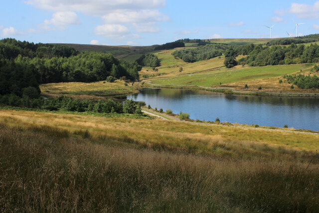
Whinberry Pasture offers several walking trails and paths, catering to different abilities and preferences. These trails provide breathtaking views of the surrounding landscape, with the Lancashire Downs providing a stunning backdrop. The area is also intersected by streams and small rivers, adding to the allure of the countryside.

Visitors to Whinberry Pasture can take advantage of the peaceful atmosphere and indulge in picnics or simply relax amidst the tranquility of nature. The area is also a popular spot for photography enthusiasts, who can capture the beauty of the landscape in all its glory.

Overall, Whinberry Pasture in Lancashire is a haven for nature lovers, offering a peaceful retreat amidst the stunning beauty of the Lancashire Downs and Moorland. Whether it's hiking, birdwatching, or simply immersing oneself in the serenity of the countryside, this idyllic location has something to offer for everyone.

If you have any feedback on the listing, please let us know in the comments section below.

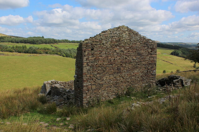
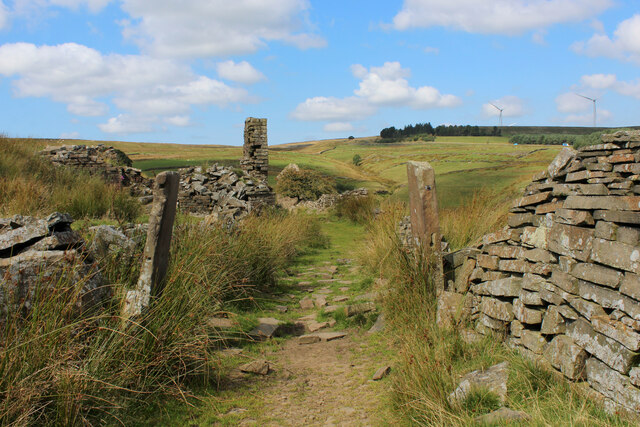
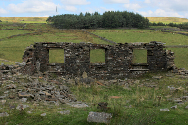
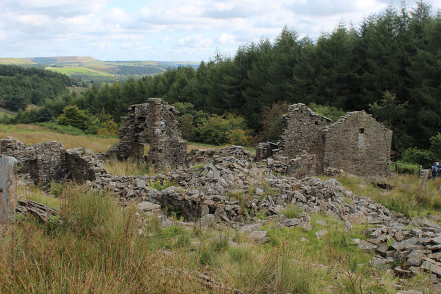
Whinberry Pasture Images

Images are sourced within 2km of 53.688271/-2.3929207 or Grid Reference SD7421. Thanks to Geograph Open Source API. All images are credited.

Descending into the Grane Valley (1) Public footpath follows the substantial wall into the head of the Grane Valley - which contains the River Ogden.
Descending into the Grane Valley (1)
Public footpath follows the substantial wall into the head of the Grane Valley - which contains the River Ogden.
Descending into the Grane Valley (2) Footpath descending into the head of the Grane Valley, although it is not visible on the ground - so attention needs to be concentrated on the map.
Descending into the Grane Valley (2)
Footpath descending into the head of the Grane Valley, although it is not visible on the ground - so attention needs to be concentrated on the map.
Footpath heading towards Broadhead Road
Track leading away from Broadhead Road The public footpath concealed and smothered by vegetation
Track leading away from Broadhead Road
The public footpath concealed and smothered by vegetation
Ruins of Peak House, Haslingden Grane Part of Grane Village, once a thriving community of over a thousand souls involved with farming, quarrying and illicit whisky distillation.
The construction of the 3 reservoirs sounded the death knell, depopulating the valley and leaving behind many ruined buildings
Ruins of Peak House, Haslingden Grane
Part of Grane Village, once a thriving community of over a thousand souls involved with farming, quarrying and illicit whisky distillation. The construction of the 3 reservoirs sounded the death knell, depopulating the valley and leaving behind many ruined buildings
Rossendale Way in Haslingden Grane The long distance footpath in the deserted ruins of Grane Village, a once thriving community depopulated after the construction of the three reservoirs.
Rossendale Way in Haslingden Grane
The long distance footpath in the deserted ruins of Grane Village, a once thriving community depopulated after the construction of the three reservoirs.
Ruins of Close Bottom, Haslingden Grane One of many ruins dotted hereabouts, that once made up the community of Grane Village.
Now abandoned and deserted, after the construction of 3 reservoirs along the River Ogden.
Ruins of Close Bottom, Haslingden Grane
One of many ruins dotted hereabouts, that once made up the community of Grane Village. Now abandoned and deserted, after the construction of 3 reservoirs along the River Ogden.
Ruins of Top o' th' Knoll, Haslingden Grane (1) Once substantial premises in the now abandoned Grane Village, passed by on the Rossendale Way.
Ruins of Top o' th' Knoll, Haslingden Grane (1)
Once substantial premises in the now abandoned Grane Village, passed by on the Rossendale Way.
Ruins of Top o' th' Knoll, Haslingden Grane (2) Part of the now deserted community of the once thriving Grane Village - a former farming, quarrying and illicit whisky distillation centre in the upper Ogden Valley
Ruins of Top o' th' Knoll, Haslingden Grane (2)
Part of the now deserted community of the once thriving Grane Village - a former farming, quarrying and illicit whisky distillation centre in the upper Ogden Valley
Grane Head In the plantations above Calf Hey Reservoir
Grane Head
In the plantations above Calf Hey Reservoir
Rossendale Way above Calf Hey Reservoir The long distance footpath in the Ogden Valley
Rossendale Way above Calf Hey Reservoir
The long distance footpath in the Ogden Valley
Calf Hey Reservoir The uppermost of three reservoirs in the Ogden Valley, as seen from the Rossendale Way.
Calf Hey Reservoir
The uppermost of three reservoirs in the Ogden Valley, as seen from the Rossendale Way.
Looking across the Ogden Valley Looking north from the Rossendale Way
Looking across the Ogden Valley
Looking north from the Rossendale Way
Musbury Heights
Musbury Heights
Quarry Stone on Edgerton Moss A menhir of the future with Hyndburn Wind Farm on Oswaldtwistle Moor beyond
Quarry Stone on Edgerton Moss
A menhir of the future with Hyndburn Wind Farm on Oswaldtwistle Moor beyond
On Hoddlesden Moss There is a tangible footpath passing the wooden post, it is just buried beneath vegetation as it gradually descends from Grey Stone Hill
On Hoddlesden Moss
There is a tangible footpath passing the wooden post, it is just buried beneath vegetation as it gradually descends from Grey Stone Hill
Summit of Grey Stone Hill Moorland gradually slopes down on all sides from the summit, which is crowned with a small gritstone boulder - presumably giving this hill its name.
Summit of Grey Stone Hill
Moorland gradually slopes down on all sides from the summit, which is crowned with a small gritstone boulder - presumably giving this hill its name.
Heading towards Soot Hill Descending the southern flank of Grey Stone Hill towards the distant Soot Hill.  A strip has been cut beside the fence making progress much easier.
Heading towards Soot Hill
Descending the southern flank of Grey Stone Hill towards the distant Soot Hill. A strip has been cut beside the fence making progress much easier.
Show me another place!

Whinberry Pasture is located at Grid Ref: SD7421 (Lat: 53.688271, Lng: -2.3929207)

Unitary Authority: Blackburn with Darwen

Police Authority: Lancashire

What 3 Words

///majors.pickle.daydreams. Near Edgworth, Lancashire

Related Wikis

Calf Hey Reservoir

Calf Hey Reservoir is a reservoir in Haslingden Grane, close to the town of Haslingden, in the Borough of Rossendale, England. It was the first of three...

Yate and Pickup Bank

Yate and Pickup Bank is a civil parish in the borough of Blackburn with Darwen, Lancashire, England. The population of the civil parish taken at the census...

Haslingden Grane

Haslingden Grane is the glaciated upper portion of the valley of the River Ogden, which lies west of Haslingden and is in the north east section of the...

Musbury Valley

The Musbury Valley is a small valley in the Helmshore area of Rossendale Valley, Lancashire. Musbury Brook flows through its length, and its south side...

Nearby Amenities

Located within 500m of 53.688271,-2.3929207
The data included in this document is from www.openstreetmap.org. The data is made available under ODbL.

Have you been to Whinberry Pasture?

Leave your review of Whinberry Pasture below (or comments, questions and feedback).