East Moor

Downs, Moorland in Westmorland Eden

England

East Moor

Bridge over Hilton Beck The bridge carries Leagarth Lane, Hilton's main road, over Hilton Beck, and is seen from the public footpath on the south bank heading for Langton and Brackenber. Water levels are quite high, and for those keen to try out little-known river descents, is almost at a paddleable level - this would be a convenient put-on, with parking to the left of the background trees. There's at least one livestock fence to watch out for downstream (but has a big eddy and can probably be sneaked via a broken panel, as of early 2022).
Bridge over Hilton Beck Credit: Andy Waddington

East Moor, Westmorland, also known as Downs, Moorland, is a picturesque region located in the county of Cumbria in northwestern England. Situated in the beautiful Lake District National Park, this area is renowned for its natural beauty, rolling hills, and stunning landscapes.

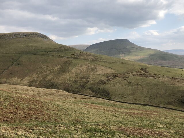
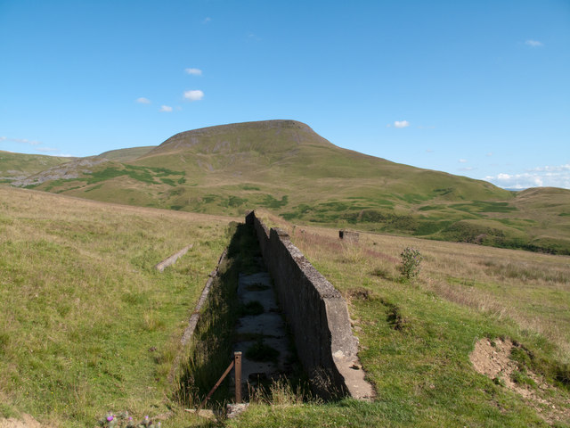
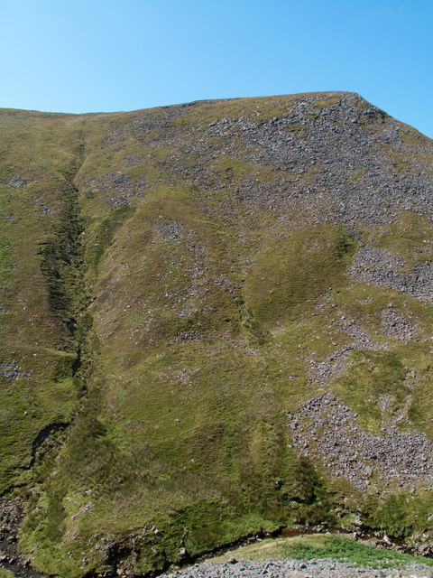
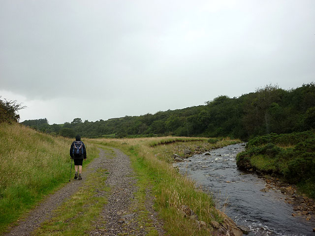
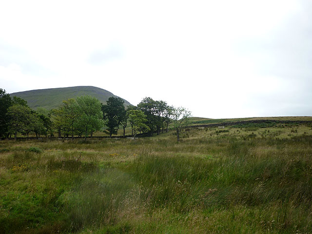
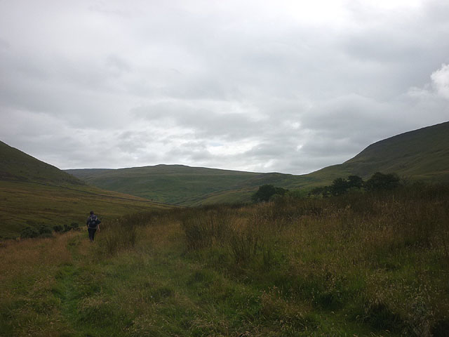
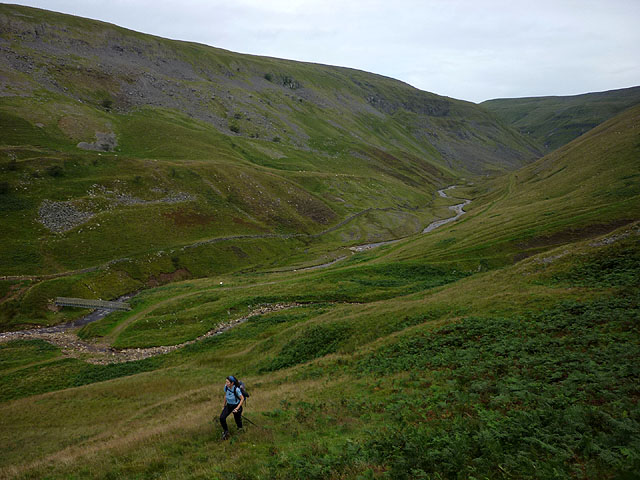
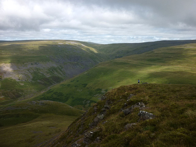
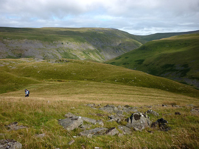
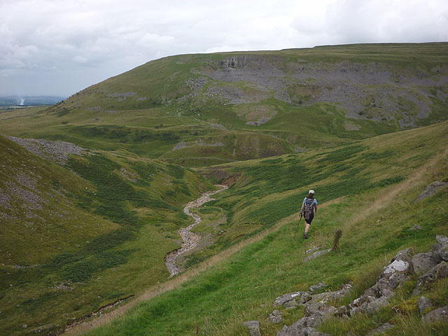
Covering a significant portion of the eastern part of Westmorland, East Moor is characterized by its vast expanses of moorland, heather-covered hills, and meandering streams. The region is dotted with charming villages, each with its own unique character and architecture, providing a glimpse into the area's rich history.

East Moor is home to a wide variety of flora and fauna, including heather, bracken, and wildflowers, as well as several species of birds and small mammals. The moorland serves as a habitat for many rare and protected species, making it an important conservation area.

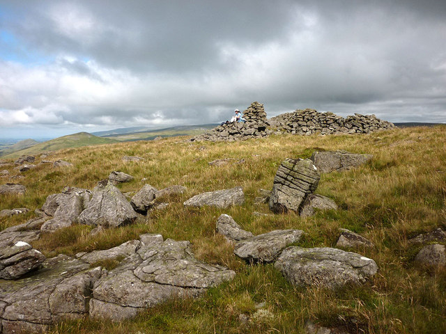
Outdoor enthusiasts are drawn to East Moor for its excellent walking and hiking trails, offering visitors the opportunity to explore the stunning countryside and take in breathtaking panoramic views. The area is also popular for birdwatching, with several species of birds of prey, such as the peregrine falcon and merlin, frequently spotted here.

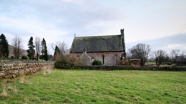
Visitors to East Moor can also indulge in the region's rich cultural heritage by visiting historical sites, including ancient stone circles and prehistoric settlements. The nearby market town of Kendal provides a gateway to the Lake District, offering a range of amenities, including shops, restaurants, and accommodation options.

In summary, East Moor, Westmorland, is a captivating region with its moorland landscapes, charming villages, and abundant wildlife. It is an idyllic destination for nature lovers and those seeking a peaceful retreat in the heart of the Lake District.

If you have any feedback on the listing, please let us know in the comments section below.

East Moor Images

Images are sourced within 2km of 54.573683/-2.3963369 or Grid Reference NY7419. Thanks to Geograph Open Source API. All images are credited.

Bridge over Hilton Beck The bridge carries Leagarth Lane, Hilton's main road, over Hilton Beck, and is seen from the public footpath on the south bank heading for Langton and Brackenber. Water levels are quite high, and for those keen to try out little-known river descents, is almost at a paddleable level - this would be a convenient put-on, with parking to the left of the background trees. There's at least one livestock fence to watch out for downstream (but has a big eddy and can probably be sneaked via a broken panel, as of early 2022).
Bridge over Hilton Beck
The bridge carries Leagarth Lane, Hilton's main road, over Hilton Beck, and is seen from the public footpath on the south bank heading for Langton and Brackenber. Water levels are quite high, and for those keen to try out little-known river descents, is almost at a paddleable level - this would be a convenient put-on, with parking to the left of the background trees. There's at least one livestock fence to watch out for downstream (but has a big eddy and can probably be sneaked via a broken panel, as of early 2022).
Hilton Beck from Thornless Hill The larger scales of map show the public footpath here as being at the bottom of the steep bank, but invasive gorse rather deterred one from trying anything down there. The top of the bank, however, remains largely in keeping with the name of the rising ground behind the photographer - Thornless Hill. It is not improved pasture like the enclosed fields towards the village of Hilton, but is mainly free of prickly walker-deterrent vegetation. The road is the one to Hilton from Appleby and likely the one that a SatNav would bring you to, since the road south of Hilton passes through Warcop training area and is confusingly missing from such navigation technology (presumably because sometimes it is closed to the public).
Hilton Beck from Thornless Hill
The larger scales of map show the public footpath here as being at the bottom of the steep bank, but invasive gorse rather deterred one from trying anything down there. The top of the bank, however, remains largely in keeping with the name of the rising ground behind the photographer - Thornless Hill. It is not improved pasture like the enclosed fields towards the village of Hilton, but is mainly free of prickly walker-deterrent vegetation. The road is the one to Hilton from Appleby and likely the one that a SatNav would bring you to, since the road south of Hilton passes through Warcop training area and is confusingly missing from such navigation technology (presumably because sometimes it is closed to the public).
Murton and Hilton church Situated midway between Murton and its smaller satellite Hilton, the church is dedicated to St. John the Baptist. Its graveyard lies just across the minor road between the villages, and slightly nearer to Hilton, and lies among the tall conifers seen on the left of the view.
Murton and Hilton church
Situated midway between Murton and its smaller satellite Hilton, the church is dedicated to St. John the Baptist. Its graveyard lies just across the minor road between the villages, and slightly nearer to Hilton, and lies among the tall conifers seen on the left of the view.
View past the edge of Mell Fell to Roman Fell Both fells lie within Warcop Ranges and as such are not open access. Walkers are allowed in the ranges during not firing times - after 1 pm on a Sunday and 14 weekends per year - but must stick to footpaths / bridleways.
View past the edge of Mell Fell to Roman Fell
Both fells lie within Warcop Ranges and as such are not open access. Walkers are allowed in the ranges during not firing times - after 1 pm on a Sunday and 14 weekends per year - but must stick to footpaths / bridleways.
Ordnance Survey Cut Mark This OS cut mark can be found on the east angle of St John's Church. It marks a point 232.361m above mean sea level.
Ordnance Survey Cut Mark
This OS cut mark can be found on the east angle of St John's Church. It marks a point 232.361m above mean sea level.
Church at Murton The Church of St. John the Baptist stands beside the minor road linking the villages of Murton and Hilton.
Church at Murton
The Church of St. John the Baptist stands beside the minor road linking the villages of Murton and Hilton.
The Cottage and barn at Hilton Hilton is a small, attractive village at the foot of the steep western slope of the northern Pennines; it's unfortunate that it's also perhaps the closest settlement to the MOD's Warcop Firing range with 'live' artillery firing occurring on most days of the year. No danger of course but the noise must be aggravating! The small cottage is actually named 'The Cottage'; it's on the north side of the road.
The Cottage and barn at Hilton
Hilton is a small, attractive village at the foot of the steep western slope of the northern Pennines; it's unfortunate that it's also perhaps the closest settlement to the MOD's Warcop Firing range with 'live' artillery firing occurring on most days of the year. No danger of course but the noise must be aggravating! The small cottage is actually named 'The Cottage'; it's on the north side of the road.
Rifle range target This feature installed on rough pasture land close to the village of Hilton is a disused target for the MOD firing range at Warcop. There's a concrete wall with an earth rampart on the downhill side - the direction from which fire would have come. Presumably the walkway below the wall was where targets were prepared and then raised above the parapet. The distant hill is Roman Fell and the obvious groove between it and the target is the line of Scordale Beck.
Rifle range target
This feature installed on rough pasture land close to the village of Hilton is a disused target for the MOD firing range at Warcop. There's a concrete wall with an earth rampart on the downhill side - the direction from which fire would have come. Presumably the walkway below the wall was where targets were prepared and then raised above the parapet. The distant hill is Roman Fell and the obvious groove between it and the target is the line of Scordale Beck.
Roman Fell across Swindale The steep north-eastern face of Roman Fell is largely grassed but with an extensive area of boulders too, the upper ones at least are apparently known as Slape Stones or Fox Yards. In this view from a path across the valley below Swindale Edge, Roman Fell's summit is not in view, being beyond the apparent crest of the hill over a slope at a more gentle angle.
Roman Fell across Swindale
The steep north-eastern face of Roman Fell is largely grassed but with an extensive area of boulders too, the upper ones at least are apparently known as Slape Stones or Fox Yards. In this view from a path across the valley below Swindale Edge, Roman Fell's summit is not in view, being beyond the apparent crest of the hill over a slope at a more gentle angle.
Bridleway beside Scordale Beck Heading towards Hilton as the rain arrives.
Bridleway beside Scordale Beck
Heading towards Hilton as the rain arrives.
Rough pasture by the bridleway to Scordale Roman Fell beyond.
Rough pasture by the bridleway to Scordale
Roman Fell beyond.
Bridleway to Scordale Two bridleways leave Hilton then join by the beck before advancing into Scordale now opening up ahead.
Bridleway to Scordale
Two bridleways leave Hilton then join by the beck before advancing into Scordale now opening up ahead.
Starting up the north ridge of Roman Fell Leaving the good bridleway in Scordale for the rough and steep climb up the north ridge of Roman Fell. Below is the footbridge over Scordale Beck just upstream of the confluence of Swindale Beck.
Starting up the north ridge of Roman Fell
Leaving the good bridleway in Scordale for the rough and steep climb up the north ridge of Roman Fell. Below is the footbridge over Scordale Beck just upstream of the confluence of Swindale Beck.
Roman Fell Scar After a very steep climb up the north ridge the going eases above Roman Fell Scar. Far below are the deep trenches of Swindale and Scordale.
Roman Fell Scar
After a very steep climb up the north ridge the going eases above Roman Fell Scar. Far below are the deep trenches of Swindale and Scordale.
Climbing up Roman Fell Partway up the north ridge of Roman Fell there is a large flat area known as High Hause with a slight col beyond, Hause Harrows. Above here the ridge is a very steep and bouldery slope called Slape Stones (or Fox Yards). We saw no foxes but encountered clouds of midges which did not abate until a breeze on the summit kept them down.
Climbing up Roman Fell
Partway up the north ridge of Roman Fell there is a large flat area known as High Hause with a slight col beyond, Hause Harrows. Above here the ridge is a very steep and bouldery slope called Slape Stones (or Fox Yards). We saw no foxes but encountered clouds of midges which did not abate until a breeze on the summit kept them down.
The summit of Roman Fell (594m) The summit area is a large, tilted plateau of gritstone with scatterings of boulders surrounding a large cairn. The map does not suggest that this is a burial cairn but the boulders look to have been collected into a large structure part of which has also been fashioned into a fold or shelter. To the north can be seen the conical peaks of Murton and Dufton Pikes.
The summit of Roman Fell (594m)
The summit area is a large, tilted plateau of gritstone with scatterings of boulders surrounding a large cairn. The map does not suggest that this is a burial cairn but the boulders look to have been collected into a large structure part of which has also been fashioned into a fold or shelter. To the north can be seen the conical peaks of Murton and Dufton Pikes.
The bridleway above Swindale A lovely green track descending into Scordale.
The bridleway above Swindale
A lovely green track descending into Scordale.
Roman Fell from Murton Pike Roman Fell is a rugged height which would not look out of place in the Lake District. Low October light accentuates the gullied flank below Roman Fell Scar. In the foreground is the limestone band of Delfekirk Scar. A zoom shot from Murton Pike to the north.
Roman Fell from Murton Pike
Roman Fell is a rugged height which would not look out of place in the Lake District. Low October light accentuates the gullied flank below Roman Fell Scar. In the foreground is the limestone band of Delfekirk Scar. A zoom shot from Murton Pike to the north.
Show me another place!

East Moor is located at Grid Ref: NY7419 (Lat: 54.573683, Lng: -2.3963369)

Administrative County: Cumbria

District: Eden

Police Authority: Cumbria

What 3 Words

///frightens.initiated.oils. Near Appleby-in-Westmorland, Cumbria

Nearby Locations

East Moor

Related Wikis

Hilton, Cumbria

Hilton is a village in Cumbria, England, in the civil parish of Murton, about 3 miles (4.8 km) east of Appleby-in-Westmorland and at an elevation of 752...

Murton, Cumbria

Murton is a small village and civil parish in the Eden District of Cumbria, England. The parish had a population of 330 in 2001, rising to 360 at the 2011...

Brackenber

Brackenber is a hamlet in the civil parish of Murton in Cumbria, England. It is near the town of Appleby-in-Westmorland and the village of Hilton, Cumbria...

Coupland, Cumbria

Coupland is a small village in Cumbria, England, in the civil parish of Warcop. It is situated a short distance to the south-east of Appleby-in-Westmorland...

Have you been to East Moor?

Leave your review of East Moor below (or comments, questions and feedback).