Duxbury Wood

Downs, Moorland in Lancashire Hyndburn

England

Duxbury Wood

Empress Garage
Empress Garage Credit: Anthony Parkes

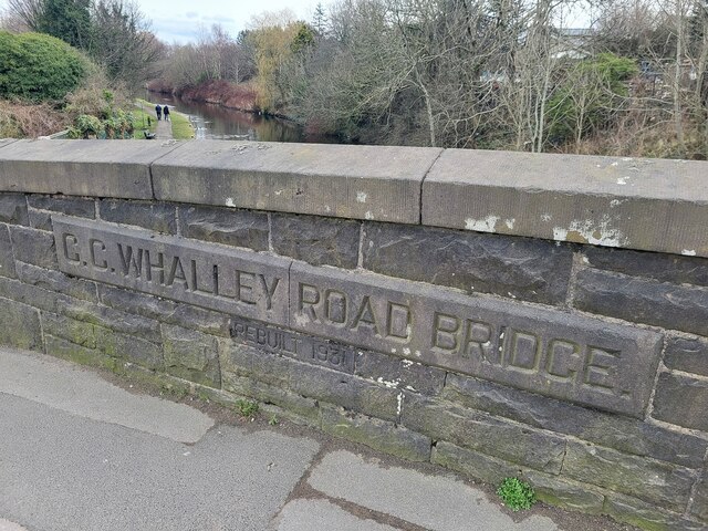
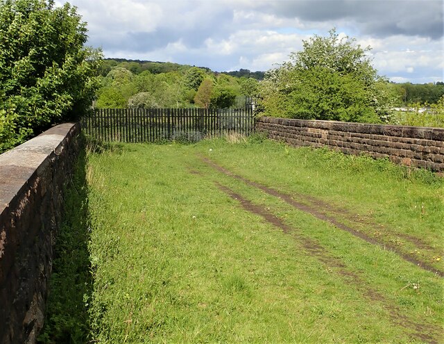
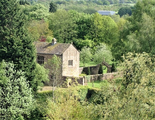
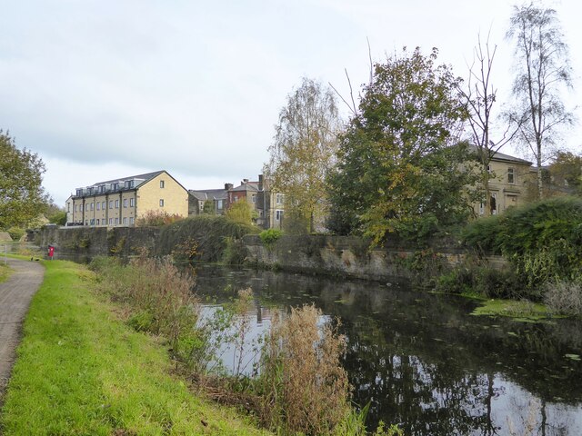
Duxbury Wood is a picturesque woodland located in the county of Lancashire, England. Situated in the area known as Duxbury Park, the wood is nestled amidst the rolling hills, downs, and moorland, offering visitors a diverse and enchanting natural landscape to explore.

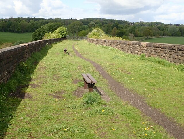
The woodland covers an expansive area, spanning approximately 100 acres, and is characterized by a rich variety of flora and fauna. The dense canopy of trees, predominantly oak and beech, provides a cool and shaded environment, making it an ideal spot for leisurely walks and nature enthusiasts alike.

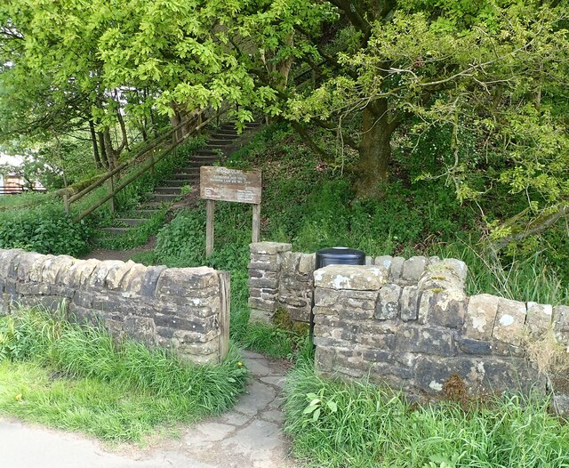
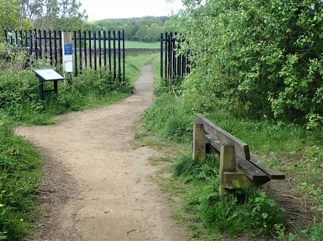
Duxbury Wood boasts a network of well-maintained walking trails, allowing visitors to traverse the wood and immerse themselves in its tranquil ambiance. The paths wind through the wood, offering glimpses of vibrant wildflowers, ferns, and mosses that carpet the forest floor. The wood is also home to an array of wildlife, including deer, foxes, rabbits, and a multitude of bird species, making it a haven for wildlife enthusiasts and birdwatchers.

For centuries, Duxbury Wood has been an integral part of the local community, providing a recreational space for residents and visitors alike. The wood is a popular destination for family outings, picnics, and even organized events, such as guided nature walks and educational programs.

Overall, Duxbury Wood in Lancashire offers a serene and idyllic escape from the hustle and bustle of everyday life. Its natural beauty, diverse ecosystem, and peaceful atmosphere make it a must-visit destination for those seeking solace in nature.

If you have any feedback on the listing, please let us know in the comments section below.

Duxbury Wood Images

Images are sourced within 2km of 53.786048/-2.3887347 or Grid Reference SD7432. Thanks to Geograph Open Source API. All images are credited.

Empress Garage
Empress Garage
Checco's Pizzeria
Checco's Pizzeria
Gated Track near Hyndburn Bridge
Old Bridge Marker on the A680 Whalley Road Bridge Marker inscribed in the capstone of the north pier of Hyndburn Bridge, Hyndburn Brook, on the east side of the A680 Whalley Road. On the boundary of Great Harwood and Clayton le Moors parishes until 1974 when both were abolished. REBUILT 1930 in inscribed on the capstone of the south pier on the east side of the road.

Milestone Society National ID: LA_GHACLM01br
Old Bridge Marker on the A680 Whalley Road
Bridge Marker inscribed in the capstone of the north pier of Hyndburn Bridge, Hyndburn Brook, on the east side of the A680 Whalley Road. On the boundary of Great Harwood and Clayton le Moors parishes until 1974 when both were abolished. REBUILT 1930 in inscribed on the capstone of the south pier on the east side of the road. Milestone Society National ID: LA_GHACLM01br
Old Bridge Marker on the A680 Whalley Road Bridge Marker inscribed on two stones in the parapet of Whalley Road Bridge, Leeds and Liverpool Canal, on the east side of the A680 Whalley Road. In Clayton le Moors parish until 1974 when it was abolished.

Milestone Society National ID: LA_CLAYLM01br
Old Bridge Marker on the A680 Whalley Road
Bridge Marker inscribed on two stones in the parapet of Whalley Road Bridge, Leeds and Liverpool Canal, on the east side of the A680 Whalley Road. In Clayton le Moors parish until 1974 when it was abolished. Milestone Society National ID: LA_CLAYLM01br
Gateway for steps leading to Viaduct The gateway leading to the 74 steps providing access from Martholme Lane up to the Viaduct and Martholme Greenway.
Gateway for steps leading to Viaduct
The gateway leading to the 74 steps providing access from Martholme Lane up to the Viaduct and Martholme Greenway.
Access to Martholme Viaduct The barrier with gateway providing access to Martholme Viaduct from Martholme Greenway. The path leading off on the left leads to the 74 steps going down to Martholme Lane.
Access to Martholme Viaduct
The barrier with gateway providing access to Martholme Viaduct from Martholme Greenway. The path leading off on the left leads to the 74 steps going down to Martholme Lane.
Wooden Benches on Martholme Viaduct The benches on the path over Martholme Viaduct. Access beyond the viaduct has been closed off see closer view here - <a title="https://www.geograph.org.uk/photo/7483819" href="https://www.geograph.org.uk/photo/7483819">Link</a>
Wooden Benches on Martholme Viaduct
The benches on the path over Martholme Viaduct. Access beyond the viaduct has been closed off see closer view here - Link
End of Access from Martholme Viaduct A closer view of the barrier erected at the end of the path leading over Martholme Viaduct towards Read and Simmonstone.
End of Access from Martholme Viaduct
A closer view of the barrier erected at the end of the path leading over Martholme Viaduct towards Read and Simmonstone.
Martholme Gatehouse and outer archway Martholme manor house dates from the 13th century when the house belonged to the de Fitton family. It was passed through marriage to the Hesketh family and re-built in 1577 during the reign of Queen Elizabeth I. During that time the Lords of the Manor would carry out their own code of justice on local law breakers and this was dispensed at the Gatehouse. The Gatehouse can be seen in the picture with the Outer Archway which was added in 1607. The remaining buildings are located off to the left and obscured by trees.
Manor House - <span class="nowrap"><a title="https://redrosecollections.lancashire.gov.uk/view-item?i=274760&WINID=1690967778154" rel="nofollow ugc noopener" href="https://redrosecollections.lancashire.gov.uk/view-item?i=274760&WINID=1690967778154">Link</a><img style="margin-left:2px;" alt="External link" title="External link - shift click to open in new window" src="https://s1.geograph.org.uk/img/external.png" width="10" height="10"/></span>
Martholme Gatehouse and outer archway
Martholme manor house dates from the 13th century when the house belonged to the de Fitton family. It was passed through marriage to the Hesketh family and re-built in 1577 during the reign of Queen Elizabeth I. During that time the Lords of the Manor would carry out their own code of justice on local law breakers and this was dispensed at the Gatehouse. The Gatehouse can be seen in the picture with the Outer Archway which was added in 1607. The remaining buildings are located off to the left and obscured by trees. Manor House - LinkExternal link
Leeds & Liverpool Canal The Leeds & Liverpool Canal at Enfield.
Leeds & Liverpool Canal
The Leeds & Liverpool Canal at Enfield.
M65 The M65 Motorway seen from the Leeds & Liverpool Canal.
M65
The M65 Motorway seen from the Leeds & Liverpool Canal.
Old Milestone by the A680, Rodger Hey Farm, Great Harwood parish Carved stone post by the A680, in parish of GREAT HARWOOD (HYNDBURN District), North of Rodger Hey, by the road, on West side of road. Lancs CC stone triangle, erected by the County Council in the 19th/20th century. 

Inscription reads:-
: WHALLEY / 2 MILES / CLITHEROE / 6 MILES : : GREAT / HARWOOD : : ACCRINGTON / 3 MILES : 

Milestone Society National ID: LA_CLAC06.
Old Milestone by the A680, Rodger Hey Farm, Great Harwood parish
Carved stone post by the A680, in parish of GREAT HARWOOD (HYNDBURN District), North of Rodger Hey, by the road, on West side of road. Lancs CC stone triangle, erected by the County Council in the 19th/20th century. Inscription reads:- : WHALLEY / 2 MILES / CLITHEROE / 6 MILES : : GREAT / HARWOOD : : ACCRINGTON / 3 MILES : Milestone Society National ID: LA_CLAC06.
Livestock Barn At Moorside Farm with plenty of winter feed adjacent
Livestock Barn
At Moorside Farm with plenty of winter feed adjacent
Leeds and Liverpool Canal Just after passing Pilkington Canal Bridge. The towpath now has competition from an illuminated housing estate path that follows the other bank.
Leeds and Liverpool Canal
Just after passing Pilkington Canal Bridge. The towpath now has competition from an illuminated housing estate path that follows the other bank.
Leeds and Liverpool Canal The towpath is approaching some green security fencing that comes down to the canal from the local school.
Leeds and Liverpool Canal
The towpath is approaching some green security fencing that comes down to the canal from the local school.
Leeds and Liverpool Canal Approaching Whalley Road Bridge with some old mill walling on the bank opposite the towpath
Leeds and Liverpool Canal
Approaching Whalley Road Bridge with some old mill walling on the bank opposite the towpath
Modern housing estate On Bold Venture Way near the boundary with Altham
Modern housing estate
On Bold Venture Way near the boundary with Altham
Show me another place!

Duxbury Wood is located at Grid Ref: SD7432 (Lat: 53.786048, Lng: -2.3887347)

Administrative County: Lancashire

District: Hyndburn

Police Authority: Lancashire

What 3 Words

///glory.bliss.sweat. Near Great Harwood, Lancashire

Related Wikis

Great Harwood railway station

Great Harwood railway station was located in the south east side of Great Harwood, Lancashire, England on Station Road, which still remains. The station...

Oakenshaw, Lancashire

Oakenshaw is part of Clayton-le-Moors in Lancashire, England. Thomas de Clayton was the first grantee of Oakenshaw in the middle of the 11th-century. A...

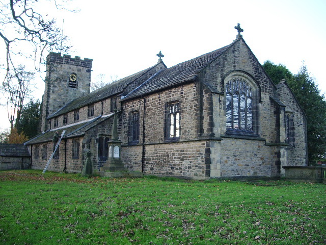
St Bartholomew's Church, Great Harwood

St Bartholomew's Church is in the town of Great Harwood in Lancashire, England. It is an active Anglican parish church in the Diocese of Blackburn. The...

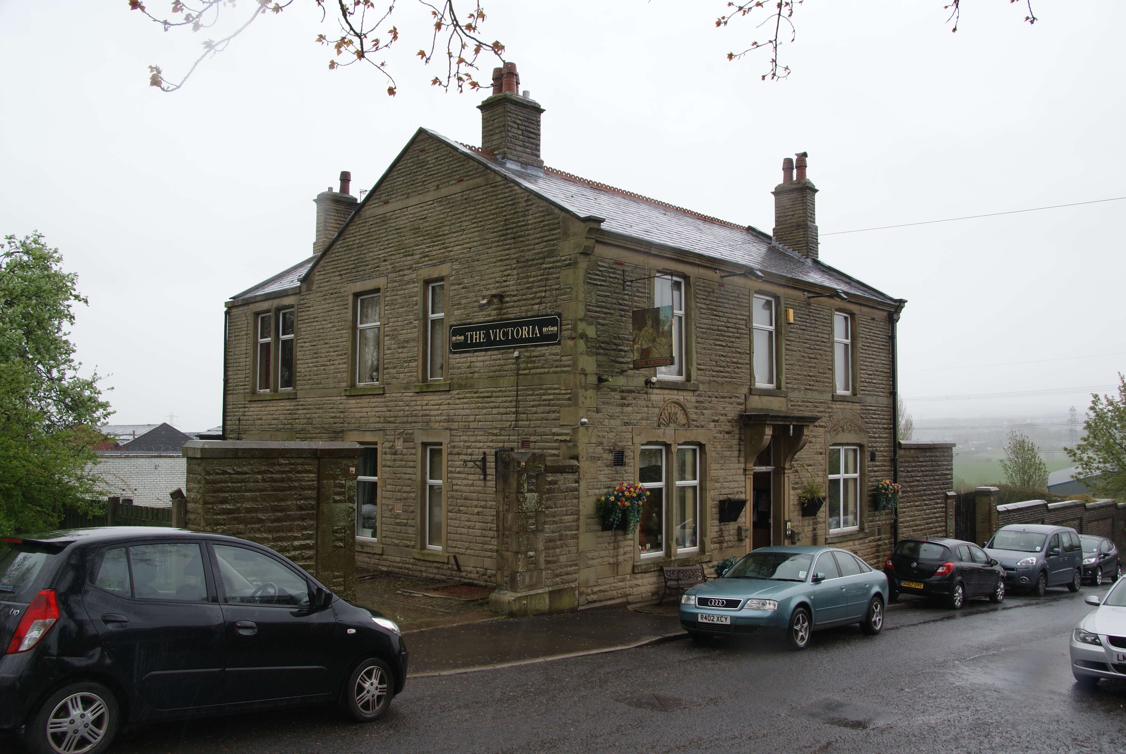
The Victoria, Great Harwood

The Victoria is a Grade II listed public house at St John's Street, Great Harwood, Blackburn, Lancashire BB6 7EP.It is on the Campaign for Real Ale's National...

St John's Church, Great Harwood

St John's Church was an Anglican parish church in St Hubert's Road, Great Harwood, Lancashire, England. Its benefice has been united with that of St Bartholomew...

Great Harwood Town Hall

Great Harwood Town Hall is a municipal building in Town Hall Square, Great Harwood, Lancashire, England. The town hall, which was the headquarters of Great...

Great Harwood

Great Harwood is a town in the Hyndburn district of Lancashire, England, located 5 miles (8.0 km) north east of Blackburn and adjacent to the Ribble Valley...

Clayton-le-Moors

Clayton-le-Moors is an industrial town in the borough of Hyndburn in the county of Lancashire, England. located two miles north of Accrington. The town...

Nearby Amenities

Located within 500m of 53.786048,-2.3887347
Traffic Signals
Lat/Long: 53.7875709/-2.3846639
Turning Circle
Lat/Long: 53.783429/-2.383092
Turning Circle
Lat/Long: 53.7843091/-2.3841433
Bus Stop
Bus: yes
Naptan AtcoCode: 2500IMG2307
Naptan NaptanCode: langapjp
Public Transport: platform
Lat/Long: 53.786274/-2.3923201
Bus Stop
Wood St.
Bus: yes
Public Transport: platform
Lat/Long: 53.7861605/-2.3926664
Bus Stop
Bus: yes
Public Transport: platform
Lat/Long: 53.7865935/-2.3844672
Bus Stop
Bus: yes
Public Transport: platform
Lat/Long: 53.786565/-2.3842848
Bus Stop
Bus: yes
Public Transport: platform
Lat/Long: 53.789289/-2.3858709
Bus Stop
Bus: yes
Public Transport: platform
Lat/Long: 53.7894792/-2.3857636
Fuel
Ridings Auto Services
Lat/Long: 53.787179/-2.3922328
Power: tower
Lat/Long: 53.7854424/-2.3829812
Power: tower
Lat/Long: 53.783173/-2.3931253
Power: tower
Lat/Long: 53.7860667/-2.3862052
Power: tower
Lat/Long: 53.7847895/-2.3858994
Power: tower
Lat/Long: 53.7876654/-2.3824509
Power: tower
Lat/Long: 53.7847007/-2.3894936
Power: tower
Lat/Long: 53.783135/-2.3919612
Generator Method: photovoltaic
Generator Output Electricity: yes
Generator Source: solar
Generator Type: solar_photovoltaic_panel
Location: roof
Power: generator
Lat/Long: 53.7844356/-2.3838018
Generator Method: photovoltaic
Generator Output Electricity: yes
Generator Source: solar
Generator Type: solar_photovoltaic_panel
Location: roof
Power: generator
Lat/Long: 53.7835862/-2.3834745
Generator Method: photovoltaic
Generator Output Electricity: yes
Generator Source: solar
Generator Type: solar_photovoltaic_panel
Location: roof
Power: generator
Lat/Long: 53.7829539/-2.3833646
Generator Method: photovoltaic
Generator Output Electricity: yes
Generator Source: solar
Generator Type: solar_photovoltaic_panel
Location: roof
Power: generator
Lat/Long: 53.7831298/-2.3853387
Generator Method: photovoltaic
Generator Output Electricity: yes
Generator Source: solar
Generator Type: solar_photovoltaic_panel
Location: roof
Power: generator
Lat/Long: 53.7827177/-2.3852582
Generator Method: photovoltaic
Generator Output Electricity: yes
Generator Source: solar
Generator Type: solar_photovoltaic_panel
Location: roof
Power: generator
Lat/Long: 53.781831/-2.3870768
Generator Method: photovoltaic
Generator Output Electricity: yes
Generator Source: solar
Generator Type: solar_photovoltaic_panel
Location: roof
Power: generator
Lat/Long: 53.7829848/-2.3862721
Generator Method: photovoltaic
Generator Output Electricity: yes
Generator Source: solar
Generator Type: solar_photovoltaic_panel
Location: roof
Power: generator
Lat/Long: 53.7832098/-2.3865269
Generator Method: photovoltaic
Generator Output Electricity: yes
Generator Source: solar
Generator Type: solar_photovoltaic_panel
Location: roof
Power: generator
Lat/Long: 53.7835997/-2.3856927
Generator Method: photovoltaic
Generator Output Electricity: yes
Generator Source: solar
Generator Type: solar_photovoltaic_panel
Location: roof
Power: generator
Lat/Long: 53.7818707/-2.3882462
Turning Circle
Lat/Long: 53.7819426/-2.3884184
Turning Circle
Lat/Long: 53.7842031/-2.3841216
Barrier: bollard
Bollard: fixed
Height: 1
Material: concrete
Source: survey
Lat/Long: 53.7863672/-2.3924989
Barrier: bollard
Bollard: fixed
Height: 1
Material: concrete
Source: survey
Lat/Long: 53.7863366/-2.3924989
Barrier: bollard
Bollard: fixed
Height: 1
Material: concrete
Source: survey
Lat/Long: 53.7863049/-2.3924989
Addr Housenumber: 15
Addr Street: Water Street
Lat/Long: 53.7864003/-2.3853908
Addr Housenumber: 1
Addr Street: Whalley Road
Lat/Long: 53.7856774/-2.3836842
Generator Method: photovoltaic
Generator Output Electricity: yes
Generator Source: solar
Generator Type: solar_photovoltaic_panel
Location: roof
Power: generator
Source: survey
Lat/Long: 53.7857642/-2.3837592
Addr Housenumber: 7
Addr Street: Whalley Road
Lat/Long: 53.785932/-2.3843617
The data included in this document is from www.openstreetmap.org. The data is made available under ODbL.

Have you been to Duxbury Wood?

Leave your review of Duxbury Wood below (or comments, questions and feedback).