Dunglass Common

Downs, Moorland in Berwickshire

Scotland

Dunglass Common

Minor road near Ecclaw Hill
Minor road near Ecclaw Hill Credit: Steven Brown

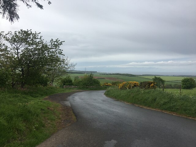
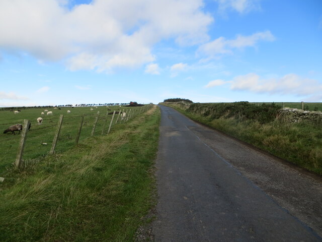
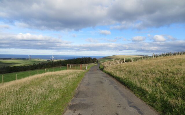
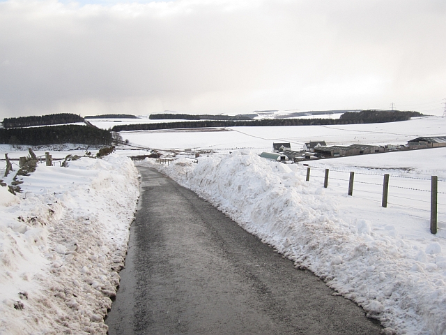
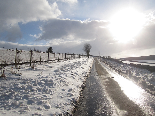
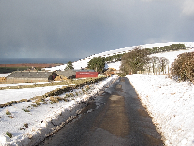
Dunglass Common is a picturesque expanse of downs and moorland located in Berwickshire, Scotland. Spanning an area of approximately 500 acres, this natural reserve offers breathtaking views and a rich diversity of flora and fauna.

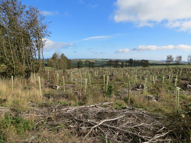
The common is characterized by gently rolling hills and open grasslands, interspersed with patches of heather and gorse. The landscape is predominantly undulating, with a few steeper slopes adding variation to the terrain. The unique topography of the area attracts a variety of wildlife, including birds, rabbits, and occasional deer.

The vegetation found in Dunglass Common is mainly heathland species, such as heather, bilberry, and crowberry. These plants thrive in the acidic soil and provide a colorful display during the flowering season. The common is also home to several species of grasses and sedges that contribute to the overall biodiversity of the area.

The site is a popular destination for nature enthusiasts, hikers, and birdwatchers. Numerous walking trails crisscross the common, allowing visitors to explore its natural beauty at their own pace. The paths are well-maintained and offer stunning panoramic views of the surrounding countryside, including the nearby Dunglass Estate and the North Sea.

Dunglass Common is a designated Site of Special Scientific Interest due to its ecological importance and the presence of rare plant species. It is managed by the Scottish Natural Heritage, which ensures the preservation and conservation of its natural habitat.

Overall, Dunglass Common is a remarkable natural landscape that showcases the beauty and diversity of Berwickshire's downs and moorland.

If you have any feedback on the listing, please let us know in the comments section below.

Dunglass Common Images

Images are sourced within 2km of 55.891522/-2.4084071 or Grid Reference NT7466. Thanks to Geograph Open Source API. All images are credited.

Minor road near Ecclaw Hill
Wall and hedge enclosed minor road ascending Ecclaw Hill Looking northward.
Wall and hedge enclosed minor road ascending Ecclaw Hill
Looking northward.
The re-birth of Mount Skip Wood Looking eastward.
The re-birth of Mount Skip Wood
Looking eastward.
Minor road with cattle grid on the flank of Ecclaw Hill Looking north-eastward.
Minor road with cattle grid on the flank of Ecclaw Hill
Looking north-eastward.
Eye Water viewed from the road bridge near to Paitshill Looking south-westward.
Eye Water viewed from the road bridge near to Paitshill
Looking south-westward.
Sheep pasture and woodland near Corse Law Looking south-eastward.
Sheep pasture and woodland near Corse Law
Looking south-eastward.
Sheep pens and woodland near Corse Law Looking southward.
Sheep pens and woodland near Corse Law
Looking southward.
Silage store Very useful during an era of tough Winters.
Silage store
Very useful during an era of tough Winters.
Road, Blackburn Mill The snow is lighter here where trees have stopped the drifting. Either side of the wood the drifts were up to 2m high.
Road, Blackburn Mill
The snow is lighter here where trees have stopped the drifting. Either side of the wood the drifts were up to 2m high.
Road near Blackburn Mill Bridge The houses and new farm buildings are just visible over the drifts.
Road near Blackburn Mill Bridge
The houses and new farm buildings are just visible over the drifts.
Road near Blackburn Mill Bridge Big drifts and the snow was still blowing.
Road near Blackburn Mill Bridge
Big drifts and the snow was still blowing.
Drifting snow, Ecclaw Hill Some of the drifts were over 2m high.
Drifting snow, Ecclaw Hill
Some of the drifts were over 2m high.
Sheep, Ecclaw Hill This time in 2012 the problem was no fresh grass due to dry weather and heat. Things seem even worse in 2013.
Sheep, Ecclaw Hill
This time in 2012 the problem was no fresh grass due to dry weather and heat. Things seem even worse in 2013.
Elma's Wood A strip wood on Ecclaw Hill.
Elma's Wood
A strip wood on Ecclaw Hill.
Snow drifts, Ecclaw Hill
Road, Ecclaw Forgive the flaring, but I had not seen the sun for a while.
Road, Ecclaw
Forgive the flaring, but I had not seen the sun for a while.
Ecclaw The depth of snow is decreasing with loss of altitude.
Ecclaw
The depth of snow is decreasing with loss of altitude.
Snow drifts, Ecclaw Hill Deep snow drifted by persistant easterly winds.
Snow drifts, Ecclaw Hill
Deep snow drifted by persistant easterly winds.
Show me another place!

Dunglass Common is located at Grid Ref: NT7466 (Lat: 55.891522, Lng: -2.4084071)

Unitary Authority: The Scottish Borders

Police Authority: The Lothians and Scottish Borders

What 3 Words

///polo.swarm.paddle. Near Duns, Scottish Borders

Nearby Locations

Dunglass Common

Related Wikis

Oldhamstocks

Oldhamstocks or Aldhamstocks ("old dwelling place") is a civil parish and small village in the east of East Lothian, Scotland, adjacent to the Scottish...

Abbey St Bathans

Abbey St Bathans (Scottish Gaelic: Abaid Bhaoithin) is a parish in the Lammermuir district of Berwickshire, in the eastern part of the Scottish Borders...

Penmanshiel Tunnel

Penmanshiel Tunnel is a now-disused railway tunnel near Grantshouse, Berwickshire, in the Scottish Borders region of Scotland. It was formerly part of...

Berwickshire Coastal Path

The Berwickshire Coastal Path is a walking route some 48 kilometres (30 mi) long. It follows the eastern coastline of Scotland from Cockburnspath in the...

Nearby Amenities

Located within 500m of 55.891522,-2.4084071
Paitshill
Place: locality
Lat/Long: 55.8943861/-2.4058878
Power: pole
Lat/Long: 55.8897958/-2.4151054
Power: pole
Lat/Long: 55.8903649/-2.4141036
Power: pole
Lat/Long: 55.8908881/-2.4131427
Power: pole
Lat/Long: 55.8913799/-2.4122591
Power: pole
Lat/Long: 55.891873/-2.4113497
Power: pole
Lat/Long: 55.8923817/-2.4104597
Power: pole
Lat/Long: 55.8928615/-2.4095396
Power: pole
Lat/Long: 55.8933726/-2.4085894
Power: pole
Lat/Long: 55.8938729/-2.4076327
Power: pole
Lat/Long: 55.8943647/-2.4067319
The data included in this document is from www.openstreetmap.org. The data is made available under ODbL.

Have you been to Dunglass Common?

Leave your review of Dunglass Common below (or comments, questions and feedback).