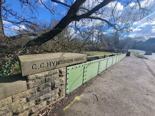
Hyndburn Bridge

Settlement in Lancashire Hyndburn

England

Hyndburn Bridge

Empress Garage
Empress Garage Credit: Anthony Parkes

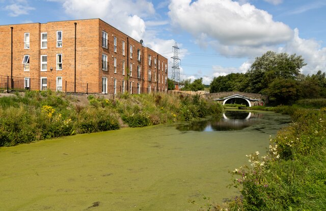
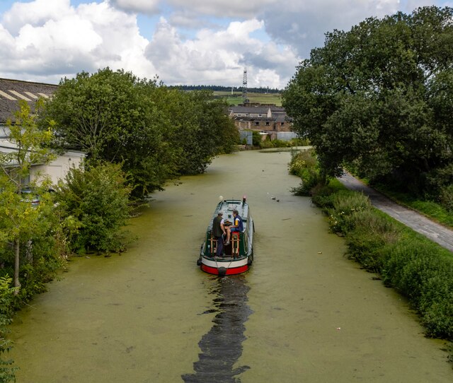
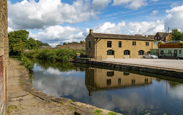
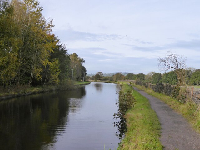
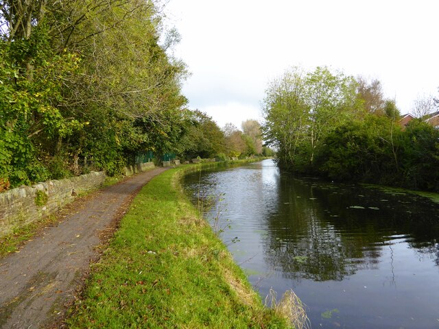
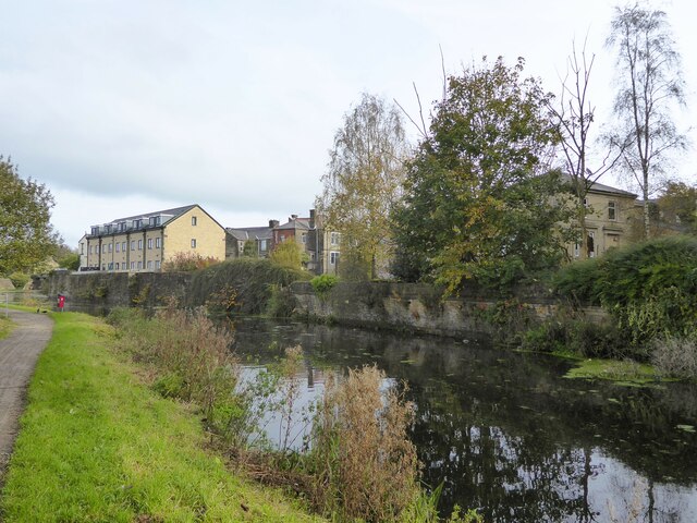
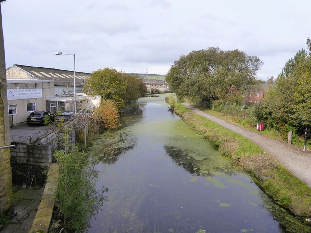
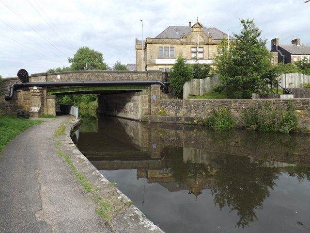
Hyndburn Bridge, located in Lancashire, England, is an iconic landmark that spans over the River Hyndburn. The bridge serves as a vital transportation link connecting the towns of Accrington and Church. Its strategic location has made it an integral part of the local infrastructure, facilitating the movement of people, goods, and services in the region.

Constructed in the late 19th century, Hyndburn Bridge is an impressive feat of engineering. It features a robust steel and concrete structure, which has withstood the test of time and various weather conditions. The bridge stands tall with its multiple arches, providing a picturesque view of the river below.

The bridge plays a significant role in the daily lives of the local residents. It offers a convenient route for commuters traveling between Accrington and Church, reducing travel time and congestion on alternative routes. Additionally, the bridge serves as a popular walking and cycling route, attracting fitness enthusiasts and nature lovers alike.

Hyndburn Bridge's historical significance adds to its appeal. It has witnessed the industrial growth of Lancashire, serving as a witness to the region's rich heritage. The bridge has also become a symbol of community pride, with various events and celebrations held in its vicinity.

Overall, Hyndburn Bridge stands as a testament to Lancashire's engineering prowess and serves as a vital link connecting the towns of Accrington and Church. Its picturesque architecture, historical significance, and functional importance make it a cherished landmark in the region.

If you have any feedback on the listing, please let us know in the comments section below.

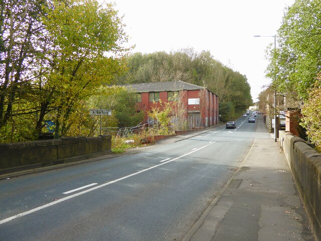
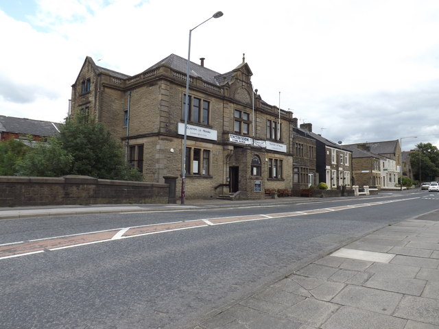
Hyndburn Bridge Images

Images are sourced within 2km of 53.783669/-2.3960734 or Grid Reference SD7432. Thanks to Geograph Open Source API. All images are credited.

Empress Garage
Empress Garage
Checco's Pizzeria
Checco's Pizzeria
Gated Track near Hyndburn Bridge
Old Bridge Marker on the A680 Whalley Road Bridge Marker inscribed in the capstone of the north pier of Hyndburn Bridge, Hyndburn Brook, on the east side of the A680 Whalley Road. On the boundary of Great Harwood and Clayton le Moors parishes until 1974 when both were abolished. REBUILT 1930 in inscribed on the capstone of the south pier on the east side of the road.

Milestone Society National ID: LA_GHACLM01br
Old Bridge Marker on the A680 Whalley Road
Bridge Marker inscribed in the capstone of the north pier of Hyndburn Bridge, Hyndburn Brook, on the east side of the A680 Whalley Road. On the boundary of Great Harwood and Clayton le Moors parishes until 1974 when both were abolished. REBUILT 1930 in inscribed on the capstone of the south pier on the east side of the road. Milestone Society National ID: LA_GHACLM01br
Old Bridge Marker on the A680 Whalley Road Bridge Marker inscribed on two stones in the parapet of Whalley Road Bridge, Leeds and Liverpool Canal, on the east side of the A680 Whalley Road. In Clayton le Moors parish until 1974 when it was abolished.

Milestone Society National ID: LA_CLAYLM01br
Old Bridge Marker on the A680 Whalley Road
Bridge Marker inscribed on two stones in the parapet of Whalley Road Bridge, Leeds and Liverpool Canal, on the east side of the A680 Whalley Road. In Clayton le Moors parish until 1974 when it was abolished. Milestone Society National ID: LA_CLAYLM01br
Melrose House Melrose House in Rishton, alongside the Leeds & Liverpool Canal.
Melrose House
Melrose House in Rishton, alongside the Leeds & Liverpool Canal.
Leeds & Liverpool Canal The Leeds and Liverpool Canal is the longest canal in Northern England at 127 miles long. The first of the trans-Pennine canals it took 46 years to build at a cost of five times the original budget, mainly because of the length and complexity of the route. It passes through 91 locks with a summit level of 487 feet at Foulridge near Nelson and Colne. It was originally conceived in the 18th century to carry woollen goods from Leeds and Bradford and limestone from Skipton but in its 19th century heyday it carried stone, coal and many other goods. The impact of the railways was not as great as with other canals and commercial traffic continued along the main canal until 1964. Regular work stopped in 1972 when the movement of coal to Wigan Power Station ceased. In the latter part of the 20th century the leisure potential of the canal was developed and it is now a popular destination for cruising, fishing, walking and cycling. See <span class="nowrap"><a title="http://www.penninewaterways.co.uk/ll/index.htm" rel="nofollow ugc noopener" href="http://www.penninewaterways.co.uk/ll/index.htm">Link</a><img style="margin-left:2px;" alt="External link" title="External link - shift click to open in new window" src="https://s1.geograph.org.uk/img/external.png" width="10" height="10"/></span> for detailed information.
Leeds & Liverpool Canal
The Leeds and Liverpool Canal is the longest canal in Northern England at 127 miles long. The first of the trans-Pennine canals it took 46 years to build at a cost of five times the original budget, mainly because of the length and complexity of the route. It passes through 91 locks with a summit level of 487 feet at Foulridge near Nelson and Colne. It was originally conceived in the 18th century to carry woollen goods from Leeds and Bradford and limestone from Skipton but in its 19th century heyday it carried stone, coal and many other goods. The impact of the railways was not as great as with other canals and commercial traffic continued along the main canal until 1964. Regular work stopped in 1972 when the movement of coal to Wigan Power Station ceased. In the latter part of the 20th century the leisure potential of the canal was developed and it is now a popular destination for cruising, fishing, walking and cycling. See LinkExternal link for detailed information.
Leeds & Liverpool Canal The Leeds & Liverpool Canal at Enfield.
Leeds & Liverpool Canal
The Leeds & Liverpool Canal at Enfield.
M65 The M65 Motorway seen from the Leeds & Liverpool Canal.
M65
The M65 Motorway seen from the Leeds & Liverpool Canal.
Old Milestone by the A680, Rodger Hey Farm, Great Harwood parish Carved stone post by the A680, in parish of GREAT HARWOOD (HYNDBURN District), North of Rodger Hey, by the road, on West side of road. Lancs CC stone triangle, erected by the County Council in the 19th/20th century. 

Inscription reads:-
: WHALLEY / 2 MILES / CLITHEROE / 6 MILES : : GREAT / HARWOOD : : ACCRINGTON / 3 MILES : 

Milestone Society National ID: LA_CLAC06.
Old Milestone by the A680, Rodger Hey Farm, Great Harwood parish
Carved stone post by the A680, in parish of GREAT HARWOOD (HYNDBURN District), North of Rodger Hey, by the road, on West side of road. Lancs CC stone triangle, erected by the County Council in the 19th/20th century. Inscription reads:- : WHALLEY / 2 MILES / CLITHEROE / 6 MILES : : GREAT / HARWOOD : : ACCRINGTON / 3 MILES : Milestone Society National ID: LA_CLAC06.
Leeds and Liverpool Canal Just after passing Pilkington Canal Bridge. The towpath now has competition from an illuminated housing estate path that follows the other bank.
Leeds and Liverpool Canal
Just after passing Pilkington Canal Bridge. The towpath now has competition from an illuminated housing estate path that follows the other bank.
Leeds and Liverpool Canal The towpath is approaching some green security fencing that comes down to the canal from the local school.
Leeds and Liverpool Canal
The towpath is approaching some green security fencing that comes down to the canal from the local school.
Leeds and Liverpool Canal Approaching Whalley Road Bridge with some old mill walling on the bank opposite the towpath
Leeds and Liverpool Canal
Approaching Whalley Road Bridge with some old mill walling on the bank opposite the towpath
Leeds and Liverpool Canal View from the bridge on Hermitage Street
Leeds and Liverpool Canal
View from the bridge on Hermitage Street
Entering Rishton on Hermitage Street At the end of Holt Mill Bridge with the former Rishton Paper Mill ahead and the climb up into Rishton
Entering Rishton on Hermitage Street
At the end of Holt Mill Bridge with the former Rishton Paper Mill ahead and the climb up into Rishton
Modern housing estate On Bold Venture Way near the boundary with Altham
Modern housing estate
On Bold Venture Way near the boundary with Altham
Clayton-Le-Moors Conservative Club Adjacent to the Leeds and Liverpool canal.
Clayton-Le-Moors Conservative Club
Adjacent to the Leeds and Liverpool canal.
Bridge 114 Leeds and Liverpool Canal At Clayton-Le-Moors. The Conservative Club stands to the right.
Bridge 114 Leeds and Liverpool Canal
At Clayton-Le-Moors. The Conservative Club stands to the right.
Show me another place!

Hyndburn Bridge is located at Grid Ref: SD7432 (Lat: 53.783669, Lng: -2.3960734)

Administrative County: Lancashire

District: Hyndburn

Police Authority: Lancashire

What 3 Words

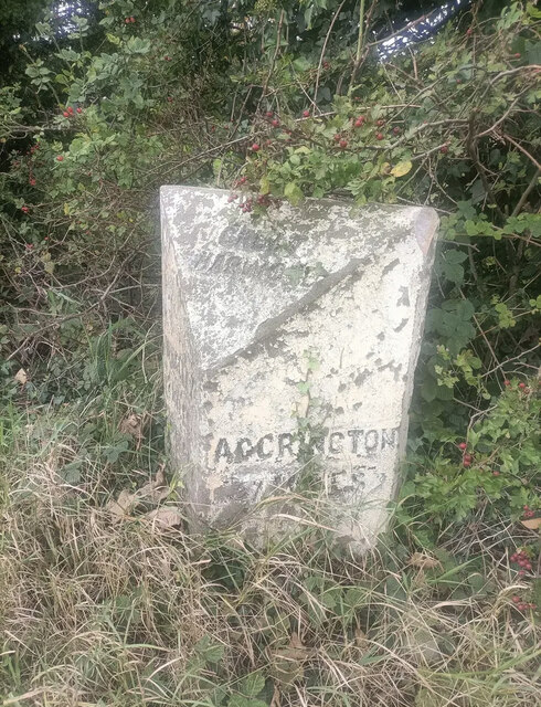
///dwell.idea.struck. Near Great Harwood, Lancashire

Related Wikis

Great Harwood railway station

Great Harwood railway station was located in the south east side of Great Harwood, Lancashire, England on Station Road, which still remains. The station...

Oakenshaw, Lancashire

Oakenshaw is part of Clayton-le-Moors in Lancashire, England. Thomas de Clayton was the first grantee of Oakenshaw in the middle of the 11th-century. A...

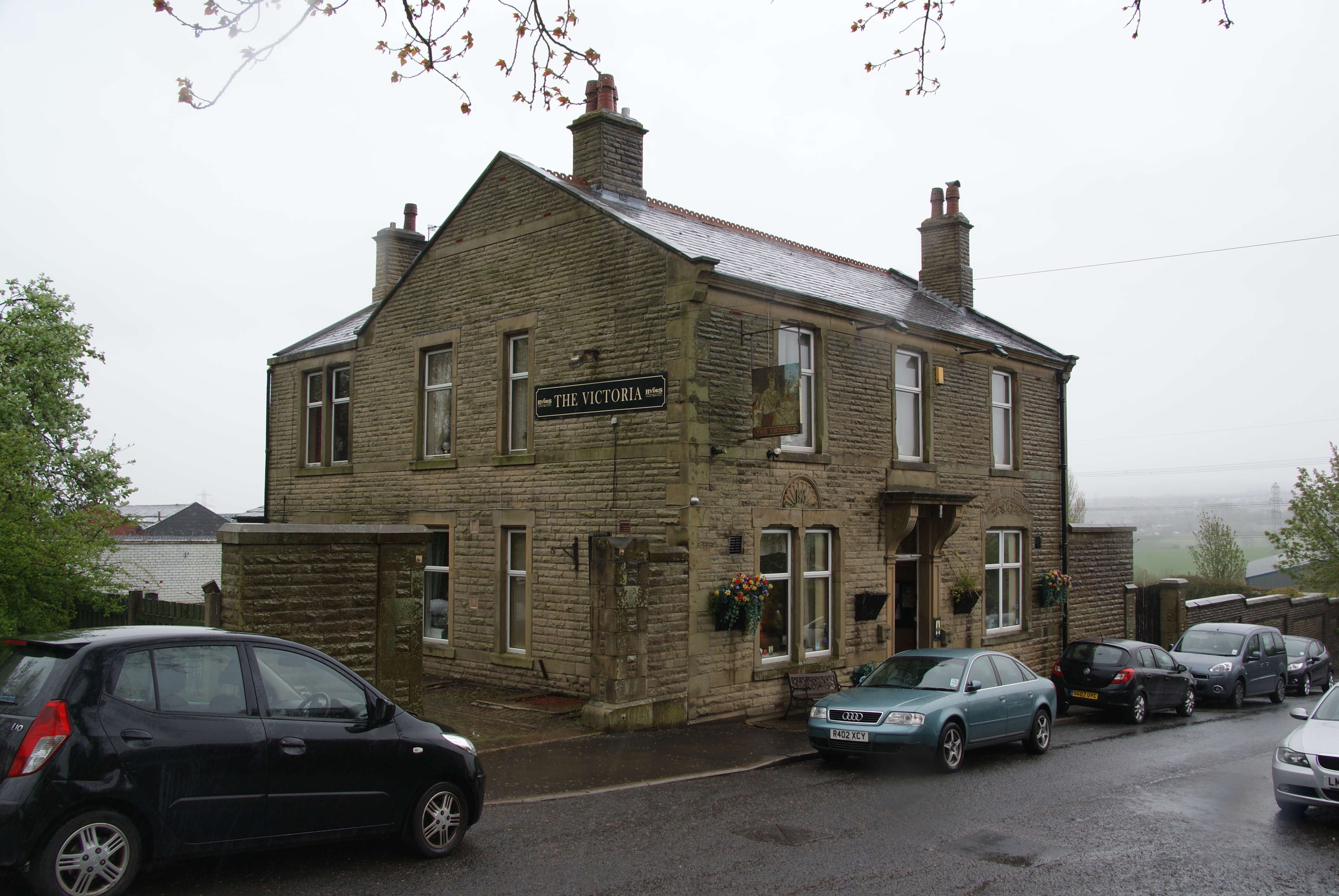
The Victoria, Great Harwood

The Victoria is a Grade II listed public house at St John's Street, Great Harwood, Blackburn, Lancashire BB6 7EP.It is on the Campaign for Real Ale's National...

St John's Church, Great Harwood

St John's Church was an Anglican parish church in St Hubert's Road, Great Harwood, Lancashire, England. Its benefice has been united with that of St Bartholomew...

Great Harwood Town Hall

Great Harwood Town Hall is a municipal building in Town Hall Square, Great Harwood, Lancashire, England. The town hall, which was the headquarters of Great...

Great Harwood

Great Harwood is a town in the Hyndburn district of Lancashire, England, located 5 miles (8.0 km) north east of Blackburn and adjacent to the Ribble Valley...

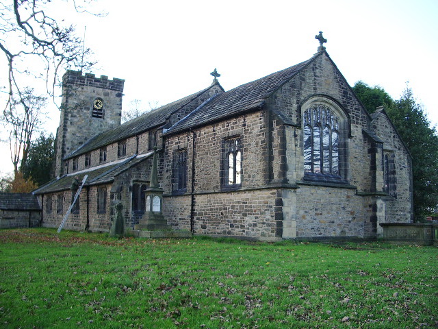
St Bartholomew's Church, Great Harwood

St Bartholomew's Church is in the town of Great Harwood in Lancashire, England. It is an active Anglican parish church in the Diocese of Blackburn. The...

Tottleworth

Tottleworth is a small hamlet situated between Great Harwood and Rishton in Lancashire, England. It situated close to the confluence of Lidgett and Norden...

Nearby Amenities

Located within 500m of 53.783669,-2.3960734
Barrier: bollard
Lat/Long: 53.7851769/-2.3973304
Pub
Royal Hotel
Addr City: Blackburn
Addr Housenumber: 2
Addr Postcode: BB6 7BA
Addr Street: Station Road
Addr Suburb: Great Harwood
Fhrs Id: 927568
Source Addr: FHRS Open Data
Lat/Long: 53.7859621/-2.3977224
Whiteheads
Addr City: Blackburn
Addr Postcode: BB6 7BD
Addr Street: Princess Street
Addr Suburb: Great Harwood
Fhrs Id: 851847
Shop: convenience
Source Addr: FHRS Open Data
Lat/Long: 53.7861319/-2.3982626
Bus Stop
Bus: yes
Naptan AtcoCode: 2500IMG2307
Naptan NaptanCode: langapjp
Public Transport: platform
Lat/Long: 53.786274/-2.3923201
Ford: yes
Lat/Long: 53.7819258/-2.3966996
ALDI
Addr City: Blackburn
Addr Housenumber: 1
Addr Postcode: BB6 7UA
Addr Street: Heys Lane
Addr Suburb: Great Harwood
Brand: ALDI
Brand Wikidata: Q41171672
Brand Wikipedia: en:Aldi
Contact Website: https://stores.aldi.co.uk/great-harwood/1-heys-lane
Fhrs Id: 111365
Shop: supermarket
Source Addr: FHRS Open Data
Lat/Long: 53.7857467/-2.3969643
Fast Food
The Cake Shop
Addr City: Blackburn
Addr Housenumber: 14
Addr Postcode: BB6 7BE
Addr Street: Saint Huberts Street
Addr Suburb: Great Harwood
Fhrs Id: 97971
Source Addr: FHRS Open Data
Lat/Long: 53.7857338/-2.4021323
Bargain Booze
Shop: convenience
Lat/Long: 53.7859254/-2.4023696
Bus Stop
Wood St.
Bus: yes
Public Transport: platform
Lat/Long: 53.7861605/-2.3926664
Post Box
Fixme: collection_times
Ref: BB6 43
Lat/Long: 53.7859381/-2.402544
Bus Stop
Bus: yes
Public Transport: platform
Lat/Long: 53.7861889/-2.4000007
Bus Stop
Bus: yes
Naptan AtcoCode: 250011803
Naptan NaptanCode: lanagpaw
Public Transport: platform
Lat/Long: 53.7863696/-2.3992551
Place Of Worship
Our Lady and Saint Huberts
Denomination: catholic
Religion: christian
Wikidata: Q17531207
Lat/Long: 53.7852522/-2.4007006
Barrier: bollard
Foot: yes
Motor Vehicle: no
Lat/Long: 53.7853379/-2.3972595
Place Of Worship
Ghousia Masjid mosque
Religion: muslim
Lat/Long: 53.7856942/-2.3986293
Fuel
Petrol Station
Lat/Long: 53.7863205/-2.400623
Barrier: bollard
Lat/Long: 53.7856302/-2.3979211
Barrier: bollard
Lat/Long: 53.7859221/-2.3989022
Fuel
Ridings Auto Services
Lat/Long: 53.787179/-2.3922328
Park Road Garage
Landuse: industrial
Shop: car_repair
Lat/Long: 53.7865487/-2.3972005
Riley Dawson Car Sales
Landuse: commercial
Shop: car
Lat/Long: 53.7863839/-2.3971575
M and A Car Parts
Fixme: opening_hours
Shop: car
Lat/Long: 53.7859532/-2.4026061
MetFlex
Landuse: industrial
Source: GPS
Lat/Long: 53.782306/-2.4013061
Traffic Signals
Traffic Signals Sound: yes
Lat/Long: 53.7863701/-2.3988681
Power: tower
Lat/Long: 53.783173/-2.3931253
Power: tower
Lat/Long: 53.7807339/-2.398866
Power: tower
Lat/Long: 53.7819732/-2.3947032
Power: tower
Lat/Long: 53.7847007/-2.3894936
Power: tower
Lat/Long: 53.783135/-2.3919612
Power: tower
Lat/Long: 53.7807039/-2.3976689
Barrier: bollard
Fixme: Are cycles permitted?
Foot: yes
Motor Vehicle: no
Lat/Long: 53.7860963/-2.3976826
Great Harwood
Historic Railway: station
Railway: site
Wikidata: Q5599300
Wikipedia: en:Great Harwood railway station
Lat/Long: 53.7851756/-2.3969893
Barrier: bollard
Bollard: fixed
Height: 1
Material: concrete
Source: survey
Lat/Long: 53.7863672/-2.3924989
Barrier: bollard
Bollard: fixed
Height: 1
Material: concrete
Source: survey
Lat/Long: 53.7863366/-2.3924989
Barrier: bollard
Bollard: fixed
Height: 1
Material: concrete
Source: survey
Lat/Long: 53.7863049/-2.3924989
The data included in this document is from www.openstreetmap.org. The data is made available under ODbL.

Have you been to Hyndburn Bridge?

Leave your review of Hyndburn Bridge below (or comments, questions and feedback).