Birch Copse

Wood, Forest in Surrey Waverley

England

Birch Copse

Woodland track going southwards from the Sussex Border Path(2)
Woodland track going southwards from the Sussex Border Path(2) Credit: Shazz

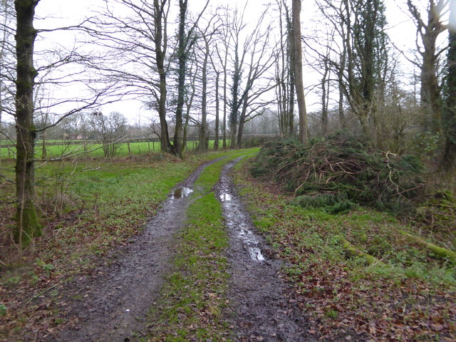
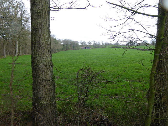
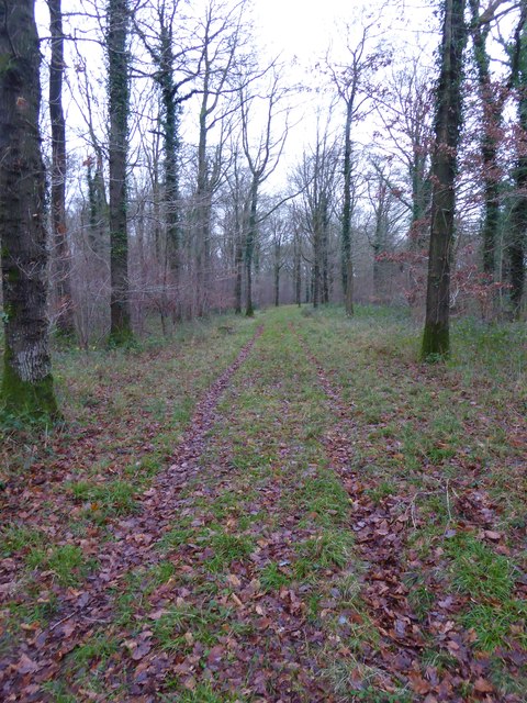
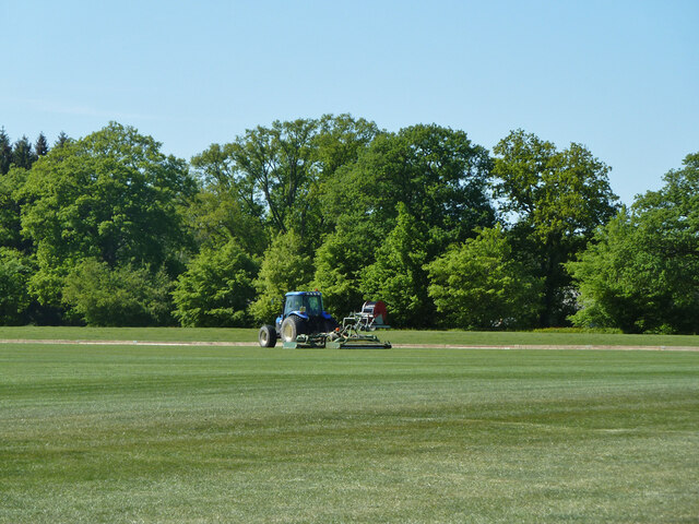
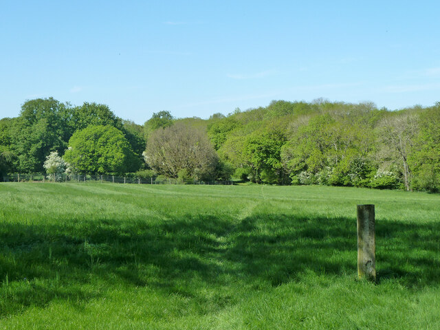
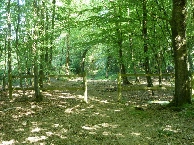
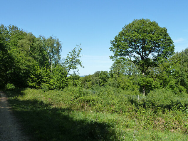
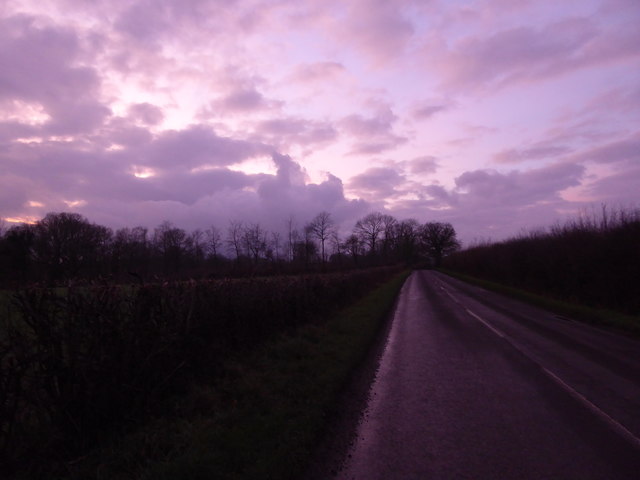
Birch Copse is a picturesque woodland located in the county of Surrey, England. Spanning over an area of approximately 20 acres, it is known for its dense population of birch trees, which lend the copse its name and distinct character. The woodland is situated in a rural area, surrounded by rolling hills and fields, making it a popular destination for nature lovers and outdoor enthusiasts.

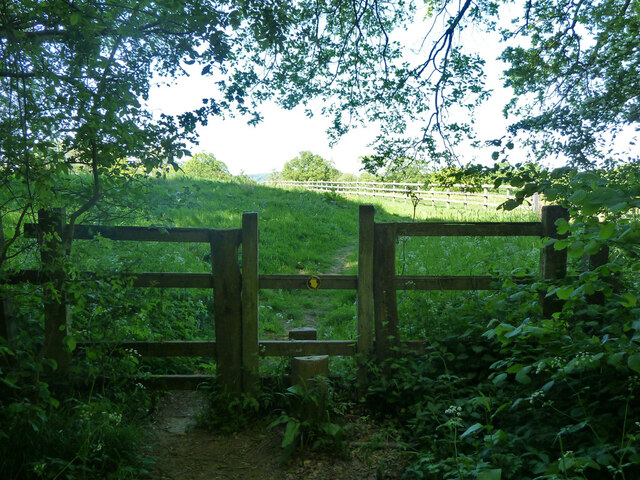
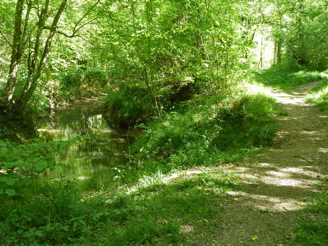
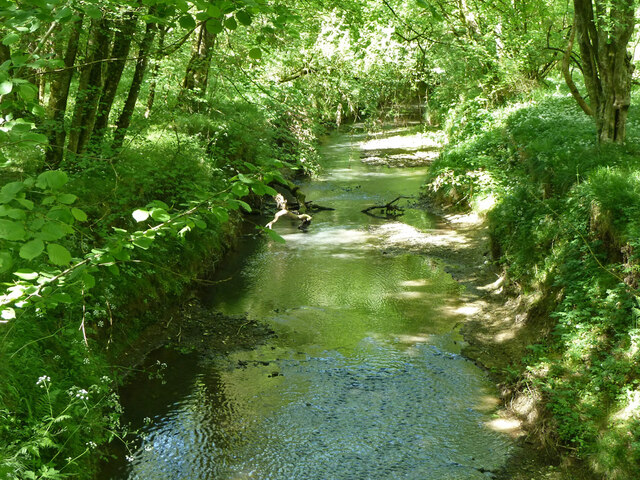
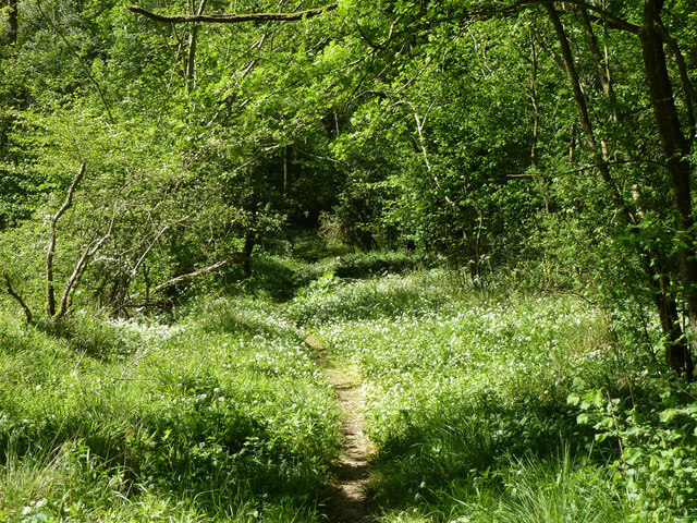
The copse offers a tranquil and serene environment, providing a perfect escape from the hustle and bustle of daily life. The towering birch trees create a dense canopy, allowing only dappled sunlight to filter through, adding to the enchanting atmosphere. The forest floor is covered with a thick carpet of moss and ferns, creating a rich and diverse ecosystem for various flora and fauna.

Birch Copse is home to a variety of wildlife, including several species of birds, such as woodpeckers and owls, which can be spotted and heard throughout the year. It is also a habitat for small mammals like squirrels and rabbits, and occasionally larger creatures like deer can be glimpsed roaming through the undergrowth.

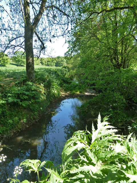
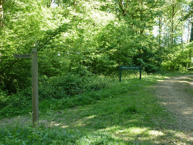
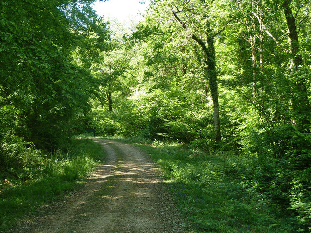
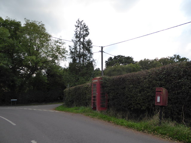
The copse is crisscrossed by a network of well-maintained walking trails, providing visitors with the opportunity to explore and discover the natural beauty of the woodland. These pathways lead to hidden clearings, babbling brooks, and even a small pond, adding to the charm of the area. Birch Copse is a true gem of Surrey, attracting visitors from near and far who seek solace and tranquility in its serene surroundings.

If you have any feedback on the listing, please let us know in the comments section below.

Birch Copse Images

Images are sourced within 2km of 51.08951/-0.59249756 or Grid Reference SU9833. Thanks to Geograph Open Source API. All images are credited.

Woodland track going southwards from the Sussex Border Path(2)
View across field to large barn On the left is the western edge of Weald Barkfold Copse.
View across field to large barn
On the left is the western edge of Weald Barkfold Copse.
Woodland track going south from the Sussex Border Path (1)
Burningfold Manor A grade II listed building, 16th century but much extended later. The Historic England map marker for this is misplaced on a range of stables off to the left, part of the stud farm here.
Burningfold Manor
A grade II listed building, 16th century but much extended later. The Historic England map marker for this is misplaced on a range of stables off to the left, part of the stud farm here.
Tractor, Burningfold Polo Club Equipped for mowing the field.
Tractor, Burningfold Polo Club
Equipped for mowing the field.
Footpath towards Burningfold Manor Leaving Forestry Commission woodland.
Footpath towards Burningfold Manor
Leaving Forestry Commission woodland.
Footpath by River Lox Passing through Forestry Commission woodland.
Footpath by River Lox
Passing through Forestry Commission woodland.
River Lox Passing through Forestry Commission woodland.
River Lox
Passing through Forestry Commission woodland.
Footpath through Hogwood An extensive area of Forestry Commission woodland.
Footpath through Hogwood
An extensive area of Forestry Commission woodland.
River Lox The bane of this river system is Giant Hogweed, some of which is coming up in the foreground. It grows beside the river on the flood plain, and so sometimes interferes with footpaths. It should not be touched, as it can cause severe blistering, particularly when exposed to sunlight.
River Lox
The bane of this river system is Giant Hogweed, some of which is coming up in the foreground. It grows beside the river on the flood plain, and so sometimes interferes with footpaths. It should not be touched, as it can cause severe blistering, particularly when exposed to sunlight.
Footpath towards Burningfold Manor
Garden Cottage, Upper Ifold Upper Ifold House is largely hidden beyond.
Garden Cottage, Upper Ifold
Upper Ifold House is largely hidden beyond.
Bridleway leaving Forestry Commission woodland Leaving the Hogwood complex towards Upper Ifold.
Bridleway leaving Forestry Commission woodland
Leaving the Hogwood complex towards Upper Ifold.
Woodland path junction In the Hogwood Forestry Commission complex. The public bridleway goes left, but riding is by permit only round to the right.
Woodland path junction
In the Hogwood Forestry Commission complex. The public bridleway goes left, but riding is by permit only round to the right.
Woodland track In the Hogwood Forestry Commission complex.
Woodland track
In the Hogwood Forestry Commission complex.
Small clearing, Upper Ifold Wood In the Hogwood Forestry Commission complex. Part of this clearing is enclosed in a close mesh fence, presumably to keep browsing animals out.
Small clearing, Upper Ifold Wood
In the Hogwood Forestry Commission complex. Part of this clearing is enclosed in a close mesh fence, presumably to keep browsing animals out.
December sky at dusk This day had the earliest sunset of the year.
December sky at dusk
This day had the earliest sunset of the year.
2016: a year on Geograph (Day 287) Approaching the junction of Plaistow Road and Fisher Lane
2016: a year on Geograph (Day 287)
Approaching the junction of Plaistow Road and Fisher Lane
Show me another place!

Birch Copse is located at Grid Ref: SU9833 (Lat: 51.08951, Lng: -0.59249756)

Administrative County: Surrey

District: Waverley

Police Authority: Surrey

What 3 Words

///boost.river.estimates. Near Chiddingfold, Surrey

Related Wikis

Chiddingfold Forest

Chiddingfold Forest is a 542.5-hectare (1,341-acre) biological Site of Special Scientific Interest in Chiddingfold in Surrey and West Sussex. One part...

The Farm (recording studio)

The Farm (also known as Fisher Lane Farm) was a recording studio in Chiddingfold, Surrey owned by the rock band Genesis. The group bought the property...

Shillinglee

Shillinglee is an 18th-century house and estate in West Sussex, England near the Surrey border, in between the villages of Chiddingfold and Plaistow. It...

Pickhurst

Pickhurst is a grade II* listed house set in 130 acres (53 ha) of land near Chiddingfold, Surrey, England. == History == It was designed by the Scottish...

Plaistow, West Sussex

Plaistow ( PLAST-oh) is a village and civil parish in the north of the Chichester District of West Sussex, England. There is a village green, a recreation...

Shillinglee Lake

Shillinglee Lake is a 17-hectare (42-acre) biological Site of Special Scientific Interest west of Plaistow in West Sussex.The lake has been designated...

Chiddingfold

Chiddingfold is a village and civil parish in the Weald in the Waverley district of Surrey, England. It lies on the A283 road between Milford and Petworth...

Dunsfold

Dunsfold is a village in the borough of Waverley, Surrey, England, 8.7 miles (14.0 kilometres) south of Guildford. It lies in the Weald and reaches in...

Nearby Amenities

Located within 500m of 51.08951,-0.59249756
Durfold Wood
Natural: wood
Source: npe
Lat/Long: 51.0856416/-0.5890259
Barrier: stile
Lat/Long: 51.088723/-0.5960347
Barrier: stile
Lat/Long: 51.0889545/-0.5938457
Barrier: stile
Lat/Long: 51.0895418/-0.593748
Barrier: stile
Lat/Long: 51.0900525/-0.5939393
Barrier: stile
Lat/Long: 51.0909952/-0.5918231
Barrier: stile
Lat/Long: 51.0912309/-0.5914028
Barrier: stile
Lat/Long: 51.0917937/-0.5885501
The data included in this document is from www.openstreetmap.org. The data is made available under ODbL.

Have you been to Birch Copse?

Leave your review of Birch Copse below (or comments, questions and feedback).