Nelson's Clump

Wood, Forest in Yorkshire

England

Nelson's Clump

A view of Denaby Ings
A view of Denaby Ings Credit: Neil Theasby

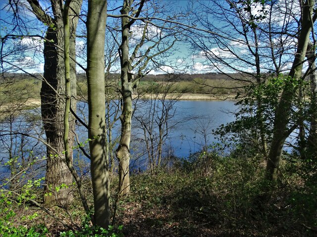
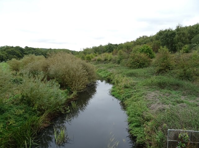
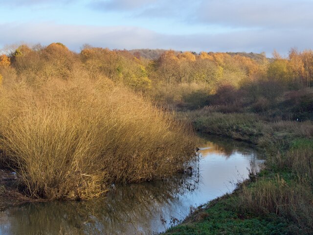
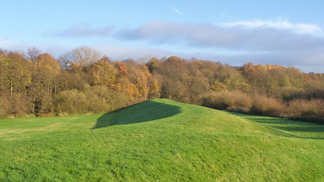
Nelson's Clump is a picturesque woodland located in Yorkshire, England. Situated within the larger forest area, this clump of trees stands out due to its unique composition and historical significance. The forest is predominantly made up of oak and beech trees, which create a dense canopy that provides shelter for various wildlife species.

Named after the renowned British naval hero, Admiral Lord Nelson, Nelson's Clump holds historical significance within the region. It is believed that the clump was planted in the early 19th century to commemorate Nelson's victories at the Battle of Trafalgar in 1805. The trees were carefully selected and arranged to form a distinct clump, creating a visually striking landmark.

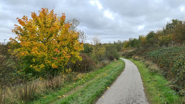
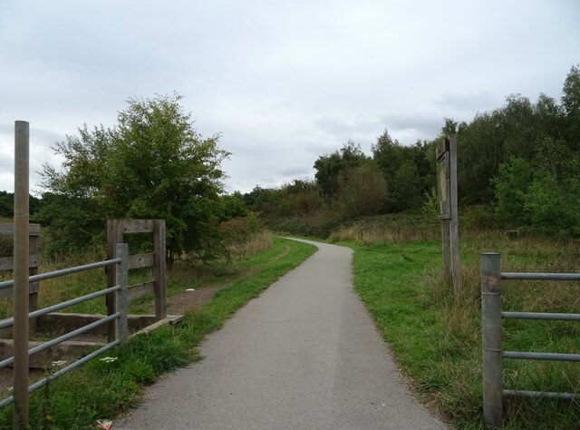
The woodland is a popular destination for nature enthusiasts and hikers, offering serene walking trails that wind through the ancient trees. The forest floor is carpeted with a variety of wildflowers, adding bursts of color to the green landscape during spring and summer months. Visitors may also encounter an array of wildlife, including deer, foxes, and a wide range of bird species.

Managed by local conservation organizations, Nelson's Clump is carefully preserved to maintain its natural beauty and ecological balance. The woodland serves as an important habitat for numerous species, contributing to the overall biodiversity of the area.

Overall, Nelson's Clump offers visitors a tranquil escape into nature, showcasing the beauty of Yorkshire's woodlands and providing a glimpse into the region's historical connections.

If you have any feedback on the listing, please let us know in the comments section below.

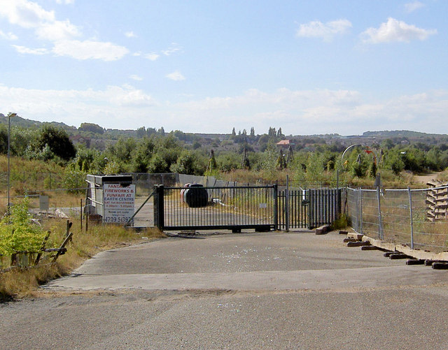
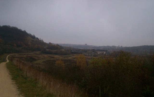
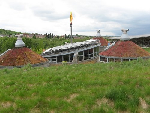
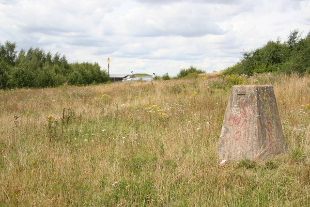
Nelson's Clump Images

Images are sourced within 2km of 53.509738/-1.2369942 or Grid Reference SE5001. Thanks to Geograph Open Source API. All images are credited.

A view of Denaby Ings
Derne Way
Derne Way
Road junction, Dearne Bridge
Sunflowers, Dearne Bridge
The River Dearne
The River Dearne
Trans Pennine Trail near the River Dearne
The Pastures Lodge public house
Sign for the Pastures Lodge public house
The River Dearne at Denaby Ings
Flood defence embankment Beside the River Dearne at Denaby Ings
Flood defence embankment
Beside the River Dearne at Denaby Ings
A model of (un) sustainable development. The now closed millennium project The Earth Centre.
A model of (un) sustainable development.
The now closed millennium project The Earth Centre.
What a mess. (From the Trans Pennine Trail.) These were the offices of the now defunct Earth Centre.
What a mess. (From the Trans Pennine Trail.)
These were the offices of the now defunct Earth Centre.
No more fireworks here! Rear entrance off the Trans Pennine Trail to what was the Earth Centre.
No more fireworks here!
Rear entrance off the Trans Pennine Trail to what was the Earth Centre.
View over the near-derelict EarthCentre site. Looking south-east over the site of the old Earth Centre on a gloomy November afternoon. Conisbrough Castle is visible on the horizon.
View over the near-derelict EarthCentre site.
Looking south-east over the site of the old Earth Centre on a gloomy November afternoon. Conisbrough Castle is visible on the horizon.
Some of the Earth Centre buildings
Trigpoint imposter What looked convincingly like a trigpoint but seemingly isn't. View towards the now closed Earth Centre by the Trans Pennine Trail
Trigpoint imposter
What looked convincingly like a trigpoint but seemingly isn't. View towards the now closed Earth Centre by the Trans Pennine Trail
Works yard Yard by the disused Earth Centre, seen from the Trans Pennine Trail
Works yard
Yard by the disused Earth Centre, seen from the Trans Pennine Trail
A  Good  Idea  but  it  Failed Buildings at the Earth Centre closed and deteriorating.
A Good Idea but it Failed
Buildings at the Earth Centre closed and deteriorating.
Show me another place!

Nelson's Clump is located at Grid Ref: SE5001 (Lat: 53.509738, Lng: -1.2369942)

Division: West Riding

Unitary Authority: Doncaster

Police Authority: South Yorkshire

What 3 Words

///overt.trapdoor.reset. Near Barnburgh, South Yorkshire

Related Wikis

Doncaster Business School

Doncaster Business School was the business school of Doncaster College, England. Established in 1992, as Dearne Valley Business School, the school offered...

St James' Church, High Melton

St James' Church, High Melton is a parish church of the Church of England in High Melton, South Yorkshire, England. == Background == The Church of St James...

High Melton

High Melton is a village and civil parish in the City of Doncaster in South Yorkshire, England. It had a population of 339 in 2001, reducing to 300 at...

Denaby Halt railway station

Denaby Halt was a small railway station on the Dearne Valley Railway (DVR), intended to serve the mining community of Denaby Main in South Yorkshire, England...

St John the Evangelist's Church, Cadeby

St John the Evangelist's Church is a redundant Anglican church in the village of Cadeby, South Yorkshire, England. It is recorded in the National Heritage...

Cadeby, South Yorkshire

Cadeby is a village and civil parish in the City of Doncaster in South Yorkshire, England. The population at the census of 2011 was 203. It is about five...

Dearne Valley

The Dearne Valley is an area of South Yorkshire, England, along the River Dearne. It encompasses the towns of Wombwell, Wath-upon-Dearne, Swinton, Conisbrough...

River Dearne

The River Dearne South Yorkshire, England flows roughly east for more than 30 kilometres (19 mi), from its source just inside West Yorkshire. It flows...

Nearby Amenities

Located within 500m of 53.509738,-1.2369942
High Melton
Place: village
Source Name: OS_OpenData_StreetView
Lat/Long: 53.5119178/-1.2336698
Bus Stop
Doncaster Road/High Melton College
Alt Name: Doncaster Road/High Melton College
Naptan AltCommonName: Doncaster Road/High Melton College
Naptan AtcoCode: 370045545
Naptan Bearing: E
Naptan CommonName: Doncaster Road/High Melton College
Naptan Indicator: 45545
Naptan Landmark: CHURCH
Naptan PlusbusZoneRef: ROTHCEN
Naptan Street: Doncaster Road
Naptan Verified: no
Source: naptan_import
Lat/Long: 53.5118995/-1.2330967
Bus Stop
Doncaster Road/High Melton College
Alt Name: Doncaster Road/High Melton College
Naptan AltCommonName: Doncaster Road/High Melton College
Naptan AtcoCode: 370045546
Naptan Bearing: W
Naptan CommonName: Doncaster Road/High Melton College
Naptan Indicator: 45546
Naptan Landmark: Streetlight No 21700
Naptan PlusbusZoneRef: ROTHCEN
Naptan Street: Doncaster Road
Naptan Verified: no
Source: naptan_import
Lat/Long: 53.5117511/-1.233793
Bus Stop
Doncaster College High Melton Site
Naptan AtcoCode: 370081170
Naptan Bearing: N
Naptan CommonName: Doncaster College High Melton Site
Naptan Indicator: 81170
Naptan Landmark: 81170
Naptan PlusbusZoneRef: ROTHCEN
Naptan Street: Doncaster College High Melton Site
Naptan Verified: no
Source: naptan_import
Lat/Long: 53.5114315/-1.2344171
Barrier: stile
Lat/Long: 53.5112906/-1.240391
Barrier: stile
Step Count: 2
Stile: stepover
Lat/Long: 53.5118534/-1.2397972
Generator Method: photovoltaic
Generator Output Electricity: yes
Generator Source: solar
Generator Type: solar_photovoltaic_panel
Location: roof
Power: generator
Lat/Long: 53.5116463/-1.2340281
The data included in this document is from www.openstreetmap.org. The data is made available under ODbL.

Have you been to Nelson's Clump?

Leave your review of Nelson's Clump below (or comments, questions and feedback).