High Croft Wood

Wood, Forest in Hampshire New Forest

England

High Croft Wood

Path towards Church Moor Near Fort Hill the path towards Church Moor
Path towards Church Moor Credit: Shaun Ferguson

High Croft Wood is a picturesque woodland located in the county of Hampshire, England. Spanning over an area of approximately 50 acres, this enchanting forest is a haven for nature lovers and outdoor enthusiasts alike.

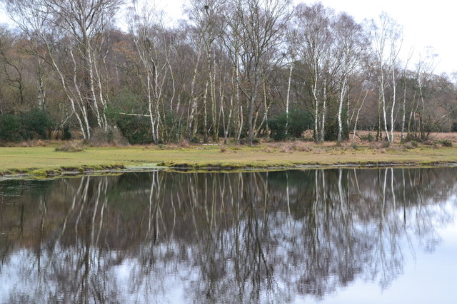
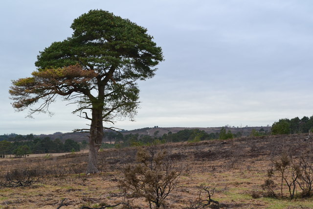
The woodland is primarily composed of a diverse range of deciduous trees, including oak, beech, and ash, which create a vibrant and ever-changing landscape throughout the seasons. The dense canopy formed by these majestic trees provides a cool and shaded environment, perfect for leisurely walks and exploration.

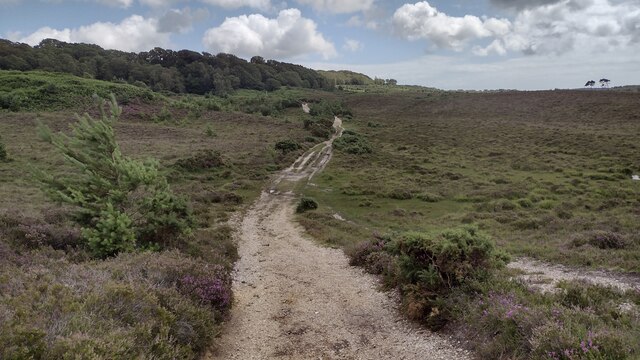
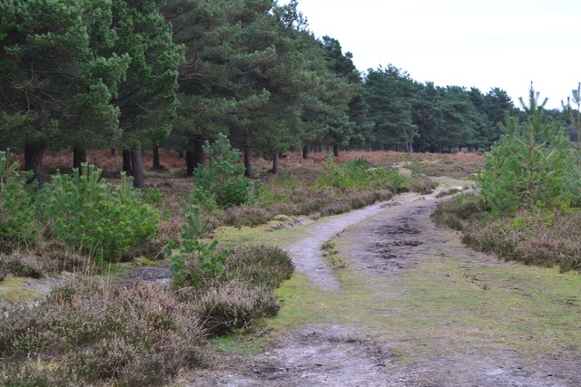
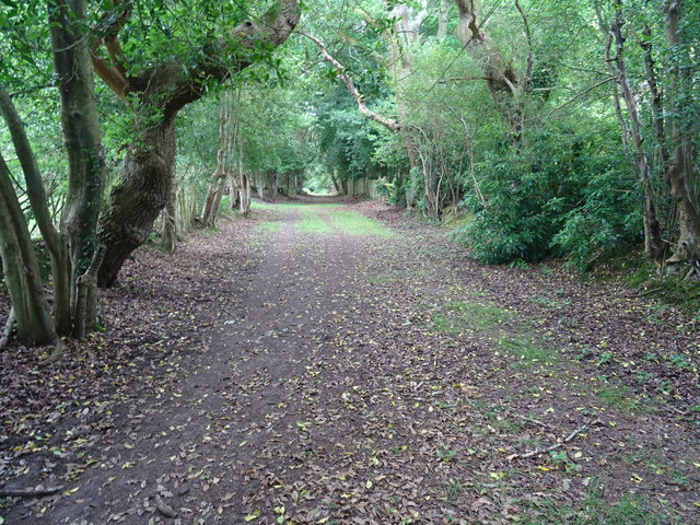
Traversing through High Croft Wood, visitors will find a network of well-maintained footpaths that wind their way through the forest, leading to various points of interest. These paths offer an opportunity to immerse oneself in the sights and sounds of nature, with occasional glimpses of wildlife, such as squirrels, deer, and a myriad of bird species.

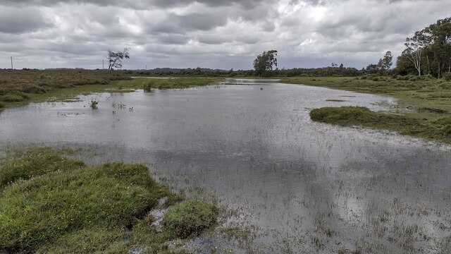
The woodland boasts a rich biodiversity, with an array of wildflowers, ferns, and mosses carpeting the forest floor. This natural beauty is further enhanced by a small stream that meanders through the wood, adding a touch of tranquility to the surroundings.

High Croft Wood is a popular destination for outdoor activities, such as hiking, birdwatching, and photography. It offers a serene escape from the bustling city life, allowing visitors to reconnect with nature and enjoy a sense of peace and solitude.

Overall, High Croft Wood in Hampshire is a stunning woodland retreat that showcases the beauty of the English countryside. With its diverse flora and fauna, well-maintained trails, and peaceful atmosphere, it is a must-visit destination for nature enthusiasts seeking a respite from the outside world.

If you have any feedback on the listing, please let us know in the comments section below.

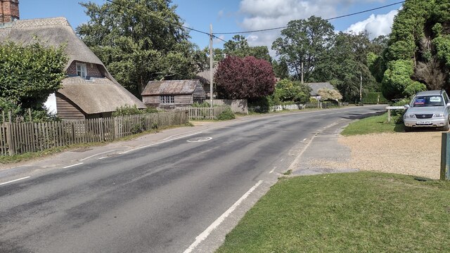
High Croft Wood Images

Images are sourced within 2km of 50.825444/-1.7003084 or Grid Reference SU2102. Thanks to Geograph Open Source API. All images are credited.

Path towards Church Moor Near Fort Hill the path towards Church Moor
Path towards Church Moor
Near Fort Hill the path towards Church Moor
Long Pond A tranquil Long Pond
Long Pond
A tranquil Long Pond
Old Guide Stone, Burley Street Peace guidestone by the UC road, in parish of Burley (New Forest District), Burley Street, junction of Castle Hill and Verely Hill, on raised bank.
In 1902 a Benchmark on the stone represented 241 m ASL. Views of the two other faces see <a href="https://www.geograph.org.uk/photo/6043440">SU1904 : Old Guide Stone, Burley Street, Burley Parish</a>.

Inscription reads: To / Ringwood / Rest and be thankful // 
PEACE / Restored / 27th March / 1802 // To / Crow

Grade II listed. List Entry Number: 1094926 <span class="nowrap"><a title="https://historicengland.org.uk/listing/the-list/list-entry/1094926" rel="nofollow ugc noopener" href="https://historicengland.org.uk/listing/the-list/list-entry/1094926">Link</a><img style="margin-left:2px;" alt="External link" title="External link - shift click to open in new window" src="https://s1.geograph.org.uk/img/external.png" width="10" height="10"/></span>

Milestone Society National ID: HA_RILY03P
Old Guide Stone, Burley Street
Peace guidestone by the UC road, in parish of Burley (New Forest District), Burley Street, junction of Castle Hill and Verely Hill, on raised bank. In 1902 a Benchmark on the stone represented 241 m ASL. Views of the two other faces see SU1904 : Old Guide Stone, Burley Street, Burley Parish. Inscription reads: To / Ringwood / Rest and be thankful // PEACE / Restored / 27th March / 1802 // To / Crow Grade II listed. List Entry Number: 1094926 LinkExternal link Milestone Society National ID: HA_RILY03P
Road junction near Little Castle Common
Trees reflected in Long Pond
Isolated tree near Brown Loaf
Path beside dismantled railway The route of the railway itself is at this point heavily waterlogged and impassable on foot.
Path beside dismantled railway
The route of the railway itself is at this point heavily waterlogged and impassable on foot.
Footpath towards Burley The direct route from Castle Hill.
Footpath towards Burley
The direct route from Castle Hill.
Milestone above Burley Street One of a number erected in 1802 by Thomas Eyre marking the Peace of Amiens. Thankfully the stones outlasted the peace. This one is on a high bank in a grass triangle on the edge of heathland.
Milestone above Burley Street
One of a number erected in 1802 by Thomas Eyre marking the Peace of Amiens. Thankfully the stones outlasted the peace. This one is on a high bank in a grass triangle on the edge of heathland.
Green tree in brown bracken
Autumn heathland
Autumn heathland
Pond beside former railway line
Edge of pond on Cranes Moor This is the smaller of two ponds and is not named on Ordnance Survey maps at any scale.
Edge of pond on Cranes Moor
This is the smaller of two ponds and is not named on Ordnance Survey maps at any scale.
Old Guide Stone, Burley Street, Burley Parish Peace guidestone by the UC road, in parish of Burley (New Forest District), Burley Street, junction of Castle Hill and Verely Hill, on raised bank.

Inscription reads:-
: To / Ringwood / Rest and be thankful : : PEACE / Restored / 27th March / 1802 :

Grade II listed. List Entry Number: 1094926
<span class="nowrap"><a title="https://historicengland.org.uk/listing/the-list/list-entry/1094926" rel="nofollow ugc noopener" href="https://historicengland.org.uk/listing/the-list/list-entry/1094926">Link</a><img style="margin-left:2px;" alt="External link" title="External link - shift click to open in new window" src="https://s1.geograph.org.uk/img/external.png" width="10" height="10"/></span>

Surveyed

Milestone Society National ID: HA_RILY03P
Old Guide Stone, Burley Street, Burley Parish
Peace guidestone by the UC road, in parish of Burley (New Forest District), Burley Street, junction of Castle Hill and Verely Hill, on raised bank. Inscription reads:- : To / Ringwood / Rest and be thankful : : PEACE / Restored / 27th March / 1802 : Grade II listed. List Entry Number: 1094926 LinkExternal link Surveyed Milestone Society National ID: HA_RILY03P
Pound Lane heading towards Burley Pound Lane passing Copse Road heading towards Burley
Pound Lane heading towards Burley
Pound Lane passing Copse Road heading towards Burley
The Cross The Cross Burley
The Cross
The Cross Burley
Ringwood Road Ringwood Road by the hatched entrance to the Fire Station heading into Burley
Ringwood Road
Ringwood Road by the hatched entrance to the Fire Station heading into Burley
Ringwood Road Ringwood Road passing Randalls Lane and Burley Street Garage
Ringwood Road
Ringwood Road passing Randalls Lane and Burley Street Garage
Show me another place!

High Croft Wood is located at Grid Ref: SU2102 (Lat: 50.825444, Lng: -1.7003084)

Administrative County: Hampshire

District: New Forest

Police Authority: Hampshire

What 3 Words

///chess.stoops.musically. Near Burley, Hampshire

Related Wikis

Burley, Hampshire

Burley is a village and civil parish in the New Forest, Hampshire, England. It has ancient origins and is now somewhat tourist-orientated. == The village... ==

Castle Hill, Hampshire

Castle Hill is the site of an Iron Age univallate hillfort located in the civil parish of Burley in the New Forest national park in Hampshire, England...

Holmsley railway station

Holmsley is a closed railway station in the county of Hampshire which served rural settlements in the New Forest. == History == The station was opened...

All Saints' Church, Thorney Hill

All Saints' Church is a Church of England church in Thorney Hill, Hampshire, England. It was built in 1905–06 and has been a Grade I listed building since...

Avon Tyrrell House

Avon Tyrrell is an historic manor within the parish of Sopley, Hampshire. It is situated within the New Forest, near Christchurch. The present manor house...

Picket Post

Picket Post is a road junction and service area in the New Forest National Park of Hampshire, England. It lies on the A31 road. == Facilities == Picket...

Bagnum

Bagnum is a hamlet in the English county of Hampshire. The settlement is within the civil parish of Ringwood (where the 2011 Census was included), and...

Picket Hill

Picket Hill is a hamlet next to Picket Post in the New Forest National Park of Hampshire, England. It lies on the outskirts of Ringwood.

Related Videos

Sport Walking training in the New Forest, Spring 2024 - Sport Walk Trail Blog

Roger's on a training walk in Wilverley Enclosure in the New Forest, which has both fir and beech woodland, as well as open New ...

Join me for a walk through the curious village of Burley.

explore #witch #witchcraft #spooky #haunted #burley #newforest #dragon #folklore #walk #walking.

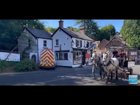
🔴 Burley Village in Burley New Forest A walk through #burley #newforest #burleymanor

A walk through Burley in the New Forest ending up at Burley Manor #burley #newforest #bournemouth #hampshire #dorset ...

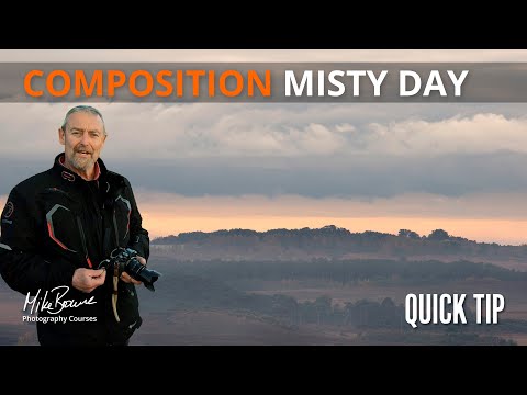
Composition In Misty Landscape Photos - Mike Browne

Misty mornings are great for landscape photography, but take care with your composition or you'll get too much in and the image ...

Nearby Amenities

Located within 500m of 50.825444,-1.7003084
Burley
Place: village
Population: 1350
Wikidata: Q3195509
Wikipedia: en:Burley, Hampshire
Lat/Long: 50.8266/-1.70164
Barrier: cattle_grid
Lat/Long: 50.8267858/-1.7020754
Toilets
Fee: no
Wheelchair: yes
Lat/Long: 50.8271451/-1.7006486
Barrier: cattle_grid
Lat/Long: 50.8266045/-1.7020928
Barrier: cattle_grid
Lat/Long: 50.8236261/-1.7068151
Barrier: stile
Lat/Long: 50.8231498/-1.7029172
Barrier: stile
Lat/Long: 50.8225951/-1.701649
Doctors
Park View Surgery
Healthcare: doctor
Lat/Long: 50.827862/-1.703974
Burley War Memorial
Historic: memorial
Memorial: war_memorial
Source: survey
Wikidata: Q55707422
Lat/Long: 50.8264156/-1.7017668
Bicycle Rental
Forest Leisure Cycling
Addr Postcode: BH24 4AB
Bicycle Rental: shop
Shop: bicycle
Website: https://www.forestleisurecycling.co.uk/
Lat/Long: 50.8266159/-1.7017481
Fuel
Dawson Engineering
Lat/Long: 50.8248911/-1.7031222
Littlemead Bed & Breakfast
Tourism: guest_house
Lat/Long: 50.8242028/-1.7036299
Burley School only
Naptan AtcoCode: 1900HA080901
Naptan Bearing: NW
Naptan BusStopType: CUS
Naptan CommonName: Burley School only
Naptan Landmark: Cricket Ground
Naptan NaptanCode: hamadtjg
Naptan Street: Unamed Road to Village
Naptan Verified: no
Source: naptan_import
Lat/Long: 50.8257518/-1.6980781
Burley School Only
Naptan AtcoCode: 1900HA080902
Naptan Bearing: SE
Naptan BusStopType: CUS
Naptan CommonName: Burley School Only
Naptan Landmark: Cricket Ground
Naptan NaptanCode: hamadtjm
Naptan Street: Unamed Road to Village
Naptan Verified: no
Source: naptan_import
Lat/Long: 50.8257966/-1.698021
Bus Stop
Burley Queens Head (temp)
Bench: yes
Bin: yes
Bus: yes
Lit: no
Naptan AtcoCode: 1900HA080903
Naptan Bearing: SW
Naptan CommonName: Burley Queens Head (temp)
Naptan Crossing: Ringwood Road
Naptan NaptanCode: hamadtjd
Naptan Street: The Cross
Naptan Verified: no
Public Transport: platform
Shelter: yes
Source: naptan_import
Tactile Paving: no
Lat/Long: 50.8265239/-1.701069
Bus Stop
Burley Queens Head (temp)
Bench: no
Bin: no
Bus: yes
Lit: no
Naptan AtcoCode: 1900HA080904
Naptan Bearing: NE
Naptan CommonName: Burley Queens Head (temp)
Naptan Crossing: Ringwood Road
Naptan NaptanCode: hamadtja
Naptan Street: The Cross
Naptan Verified: no
Public Transport: platform
Shelter: no
Source: naptan_import
Tactile Paving: no
Lat/Long: 50.8265961/-1.7011537
Bus Stop
Burley Coach House
Bench: no
Bin: no
Bus: yes
Lit: no
Naptan AtcoCode: 1900HA080905
Naptan Bearing: SE
Naptan CommonName: Burley Coach House
Naptan Crossing: Howard Close
Naptan Landmark: O/s Witchcraft Shop
Naptan NaptanCode: hamadtgt
Naptan Street: Ringwood Road
Naptan Verified: no
Public Transport: platform
Shelter: no
Source: naptan_import
Tactile Paving: no
Lat/Long: 50.826625/-1.7019202
Bus Stop
Burley Coach House
Bench: no
Bin: no
Bus: yes
Lit: no
Naptan AtcoCode: 1900HA080906
Naptan Bearing: NW
Naptan CommonName: Burley Coach House
Naptan Crossing: Howard Close
Naptan NaptanCode: hamadtgp
Naptan Street: Ringwood Road
Naptan Verified: no
Public Transport: platform
Shelter: no
Source: naptan_import
Tactile Paving: no
Lat/Long: 50.8266977/-1.7022321
Bus Stop
Copse Road
Bus: yes
Naptan AtcoCode: 1900HA080911
Naptan Bearing: SW
Naptan CommonName: Copse Road
Naptan Crossing: Copse Road
Naptan NaptanCode: hamadtgm
Naptan Street: Pound Lane
Naptan Verified: no
Public Transport: platform
Shelter: no
Source: naptan_import
Lat/Long: 50.8234774/-1.7054186
Bus Stop
Copse Road
Bus: yes
Naptan AtcoCode: 1900HA080912
Naptan Bearing: NE
Naptan BusStopType: CUS
Naptan CommonName: Copse Road
Naptan Crossing: Copse Road
Naptan NaptanCode: hamadtgj
Naptan Street: Pound Lane
Naptan Verified: no
Public Transport: platform
Source: naptan_import
Lat/Long: 50.8235315/-1.7054751
Barrier: entrance
Lat/Long: 50.8213502/-1.7031868
Cafe
The Burley Stores
Lat/Long: 50.8268527/-1.7021158
Entrance: yes
Lat/Long: 50.8275604/-1.6974997
Burley WI
Addr Housename: Myrtle Hall
Addr Housenumber: 11
Addr Postcode: BH24 4EG
Addr Street: Copse Road
Club: culture
Website: https://hampshirewi.org.uk/wi-page/burley-wi/
Lat/Long: 50.8243224/-1.7057207
Post Box
Check Date Collection Times: 2022-10-15
Collection Plate: not visible
Collection Times: Mo-Fr 16:45; Sa 12:00
Note: This postbox is of a brand new EIIR design. This postbox has moved since its last edit on OSM so I have moved the icon to its current location.
Operator: Royal Mail
Operator Wikidata: Q638098
Post Box Type: lamp
Ref: BH24 8
Royal Cypher: EIIR
Royal Cypher Wikidata: Q33102113
Lat/Long: 50.8270294/-1.7025939
Post Box
Collection Plate: not visible
Collection Times: Mo-Fr 09:00; Sa 07:00
Old Ref: BH24 35
Operator: Royal Mail
Operator Wikidata: Q638098
Post Box Type: wall
Ref: BH24 35D
Royal Cypher: GR
Royal Cypher Wikidata: Q33102273
Lat/Long: 50.8216079/-1.7030897
Historic: milestone
Lat/Long: 50.8266895/-1.7004446
Post Office
Burley Post Office
Addr City: Burley
Addr Housename: The Cross
Addr Postcode: BH24 4AB
Addr Street: Ringwood Road
Brand: Post Office
Brand Wikidata: Q1783168
Description: This post office is inside Shappen Stores.
Ref Pol Id: 144952
Lat/Long: 50.8269831/-1.7026762
Barrier: cattle_grid
Lat/Long: 50.8267227/-1.7026424
Drinking Water
Access: yes
Bottle: yes
Fountain: bottle_refill
Operator: New Forest District Council
Lat/Long: 50.8271705/-1.7005694
Defibrillator
Access: yes
Defibrillator Location: Outside of building next to road
Emergency: defibrillator
Indoor: no
Ref: 3351
Lat/Long: 50.8245625/-1.7034797
Defibrillator
Access: yes
Defibrillator Location: Outside of Shappen Stores
Emergency: defibrillator
Indoor: no
Lat/Long: 50.8270419/-1.702632
Entrance: yes
Lat/Long: 50.8270162/-1.7026247
Entrance: yes
Lat/Long: 50.8271306/-1.7027097
Spencers
Office: estate_agent
Lat/Long: 50.8263842/-1.7014607
Vama Spa & Aesthetic
Shop: beauty
Lat/Long: 50.8263539/-1.701501
Millenium Stone
Historic: memorial
Lat/Long: 50.8264202/-1.7019003
Caraccio’s
Shop: confectionery
Lat/Long: 50.8264028/-1.7014127
The data included in this document is from www.openstreetmap.org. The data is made available under ODbL.

Have you been to High Croft Wood?

Leave your review of High Croft Wood below (or comments, questions and feedback).