Ham Plantation

Wood, Forest in Wiltshire

England

Ham Plantation

Sheep on the path on Amesbury Down
Sheep on the path on Amesbury Down Credit: David Martin

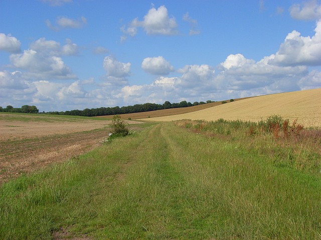
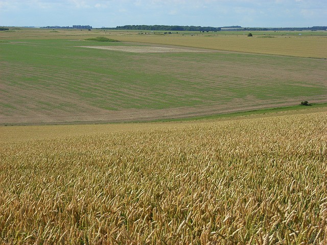
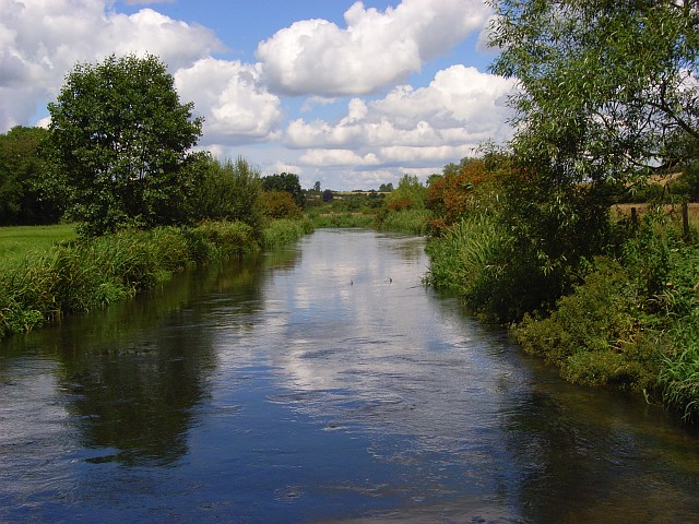
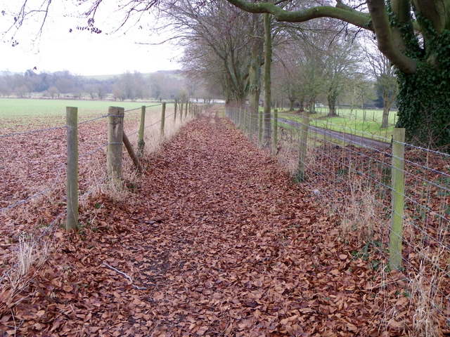
Ham Plantation, located in Wiltshire, England, is a picturesque woodland area known for its lush forests and natural beauty. Situated near the village of Ham, this plantation covers a vast expanse of land, providing a tranquil escape for nature enthusiasts and hikers alike.

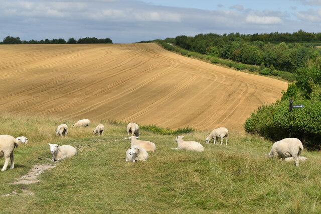
The woodland of Ham Plantation is predominantly comprised of deciduous trees, such as oak, beech, and birch, which create a vibrant and ever-changing landscape throughout the seasons. These trees, along with an array of shrubs and wildflowers, provide a diverse habitat for various species of wildlife, including deer, squirrels, and numerous bird species.

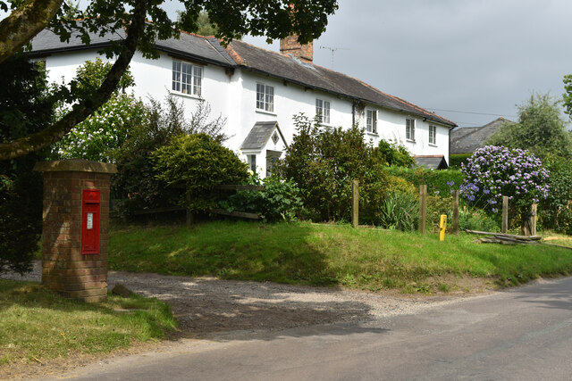
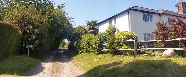
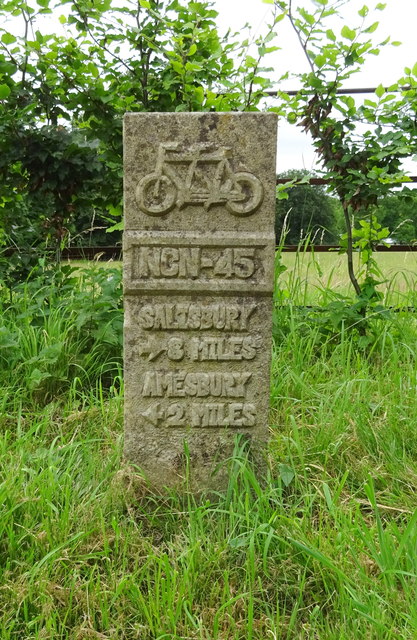
The plantation offers a network of well-maintained trails, inviting visitors to explore its serene surroundings. These trails meander through the woodland, allowing visitors to experience the peace and solitude of the forest. The plantation also features a picnic area, providing a perfect spot for visitors to relax and enjoy a meal amidst the tranquil ambiance.

Ham Plantation is not only a haven for nature enthusiasts but also serves as an important conservation area. The woodland is carefully managed to promote biodiversity and protect the delicate ecosystem. Conservation efforts include regular tree planting, maintaining wildlife habitats, and managing invasive species.

Overall, Ham Plantation in Wiltshire is a natural gem, offering a serene escape from the hustle and bustle of everyday life. Its abundant flora and fauna, well-maintained trails, and commitment to conservation make it a haven for outdoor enthusiasts and nature lovers seeking a peaceful retreat in the heart of the English countryside.

If you have any feedback on the listing, please let us know in the comments section below.

Ham Plantation Images

Images are sourced within 2km of 51.145438/-1.8095621 or Grid Reference SU1338. Thanks to Geograph Open Source API. All images are credited.

Sheep on the path on Amesbury Down
Houses and postbox at Normanton
River Avon at Normanton
Private Track in Normanton
Crop field, Normanton Off National Cycle Route 45.
Crop field, Normanton
Off National Cycle Route 45.
National Cycle Route 45, Normanton Towards Salisbury.
National Cycle Route 45, Normanton
Towards Salisbury.
Milestone on National Cycle Route 45, Normanton Salisbury 8 Miles / Amesbury 2 Miles.
Milestone on National Cycle Route 45, Normanton
Salisbury 8 Miles / Amesbury 2 Miles.
Houses on National Cycle Route 45, Normanton
Edward VII postbox, Normanton Postbox No. SP4 151.

See <a href="https://www.geograph.org.uk/photo/6329517">SU1340 : Track off National Cycle Route 45, Normanton</a> for context.
Edward VII postbox, Normanton
Postbox No. SP4 151. See SU1340 : Track off National Cycle Route 45, Normanton for context.
Track off National Cycle Route 45, Normanton Showing position of Postbox No. SP4 151.

See <a href="https://www.geograph.org.uk/photo/6329515">SU1340 : Edward VII postbox, Normanton</a> for postbox.
Track off National Cycle Route 45, Normanton
Showing position of Postbox No. SP4 151. See SU1340 : Edward VII postbox, Normanton for postbox.
Training Hurdles Training fences for the racehorses being trained at Wilsford Racing Stables.
Training Hurdles
Training fences for the racehorses being trained at Wilsford Racing Stables.
Spring Bottom Looking up the dry valley above Springbottom Farm.
Spring Bottom
Looking up the dry valley above Springbottom Farm.
Spring Bottom Arable downland typical of the area around Stonehenge. It is studded with may tumuli. The prominent one across the valley is in the northwest of the grid-square.
Spring Bottom
Arable downland typical of the area around Stonehenge. It is studded with may tumuli. The prominent one across the valley is in the northwest of the grid-square.
The River Avon, Normanton Looking upstream from the bridge on the footpath east of the hamlet.
The River Avon, Normanton
Looking upstream from the bridge on the footpath east of the hamlet.
Bridleway, Amesbury Down Heading towards Amesbury from Great Durnford.
Bridleway, Amesbury Down
Heading towards Amesbury from Great Durnford.
Pylon line towards Amesbury From the tree-lined path between Wilsford and Springbottom Farm.
Pylon line towards Amesbury
From the tree-lined path between Wilsford and Springbottom Farm.
Postbox, Normanton An Edward VII reign postbox in the Woodford Valley.
Postbox, Normanton
An Edward VII reign postbox in the Woodford Valley.
Footpath, Normanton The path takes walkers towards the River Avon and once across the river onwards to Amesbury Down.
Footpath, Normanton
The path takes walkers towards the River Avon and once across the river onwards to Amesbury Down.
Show me another place!

Ham Plantation is located at Grid Ref: SU1338 (Lat: 51.145438, Lng: -1.8095621)

Unitary Authority: Wiltshire

Police Authority: Wiltshire

What 3 Words

///jetliner.visit.templates. Near Durnford, Wiltshire

Related Wikis

Lake House

Lake House is an Elizabethan country house dating from 1578, in Wilsford cum Lake in Wiltshire, England, about seven miles north of Salisbury. It is a...

Durnford, Wiltshire

Durnford is a civil parish in Wiltshire, England, between Salisbury and Amesbury. It lies in the Woodford Valley and is bounded to the west by the Salisbury...

Salisbury Plain

Salisbury Plain is a chalk plateau in southern England covering 300 square miles (780 km2). It is part of a system of chalk downlands throughout eastern...

Wilsford cum Lake

Wilsford cum Lake is a civil parish in the Woodford valley in Wiltshire, England. The parish is bounded to the east by the Salisbury Avon and contains...

Woodford, Wiltshire

Woodford is a civil parish in southern-central Wiltshire, England, on the west bank of the Salisbury Avon, about 4 miles (6 km) north of Salisbury. Its...

Bluestonehenge

Bluestonehenge or Bluehenge (also known as West Amesbury Henge) is a prehistoric henge and stone circle monument that was discovered by the Stonehenge...

Normanton Down Barrows

Normanton Down is a Neolithic and Bronze Age barrow cemetery, about 0.6 miles (1 km) south of Stonehenge in Wiltshire, England. The burials date from...

Coneybury Henge

Coneybury Henge is a henge which is part of the Stonehenge Landscape in Wiltshire, England. The henge, which has been almost completely flattened, was...

Nearby Amenities

Located within 500m of 51.145438,-1.8095621
Barrier: stile
Lat/Long: 51.1496525/-1.8106706
Post Box
Collection Times: Mo-Fr 16:30; Sa 10:00
Post Box Type: lamp
Ref: SP4 420
Royal Cypher: EIIR
Royal Cypher Wikidata: Q33102113
Lat/Long: 51.1441848/-1.8050354
Entrance: main
Lat/Long: 51.1440831/-1.8063659
Great Durnford
Place: village
Lat/Long: 51.1427022/-1.8060451
Barrier: stile
Lat/Long: 51.1465816/-1.8127223
Power: pole
Lat/Long: 51.1488179/-1.8134739
Power: pole
Lat/Long: 51.1484359/-1.8132996
Power: pole
Lat/Long: 51.148054/-1.8131279
Power: pole
Lat/Long: 51.1476872/-1.8129455
Power: pole
Lat/Long: 51.1473591/-1.812798
Power: pole
Lat/Long: 51.1469435/-1.8126129
Telephone
Booth: K6
Covered: booth
Listed Status: Grade II
Phone: +44 1722 782211
Lat/Long: 51.1433897/-1.8053533
Bench
Dundford AD parish bench
Backrest: yes
Lat/Long: 51.1432967/-1.8067534
The data included in this document is from www.openstreetmap.org. The data is made available under ODbL.

Have you been to Ham Plantation?

Leave your review of Ham Plantation below (or comments, questions and feedback).