Ham Wood
Wood, Forest in Wiltshire
England
Ham Wood
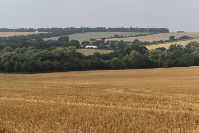
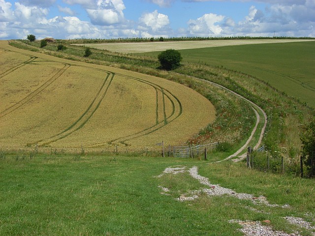
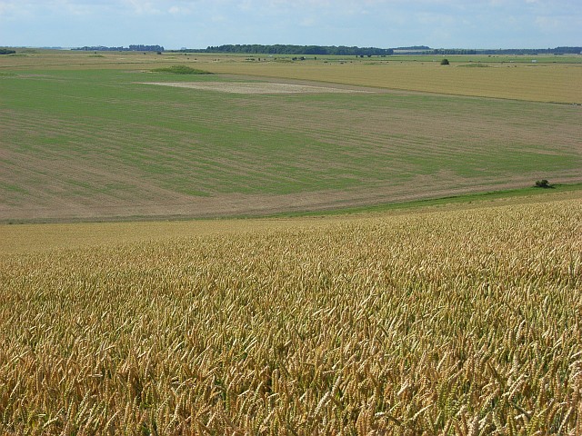
Ham Wood is a picturesque forest located in the county of Wiltshire, England. Spanning over an area of approximately 300 acres, it is a prominent natural landmark in the region. The wood is nestled in the scenic countryside, surrounded by rolling hills and stunning landscapes.
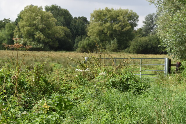
The wood is predominantly composed of native broadleaf trees, including oak, beech, and ash. These trees create a dense canopy, providing shade and shelter for a diverse range of flora and fauna. Bluebells, wild garlic, and wood anemones carpet the forest floor during spring, creating a vibrant and colorful display.
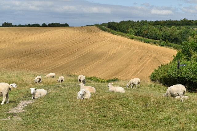
Ham Wood is a haven for wildlife, with numerous species calling it their home. It is a known habitat for birds such as woodpeckers, owls, and various songbirds. Additionally, mammals like deer, foxes, and badgers can be spotted in the wood, adding to its natural charm.
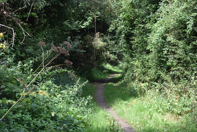
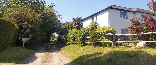
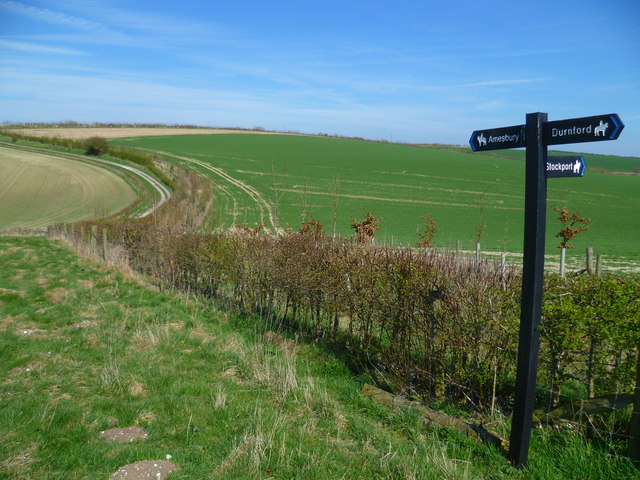
The forest also features a network of walking trails, allowing visitors to explore its beauty firsthand. These paths wind through the wood, offering stunning views of the surrounding countryside. The tranquil atmosphere and peaceful surroundings make Ham Wood a popular destination for nature lovers, hikers, and photographers.
Ham Wood is managed by local authorities who ensure its preservation and conservation. Efforts have been made to maintain the wood's natural integrity while providing a safe and enjoyable experience for visitors. With its scenic beauty, diverse wildlife, and recreational opportunities, Ham Wood is truly a gem of Wiltshire's natural landscape.
If you have any feedback on the listing, please let us know in the comments section below.
Ham Wood Images
Images are sourced within 2km of 51.148619/-1.8027582 or Grid Reference SU1338. Thanks to Geograph Open Source API. All images are credited.


Ham Wood is located at Grid Ref: SU1338 (Lat: 51.148619, Lng: -1.8027582)
Unitary Authority: Wiltshire
Police Authority: Wiltshire
What 3 Words
///surprised.warrior.embraced. Near Durnford, Wiltshire
Nearby Locations
Related Wikis

Lake House
Lake House is an Elizabethan country house dating from 1578, in Wilsford cum Lake in Wiltshire, England, about seven miles north of Salisbury. It is a...

Salisbury Plain
Salisbury Plain is a chalk plateau in southern England covering 300 square miles (780 km2). It is part of a system of chalk downlands throughout eastern...
Durnford, Wiltshire
Durnford is a civil parish in Wiltshire, England, between Salisbury and Amesbury. It lies in the Woodford Valley and is bounded to the west by the Salisbury...
Wilsford cum Lake
Wilsford cum Lake is a civil parish in the Woodford valley in Wiltshire, England. The parish is bounded to the east by the Salisbury Avon and contains...

Woodford, Wiltshire
Woodford is a civil parish in southern-central Wiltshire, England, on the west bank of the Salisbury Avon, about 4 miles (6 km) north of Salisbury. Its...
Bluestonehenge
Bluestonehenge or Bluehenge (also known as West Amesbury Henge) is a prehistoric henge and stone circle monument that was discovered by the Stonehenge...

Coneybury Henge
Coneybury Henge is a henge which is part of the Stonehenge Landscape in Wiltshire, England. The henge, which has been almost completely flattened, was...
Coneybury Anomaly
The Coneybury Anomaly is a pit with animal and other refuse, interpreted as the remains of a cross-cultural feast, within the Stonehenge Landscape in Wiltshire...
Nearby Amenities
Located within 500m of 51.148619,-1.8027582Have you been to Ham Wood?
Leave your review of Ham Wood below (or comments, questions and feedback).