Quarry Coppice

Wood, Forest in Dorset

England

Quarry Coppice

The eastern end of Charborough Park wall The famous wall of the deer park, beside the A31, one of the longest brick walls in England
The eastern end of Charborough Park wall Credit: David Smith

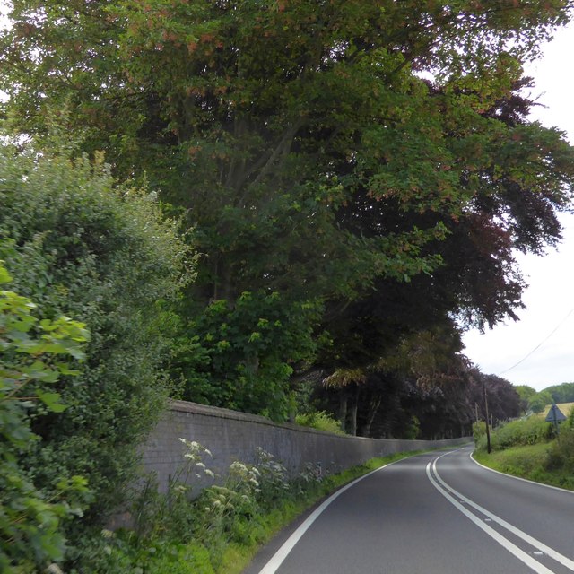
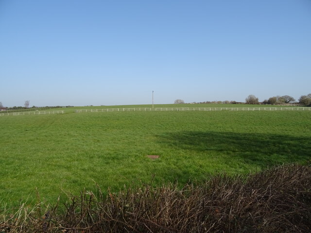
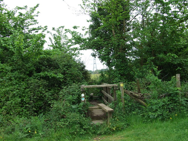
Quarry Coppice is a picturesque woodland located in the county of Dorset, England. Situated near the town of Swanage, this woodland covers an area of approximately 100 acres and is renowned for its natural beauty and diverse wildlife.

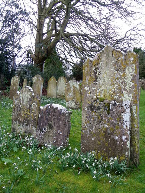
The coppice is predominantly made up of oak and beech trees, which provide a dense canopy that shelters a wide range of flora and fauna. The forest floor is carpeted with a variety of wildflowers, including bluebells, primroses, and wood anemones, creating a vibrant and colorful landscape during the spring and summer months.

As visitors wander through the woodland, they may encounter an array of wildlife. The coppice is home to numerous bird species, such as woodpeckers, owls, and various songbirds. Additionally, small mammals like squirrels, rabbits, and foxes can often be spotted darting between the trees.

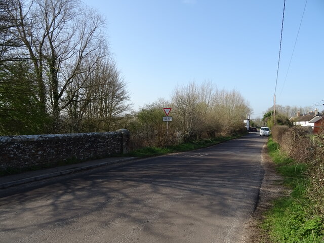
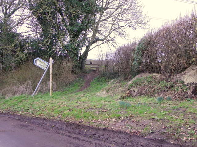
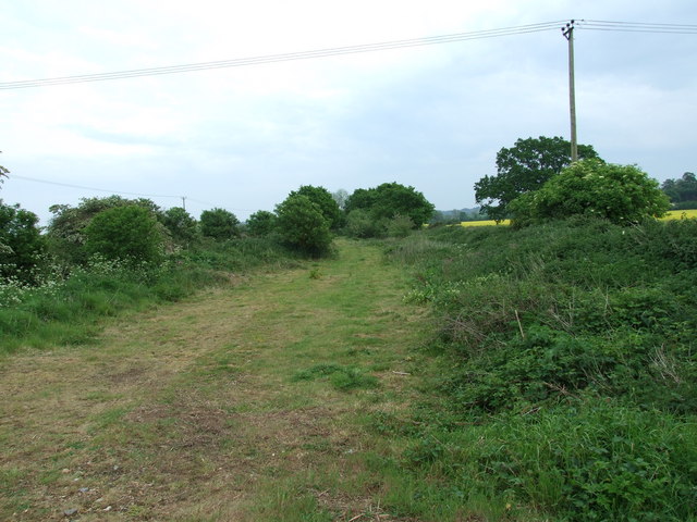
The woodland also boasts several walking trails and footpaths, allowing visitors to explore its natural wonders at their own pace. These trails guide visitors through the heart of the woodland, passing by tranquil streams, moss-covered rocks, and ancient trees.

Quarry Coppice is not only a haven for nature enthusiasts but also serves as an important ecological site. It provides a vital habitat for many rare and protected species, contributing to the conservation efforts of the region.

Overall, Quarry Coppice is a must-visit destination for those seeking a peaceful retreat in the heart of Dorset's natural beauty. With its enchanting woodland, diverse wildlife, and serene atmosphere, this forest offers a unique and memorable experience for all who venture within its boundaries.

If you have any feedback on the listing, please let us know in the comments section below.

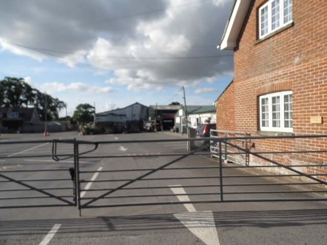
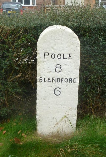
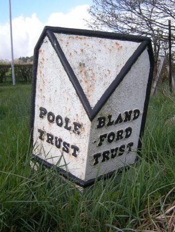
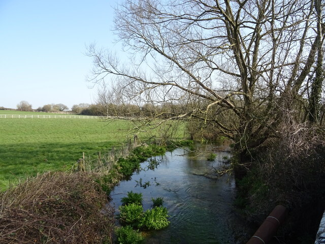
Quarry Coppice Images

Images are sourced within 2km of 50.780462/-2.0774633 or Grid Reference SY9497. Thanks to Geograph Open Source API. All images are credited.

The eastern end of Charborough Park wall The famous wall of the deer park, beside the A31, one of the longest brick walls in England
The eastern end of Charborough Park wall
The famous wall of the deer park, beside the A31, one of the longest brick walls in England
Roundabout on the A31, Sturminster Marshall
Woodland by the A31, Sturminster Marshall
The entrance to Vines Close Farm
Vines Close Farm
Vines Close Farm
Old Milestone by the A350, south east of Sturminster Marshall Carved stone post by the A350, in parish of STURMINSTER MARSHALL (EAST DORSET District), Blandford Road, 160m North of cross-roads with Station Road, in front of Burton Lux, against hedge by a row of bungalows, on West side of road. Dorset 3 (limestone), erected by the Blandford & Poole turnpike trust in the 19th century. 

Inscription reads:-
POOLE
8
BLANDFORD
6   

Milestone Society National ID: DO_POBF08.
Old Milestone by the A350, south east of Sturminster Marshall
Carved stone post by the A350, in parish of STURMINSTER MARSHALL (EAST DORSET District), Blandford Road, 160m North of cross-roads with Station Road, in front of Burton Lux, against hedge by a row of bungalows, on West side of road. Dorset 3 (limestone), erected by the Blandford & Poole turnpike trust in the 19th century. Inscription reads:- POOLE 8 BLANDFORD 6 Milestone Society National ID: DO_POBF08.
Old Boundary Marker by the A31, Poole Road, Sturminster Marshall parish Turnpike Terminus Marker by the A350, in parish of Sturminster Marshall (East Dorset District), 500m south of Sturminster Marshall, centre of the roundabout where the A350 crosses the A31.

Inscription reads:-
: POOLE / TRUST : : BLAND- / -FORD / TRUST :

Surveyed

Milestone Society National ID: DO_POBF06t
Old Boundary Marker by the A31, Poole Road, Sturminster Marshall parish
Turnpike Terminus Marker by the A350, in parish of Sturminster Marshall (East Dorset District), 500m south of Sturminster Marshall, centre of the roundabout where the A350 crosses the A31. Inscription reads:- : POOLE / TRUST : : BLAND- / -FORD / TRUST : Surveyed Milestone Society National ID: DO_POBF06t
The River Winterborne
Grazing, Newton Peveril
Bridge on Newton Road
Elizabeth II postbox on Blandford Road Postbox No. BH21 65.
Elizabeth II postbox on Blandford Road
Postbox No. BH21 65.
April Lodge, Sturminster Marshall
Stile and footpath, Lytchett Matravers The footpath is part of the 13 mile, Wareham Forest Way.
Stile and footpath, Lytchett Matravers
The footpath is part of the 13 mile, Wareham Forest Way.
Lichen, The Church of St Mary the Virgin The older gravestones are covered in lichen.

Lichens do not have roots, but absorb water and gases through their upper surface, and are therefore sensitive to atmospheric pollution.  For this reason they are rarely found around cities and grow best on the wetter west side of the British Isles.  Those on trees thrive best on the sunny, south-west aspects of trunks and branches.  Disappearance of lichen species can be used to detect rising levels of air pollution.  

There are three main types.  The encrusting forms, including the bright orange/dark yellow 'Xanthoria' grow on roofs, walls, gravestones, signs and tree trunks.  Leaf-like species develop flat lobes spreading over bark or stones, and shrubby forms which grow vertically from the ground or hang from trees.  Few have common names.
Lichen, The Church of St Mary the Virgin
The older gravestones are covered in lichen. Lichens do not have roots, but absorb water and gases through their upper surface, and are therefore sensitive to atmospheric pollution. For this reason they are rarely found around cities and grow best on the wetter west side of the British Isles. Those on trees thrive best on the sunny, south-west aspects of trunks and branches. Disappearance of lichen species can be used to detect rising levels of air pollution. There are three main types. The encrusting forms, including the bright orange/dark yellow 'Xanthoria' grow on roofs, walls, gravestones, signs and tree trunks. Leaf-like species develop flat lobes spreading over bark or stones, and shrubby forms which grow vertically from the ground or hang from trees. Few have common names.
Track, Newton Pevril This track leads down to the River Winterborne.
Track, Newton Pevril
This track leads down to the River Winterborne.
Footpath, Sturminster Marshall This footpath runs through the shoulder high mustard seed.
Footpath, Sturminster Marshall
This footpath runs through the shoulder high mustard seed.
Double stile, Sturminster Marshall This double stile is on the Wareham Forest Way.
Double stile, Sturminster Marshall
This double stile is on the Wareham Forest Way.
Old Railway Track, Sturminster Marshall Part of the old Somerset and Dorset Railway line.
Old Railway Track, Sturminster Marshall
Part of the old Somerset and Dorset Railway line.
Show me another place!

Quarry Coppice is located at Grid Ref: SY9497 (Lat: 50.780462, Lng: -2.0774633)

Unitary Authority: Dorset

Police Authority: Dorset

What 3 Words

///fruit.discusses.revisits. Near Sturminster Marshall, Dorset

Related Wikis

Henbury, Dorset

Henbury is a hamlet in the civil parish of Sturminster Marshall in Dorset, England. It lies on the A31 road. Henbury House is a classical Georgian house...

Bailey Gate railway station

Bailey Gate railway station was on the Somerset & Dorset Joint Railway in the English county of Dorset. == Usage == The station served the United Dairies...

Sturminster Marshall

Sturminster Marshall is a village and civil parish in the east of Dorset in England, situated on the River Stour between Blandford Forum and Poole. The...

St Mary the Virgin, Lytchett Matravers

St Mary the Virgin is the Church of England parish church of Lytchett Matravers in Dorset. Its parish is part of the Diocese of Salisbury. The building...

Charborough House

Charborough House, also known as Charborough Park, is a Grade I listed building, the manor house of the ancient manor of Charborough. The house is between...

Barrow Hill, Dorset

Barrow Hill is a small settlement in Dorset, England, situated in the East Dorset administrative district on the A350 road approximately 4 miles (6.4 km...

River Winterborne

There are two River Winterbornes in Dorset, England.The rivers only flow overground during the winter, hence the name. They both flow through a number...

Lytchett Matravers

Lytchett Matravers is a large village and civil parish in Dorset, England. The 2011 census recorded the parish as having 1,439 households and a population...

Nearby Amenities

Located within 500m of 50.780462,-2.0774633
Power: tower
Source: Bing
Lat/Long: 50.7773618/-2.0748171
Power: tower
Source: Bing
Lat/Long: 50.7795123/-2.0725748
Material: wood
Power: pole
Source: bing
Lat/Long: 50.7785213/-2.0712148
Material: wood
Power: pole
Source: bing
Lat/Long: 50.7792676/-2.0722051
Material: wood
Power: pole
Source: bing
Lat/Long: 50.7792777/-2.0721465
Material: wood
Power: pole
Source: bing
Lat/Long: 50.781742/-2.0741746
Material: wood
Power: pole
Source: bing
Lat/Long: 50.7818564/-2.074164
Material: wood
Power: pole
Source: bing
Lat/Long: 50.7823219/-2.0747948
Material: wood
Power: pole
Source: bing
Lat/Long: 50.7838791/-2.0766775
Poles: bipole
Power: pole
Source: GPS/Survey
Transformer: yes
Lat/Long: 50.7811291/-2.0704355
Material: wood
Power: pole
Source: GPS/Survey
Lat/Long: 50.7814278/-2.0710883
Power: pole
Source: bing
Voltage: 11000
Lat/Long: 50.7844768/-2.0782158
Cables: 3
Power: pole
Source: bing
Voltage: 11000
Lat/Long: 50.7835653/-2.0787174
Power: pole
Source: bing
Voltage: 11000
Lat/Long: 50.7831956/-2.0800477
Power: pole
Source: bing
Voltage: 11000
Lat/Long: 50.7828564/-2.0813218
Power: pole
Source: bing
Voltage: 11000
Lat/Long: 50.7825427/-2.0825221
Power: pole
Source: bing
Voltage: 11000
Lat/Long: 50.781074/-2.0828614
Power: pole
Source: bing
Voltage: 11000
Lat/Long: 50.7799038/-2.0838833
Power: pole
Source: bing
Voltage: 11000
Lat/Long: 50.7765559/-2.0783526
Power: pole
Source: bing
Voltage: 11000
Lat/Long: 50.7768001/-2.0791009
Power: pole
Source: bing
Voltage: 11000
Lat/Long: 50.7771538/-2.0801134
Power: pole
Source: bing
Voltage: 11000
Lat/Long: 50.7777092/-2.0830706
Power: pole
Source: bing
Voltage: 11000
Lat/Long: 50.7784809/-2.0833629
Power: pole
Source: bing
Voltage: 11000
Lat/Long: 50.7791966/-2.0836285
Power: pole
Source: bing
Lat/Long: 50.7763473/-2.0781916
Power: pole
Source: bing
Lat/Long: 50.7761488/-2.0772395
Man Made: tower
Tower Type: communication
Lat/Long: 50.7797018/-2.0806586
Power: pole
Source: bing
Lat/Long: 50.7775617/-2.0812708
Power: pole
Source: bing
Lat/Long: 50.7776363/-2.0822082
The data included in this document is from www.openstreetmap.org. The data is made available under ODbL.

Have you been to Quarry Coppice?

Leave your review of Quarry Coppice below (or comments, questions and feedback).